
“Trip Reflection: Pyra-Queen Col is rated Class II. Turns out we are rated Class I.”
Location
Sequoia & Kings Canyon National Parks, California, USA
Mileage
68.3 miles (47 on-trail, 21.3 off-trail)
Total Climb & Descent: 20,320' [net = 0]
Days: 5 Season: early September
Year: 2020
Starting & ending trailhead
Wolverton
Basecamp Town: Fresno, CA

Map: Tom Harrison Mt. Whitney High Country Trail Map

GuideBooks: The High Sierra: Peaks, Passes, Trails by RJ Secor
Best Online Resource: www.highsierratopix.comSome inspirations: Bill Finch (classic), My Trail Mixx, a Trailspace user
Pre-Trip:
We’ve long ogled the Kaweahs, a spur of the Great Western Divide in the southern Sierra Nevada. We were introduced to their stunning and colorful ridgeline when we passed close by on the High Sierra Trail and were disappointed not to have time for exploring the area. Since then we have had several trips in the vicinity, and we always comment on their beauty. We even named our pup after Black Kaweah, one of the most dramatic points in the Kaweah Peaks Ridge, but had yet to make a visit to these mountains due to the difficult access and long distance from any trailhead. On a trip over Sawtooth Pass out of Mineral King a few years back, we resolved to put a trip to distinctive Picket Guard Peak and the neighboring Kaweah basin high on the list of backcountry priorities. There are no “easy” routes in or out of Kaweah Basin. We’ve considered Pants Pass, Pyra-Queen Col (PQC), & Kaweah Pass as the main options. Many also access the area via Picket Creek Basin, approaching from the Kern-Kaweah River either directly up Picket Creek from Rockslide Lake, or via the so-called “ledge route” from below Gallats Lake. After much studying of maps and trip reports, we decided that the ledge route approach and Pyra-Queen exit would be our Plan A. We’ve never explored Nine Lakes Basin, though we’ve passed it a handful of times on the HST, so we’d have the chance to linger if PQC went well.
After settling in to the “new abnormal” of life during COVID-19 early in the year, we optimistically set aside time in late summer to get into the mountains. We had no idea that as those dates approached we would still be firmly in the grip of this devastating pandemic. Each land management agency adopted different COVID-era rules for wilderness permits, and none offered an in-person option. In the shuffle of sorting out the new systems, we missed the window to get a Sequoia-Kings Canyon NP permit for our July dates. Instead, we picked up an online reservation for a Lamarck Col trip out of Inyo NF and had a great time. Determined to visit the Kaweahs this year, we tried again and were able to secure a permit for Sequoia Kings Canyon NP in early September. The SeKi wilderness office confirmed that we had been awarded a permit by email but advised us to expect a call from staff prior to our trip as the actual permit would not be issued until we had a phone interview with a wilderness ranger. As our dates approached we hadn’t been contacted and we constantly checked our phones for missed calls. Our email inquiry received a reply that permits for our dates/trailhead were in process and we should be patient. Conditions all across California had been in flux through August due to the huge number of wildfires burning out of control and the resulting thick smoky haze that had encompassed many areas of the state. We knew not to expect classic deep blue Sierra skies, but were hopeful that the air in the high country would be a dramatic improvement from the poor AQI and brown air we’d experienced in the SF Bay Area for the past several weeks. We assumed resources were stretched thin in all agencies and waited for the call that never came.
The night before our trip, we decided to head into the mountains with just our email confirmation of awarded permit, since there was no way for us to directly contact the permit office staff at this point. We drove through air thick with smoke all the way across California’s central valley and continuing east from Fresno. As we neared Sequoia NP, the air started to clear and our phone rang; it was the willderness ranger wondering if we still intended to use our permit. Yes! Yes, we did. He warned us that the air in the park was “hazy” from the ongoing Sequoia Complex Fire (SQF) east of Porterville, and that the Moraine Fire was active within the park quite near to where we intended to pass by at Roaring River. He suggested that we re-consider our trip as we were not likely to have good air, and warned us that conditions could change at any time. We let him know that the air was much better here than at home, we would be happy to change our route to avoid the Moraine Fire, and that we would turn around or otherwise adjust plans if air quality worsened. He apologized that he could not change the starting trailhead of our permit due to full quotas, but noted that most people probably aren’t using their permits so he didn’t expect us to run into many others even on generally popular trails. He told us that no trails were closed but emphasized that we should exercise good judgement and be safe. He underscored that our trip/route sounded amazing and he’d love to do it himself, but that he wouldn’t consider starting a trip in the current conditions. In the end, he issued our wilderness permit (though we had no way to print it at this point), and we continued our drive to the park.
During the final hour on the road while we still had some cell service, we researched the Moraine Fire and reviewed current conditions including the extent/smoke reach of the SQF. Rather than hiking north over Silliman Pass and east past Roaring River to Colby Pass, we decided to adjust our route to avoid the Moraine Fire altogether. We could hike south to meet up with the High Sierra Trail (HST), and follow that to Bearpaw Meadow before heading north to Tamarack Lake. From there we could access the upper reaches of Cloud Canyon and cut down to the Colby Pass Trail east of Roaring River. While this amended plan didn’t meet the letter of our permit due to deviating from our planned TH and initial direction, it avoided the area of an active fire and still kept us away from high-use/high-impact trails aside from a handful of miles on the HST. We would be back on our intended route by the end of Day 2, and this seemed like the most reasonable compromise given what we had just learned.
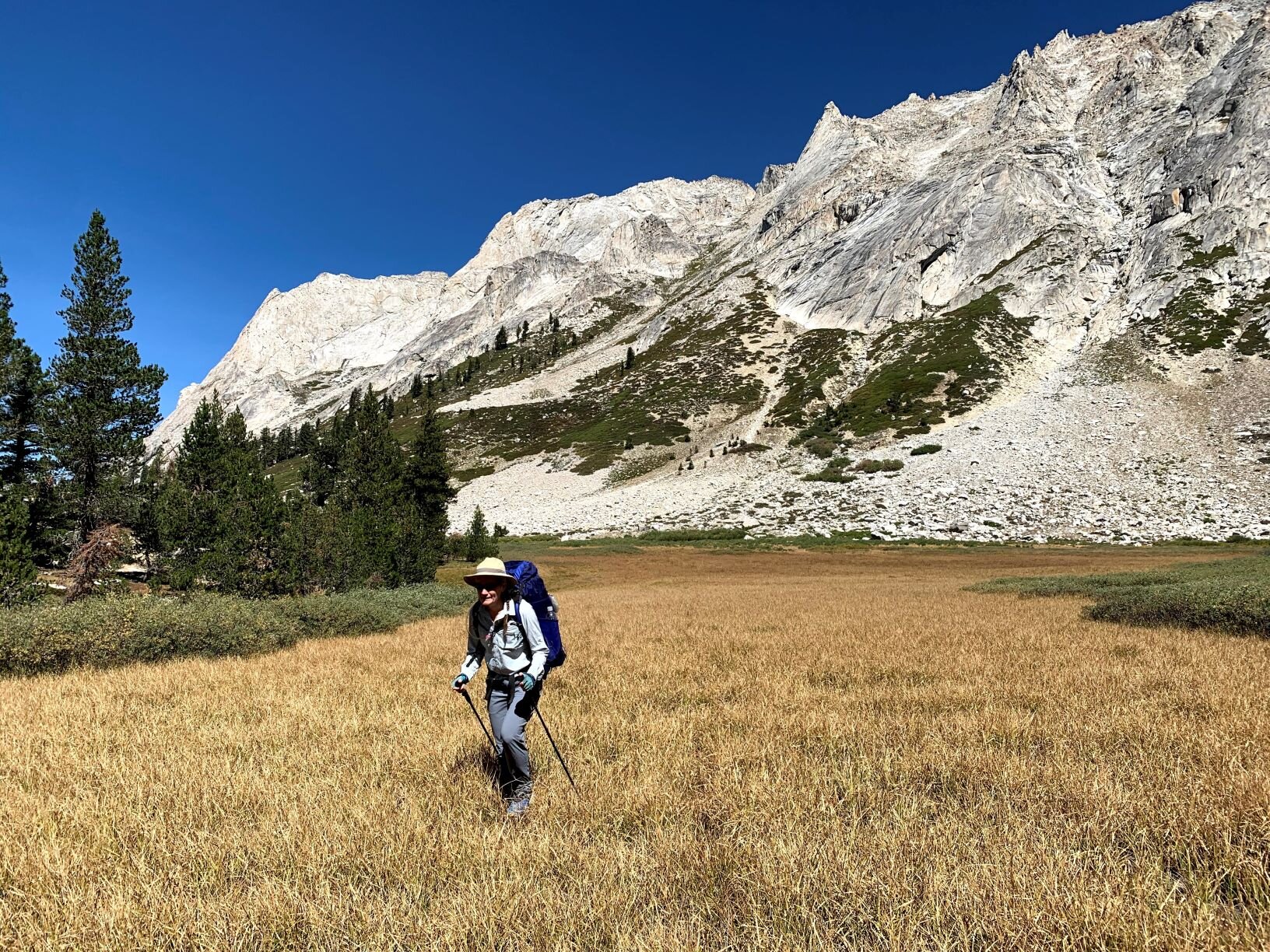
Day 1 / Wolverton TH to Bearpaw Meadow

We were shocked at the sky to the south and west from Panther Gap
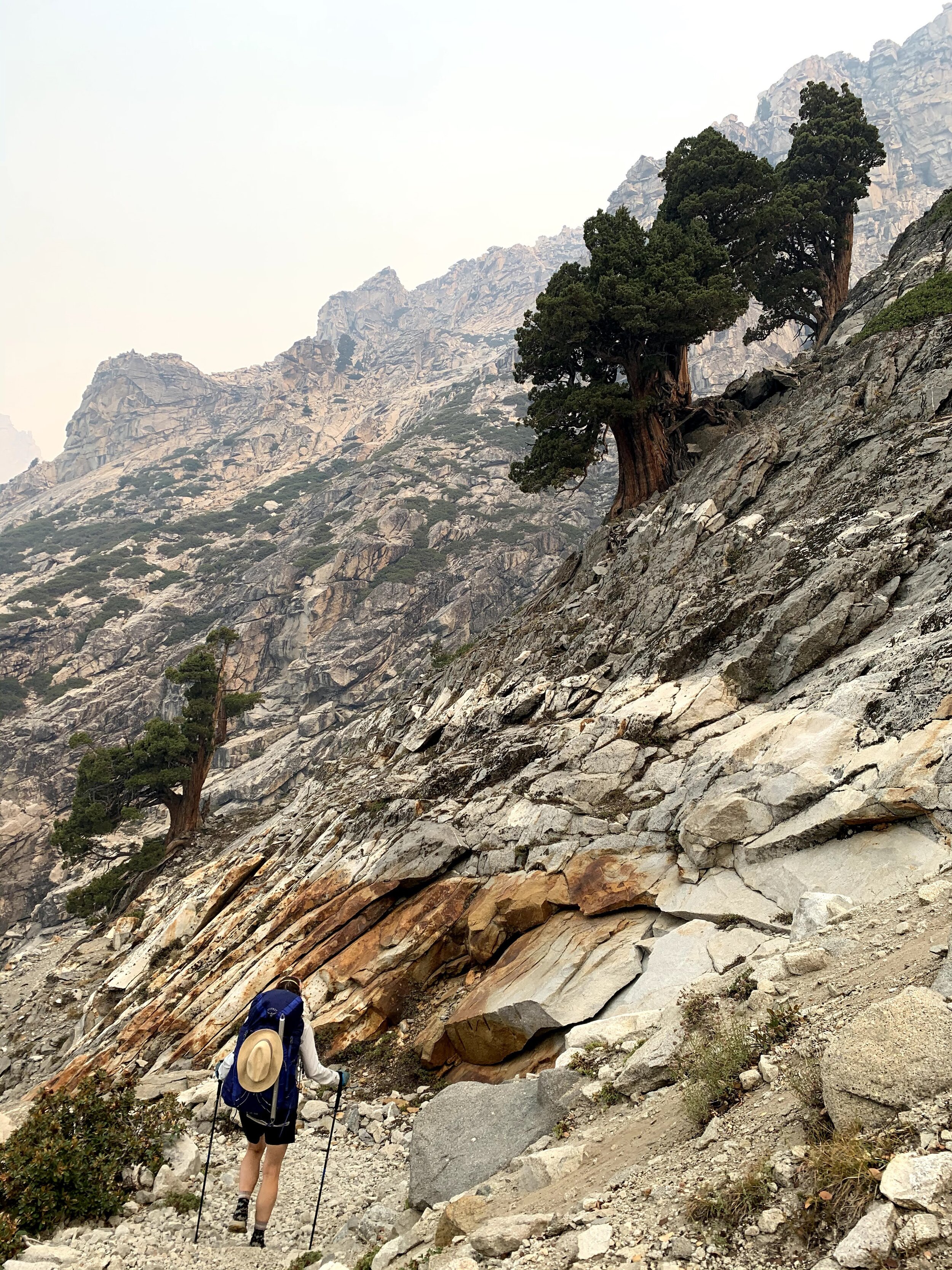
We arrived at the Wolverton TH mid-day to find the parking lot filled with more cars than expected, though this is the main access point for the popular Tablelands so we shouldn’t have been so surprised. Sure enough, the 5 other people we saw were all headed in that direction. There was a faint scent of smoke in the air, but the air looked clean enough in our forested spot. Just before locking the car, we decided to grab our N95 respirator masks (de rigeur for a CA summer of late) to stash in our packs “just in case.” Our initial plan was to aim for Tamarack Lake tonight; ambitious yet doable given our fitness and experience. We were a bit nervous about the decision to stray from our permit requirements and the sooner we were back on our “approved” route (or off-trail), the better. No sooner had we finished discussing this plan, but we came across a backcountry ranger talking to an older couple near the junction for the Tablelands. Crap! He nodded as we passed, but it wasn’t long before we heard him say “bye mom” and head in our direction. We were sure he was going to ask for our permit (which we didn’t have), and/or determine that we weren’t on our approved route (which we weren’t). He started out by asking where we were headed, and as we described our combo of on- & off-trail travel and goal of Tamarack Lake for the first night he must have decided we weren’t your basic standard backpackers. Instead of asking for our permit, we chatted about the route (he was envious), his parents (who came up to visit him), his post (Pear Lake), and his first job in the park (Crystal Cave) that also happened to be how Cheri’s younger sister spent one summer during college. He let us know that sticking to the divide we would probably have very little smoke, but if we dropped into the Kern drainage we’d likely be socked in. He wished us a great trip as he passed with his brisk ranger stride, and only when he was safely out of hearing range did we share our relief that we hadn’t been caught. We are big supporters of the quota system and other rules that maintain the wilderness experience for everyone, and even our minor deviation from the rules in extraordinary times made us feel quite guilty.

Little Blue Dome visible but hazy; the Great Western Divide beyond is reduced to ghostly outlines

Sunset colors start much earlier when the sky is filled with smoke
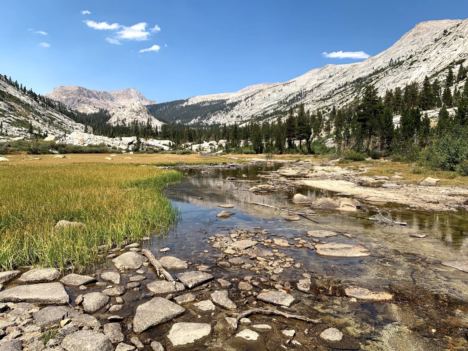
We soon arrived at Panther Gap with overlook views to the deep valley below, and were surprised to see it filled with dense brown smoke which rose towards us as a thick haze. No views across the valley, or up towards Kaweah Gap today. Where we stood, the air remained clear-ish with just the faintest small of smoke. We took a short snack break then continued down the trail towards the High Sierra Trail (HST) enjoying a steady cool breeze that carried with it an optimism that the skies would clear out. We saw just a handful of other backpackers after joining the HST and leapfrogged with our ranger a couple of times as he kept stopping to check in on permits & plans. Once we’d passed the last group of hikers, he quickly outpaced us and we didn’t see him again. We came to an unexpected campsite near a quiet little stream at the 9-mile mark on the HST much later in the afternoon than we had hoped to arrive. Seeing its deserted but well-groomed tent spaces and a bear box, we briefly considered camping. Instead we we pressed on to the Buck Creek crossing. The heat of the day had taken its toll and we again considered stopping for the night, but there were already 3 guys set up in the fairly small site. Instead we plopped down on the rocks near the foot bridge, had a snack, and refreshed with the cold water. From there the trail makes a long series of switchbacks up a hill, not overly steep but relentless. Late in the day with first-day-heavy packs, it seemed never-ending. About 3/4 of the way up, we finally admitted to each other that Tamarack Lake was no longer a reasonable goal. While we could muster the energy to make it to Lone Pine Creek, we would probably arrive just after dark and didn’t know of any specific areas likely to have usable campsites. The combination of lack of sleep (late night packing, early alarm for the drive), a long work week, and the hot day with heavy packs and lingering light smoke had gotten the better of us. As much as we hate a crowd in the wilderness, we decided to camp at Bearpaw Meadow tonight.

Dense forest near Buck Creek
The Bearpaw Meadow backpacker’s campground, according the NPS sign, is a mere 0.1 miles from the main trail. As we trudged in at dusk, the steep downhill hike to the campsites from the HST might as well have been another full mile. It was the longest, and perhaps slowest, 0.1 miles that we’ve ever walked downhill - and we couldn’t stop commenting that we would just have to climb back up tomorrow, only with full water containers. On the positive side, this “popular” campsite on the heavily-used HST was all but deserted. There was one site occupied by a threesome, who seemed as surprised to see us as we were to see nobody but them. We said some cheerful hellos and found a site far enough away that we felt like were the only ones there. As we made dinner there was a stronger scent of smoke in the air and we could see wisps floating between the trees in the beams of our headlamps. As we drifted off to sleep, we discussed the possibility of turning around and heading back out to the trailhead tomorrow if the smoke was any worse in the morning.
STATS: 11.8 MILES (TRAIL) | 5.5 HOURS | 361' NET ELEVATION GAIN | 3643' CLIMB | 3282' DESCENT
Day 2 / Bearpaw Meadow to Roaring River Slabs

Breaking out of the dense foliage to blue skies and a normal-colored sun
The next morning we got up at first light and we were cautiously optimistic about the air quality as dawn broke with its muted colors. The scent of smoke was gone, or perhaps we had become accustomed to it. We had brekkie and broke camp, then hoisted our packs for the uphill hike back to the HST. After a fair night of sleep, it seemed possible that it MIGHT be just 0.1 mile, though it still felt like at least a quarter mile.
Final climb to Tamarack Lake along the Lone Pine Creek drainage

Tamarack Lake, northern shore
We left the HST right away and continued a steady climb upslope, happy for the morning’s chill. Soon enough we started to get some peekaboo views through the dense canopy of conifers, aspens, and willows. At first we only had morning sunlight filtered by foliage but as we hiked on we picked up the warmth of stronger beams. When we finally broke out of the dense vegetation, the sky was blue above us and we had clear views of the Great Western Divide. On this 2-mile stretch between the HST and Elizabeth Pass Trail, we were a little surprised to pass 5 other hikers given the light population on generally well-traveled trails yesterday. We first passed the threesome from yesterday afternoon at Buck Creek, who were moving quite slowly and must have gotten an early start. As we descended towards Lone Pine Creek, we came across a pair of guys headed out after spending time in 9 Lakes Basin; they had camped at Tamarack Lake last night and remarked on how few others they’d seen on this trip. We realized that if we had made it there our first night, neither of us would have had the lake to ourselves. It was a quick hike down to the creek and from there was had a broad vista from Elizabeth Pass to Lion Rock, with the high ridges above Tamarack Lake in between. Nearing the junction with Tamarack Lake trail we stepped aside to let a pack train pass and briefly chatted up the packer, who had been out to resupply a trail crew. Not long after that we came across a second ranger, who had been involved in the resupply. Fortunately he seemed to be on a mission and didn’t stop to ask about our permit. This was the last person we’d see for the day.

Dry meadow on the first shelf above Tamarack Lake
We spotted the trail crew’s camp on the far side of Lone Pine Creek and wondered how often this spur trail gets maintained. We assumed most of their work would be on the more popular Elizabeth Pass route, but it seemed like they would also clear these few miles so close to their backcountry base. Through a sparse lodgepole forest, we continued to gawk at the familiar peaks of the Kings-Kaweah and Great Western Divide catching sunlight against the morning’s crisp blue sky. We have been in this canyon on a handful of trips now, and it felt a little like coming home after being away for a long time - fjellvant! We talked about the apparent misnomer of Tamarack Lake, as there are no Tamarack trees, also known as Larch (Larix occidentalis), anywhere in California. Cheri had learned from her dad that the Lodgepole Pine (Pinus contorta subsp. murrayana) so common throughout the Sierra and also in this drainage, was once called the Tamarack Pine. We assumed that this misleading nickname, rather than a very confused botantist, was the source of the lake’s name.

Lion Lake and surrounds from Lion Lake Pass
We stopped briefly at beautiful Tamarack Lake before crossing its outlet to make our way upslope to reach the dry meadow on the shelf above the lake. From here we had great views of Lion Rock guarding the next shelf above us, and Mt. Stewart with the appropriately-named Lilliput Glacier rising up from Tamarack Lake. Lilliput is the both the smallest named glacier in the Sierra Nevada, and the southernmost glacier in the United States. Pretty impressive titles for a wee glacier, especially for one that is at extreme risk of disappearing over the next few years due to climate change. We feel fortunate to have seen it many times, and on each visit root for its survival against the odds. We continued across the meadow, climbed a series of granite slabs below Lion Rock, and then made the final ascent to Lion Lake across a rock-strewn grassy slope dotted with Whitebark Pines. As we reached the edge of the talus field, we heard the outlet flow of Lion Lake gurgling between the rocks below our feet. Having crossed Class 2 Lion Lake Pass before (2018 trip out of Mineral King), we found the route-finding straightforward as we angled up the multicolored talus slope to the pass. Looming over us to the east was Triple Divide Peak, named for its position at the axis of 3 major divides. The Kings-Kaweah Divide rose to the west, the Great Western Divide extended as far as the eye could see, the Whaleback stretched like a pale finger down Cloud Canyon, and the rugged dark Kaweah Peaks Ridge extended to the south from this charismatic peak.

Descent from Lion Lake Pass towards the first tarn in upper Cloud Canyon

Nearing the edge of the Whaleback in lower Cloud Canyon
In contrast to the deep blue sky of the south and east, the usually brilliant views down Cloud Canyon from our pass were muted by smoky haze. Although Glacier Ridge was hiding the smoke column from view, we knew that the Moraine Fire was burning just beyond the mouth of this spectacular canyon. We headed down the initial talus slope towards the crystal clear aquamarine blue tarn just below the snowfield that hugs the northern slope of the pass. We skipped the glissade so as not to worry about an impromptu swim, but as we continued to work our way down Cloud Canyon we did enjoy sliding down the second, somewhat steeper snowfield. As we had on our previous visit, we followed the general course of the creek down-canyon as it tumbled down cascades, swirled into rocky pools, meandered through small meadows, or danced in thin sheets across broad granite slabs. We didn’t stop to frolic as we knew the canyon was deceivingly long, and we were on a mission. We knew we should camp somewhere near Colby Lake if we wanted to be in good position to reach upper Kaweah Basin tomorrow. It was already late afternoon when we finally came across the first faint signs of use trail leading towards the Colby Pass trail at the nose of the Whaleback. We followed it past an empty but well-established packers’ camp to the wide, groomed Colby Pass trail. It felt like a highway after nearly a full day of cross-country travel, and we knew we’d make good time from here.

Distinctive foxtail pines with a backdrop of early-evening sky
We turned right, heading away from the Moraine Fire and climbing back towards the divide. We soon reached the first stand of Foxtail pines (Pinus balfouriana) of this trip. These distinctive trees are scattered like sentinels across the white granite slope, and the well-constructed trail switchbacks and swerves around them, providing great views from every angle. As the sunlight started to pick up the deep orange of golden hour combined with slightly smoky air, we made our way over the tip of the Whaleback through our favorite Sierra trees. We dropped down into the next canyon, and started to talk about where to spend the night. Colby Lake is a beautiful spot to camp, but can feel crowded with just a few parties and we’d be arriving as it got dark. Instead we decided to find a spot up this wide canyon with views of Triple Divide Peak and the Great Western Divide ahead of us, before making the final climb to Colby Lake. It didn’t take much scouting to find a lovely spot below the trail and we made camp for a second night out. We cooked dinner by the last light of day, ate under the light of the moon, and stored everything in our bear canister for the night. As we headed to bed, Jupiter and Saturn were bright in the sky near the Milky Way pointing towards the shoulders of Triple Divide Peak. To our north, we could now see the Moraine Fire’s orange glow against the night sky. We were back on-route after a long detour, and we went to sleep hoping that we were past the worst of the smoke.
Orange glow from the Moraine Fire as seen from our campsite

Jupiter, Saturn, and the Milky Way over the shoulder of Triple Divide Peak
STATS: 14.7 MILES (7.4 on-TRAIL, 7.3 off-trail) | 11.25 HOURS | 2212' NET ELEVATION GAIN | 6090' CLIMB | 3878' DESCENT
Day 3 / Roaring River Slabs to Upper Kaweah Basin

Morning light and setting moon above the Roaring River
This time of year, there wasn’t much Roaring about the nearby waterway, but the constant chorus of the creek cascading over granite slabs was a soothing sound throughout the night. It provided a gentle lullaby and gave us a sense of security in our temporary wilderness home. Dawn broke with clear skies and the promise of a classic high country day and we were happy to be above & beyond the Moraine fire. As we approached the divide, we hoped that our ranger was correct and that just maybe the rest of our trip would provide a small respite from the smoke that had colored our entire season. We said goodbye to the stunted lodgepole pines clinging to the cracked granite slabs along the river and picked up the well-worn trail. It wasn’t long before we were climbing granite switchbacks back and forth between spectacular foxtail pines and majestic specimen lodgepoles as the trail made its way up to the narrow bench holding Colby Lake. The surrounding peaks of the Great Western Divide were our only witnesses as we walked along the lakeshore in deep morning shade then started the climb towards Colby Pass. The shadowed trail still held ice as we watched morning’s golden light spread across Triple Divide Peak and the Whaleback. The sunlight eventually reached us too, and we lost the last of our deep shade in the small meadow of the upper cirque. The air still carried the coolness of morning as we started the final rocky climb to the pass.

Starting down the south side of Colby Pass, with a rocky tarn directly below and the lowest lake of Milestone Basin’s long bench in the mid-distance. Picket Guard Peak stretches down an imposing distance to the base of the valley, and we get our first views of the craggy Kaweahs.
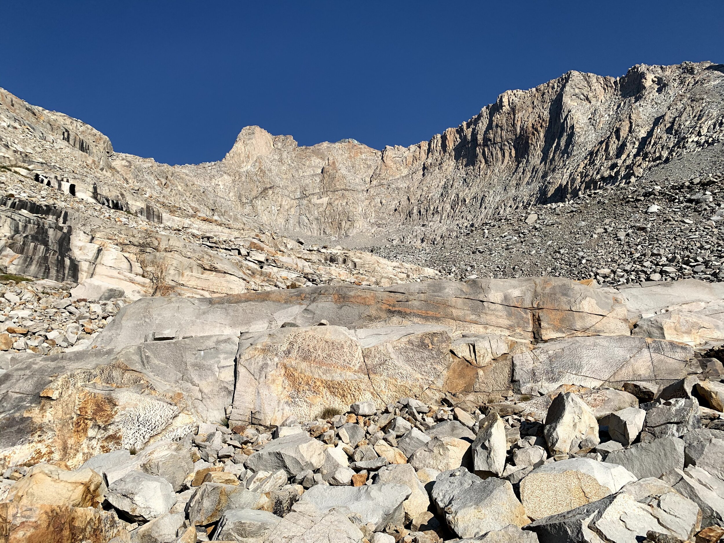
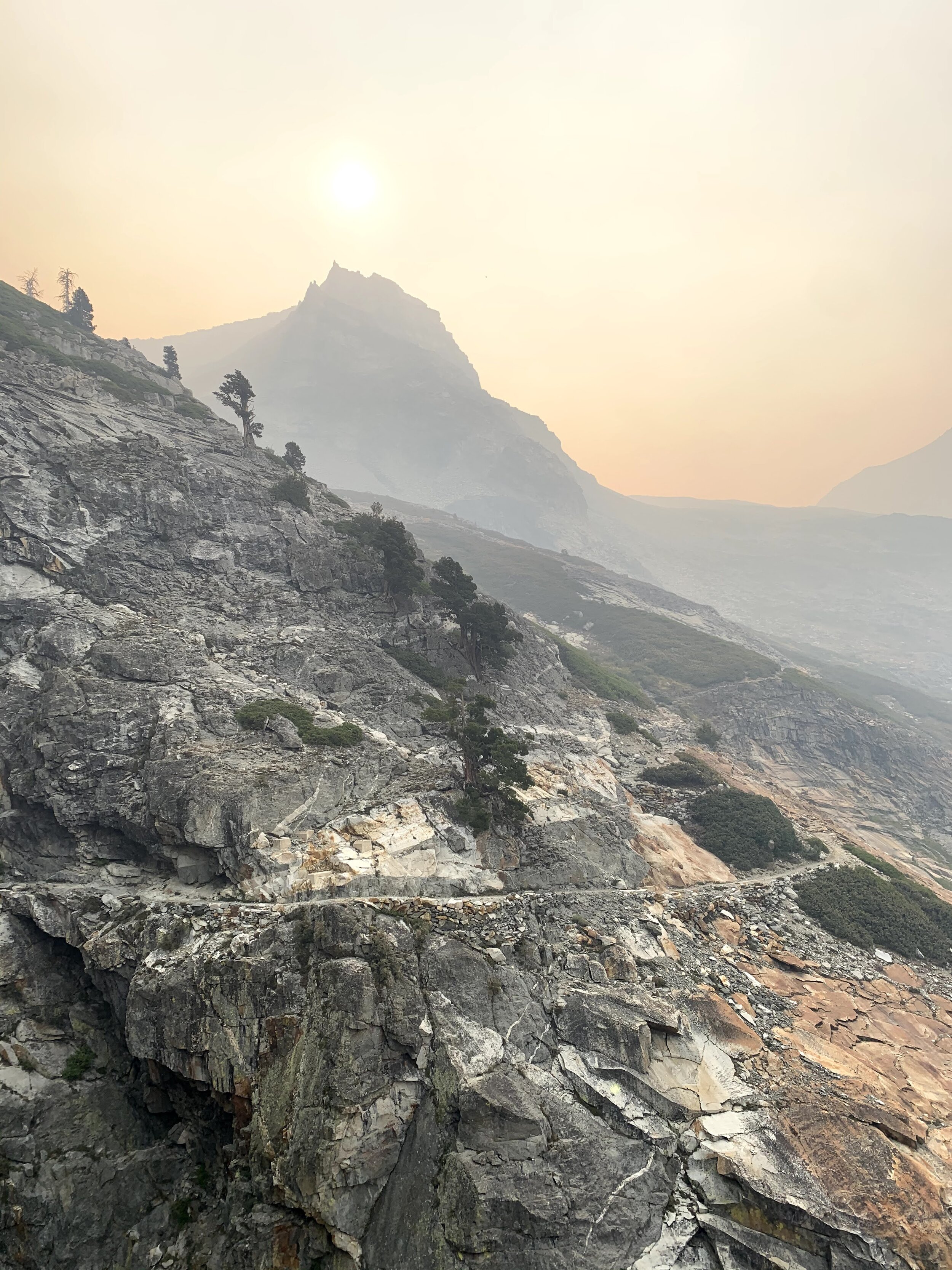
The trail makes many switchbacks through the talus field on the north side of Colby Pass. From a distance the slope appears barren and steep enough to seem nearly impassible, but up close we found evidence of life nestled into the inhospitable dry rocks. Pockets of yellowed wildflowers abounded, though well past their peak this late in the season at this high elevation. We even passed a few krummholtz trees sheltered by the ridge above. We’ve been over Colby Pass many times, but never this early in the day and the climb felt easier than it ever has. We rounded the last few short switchbacks and left the still air and morning coolness of the north face behind, cresting the pass into brilliant sunshine and a strong headwind. This experience is always a bit of a shock, though it happens at nearly every high pass in the Sierra. We take a minute to bask in natures contrasts, knowing that the south side promises some relatively easy downhill. Perched on the south face of the pass, tucked in behind some boulders out of the wind, we soaked in our first direct sunlight of the day and admired the new view unfolding in front of us. To our left the Kern Ridge shielded Milestone Basin, while straight ahead the trail meandered downslope into the Kern-Kawaeh drainage. Picket Guard Peak seemed impossibly high as it stood sentinel far ahead. We even had some distant views of the ragged peaks of the Kaweahs and started to feel the pull of our trip’s primary destination, so didn’t linger long.

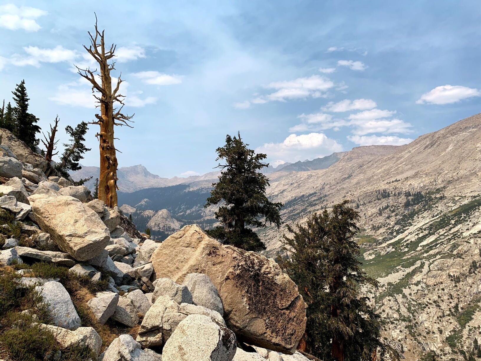
Foxtail pines in the upper meadows on the south side of Colby Pass. The High Sierra doesn’t get much better than this!
As we started our descent from Colby Pass, we crossed the Great Western Divide and re-entered Sequoia National Park. Sandy switchbacks on the upper part of the descent took us past a stark rocky tarn and by then, dry grasses were already making an appearance along the trail. The upper basin on this side is a beautiful mix of open meadow with a riot of high-elevation plants along numerous creeks and rivulets that crisscross the trail. This late in the season, most are muddy or dry but still surrounded by plant life. Above this ground-level palette, we passed through another grove of mature and stately foxtail pines. The combination of meadow, trees, dramatic rock, and deep blue Sierra sky make this section of trail one of our favorites stretches in the High Sierra. Given our deep appreciation for the foxtail pine we may be a bit biased, but unless you require a mountain lake it would be difficult to equal the beauty of this section. We hadn’t seen anyone since yesterday morning before the Tamarack Lake cutoff and were just discussing whether we’d run into any others, when we saw a hiker headed towards us. We wondered if he might have picked up the trail from Milestone Basin, but soon learned that he had come via the HST / Moraine Lake alternative and was looping back over Colby & Elizabeth Passes. In a brief conversation, he shared that he hadn’t experienced any smoke on this side of the divide, even coming up through the Kern drainage. This info buoyed our already good spirits as we descended into a dense lodgepole forest. The trail in this area has not aged well, so we not only lost our grand views but had to spend the next hour navigating a steep, dusty, washed out path of loose dirt & rock. We were glad when we finally leveled out in a broad meadow along the Kern-Kaweah River.

The wide marsh of Gallats Lake

Views stretching to the Whitney Group as we gained elevation along the “Ledge Route” to Picket Creek Basin

A sudden change in the quality of sunlight at a grassy patch along the Foxtail pines of the ledge route to Picket Creek Basin
Out of the forest, we again had a view of high peaks, but from this much lower elevation we could only see the nearest ridge. While it would be a while before we left the trail, we started a mental inventory of each drainage we passed in preparation for our off-trail navigation over the next few days. We passed beautiful but mis-named Gallats Lake; a large shallow pond in the wettest summers but a broad yellow meadow this late in any year. The Kern-Kaweah River took several wide turns as the drainage narrowed. From reading trip reports, we knew that we would be leaving the trail “about 0.5 miles above Rockslide Lake” or “just above the first marshy area that you reach below Gallats Lake” and aiming for the diagonal treeline on the opposite granite slopes. This approach is often referred to as the “Ledge Route” and as with most cross-country routes in the Sierra, everyone has a slightly different idea of the best path to take. For us coming from Colby Pass (thus with no way of knowing when we were 0.5 trail miles from Rockslide Lake), at the end of a dry year (so all marshy areas including Gallats Lake were just one big yellow meadow), this meant frequent stops to survey the surroundings and a constant low-key debate about the best place to leave the trail and set out across the Kern-Kaweah. Finally, we crossed a dry creek coming in from our left in an area with dense vegetation. Not long afterwards we saw a distinct diagonal treeline on the opposite slope as the undergrowth thinned. We both agreed that this would be OUR crossing (whether or not it matched anyone else’s favorite spot), and headed away from the trail towards the river’s shore. The shallow water would have been an easy wade anywhere this late in the year, but we were still happy to find a narrow spot along a wide sloping granite apron that made for an easy rock-hop with dry feet. We made our way through downed trees and brushy debris as we climbed away from the river on the opposite slope. From there, it was an easy decision to make an ascending traverse, more or less following the treeline that also marked the transition from granite slabs/ledges below, and talus above. Some spots were a little loose and/or exposed, but generally it was very easy Class 2 walking as “advertised” by others. As we climbed, we were happy to have chosen this “Ledge Route” over the Class 3 alternative which ascends more or less directly up Picket Creek to the lowest lake in Picket Creek Basin.
A path through the rocks to “the most beautiful lake in the High Sierra” under a sky darkening with wildfire smoke
We had made ~2/3 of our climb to the edge of Picket Creek Basin, enjoying both the spectacular trees around us and the long views east to Mt. Whitney and the surrounding high peaks when we noticed that the light was suddenly golden, though it was barely past noon. For 10-15 minutes we enjoyed this mid-day phenomenon until we realized that it was smoke blowing in from points beyond, and it wasn’t long before the entire Whitney group disappeared. We reached the ledges at what some call the “final corner” of this route as the sky filled with haze. Looking down the long expanse of smooth granite below, decided there was a bit more exposure than we preferred. We scouted a few alternatives and found a series of cairns (the first of the day) that led us up a much steeper but more protected route over a rocky notch. We followed more cairns, climbing far higher than seemed necessary, but just when we were about to turn back we found ourselves atop an outcropping that looked over the northwest shore of our target lake. We seemed impossibly high above the shore at first, but with a little scouting found an easy route down to the northern shore, where we picked our way along the granite to cross the outlet and find some sweet campsites. This little unnamed infinity lake on the edge of a high basin has been referred to by some who visit as “the most beautiful lake in the High Sierra” and by others as “the perfect swimming hole” Despite the thickening smoke, we could appreciate both sentiments. Unfortunately, it wasn’t all that pretty in the current air and we were starting to wonder if smoke and/or fire might impact our ability to get into (& out of) Kaweah Basin. We always keep a Plan B & Plan C in mind in the backcountry. We decided to push forward, but were already considering alternate routes.

Foxtail pines in Picket Creek Basin en route to Picket Creek Pass, in the direction with clearest sky
Once on the SW shore of our infinity lake, it was easy walking up Picket Creek Basin. We stayed on the north side of the drainage past the next two lakes, then crossed Picket Creek near the far shore of the second. The climb to Picket Creek Pass (sometimes called Picket-Kaweah Saddle), the low point in the ridge between the two basins, posed no challenge. We would have enjoyed the scenery immensely if we hadn’t been worried about the air suddenly thick with smoke, darkening the sun by mid-afternoon. We followed a vein of iron-rich red rock through otherwise brilliant white granite, and were happy to be surrounded by foxtail pines to help ward off the sense of doom brought on by the sky. We had glimpses of the Kaweah Peaks Ridge through the saddle and any hopes that the sky might be clearer in Kaweah Basin were dashed when we saw their ghostly silhouette. We had planned to make a detour to the lowest lake in Kaweah Basin, commonly known as “Island Lake” among Sierra backcountry enthusiasts. Given the sky and our uncertainty about the smoke’s origin, we decided it would be more prudent to continue on to the higher reaches of Kaweah Basin. From there, we would have a few options to exit - our planned route was over Class 2 Pyra-Queen Col (PQC), while Plan B would take us via Class 1 Kaweah Pass. PQC has quite a reputation as a steep climb with loose rock. Many call it a miserable and/or dangerous pass and while we have quite a bit of off-trail experience in the High Sierra, we definitely considered it the technical crux of our trip and had not seen either side before (except in pictures). Kaweah Pass is considered by many to be “easier,” but is still advertised as a long slog through steep, loose scree and sand, and would put us out onto the Chagoopa Plateau many more off-trail & trail miles from our car, vs. into Nine Lakes Basin just off of the High Sierra Trail near Kaweah Gap.

Hazy sky but spectacular Foxtail pines above “Island Lake” looking down into Kaweah Basin from Picket-Kaweah Saddle

Deep red river gorge in lower Kaweah Basin
From the saddle it was a mildly tedious but not difficult descent over large talus and small ramps into Kaweah Basin. We could no longer make out the Kaweah Peaks Ridge through the dense smoky haze, and we felt a sense of foreboding as we discussed our options. Kaweah Basin itself is sparsely vegetated, and Pyra-Queen Col is well above treeline. It seemed unlikely that an actual fire would be in our specific area, and we guessed that the sudden shift was due to a change in wind patterns carrying smoke from one of the large fires in the larger region rather than a new fire that would specifically endanger our route. On the other hand, we were a bit nervous about PQC to begin with, and crossing a challenging cross-country pass in poor visibility and/or terrible AQI didn’t seem smart or appealing. On the other OTHER hand, the air is generally best in the morning when dealing with smoke from a distant fire, and it also tends to clear out at the higher elevations. Ultimately we decided to push on to the upper reaches of Kaweah Basin to camp for the night. If the air cleared, we’d be in good position for Pyra-Queen Col early the next morning. If not, or if there were new developments, we could still head to the southeast reaches of Kaweah Basin and head out over Kaweah Pass - likely a total slog but seemingly a bit less technical. That much decided, we enjoyed our walk up through Kaweah Basin. Even through terrible haze, it is a spectacular spot. The air smelled mildly smoky but the actual AQI didn’t actually seem too bad at ground level so we didn’t avail ourselves of the N95 masks that we had tucked into our packs. Our first objective was the deep cleft cut through red-orange rock by the water draining upper Kaweah Basin as it forms the inlet stream of “Island Lake.” We stayed on the near side of the gorge for a bit, but once we could easily do so, we rock-hopped to the other side and scrambled up the opposite bank. This gave us many more options for route-finding, which was much appreciated. While there isn’t much elevation change shown on the map, there are quite a few micro-ridges and moderately sized gorges, and the walking was a bit more difficult than we expected.
Ghostly ridgeline of the Kaweah peaks from Kaweah Basin, mid-afternoon on a very smoky day

One shelf after the other, nearing treeline in Kaweah Basin with a smoke-obscured sun above Kaweah Peaks Ridge

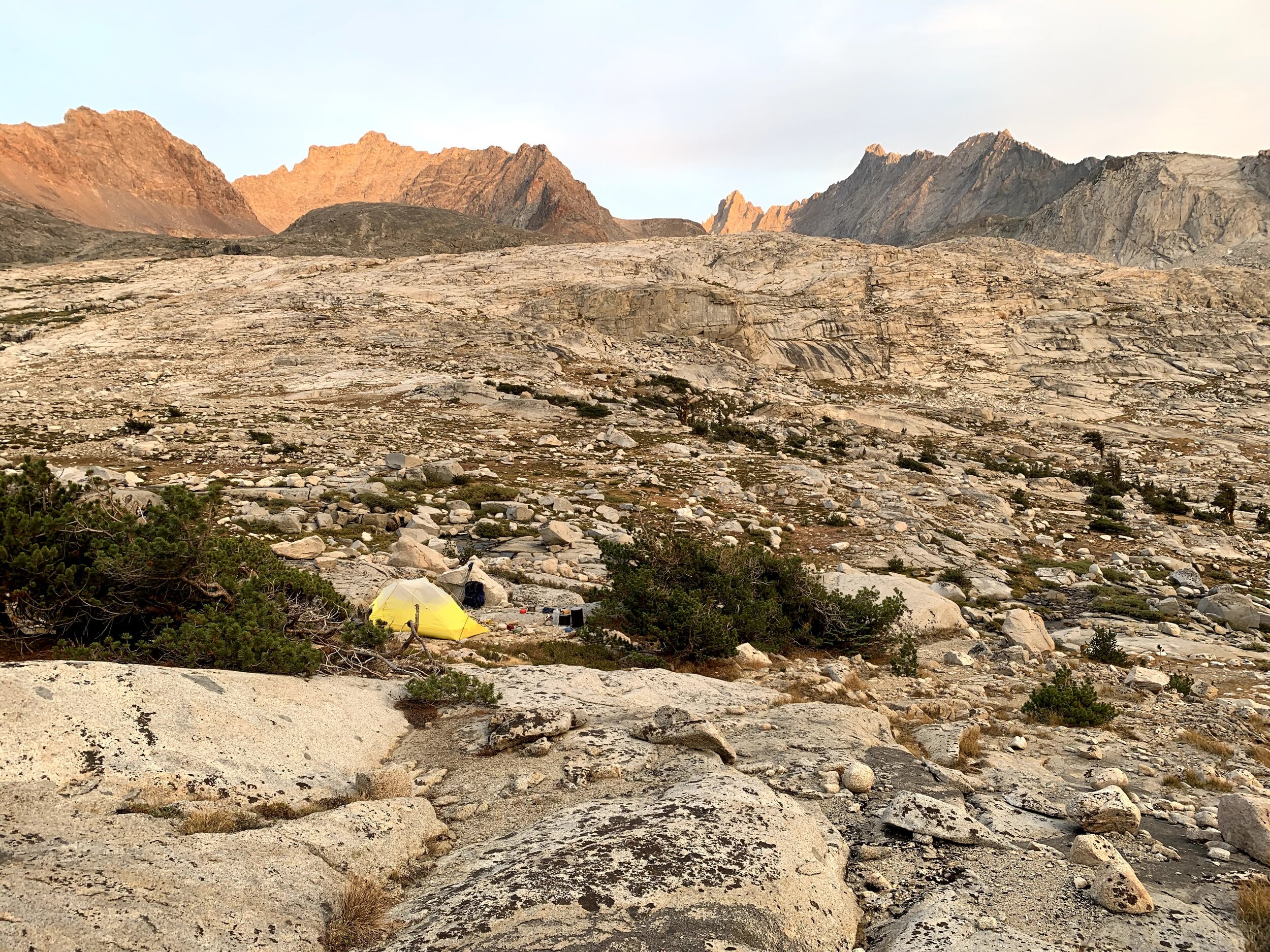
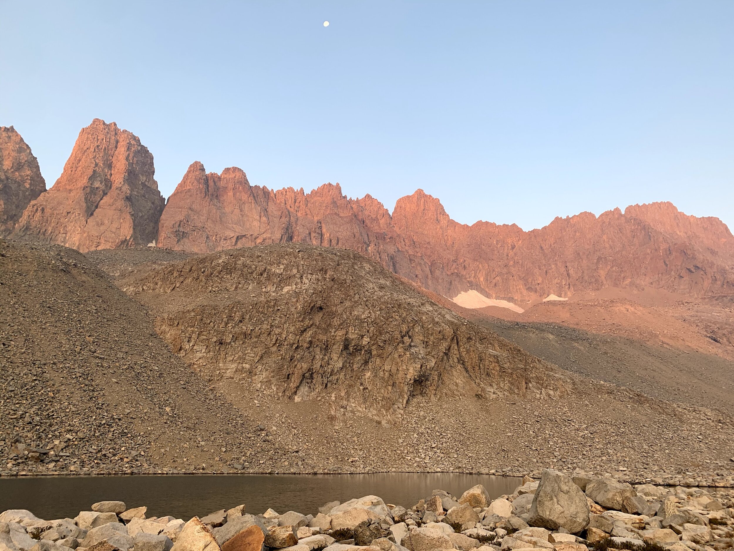
Upper Kaweah Basin holds several large-ish lakes surrounded by talus. Consolation prize for smoky air is an orange sunset sky.
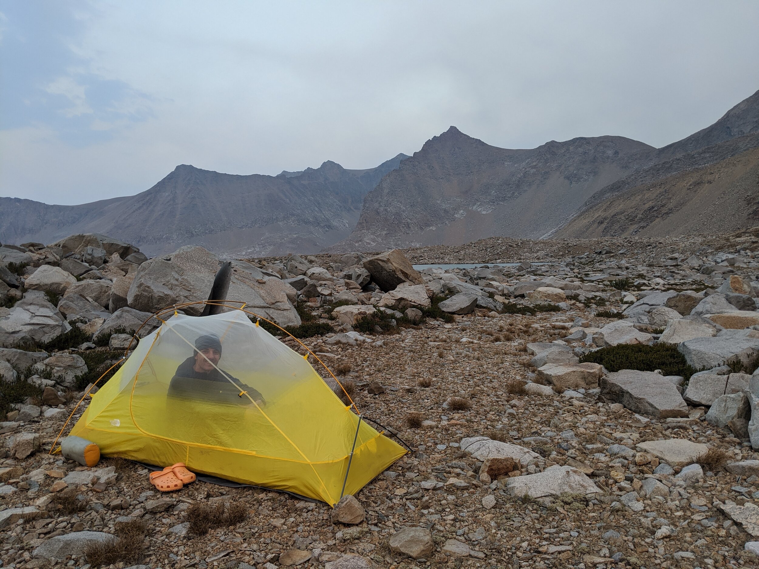
Not a perfect tent site, but good enough. And is that the sky clearing enough over Red Spur to see a few clouds?
There was plenty of water and a ton of wildflowers around the lower lakes in Kaweah Basin, though we could see from the rocks that water levels were low for the area. We skirted willows and marshy bogs, and tried to find the easiest route up a series of shelves that make up the basin. We again had a view of Kaweah Peaks Ridge, though ghostly against a grey sky. It is easy to lose sense of time when the sun is obscured by dense smoke. At times it felt like we were making good progress, and other times it seemed like we’d been walking forever and were no closer to that distant ridge. Each time we climbed to the rim of a shelf, there was another above us. It is difficult to describe the feeling of passing through a spot like this in conditions like that. We could tell it was beautiful, and in other circumstances we would be marveling not only at the small details but also at the vast expanses. Under our current conditions, we just wanted to make it to a reasonable campsite and hope that the air would clear. We noticed our surroundings, but didn’t take great joy in them. The closest I might come to describing it would be hiking in terrible weather, at night, when dead-tired. Except that if those were our problems we would have set up camp early, slept, and enjoyed our first visit to this remote basin the following day. And that did not seem to be a viable option. So onward we pushed. It was getting chilly by the time we reached the pair of large-ish lakes in the upper reaches of Kaweah Basin and started to look for a campsite. On the map the terrain looks relatively flat, but in reality it is all talus at that elevation with very little vegetation and even less exposed dirt. There is enough micro-variation in the terrain that one lake isn’t readily visible from another, and it was difficult to guess where there might be a patch of ground big enough for our small tent. We spent about 20 minutes scouting promising mounds and shorelines, and ultimately found a single spot of slightly sloping sandy gravel that would suit us just fine. Not a perfect spot, but a perfect spot for the current situation. We did have a closeup view of the Kaweah Peaks Ridge, and a good vantage from which to scout tomorrow’s route. We marveled at the bulk of Red Kaweah rising above the far shore of our lake, and the jagged slopes of Queen Kaweah in the direction of tomorrow’s climb. The sun had long ago lost its heat in the smoke-thick air, and as it dipped below the ridgeline an icy wind picked up. We stopped gawking and quickly pitched our tent, changed into warm clothes, and started in on our evening camp tasks. As the daylight waned, we noticed that the sky seemed thinner. Smoky skies always make brilliant (if eerie) orange sunsets, and we were even treated to a bit of alpenglow on the surrounding ridgelines. It was no Range of Light evening, but it was a decent consolation prize after a long afternoon of smoke-darkened skies and nagging worry. We sat out on the cold rocks, bundled in our thickest down jackets, and enjoyed our private time in upper Kaweah Basin. We hoped that the sky would continue to clear overnight.
NB: In case you’re considering Kaweah Pass as a route in or out of Kaweah Basin, Charles Hayden’s maps, pictures, and trip notes from his adventures in ‘94 & ‘97 are quite detailed & would be good resources.

Panoramic view from our campsite in upper Kaweah Basin. Mt Kaweah to the far left, Red Kaweah and the back side of Black Kaweah directly ahead, and Pyra-Queen Col off towards the right
STATS: 13.6 MILES (8 on-TRAIL, 6.6 off-trail) | 10.5 HOURS | 1664' NET ELEVATION GAIN | 4580' CLIMB | 2916' DESCENT
Day 4 / Upper Kaweah Basin to Nine Lakes Basin
Crags of Red Kaweah across the lake from our campsite

Scouting the Kaweah Peaks ridge for the location of Pyra-Queen Col (not visible, but a bit to the left of the dark iron-laden rounded bulge near the low point of the saddle)

Moon setting behind Kaweah Peaks Ridge as we climbed towards Pyra-Queen Col. PQC not visible, but rounded dark bulge is obvious to the left of the low point.

We had blue sky ahead (northwest), but this look back over Kaweah Basin shows how smoky/hazy the sky was towards the south & east. Mt Kaweah is in the middle.
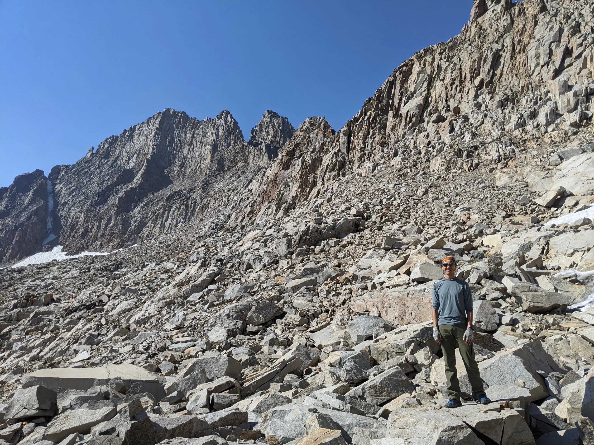
Early September is chilly in the high country, and our exposed spot in the talus was no exception. The wind kept up most of the night and we could hear intermittent rockfall down the steep talus/scree slopes of Red Kaweah across the lake. On the plus side, it was decidedly not smoky when we got up at dawn and the wind also dissipated with morning light. It wasn’t brilliantly clear, but we were elated to find just a thin haze in the sky. We had spent a little time last night visually scouting the wall that connects Red & Black Kaweahs to Kaweah Queen, and we got back to this project as we sipped our coffee/tee in the cool morning shadows. We knew from scouring trip reports that Pyra-Queen Col cannot be seen from the approach, as it cuts across the ridge at a steep angle. It also seemed that there are Class 2 and Class 3 options for crossing this ridge, and some debate about which notch is “the” named col. Many referenced the rounded bulge of dark red rock near the low point of the saddle and the deep cut just to its right (from our viewpoint). It seemed that the “actual” col was somewhat to the left, though this cut was also passable and referred to by some as PQC. We were hoping for the Class 2 route, as it sounded challenging enough. Pictures posted by many show a very steep loose initial drop along a fissured rock wall - we didn’t care to make it worse than that. Those who referenced the Class 3 option discussed finding a “ramp” to ease the early descent but details were sparse. Many suggested to stay right towards Kaweah Queen for most of the initial climb from the upper lakes. Our favorite route description suggested that “the rocks would show you the way” with added detail “go up closer to the right side, then start cutting left, even further left than you would expect, and then follow the path right.” Seems easy, right? We decided that the only way to get over it was to get started, so we headed up the right side of the initial rocky gully towards Kaweah Queen, constantly scouting the saddle and focused on the iron-rich knob.

A great spot for a break near east side of PQC, views back over Kaweah Basin to Mt Kaweah, Red Spur, and points beyond
Tiny snow patches on the upper ledge, east side of Kaweah Peaks Ridge. Red bulge of rock visible near center (Class 3 alternate PQC is just to right of it, first notch from right of photo)
As with many cross-country passes in the High Sierra, we found the walking much easier than expected once we actually got started. It was plenty of talus-hopping, but there were many grassy patches and ramps in the lower section, and most of the rock was stable. It never felt very exposed, and we were happy to make good progress. We stayed right up the entire gully to the base of Queen Kaweah, then climbed over the rim of a shelf to find a collection of huge, flattish, and stable rocks - perfect for “lizarding” on a sunny day! Here we also found our first patches of snow and trickles of snowmelt. We took the opportunity for a short break, and scouted out the wall ahead with our packs off. The dark bulge was not nearly so prominent up close, but we could still pick it out. There was no obvious col though we knew we would be able to see it until after we had passed. It looked to be easy walking at our current elevation - we could traverse along the entire base of the wall without much exposure. But the final 30-50’ to the actual ridgeline got steep fast, and we knew that we would not want to approach the wall until we had committed to a crossing point. We had the GPS track from a single hiker saved on our phones for reference, though we know well that GPS can be a bit flaky near sheer rock walls, and just because one person has taken a path doesn’t mean it’s a good choice. We started our traverse, scouting the wall to our right for any sign of a col. At the red bulge we saw a sloping ramp of shiny deep orange rock, but it looked slippery and definitely fell into the Class 3 category. We continued on; consulting our phone it seemed likely that the track we had loaded went over the notch we just passed.

Final rocky ramp to the square notch of Pyra-Queen Col - a cakewalk!

Pyra-Queen Col!
We told each other there was plenty of wall left, and that we should “go left farther than we thought necessary” to reach the actual col. The traverse itself wasn’t difficult, but the mental challenge of believing a passable col would magically open up in the steep rock face to our right became harder as we got closer to the spines of Black Kaweah and seemed to be running out of saddle. We approached the wall in a few places, thinking there might be a small notch, but each time found unstable rock, more exposure than we preferred, and no passable route over the ridge. Our spirits dipped a little with each retreat to our traverse level. The wall to our right was becoming higher as it transitioned into Black Kaweah and we had just about run out of decent terrain when we saw what seemed to be a walkable route climbing up and back towards the right. We remembered the advice of our “rocks will show you the way” guide, and decided to try one more time. It was a little slippery to start, but we didn’t have many other good options. Not 10-15’ up, we spotted a sandy patch with the footprint made by an Altra Lone Peak - the trail runner shoe of choice worn by many an ultra-light backpacker. One of us whooped and we both looked up to see an unmistakable rocky ramp leading to a square notch in the rock wall. A huge rock cairn marked the spot as Pyra-Queen Col! We soon reached better footing and quickly made our way up the final ramp to reach the technical crux of our trip, under blue skies. We took our packs off and enjoyed the sun while we scouted the west side descent. NB: report/pics from a couple who took the red notch Class 3 alternate describe that the west side was “class 4 for about 20’, then eased off to a 45-degree scree slope.” Definitely glad we kept going to the Class 2 option, even if it was a bit longer!

Cheri goes first on the slow upper descent from Pyra-Queen Col (in shadows next to wall), Queen Kaweah rising above
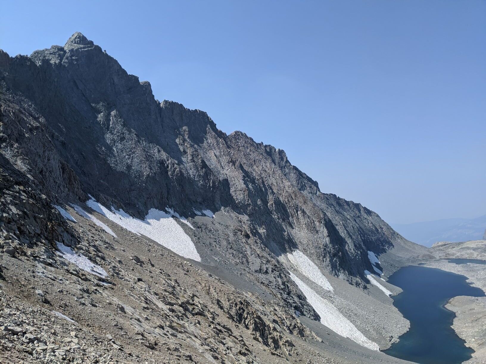
Although it was well within Class 2 difficulty, the upper part of our descent was indeed steep and loose, just as advertised by everyone who has used this route. There is a rock wall to hiker’s right and we went one at a time, jamming the handle of our ice axe into cracks in the wall to anchor ourselves in between steps. Every step sent down showers of sand and scree down the slope, so we took turns moving to minimize rockfall hazard. Black Kaweah rose above us and (once past the steep upper chute) we could finally enjoy this craggy peak, the namesake of our leggy black pup from the streets of San Jose, in all its glory. Author John Cleare (Guide to Mountains & Mountaineering, 1979) described it as “toothed and volcanic,” asserting that “the Black Kaweah is the Sierra's most forbidding peak.” Remote and infamous for loose rock, it is considered a classic Sierra climb (first ascent in 1920), but it is summited by just a handful of parties each year. The peak has a local magnetic disturbance that can cause compasses to vary by up to eight degrees in the area, and the summit is home to fulgurites (rock casts of lightning strikes)! While we are much more interested in backcountry travel than summiting peaks, the mystique of Black Kaweah nonetheless holds plenty of allure and it was pretty sweet to be on the edge of its slopes as we started our descent. It was just before noon, and the haze was spreading across the sky towards the west. Even with the muted blue background, Black Kaweah makes a foreboding bulk as its snow- and talus-covered slopes fall steeply towards Lake 11,682 far below.

Black Kaweah & Lake 11,682 on the east side of Pyra-Queen Col

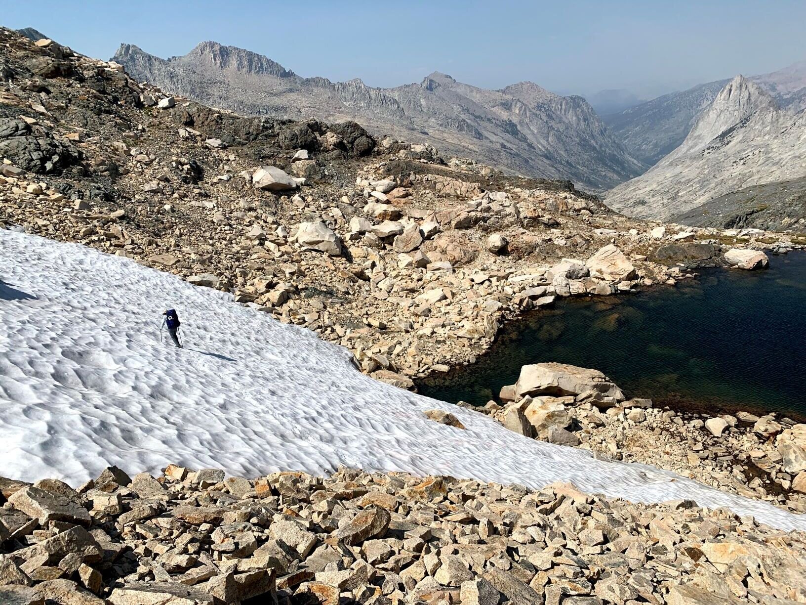
Low-angle snowfield near Lake 11,682 in upper Nine Lakes Basin
Looking back at Pyra-Queen Col from Lake 11,682. Pale down-left chute to right of saddle’s low point is the initial descent from PQC. Larger notch near low point is Class 3 alternate (note indistinct down-right rocky ramp, likely the alternate to its 4th class initial descent)
Below the initial steep chute, the slope evened out. As expected given the reputation of PQC, loose rock continued all the way to the lake and it took a surprisingly long time to cover the downhill distance. We continued to move downward in staggered zig-zags, finding the best-looking footing but taking care not to cross above/below each other for safety. It would be much quicker going if more of the slope were covered in snow. As it was, routefinding was not particularly difficult, though there are a few small cliff bands to be avoided. We made a point to hit each of the low-angle snowfields near the bottom of the slope for a little respite from the tedium of loose boulders and scree. As we descended the rocks grew larger until we were back in an endless talus-field as we approached the lake. Several trip reports emphasized that hikers should walk along the north side of Lake 11,682 and we chuckled over this recommendation. The steep slopes of Black Kaweah, covered with huge patches of high-angle snow, drop into the south side of the lake, and the soundtrack of our descent was intermittent but regular rockfall down those slopes. We couldn’t imagine that anyone coming down from Pyra-Queen Col would look at the two sides of the lake and decide to pick a path along the south shore. In any case, our terrain leveled out as we approached the end of the lake but the talus continued. We spotted a few small grey cliff-lets dropping straight into the water along the north side and picked a path 20-30’ above the shore until we had passed this final obstacle. Beyond that, we headed to the shore of the lake and dropped packs for a celebratory lunch - the crux of our trip was behind us, Black Kaweah towered above us, and we had a sparkling alpine lake all to ourselves. The sky might be hazy, but it was generally blue and there were even a few clouds in the sky. Given the lens of 2020, it felt like a perfect moment. We took off our shoes and dangled feet & ankles in the crystal-clear & cold waters and looked back up towards PQC, tracing our path from the pale chute that seemed impossibly high up the rocky slope.

Perfect spot for a post-PQC rest with views of Black Kaweah on the shore of Lake 11,682
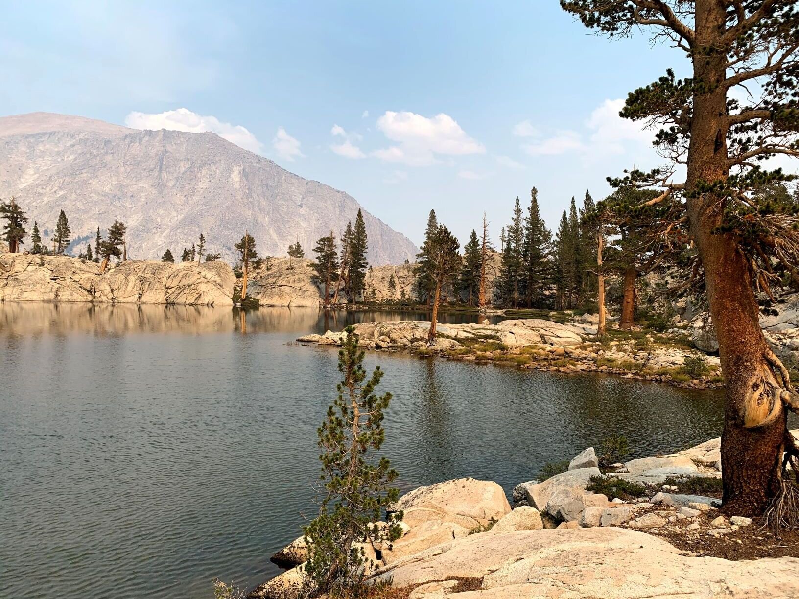
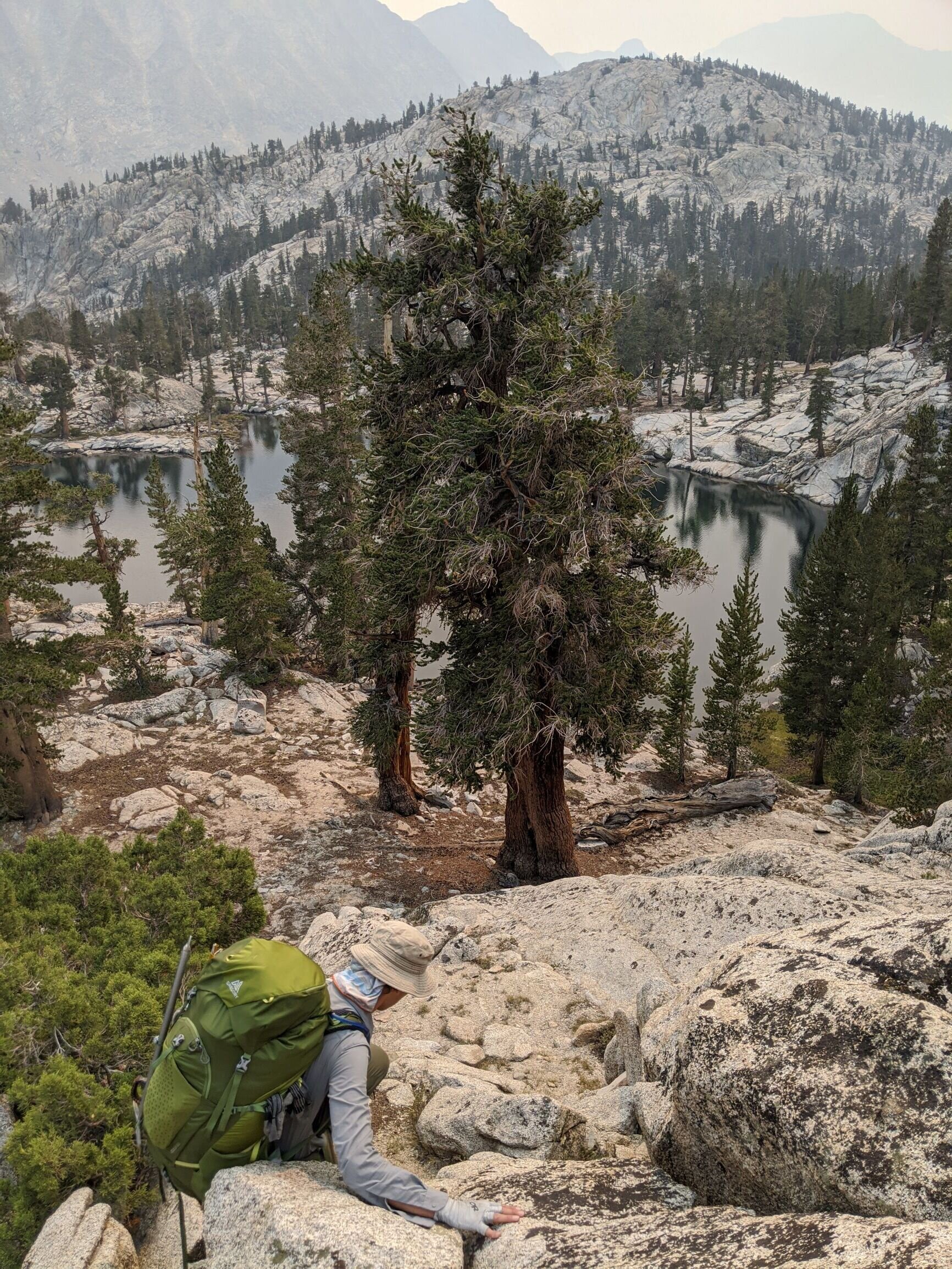
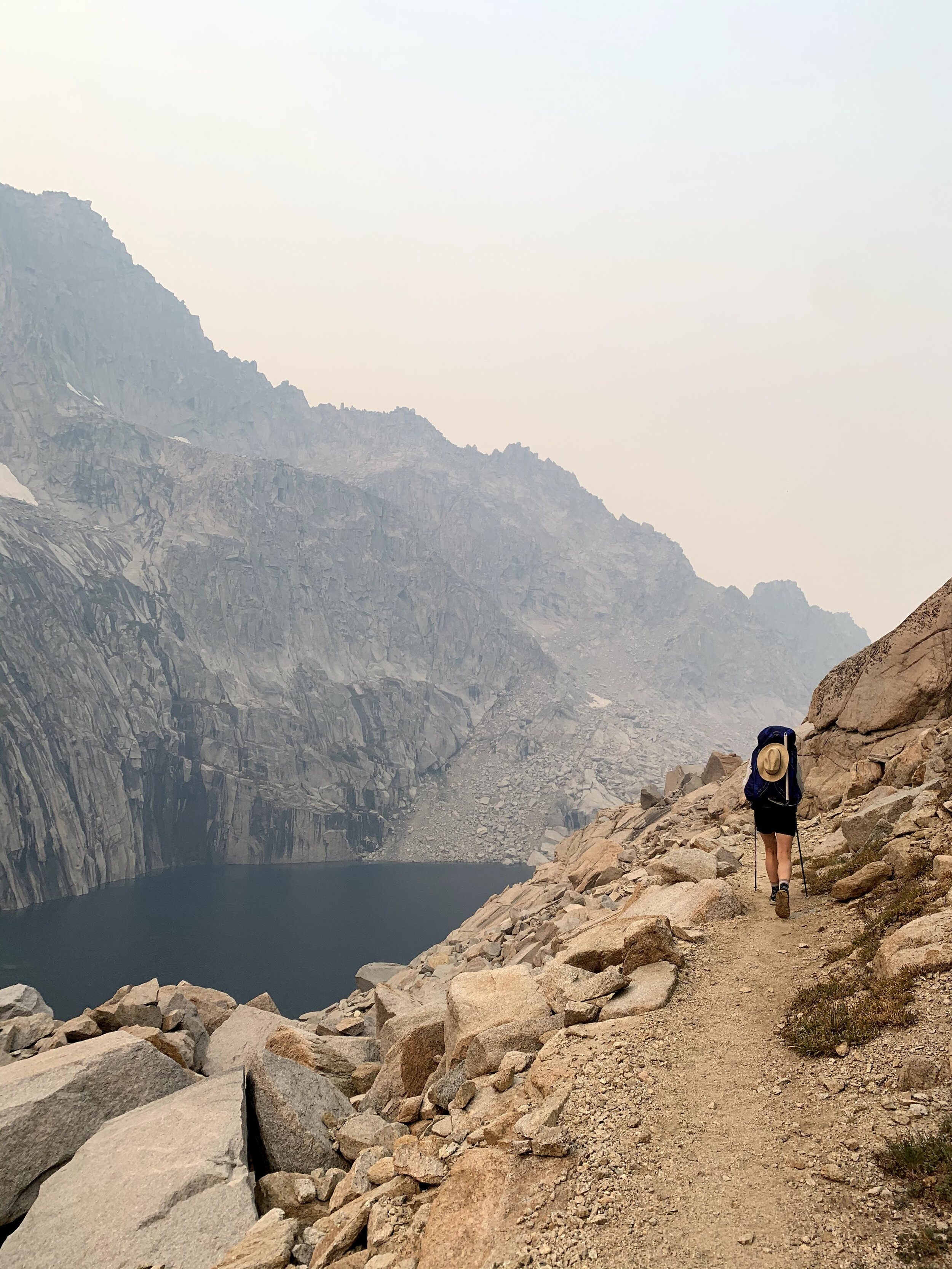
There was still plenty of talus to cross, but we found it to be relatively smooth going after crossing Pyra-Queen Col. We continued along the north shore of very long Lake 11,682 to its end, then crossed a low shoulder to arrive above the brilliant aquamarine waters of the small 2nd lake. It was a quick talus-hop to the edge of that shelf from where we had stellar views of multi-colored Lawson Peak rising above the 3rd lake. A vein of deep red rock transitioned into a steep slope of scree, and ended up as a red sandbar beneath the turquoise water of this stunning high alpine lake. We consulted the GPS track on our phones and were surprised to discover that hiker had passed between the 1st and 2nd lakes then dropped over the edge of the basin all the way down to the High Sierra Trail! Reading his trail notes, the only advice given was “pick the route carefully to avoid cliffs of 20 or more feet.” Um, OK! Looking at the topo map, we were glad our plan was to meander through the shelves of Nine Lakes Basin and more gradually re-join the HST. We thought it would be simple to drop down to the 3rd lake but that didn’t turn out to be the case. Staying on the east side of the 2nd lake’s outlet quickly put us on steep cliffy slabs, so we retraced our steps and crossed the water near the lake. We scouted a bit and found a more passable route through a talus-laden chute. It wasn’t technically challenging, but we did find it tedious to be back in terrain with moving boulders and the need to select every step carefully. We were both happy to finally reach the shore of the 3rd lake, especially since we’d read that the talus petered out after this last “upper lake.”

“3rd lake” in upper Nine Lakes Basin, with red-hued Lawson Peak rising above, and the Kaweah Peaks Ridge stretching to the right

Mt. Stewart & Lake 10,725’. Triple Divide Peak pokes up behind.

Nine Lakes Basin, below the endless talus of the uppermost lakes

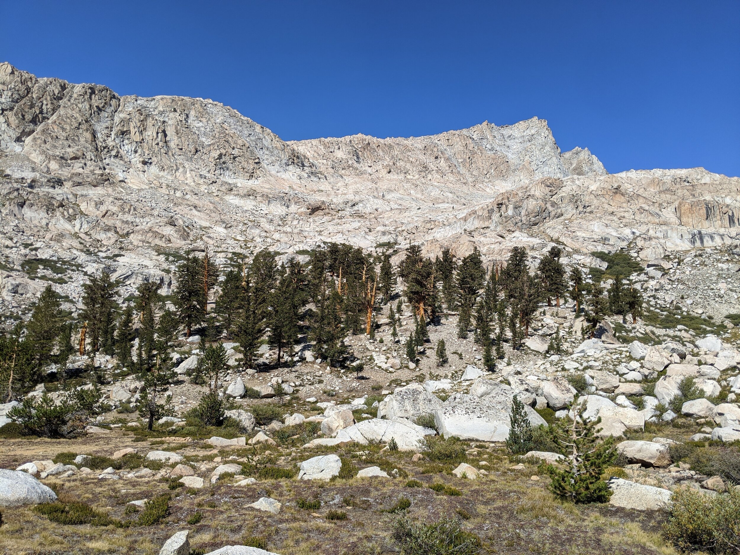
Foxtail pines in Nine Lakes Basin
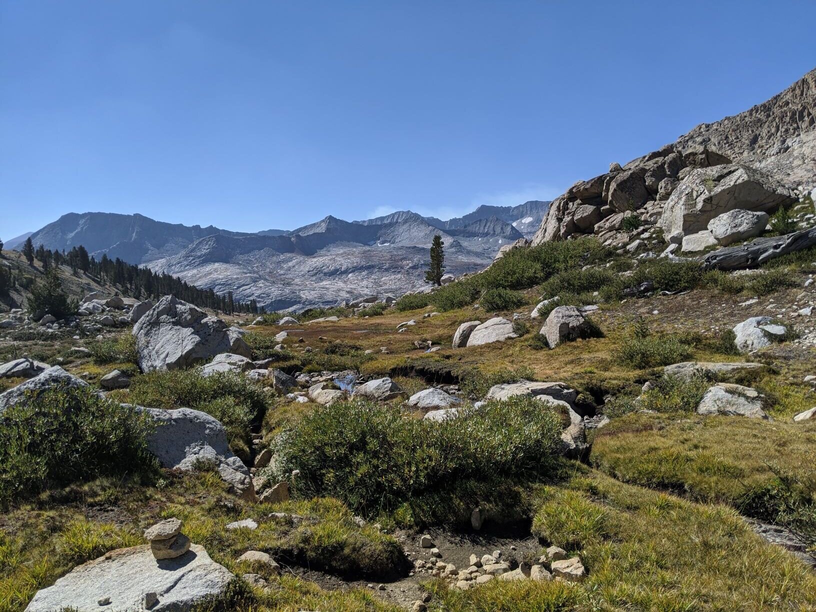
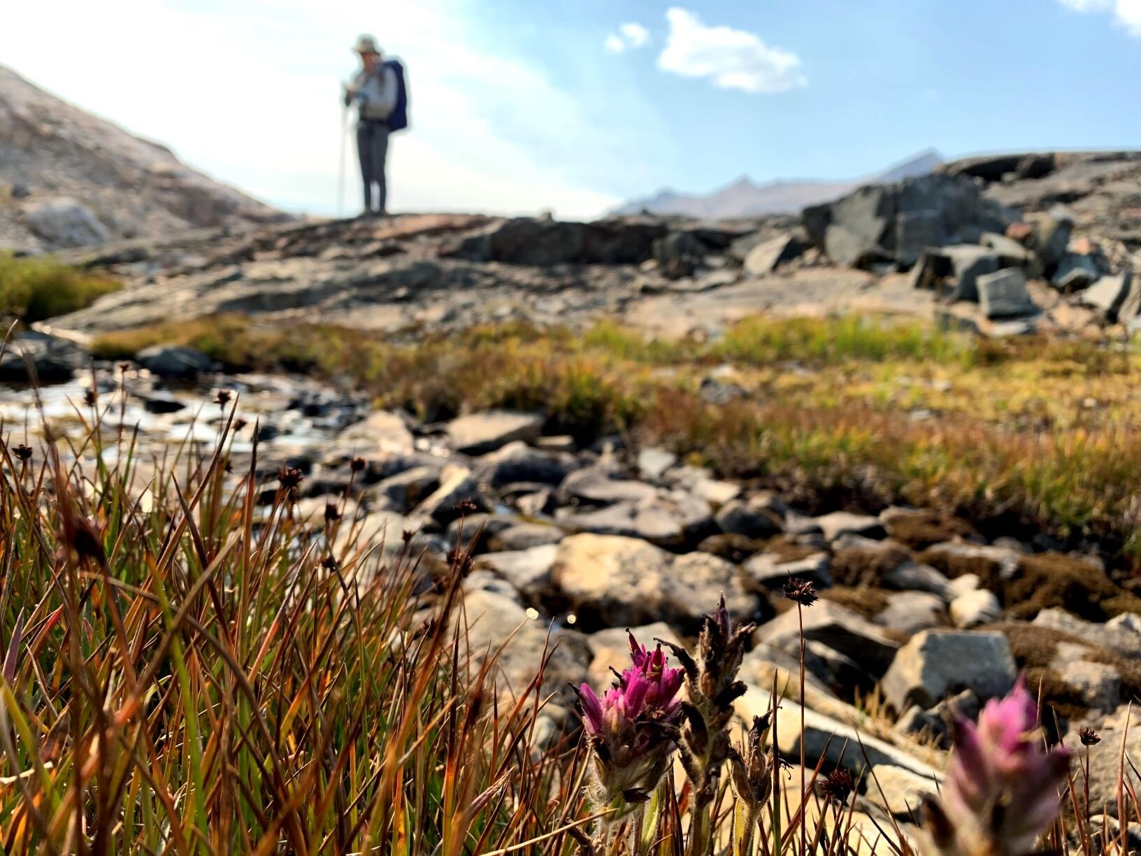
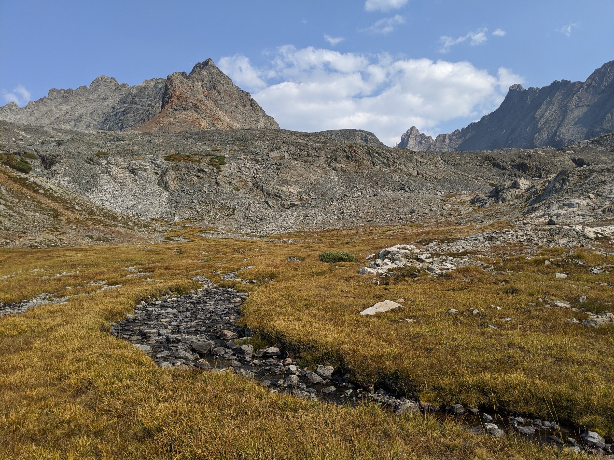
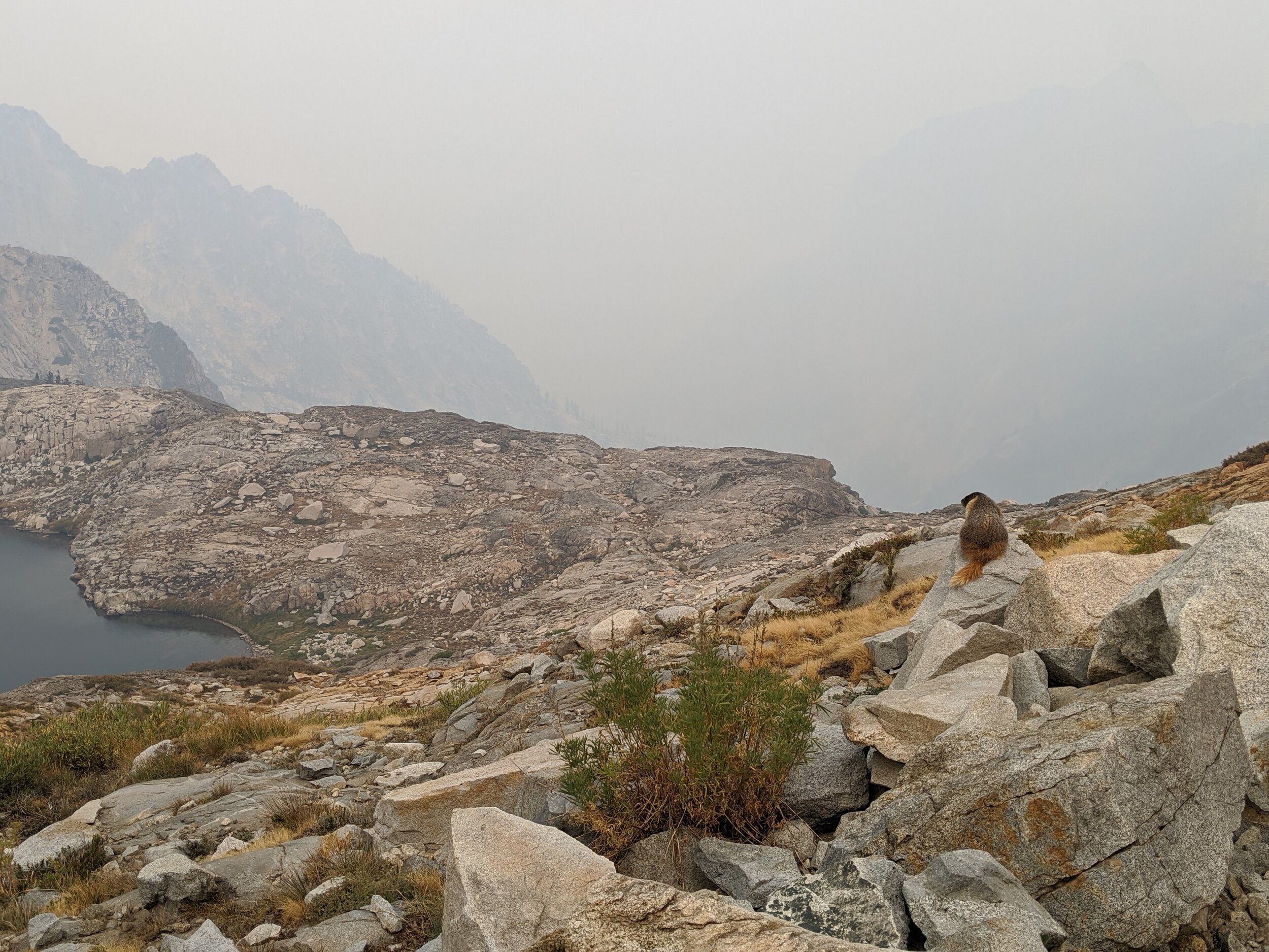
As advertised, we left the last of the talus behind near the outlet of the 3rd lake and struck out across beautiful Nine Lakes Basin. Our initial plan to follow the outlet of the 3rd lake quickly proved a poor choice, as we found ourselves on the rim of a small shelf that dropped off into short black cliffs. We followed the grassy plateau around to the north and found a grassy ramp with a use trail and plenty of footprints leading to the next level down (here’s an annotated pic that basically shows the route we also took). From there, walking was easy without any particular routefinding skills required. We dawdled through the basin, enjoying the season’s last wildflowers along the banks of tiny burbling streams. All of the grasses were yellowed and crunchy, ready for the first snow that could come any day, but with bright sun overhead it felt like late summer to us. We decided to aim for a campsite at large Lake 10,725’, the headwaters of Big Arroyo. The map showed flat terrain near the outlet, and we hoped we might have it to ourselves. We knew that Nine Lakes Basin is an accessible spot from the popular High Sierra Trail, and wanted to hold on to the wilderness solitude of the past several days just a bit longer. We had fantastic views of Triple Divide Peak, the Kaweah Peaks Ridge, and Mt. Stewart as we crossed the rolling basin in a generally north-west direction. It was somewhat reminiscent of Humphrey’s Basin a bit farther north in the Sierra, another favorite backcountry spot. We found ourselves on a series of pink granite ramps and slabs rising above the southeast shores of Lake 10,725’ by mid-afternoon. A cool wind picked up as we picked our way down towards the lake, but the sun was still warm in the sky. As the lake came into view, we re-considered our camping plan. The large expanse of water was surrounded by rock and sat in the upper reaches of a valley that would be a great funnel for wind. The wind was already whipping up the surface of the water so that the prospect of a late afternoon swim held zero appeal, and any campsite would not get morning sun. Several flat spots among the rocks near the southwest shore would easily fit a small tent, but offered no protection from the elements. We decided to meander downstream to see if we could find a better spot among the first trees, near enough to the outlet to access water. We were elated to discover that the tall trees scattered throughout this valley were all Foxtail pines, but did not find any suitable tentsites nearby. We moved our focus to the west side of the creek, and soon found a perfect sandy spot sheltered by a few low windswept Lodgepoles. We were protected from the wind, and it wasn’t a long walk to water. We set up our campsite and started making the earliest dinner of our entire trip so far.

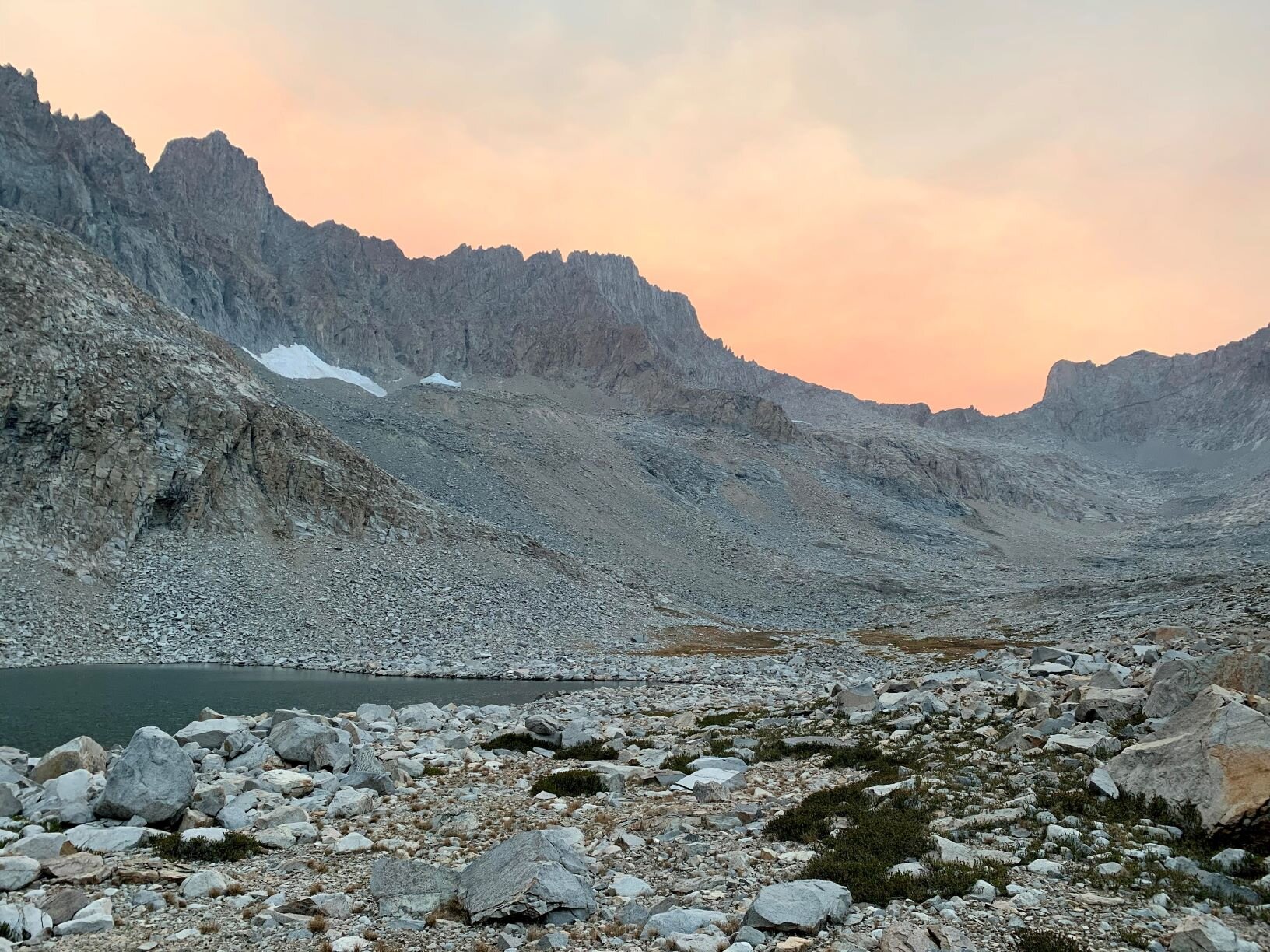
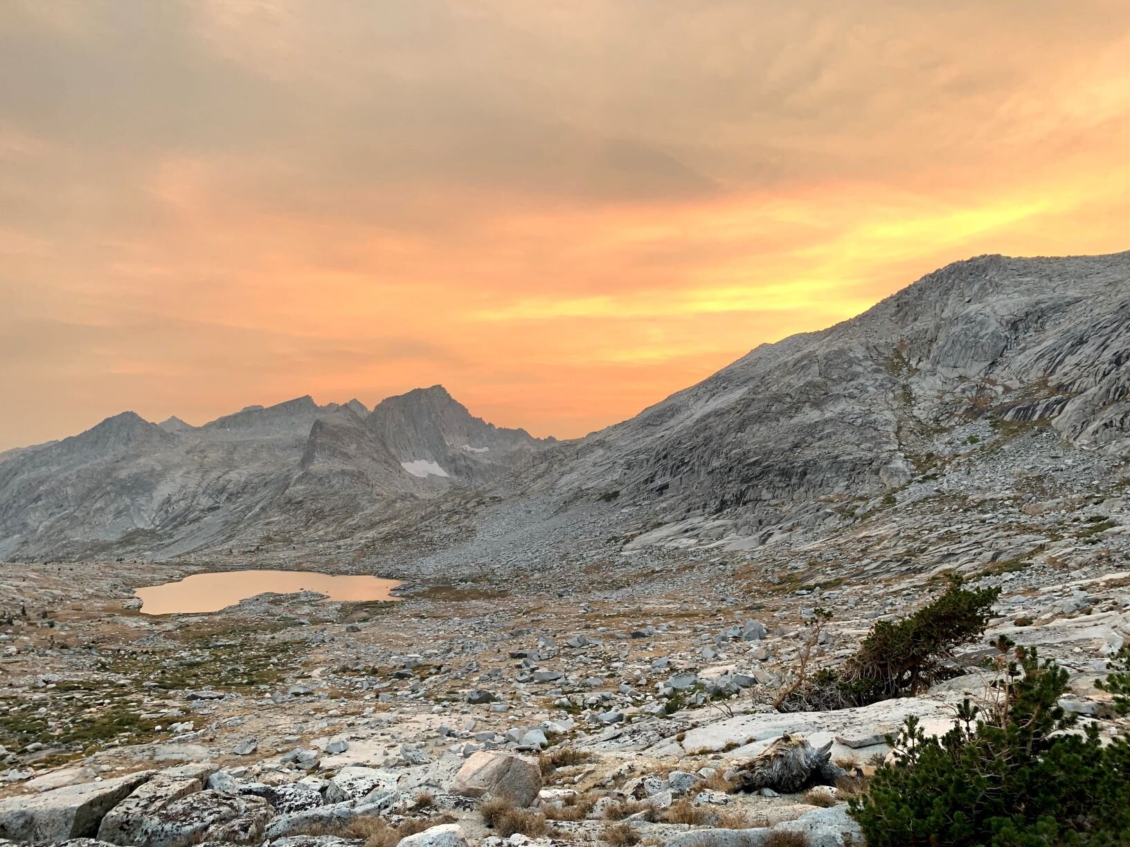
Sunset from near our campsite in Nine Lakes Basin, horseshoe-shaped lake below Kaweah Gap

Kaweah Gap from outlet stream below Lake 10,725’

Nine Lakes Basin campsite, tucked in between krummholz trees and with peekaboo views of the Kaweah Peaks Ridge
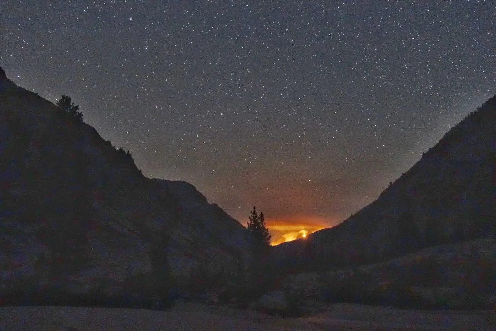
We chatted about options for our final 2 days on-trail, now that we had successfully navigated Pyra-Queen Col and seemingly gotten away from the worst of the smoke. We settled in to enjoy what we hoped would be a good Sierra sunset from our relatively high and unobstructed vantage. The sky turned colors early, a sure sign of smoke in the air, but we remained optimistic that we’d seen the worst of it. We spotted what we thought to be the HST headed towards Kaweah Gap just beyond the horseshoe-shaped lake that sat far below us. As dusk fell, we spotted a person walking near that lake and were happy for our private perch higher in the valley. We watched the sky turn all shades of orange, and waited for the final alpenglow on Kaweah Peaks Ridge before deciding to turn in for the night. Andrew decided to take a few night photos after the stars came out, and as he processed his images he was surprised to see an orange glow to the southeast. He initially thought they must be city lights in the distance, but of course there are no man-made lights in that direction — any cities would be blocked by the mountains east of the Kern Canyon. We realized it must be from a burning fire and while it seemed quite distant, we had an uneasy feeling as we drifted off to sleep. At least the fire was not between us and the trailhead, but it is never comforting to see the red glow of flames in the backcountry. (We didn’t realize then, but the Rattlesnake Fire had been burning down in the southern Kern Canyon for our entire trip, and that is most likely the source of our glow).

Orange glow down the Kern Canyon well after sunset. Jupiter & Saturn bright in the early September night sky.

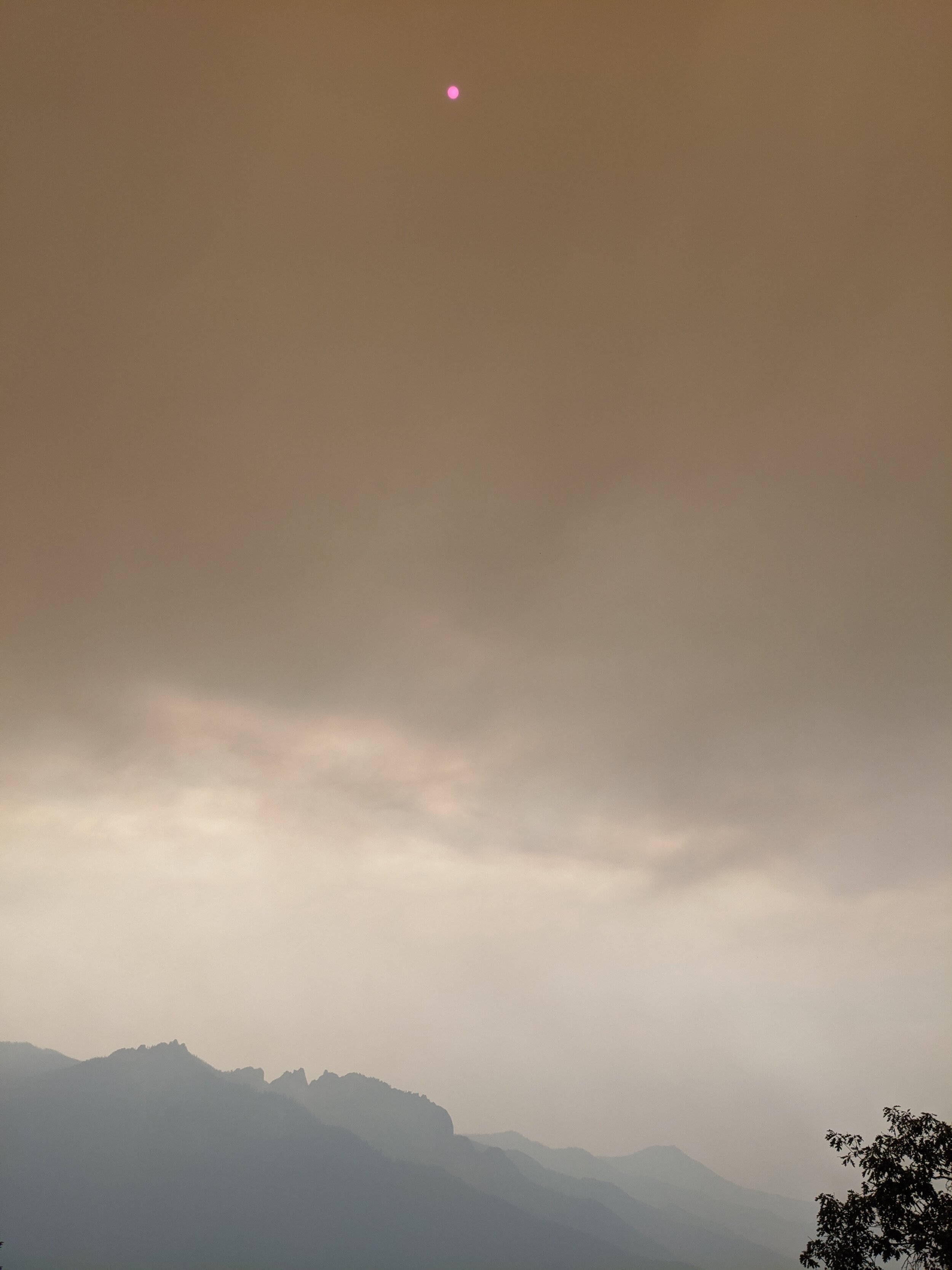
Werewolf moon and eerie midnight smoke, 12:38 am from our tent in Nine Lakes Basin
We both woke up before midnight to the eerie sensation that we were in a cold, windy fireplace. The wind howled as it blew ash and soot through the mesh of our ultra-light tent. The clear starry sky of just a few hours earlier had changed to a thick grey wall of smoke, turning the moon a werewolf orange. Despite the wind, the AQI was terrible and we coughed as the smoky particles got into our lungs. We talked a bit about possibilities and options. We had no way of knowing what had brought the sudden change, but were concerned that our orange glow down the Kern Canyon from earlier in the evening may have become a much bigger fire, or that a new fire had started - possibly much closer to us, and perhaps between us and our planned exit to the west. We still had 2 days of food remaining, and could probably stretch that to 3 or 4 in an emergency. We had water nearby and were essentially above treeline, so weren’t in immediate danger from a fire. On the other hand, we didn’t know how quickly conditions might change if we dropped to lower elevations, and weren’t sure whether our planned exit to the west might be impacted by fire. After 20-30 minutes of discussion, we decided there was nothing to be done in the dead of night. We remembered the N95 masks that were tucked into our packs, retrieved them and put them on, and tried to get a little sleep. We wondered if it was safe or advisable to sleep at high elevation with these respirators in place (actually, probably not!), but didn’t see how we could breathe/sleep without them and fortunately neither of us have any pre-existing pulmonary conditions. We each slept fitfully, if at all, and both had dreams of suffocating, dying, etc. Not our most pleasant night in the backcountry by far. By 4:30am neither of us could pretend to sleep any longer so we decided to get up, drink cold coffee, eat some bars, and hike out. We knew no more than we had the night before, but figured we’d make a push for the trailhead unless conditions dictated a different approach.
STATS: 6.4 MILES (off-trail) | 9 HOURS | 794' NET ELEVATION loss | 1805' CLIMB | 2599' DESCENT
Day 5 / Nine Lakes Basin to Wolverton TH via the High Sierra and Seven Mile Hill Trails

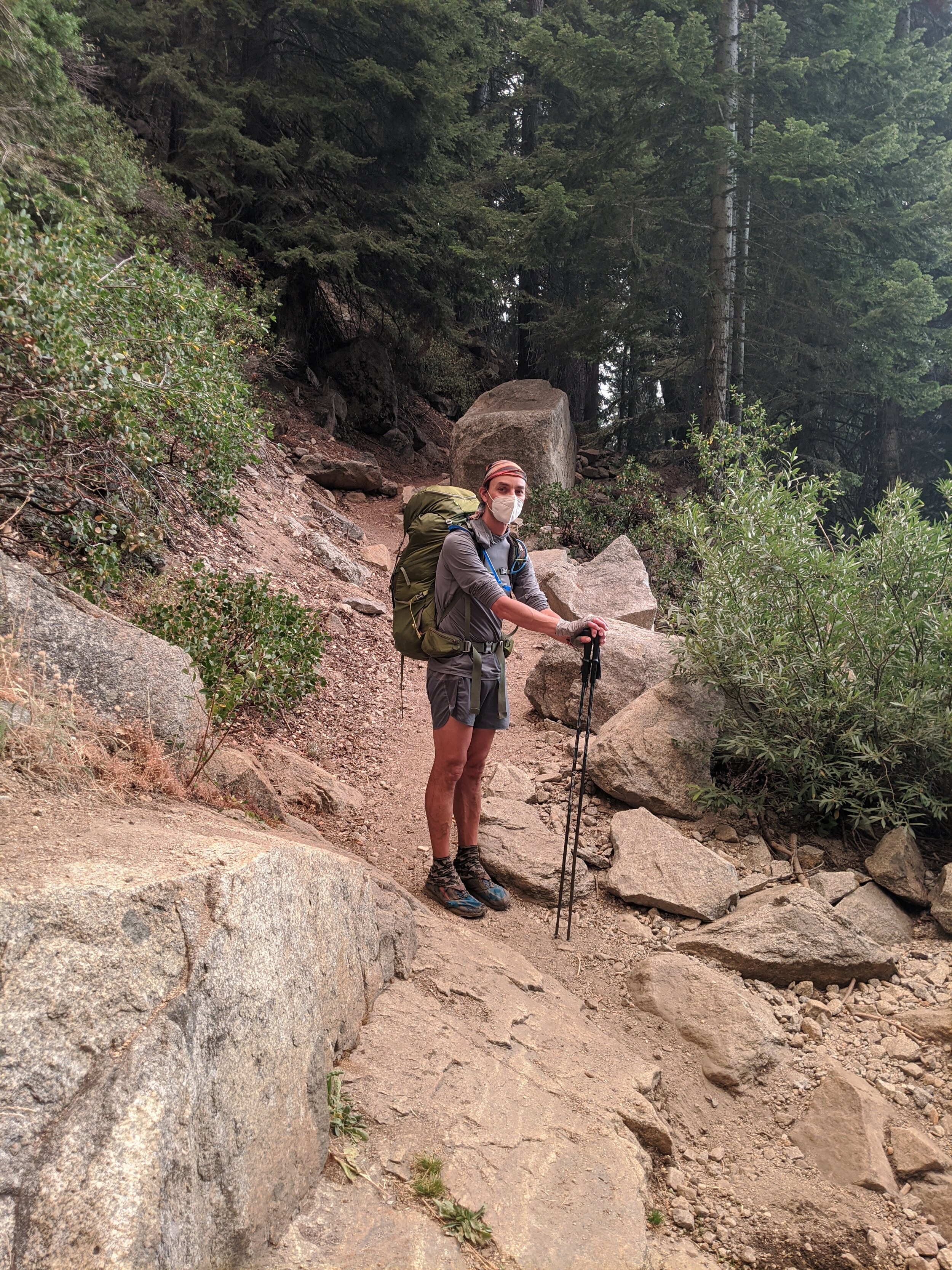
Exiting Nine Lakes Basin in an N95 respirator mask
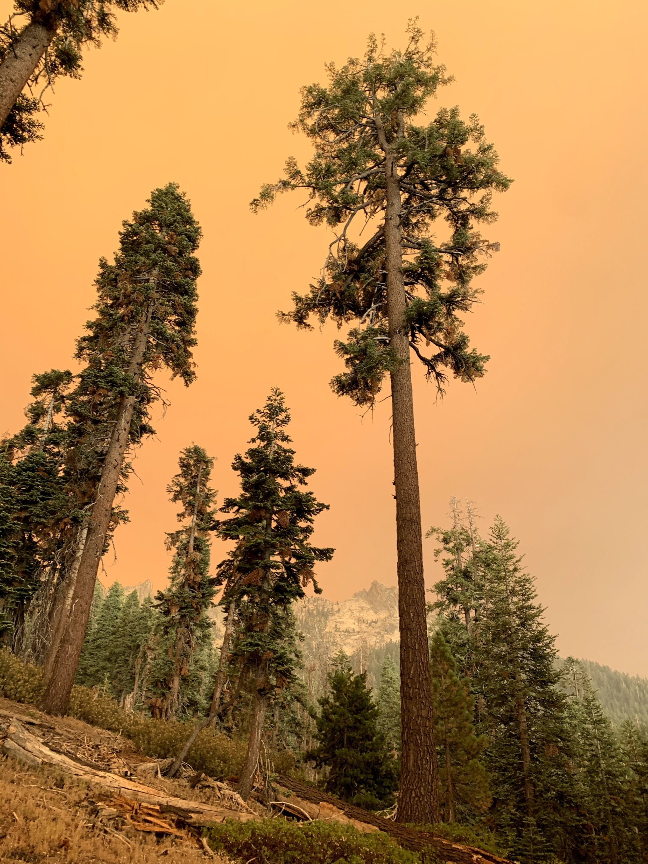
Sadly, conditions never improved overnight. As day’s first light revealed a creepy, smoke-obscured basin we were packing up the last of our gear and eating cold breakfast in preparation for a long hike out. We knew the trail was nearly all downhill (somehow not factoring in over 4,000’ of climbing!) and with near-empty packs we expected we could easily make the trailhead barring unforeseen developments. We underestimated the difficulty of hiking at high elevation in N95 respirator masks, but each time we took them off because of the annoyance we paid for it with a lung full of soot/smoke/particulates. In the end, we both decided that a sweaty face and increased respiratory effort were worth the lung protection and left them on except to sip water through a bite valve in the hoses from our hydration bladders that we slipped in through the side of the masks as needed.

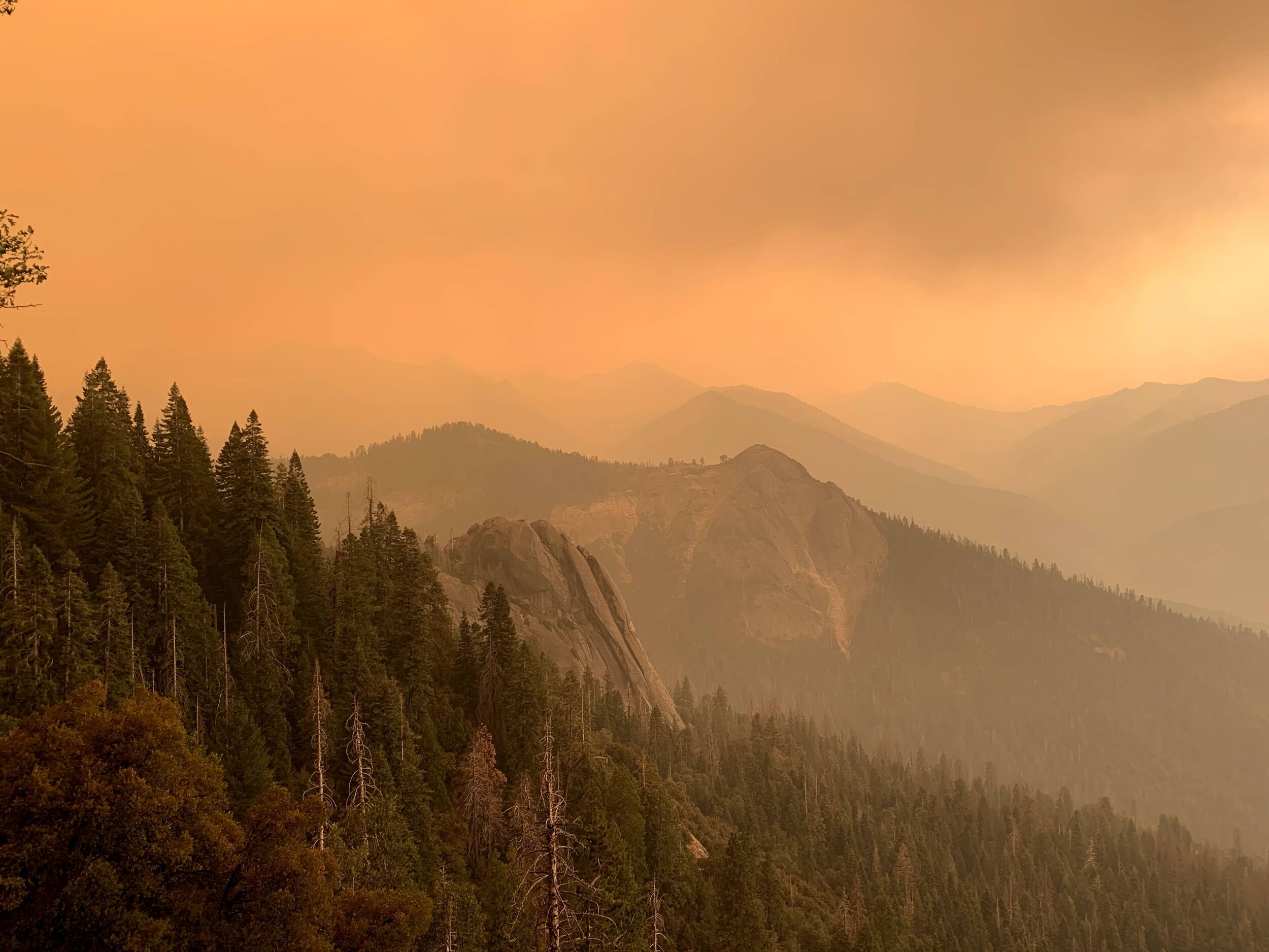
Panoramic view near Kaweah Gap on the High Sierra Trail, apocalyptic sky due to wildfire smoke
We passed the horseshoe-shaped lake and continued on to meet the switchbacks of the High Sierra Trail below Kaweah Gap. We didn’t see anyone near the lake or spot a tent, and wondered where the person we’d seen yesterday evening had spent the night. We didn’t spend too much time worrying about it, as we soon reached Kaweah Gap and discovered that the smoke was no better on that side of the ridge. If anything, it seemed a bit worse. Precipice Lake is usually a stunner, with deeply striped vertical granite walls dropping into the far wall of the lake creating the most perfect reflections below Eagle Scout Peak. Today it was just a smoky body of water with some granite dimly visible around it. It’s also a popular campsite location for HST hikers headed to Mt. Whitney and we passed many rock-ringed tent & bivy sites scattered in the decomposed granite surrounding the trail. Every one of them was deserted today. We commented that there must not be too many people headed east on the HST right now, given conditions. We still didn’t know the location or size of the fire producing our smoke, and assumed that anyone in the backcountry now was probably doing much the same as we were and heading to the nearest exit.
We were surprised to run into a pair of guys at the lake just below Precipice, who had camped there for the night, were not wearing any type of face covering, and shouted out a good morning as though nothing was wrong with the wilderness. They told us they were headed to Mt. Whitney, and didn’t seem fazed by the tales of smoke, soot, and red glow in the Kern Canyon that we had to share. We wished them luck and continued walking.
It wasn’t long before we met a group of 10-12 hikers coming up the trail towards us, breathing hard with the effort (it’s a long steady climb to Kaweah Gap from the west), carrying heavy packs, and faces covered only in bandannas. They looked to be some type of group with leaders in the front and rear, and many seemed likely to be first-time backpackers judging by the gear and clothing. They asked how far it was to Precipice Lake and we let them know they still had a decent amount of climbing ahead of them. We found out they, too, were headed to Mt. Whitney and it seemed likely that they had already spent a few nights on trail at their current pace. We let them know that conditions were terrible even beyond the gap, and suggested that they might want to reconsider their plan. Although nearly all of them carried a Garmin In-Reach on their shoulder straps, they seemed to think that adjusting their plan was not possible and said they’d keep going “until a ranger evacuated them.” We shook our heads, knowing full well that the backcountry is not swept of hikers by friendly rangers in most situations of wildfire or other natural disasters. More likely, you come across the back of a “trail closed” sign when you eventually make it out yourself. In any case, they were all adults so we let them be and continued down the trail. We saw another 4 or 5 groups of 2-3 hikers between there and the Hamilton Lakes, and each time we commented on the terrible conditions we heard “it will probably get better,” “our ride is at Mt. Whitney” or “we’ve already made plans.” We were flabbergasted to hear so many different people with the same terrible ideas, but there was nothing we could do about it. We had hoped that some might have news of where the smoke was coming from, but all of them had been on-trail for a few days, and they all seemed pretty clueless about anything but their goal of completing the named High Sierra Trail.
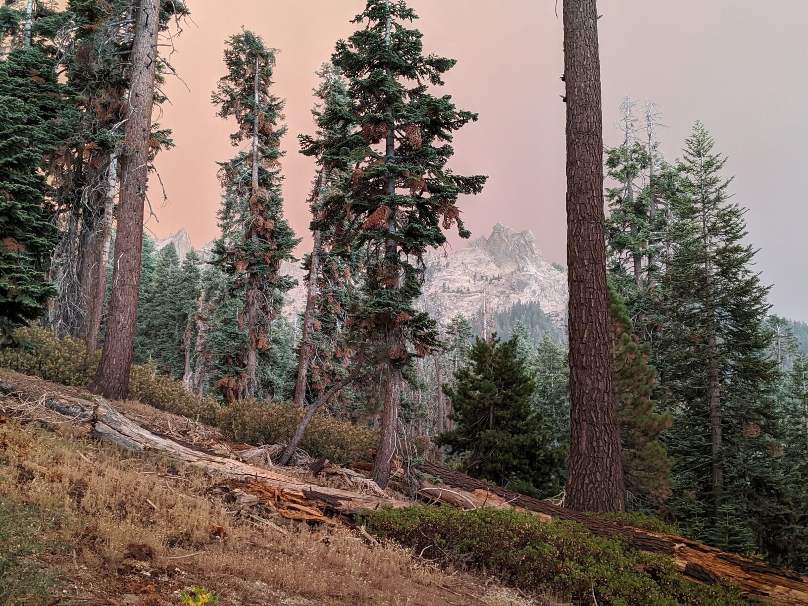
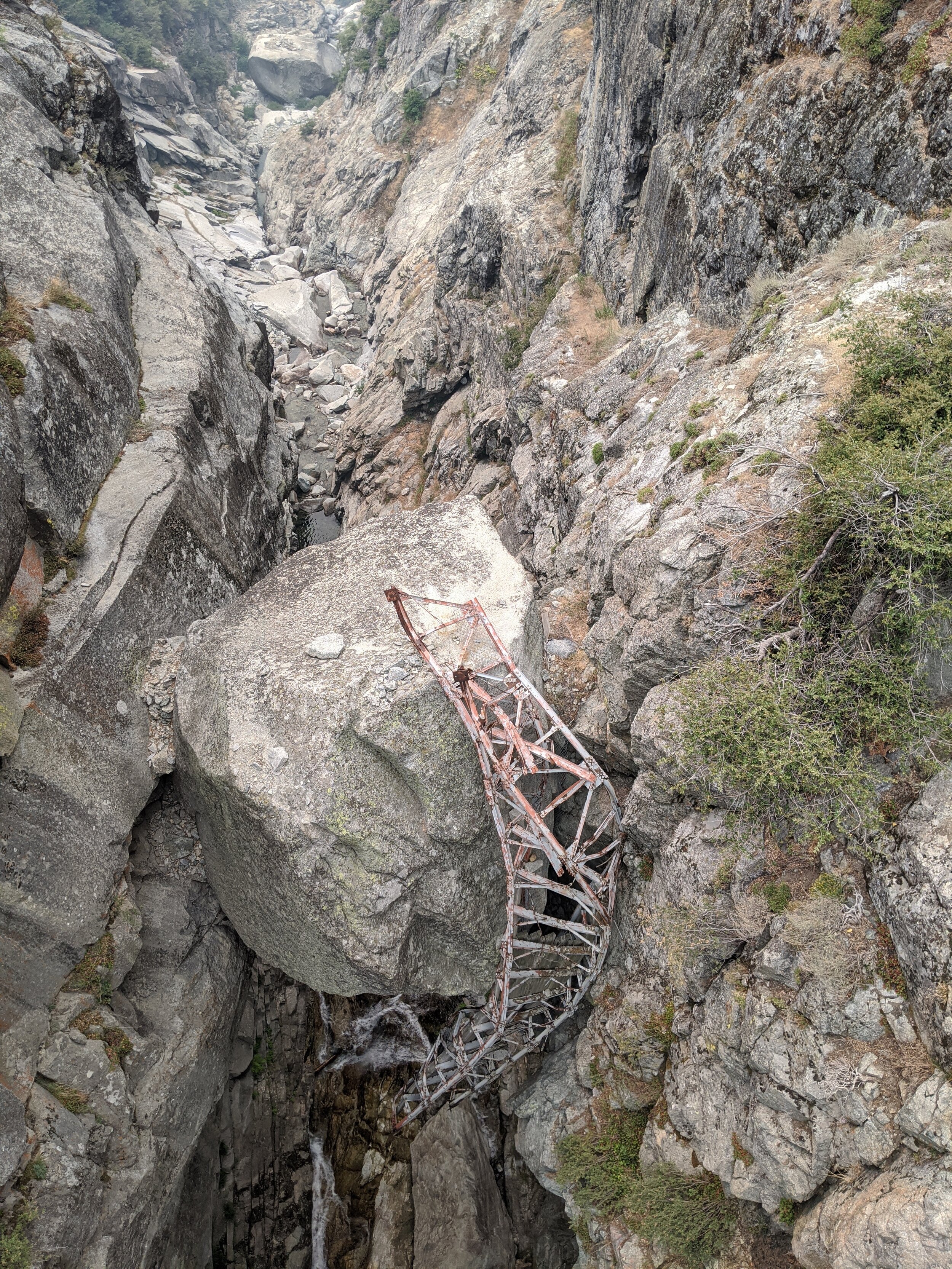
We stopped briefly at Hamilton Lake for a snack, and found it deserted. We guessed that many of the hikers we’d just passed probably camped there for the night. We had the trail to ourselves for a while. This section of the HST is truly spectacular but of course it was difficult to enjoy in the current conditions. The thick smoke didn’t abate, and even the walk through the famous rock tunnel (blasted to replace a steel bridge destroyed in 1937) at the hairpin turn seemed just a little eerie in the weird filtered light. We decided our next break would be at the Lone Pine Creek Crossing and focused on the sound of the river running far below us. We passed members of a trail crew on break near the Elizabeth Pass junction, though they were off to the side napping so we didn’t chat. We guessed that they were the ones whose campsite we saw below Tamarack Lake and were surprised they were still working in the current conditions. We peered over the new bridge at the mangled metal scaffolding of the previous footbridge, destroyed by a huge boulder carried by an avalanche (or so we’ve been told). It seemed the perfect metaphor for nature’s power on a day like today.
Beyond the Lone Pine Creek crossing, we were back in forested terrain. While the smoke was still present, it was less obvious as we lost our long “views” of the sky. We continued to pass a smattering of hikers. The ones we talked to were all on the HST journey and all determined to continue. We didn’t chat much with any, as we were on a mission and nobody asked us about conditions. Nearing Bearpaw Meadows we noticed that the sky seemed to be lightening up and we actually saw faint shadows for the first time all day. We even saw some filtered orange sunlight through the trees! We hoped that this signaled a shift in conditions and meant that we were getting farther from, rather than closer to, the source of our thick smoke. Our optimism was short-lived; by the time we reached Buck Creek, the sky was again thick with smoke and soot was raining down on us as we dipped our buffs in the creek. We met a couple there at the bridge that looked to be starting out a hike today. We wondered if they’d comment on the falling soot but nope. They just wished us a good hike as though there were nothing unusual about backpacking in N95 masks as ashes fall from the sky. Wow.
Our final hiker encounter was at 9-mile creek, where we had briefly considered camping on Day 1. There were no more ashes falling, but it was still pretty smoky with no shadows from the sun. We ran into a woman hiking alone who was purifying water. She asked about conditions and we replied that they were pretty bad. She asked how far we had come from and we told her Nine Lakes Basin, beyond Kaweah Gap. She seemed surprised we could have walked that far in a day, and didn’t really believe us when we told her the smoke was much worse there than here. Or that we could see the glow of a fire in the Kern Canyon from where we camped. She commented on our masks and asked if we thought she’d need one, as she didn’t have one with her, and seemed a little nervous as she was hiking alone. We encouraged her to re-consider her plans and turn around for safety/comfort. She thought about it, but said she had no way to contact her friend that was meeting her at Mt. Whitney so decided she’d keep hiking and hope for the best. Given that she was only on day 1-2 of what for most people is a 7-10 day hike, it seemed incredible to us that she would feel she had no other alternative than to keep going. But there it is.
We reached our turn-off from the HST at the Seven-Mile Hill trail (and discovered how it got its name!). After so much downhill, it was a rude awakening to start the dusty switchbacking climb. We wouldn’t see any other hikers between there and the trailhead. However, the sky only got more eerie as we made it closer to our destination. At first there was just a pink tinge, which we attributed to early sunset colors. As we continued towards Panther Gap and Alta we realized that the whole sky was an eerie orange, not particularly related to the location of the sun. The wind picked up, and now ashes/soot were blowing around us in earnest. In the absence of any actual information, we had every reason to believe that over any ridge we might come across an actual wildfire. Fortunately, this was not the case. The sky remained orange but the temperature cooled as it does in late afternoon/early evening. By the time we reached the trailhead it was before 6pm (though it felt much later as the sun was nowhere to be seen). There were only a handful of cars still in the parking lot, and ours was covered in a layer of ash/soot, but there were no signs or any other indication of an active incident nearby. We packed up and headed out, wondering what would happen to the many hikers we saw headed deeper into the backcountry today.
STATS: 21.8 MILES (20.8 ON-TRAIL, 1 OFF-TRAIL) | 10.5 HOURS | 3457' NET ELEVATION loss | 4200' CLIMB | 7657' DESCENT
Post-Trip:
By the time we got to Fresno, it was not only well after dark but most places selling food had closed. We ended up at a truckstop type gas station, and were shocked to discover that it was still 97F when we got out of the car. What a weird end to a weird trip. As if the global pandemic weren’t enough, there’s global warming for you and changing weather patterns. Not to mention massive wildfires burning later, bigger, and hotter every year in California.
We went inside and ordered sandwiches, still reeling from the strangeness of our night and day, and the experience of feeling as though we were the only ones who noticed that anything was wrong as the sky turned orange around us. While waiting for them to be ready, we saw horrifying pictures on the front page of the local newspaper describing the dramatic helicopter rescues of vacationers trapped by the new Creek Fire, apparently burning out of control to the north of Fresno. We wondered if it was the cause of our changed conditions (it likely was, though its smoke was apparently blowing north so it probably sucked smoke from the SQF towards us). Although it was late and we still had a long drive ahead of us, it didn’t make us want to find a place to stay in the area. We decided to get some cold drinks and try to push all the way home.
Over the next days and weeks, we heard many horror stories of backpackers evacuating by any means possible, trapped by flames, and curtailing trips due to smoke, fire, ash, and orange skies. Eventually California closed nearly all of its public lands due to wildfire risk and for public safety. The San Francisco bay area had a day of infamous orange skies of our own, likened to the movie Blade Runner. And so 2020 continued.
Kaweah Basin, we’re glad we made it there finally. But we are definitely planning a return trip, and hope to do so in a year with far less drama.