
“The sloggiest slog that ever was slogged (AKA scree of death)”
LOCATION
Sequoia National Park, CA, USA
MILEAGE
~90 miles (~80mi on-trail, ~10mi off-trail, 1 road mile)
TOTAL CLIMB: 27,585' TOTAL DESCENT: 26,665'
DAYS: 9 SEASON: EARLY SEPTEMBER
STARTING & ENDING TRAILHEADs
Paradise / Mineral King
Basecamp Town: Visalia, CA

Maps: Mt. Whitney High Country map by Tom Harrison

GuideBook: Sierra South, Sequoia & Kings Canyon NPs (both by Mike White for Wilderness Press)

Permits / Info: Mineral King Ranger Station, SeKi NPS Website
Pre-Trip
We are pretty much experts in wilderness permits for the Sierra Nevada by now. The trick is to avoid popular trailheads, so we often plan an atypical approach to the places we want to be. Our objective on this trip was to revisit Lion Pass and make it into Cloud Canyon, after running out of time/energy to do it on our High Sierra Trail (& then some) trip several years back. We also planned to spend some time in Upper Kern Basin, a favorite corner of the Sierra Nevada, and ogle the Kaweahs as we passed by. We aren’t much for out-and-back trips, and try to minimize covering the same ground twice in one journey. We like to add a little something new to every trip. With these parameters, it seemed like it was finally time to visit the Mineral King area of Sequoia National Park. We figured that late in the season, there would be plenty of availability from this remote access point. Looking into permit options, we found that the Mineral King TH itself is a surprisingly popular entry/exit, as there are a number of loop trips that visit a handful of lakes and can be easily completed in a few days. Fortunately, we don’t mind higher-mileage days than many, so we had many more options for access. Scouting the map we discovered the Paradise TH not too far down the road (across the street from Atwell Mill Campground), with all permits still available on short notice. The Paradise trail is dry & steep, and while it passes through a small grove of giant Sequoia trees, it doesn’t offer views or go anyplace obvious in particular, which makes it an unpopular starting point for wilderness trips. But if we were willing to ignore these downsides, it does connect to the High Sierra Trail, from which we could access Tamarack Lake and head over to Cloud Canyon. Once we had our starting point, it was simple to construct a route that would check off every single item on our wish list. The only thing left to do was hope that we could catch a ride from Mineral King back to our car at Paradise/Atwell at the end of our trip. Worst case scenario, it would add an annoying road walk… but we’ve found hat we can nearly always get a ride from someone at a trailhead with enough patience, a smile, and if all else fails, the willingness to split up and send just one person with a car key & no pack. We decided to give it a go and put in for the permit, which we were easily issued.
Day 1: Atwell TH to Big Sand Meadow via Paradise Ridge

Fire-scarred Giant Sequoia trees in the Atwell Grove
We drove in from the SF Bay Area, a long haul. We had to pick up our wilderness permit from the Mineral King Ranger Station, so we took the opportunity to go all the way to the end of the road and check out the trailhead where we would finish our hike. The parking lot was 2/3 full of cars, and we were optimistic that we’d be able to find a ride on our way out. There was a bit of a wait for our permit, though the “Leave No Trace” talk given by the ranger was one of the best we’ve heard in our many years of wilderness permits, so it was hard to complain. By the time we made it back to the Paradise trailhead parking it was mid-afternoon, and we were surprised (shocked, even) to find the Atwell mill campground deserted. It is a first-come, first-served spot for tents only (no RVs), there are no facilities beyond pit toilets, and it is several miles up a narrow mountain road, but still. It was before Labor Day in a national park. We decided we already liked our choice of entry points, and put together our gear to head out on the trail.

Andrew considers a not-so-giant Sequoia tree

View from upper Paradise Ridge
Our packs were heavy with 9 days of food, but at least we had the fresh energy of being in the mountains. We soon came across our first Giant Sequoia trees and took a few short detours to gawk at these massive trees with their distinctive red bark. The grove was scattered among other trees in a mixed forest, and we could see why it didn’t attract the same number of people as the larger, more accessible sequoia groves. We passed just a few day hikers on the lower section of trail but otherwise had it to ourselves. We made what seemed like slow progress, but it can be hard to judge when the trail is mostly uphill and doesn’t have much in the way of long views. We went through some burned areas and had a few peek-a-boo views as we neared the ridge of Paradise Peak. Once over the ridge, the walking was fairly non-descript and we passed through basic forest. We weren’t sure what to expect for water sources so late in the season and briefly considered finding a spot to camp near the one branch of Castle Creek shown on the map. Ultimately, we decided to press on and hoped to find water and a flat-enough spot to camp near a spot marked Little Sand Meadow on the map. We were in luck; the meadow wasn’t big or sandy, but there was a trickle of a stream, and a somewhat sloping but open durable surface in a clearing between some trees and it suited us just fine for a night 1 campsite.
Day 1 Stats: 6 miles (trail) | Total Climb 2624' | Total Descent 1027' | 1597’ Net elevation gain
Day 2: Big Sand Meadow to Tamarack Lake


From our campsite we continued through similar terrain, rounded the ridge, and started a descent towards Redwood Meadow. It wasn’t long before we found ourselves in another grove of Giant Sequoia trees. The Redwood Meadow Grove is bigger than Atwell Grove, with more trees scattered over a larger area. We made a game of spotting the Sequoias among the other trees of this mixed forest. We continued into the boggy area of the meadow itself, finding the

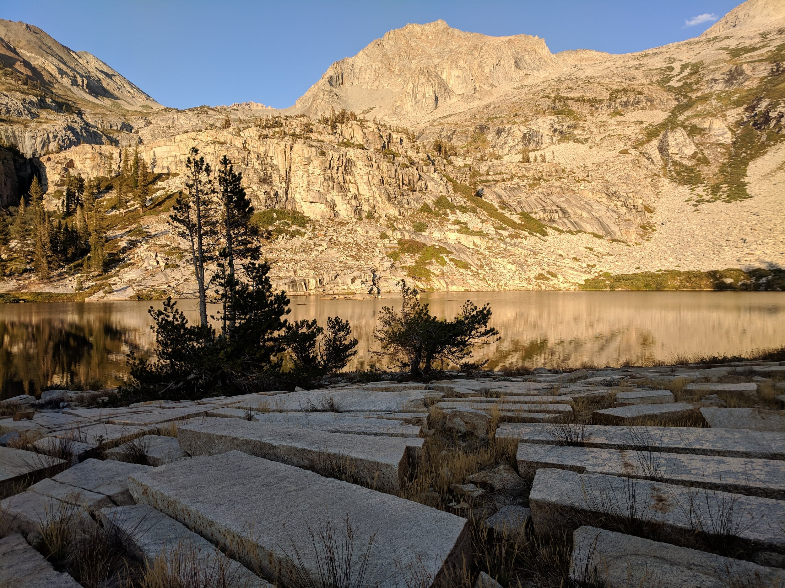
Tamarack Lake in late afternoon light
Day 2 Stats: 12.4 miles (Trail) | Total Climb 5015' | Total Descent 3949' | 1066’ net elevation gain
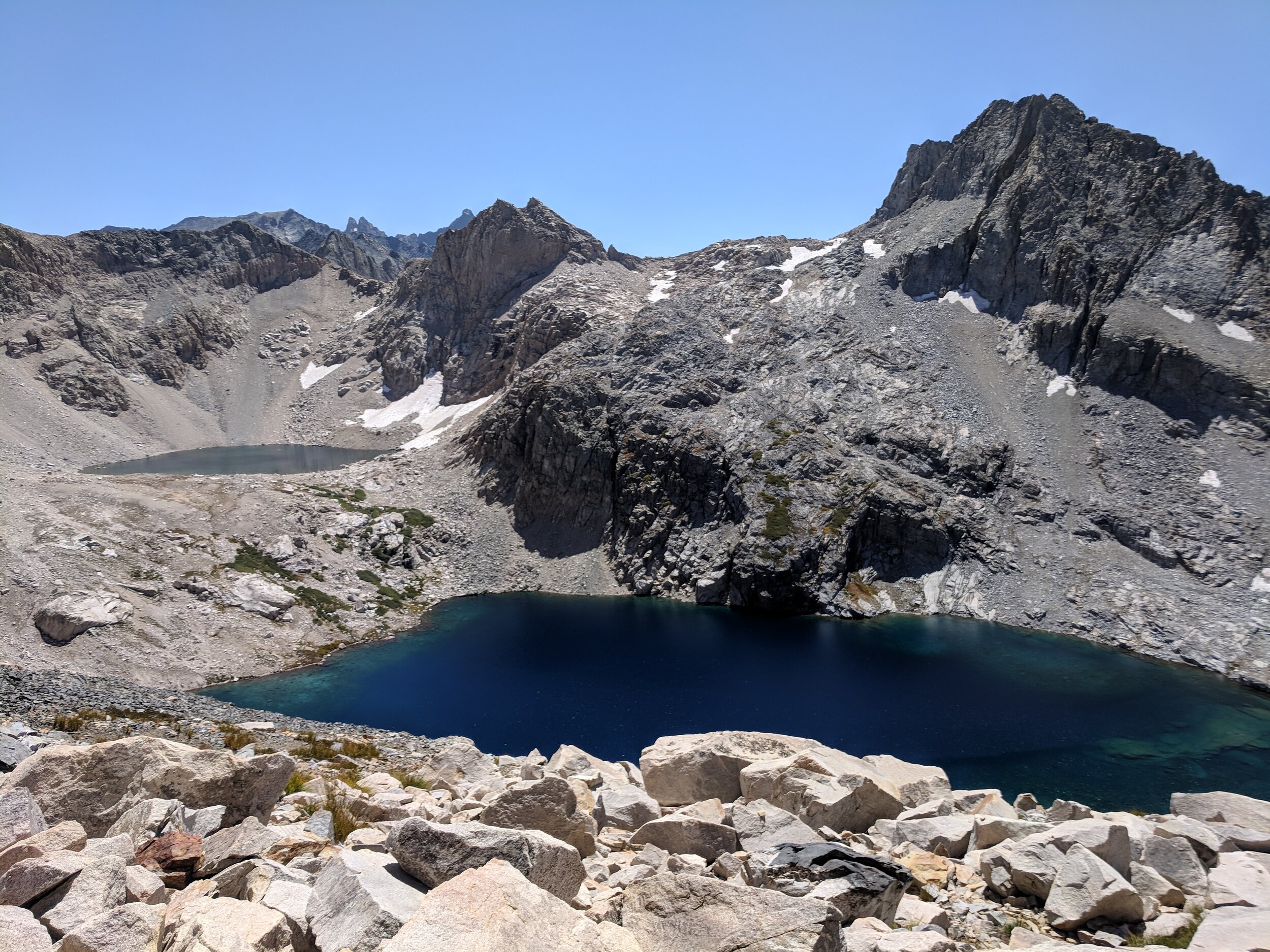
Day 3: Tamarack Lake to Colby Lake via Lion Pass & Cloud Canyon

Grassy plateau above Tamarack lake

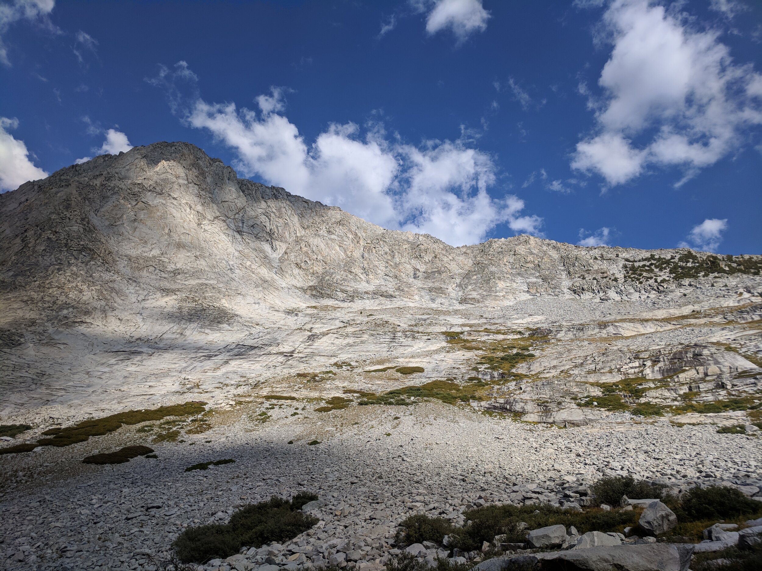
Continuing the climb from Tamarack Lake towards Lion Lake

Initial descent from Lion Pass into Cloud Canyon
Day 3 Stats: 9.6 miles (2.6 mi trail + 7 mi off-trail) | Total Climb 4449' | Total Descent 3076' | 1373’ net elevation gain
Day 4: Colby Lake to Upper Kern Canyon
Day 4 stats: 12.2 miles (trail) | Total Climb 3015' | Total Descent 4329’ | 1314’ Net elevation loss
Day 5: Upper Kern Canyon to Upper Kern Basin
Day 5 stats: 6.5 miles (~4.5 mi trail + ~2 mi poorly defined or off-trail) | Total Climb 2708' | Total Descent 610' | 2098’ net elevation gain
Day 6: Upper Kern Basin to Kern Hot Springs, via JMT/PCT then HST
Day 6 stats: 20.7 miles (trail) | Total Climb 1663' | Total Descent 6142’ | 4479’ net elevation loss
Day 7: Kern Hot Springs to Upper Lost Canyon, via Rattlesnake Creek & the Big Arroyo
Day 7 stats: 11.8 miles (Trail) | Total Climb 4806' | Total Descent 2072' | 2734’ net elevation gain
Day 8: Upper Lost Canyon to Monarch Lake via Sawtooth Pass
Day 8 stats: 5.5 miles (trail) | Total Climb 2838' | Total Descent 2075' | 763’ net elevation gain