
“This is quite an easy loop. However, good fitness, some navigation skills, and a tolerance for long and tedious stretches of large talus will be necessary to fully appreciate this trip.”
Location
John Muir Wilderness, Inyo NF & Kings Canyon National Park, California, USA
Mileage
37 miles (13.2 on-trail, 23.8 off-trail)
Total Climb & Descent: 8000' [net = 0]
Days: 5 Season: Late July
Year: 2020
Starting & ending trailhead
North Lake
Basecamp Town: Bishop, CA

Map: Tom Harrison Kings Canyon High Country Trail Map

GuideBook: The High Sierra: Peaks, Passes, Trails by RJ Secor
Beta for Alpine Col: HighSierraTopixSome inspiration: Leor Pantillat's description of Packsaddle Lake & using Packsaddle Pass as a route to Matthes Peak
Pre-Trip:
Part of this trip came together at the very last minute. We had set this time aside for backpacking trip and were planning on going down to SEKI. Given the new reality of the COVID-19 pandemic and different Federal Agencies having different requirements for wilderness permits, we missed a deadline for starting in SEKI. Cheri did some sleuthing and the wilderness fates were in our favor. She found 2 last-minute permits out of the Lamarck Col trailhead. We also applied for wilderness permits to secure our space for a trip out of SEKI. No missing a deadline by 1 day for that trip.
We were also excited to head out to this region because one of Cheri’s running partners had just been out. Lisa had completed the Evolution Traverse and Cheri had been hear all sorts of how beautiful it was out there right now.
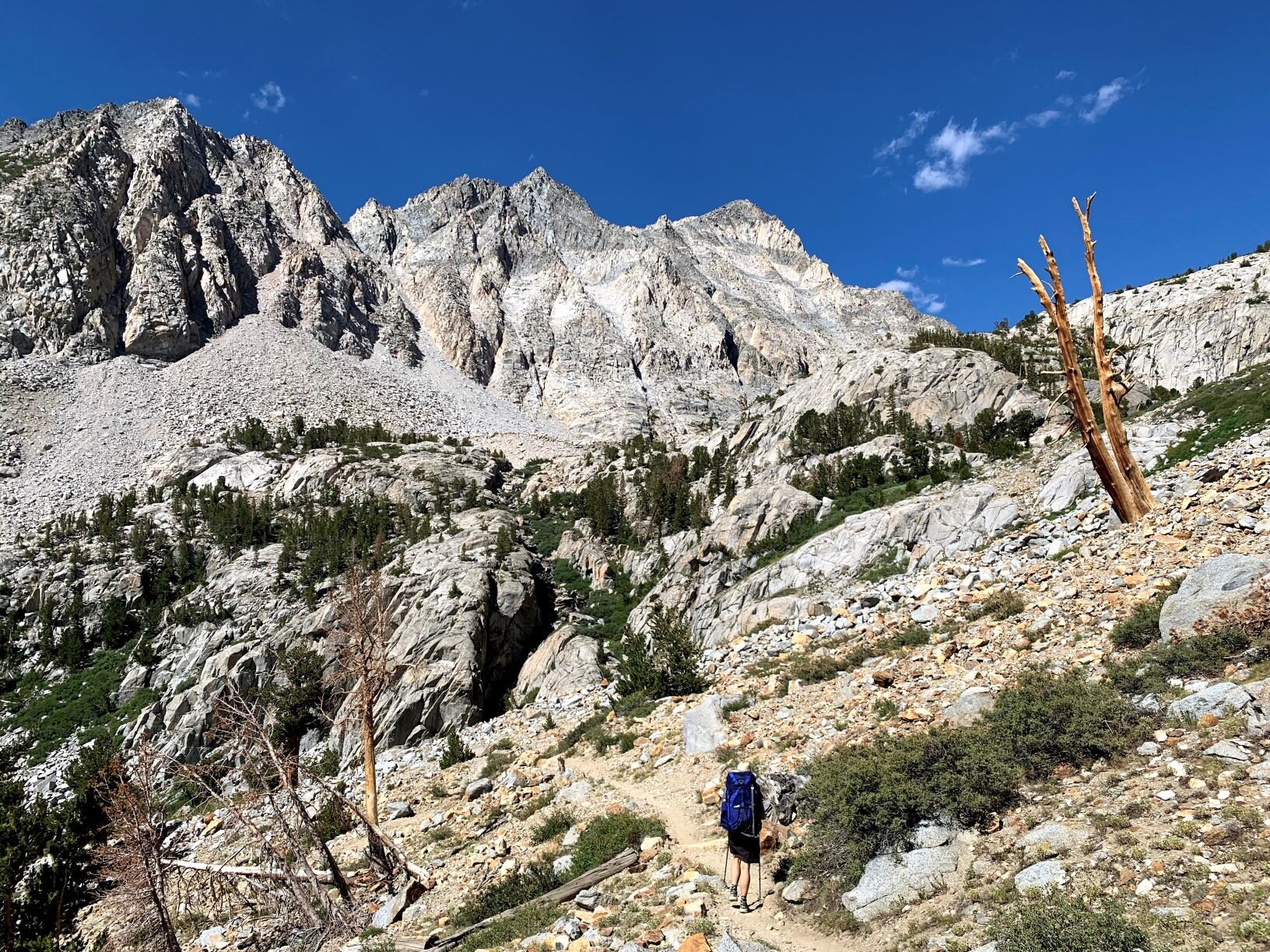
Day 1 / North Lake TH to knoll above Lamarck Lakes

Andrew enjoying a last burst of sunshine with a storm brewing.
After stopping in at Whoa Nellie Deli near Lee Vining, we start at the North Lake TH in the early afternoon. It was a warm summer day, with the typical Sierra cloud build-up already in progress. We covered the trek form the TH parking to the campground over the flat road, and were both excited at the prospect of getting back into the mountains. The campground and the TH were a hive of activity and fortunately the number of fellow hikers petered out as we headed up the trail. As we approached Lower Lamarck Lake. the skies had become absolutely grey, the temperature dropped, and the wind picked up. A thunderstorm seemed imminent and we were debating the need for rain gear, when the storm passed and skies returned to a more placid mix of blue skies and some clouds.

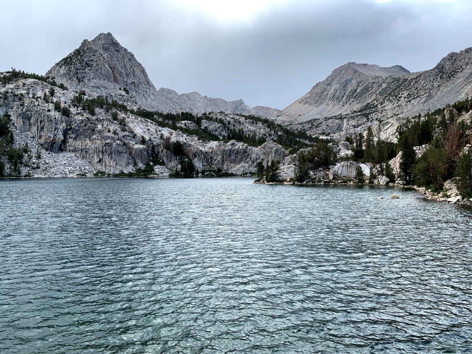
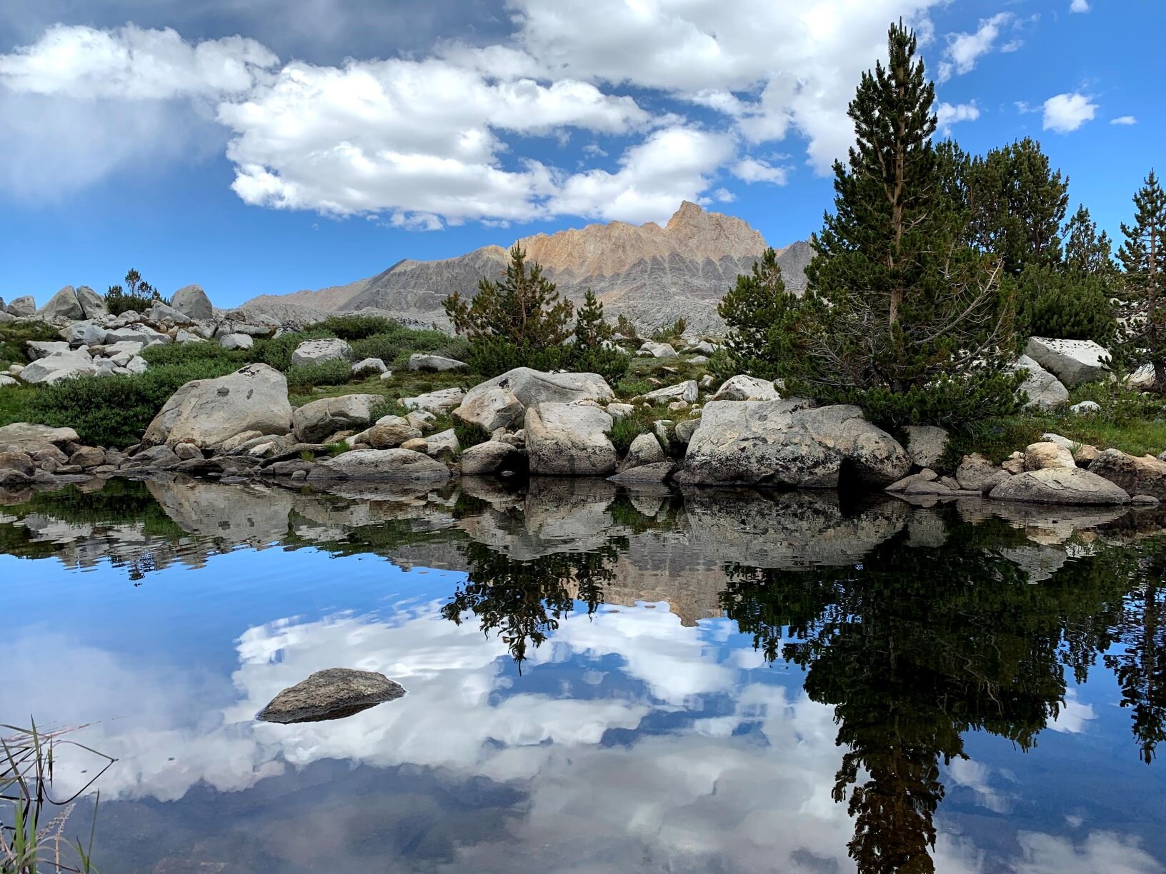
The outlet of Lower Lamarck Lake
We arrived at the junction were the maintained trail to Upper Lamarck Lake and the unmaintained trail to Lamarck Col diverged. Despite have the “trail” available to us in various forms (GPS unit, various mapping apps, and a paper map, it was a bit of a route be discovery to find the trail through a slow and talus field. After about 75-100 feet of floundering in the correct general direction, we refound the ‘trail’ to the Col. From that point onward, for an unmaintained trail, it was in very good condition. In fact, for most part it was better defined and in better repair than many official trails we’ve hiked in the Sierra. Climbing up the ridge south of the Lakes, we passed two y0ung women who were planning a short 1 night trip. We wished them luck and pushed on up the slope. The trees were starting to thin out and we were rewarded with spectacular views of the Glacier Divide.
We crossed near a creek running down from the snow melt and started to look for a campsite. The shadows were staring to get longer. We made note of this water source and continued towards the Col. The crest above the creek yielded a wide gentle slope that continued gradually upward to the southwest and a gentle knobby knoll to the northeast. Exploration of this knoll yielded a secluded and sheltered campsite with spectacular views. Sure, the nearest water source was a 5-10 minutes downhill hike, it was well worth it. The next campable site, would be at the foot of the Col at a small tarn that was more or less on the trail. In general, we prefer to have access to a stream or creek for water vs standing water, especially if it is a small tarn. So even though there was still enough daylight for us to hike up to the tarn, we opted for this locale with a panoramic view.

Not too shabby if I do say so.

Did somebody say “Let’s go backpacking?”
It had been a long drive over from home, and we had not had a lot of sleep the night before, so a shorter hike to private campsite was most appealing. Hiking down to the creek to collect water, allowed me time to soak in some of the golden hour light. There were Sierra columbine (Aquilegia pubescens) in abundance in the granite around the creek. Having collected water and set up camp, it was a wonderfully tranquil and relaxed start to our backpacking trip. We enjoyed dinner overlooking the tableau of the Owens Valley and White Mountains to the east. As we said goodbye to the last of the light, the first stars were becoming visible and a crescent moon was setting over the Sierra. Drifting off to sleep, we dreamed of a fun adventure over the next few days.

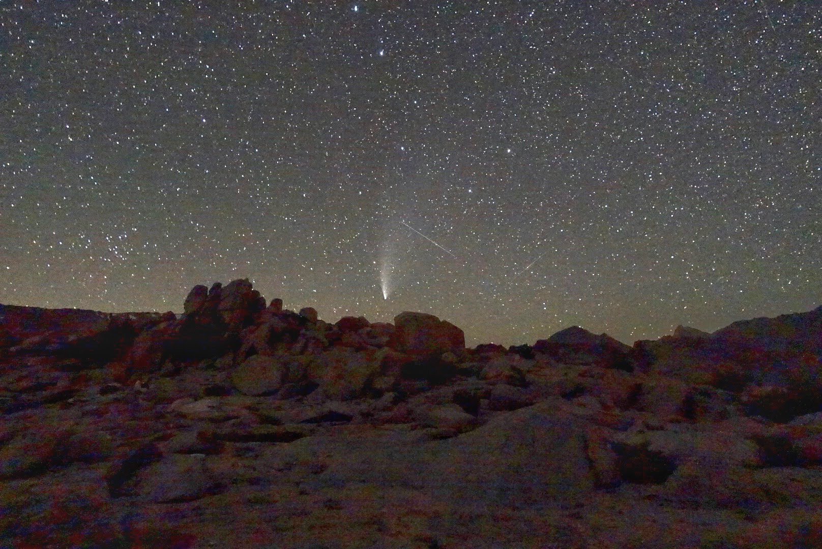
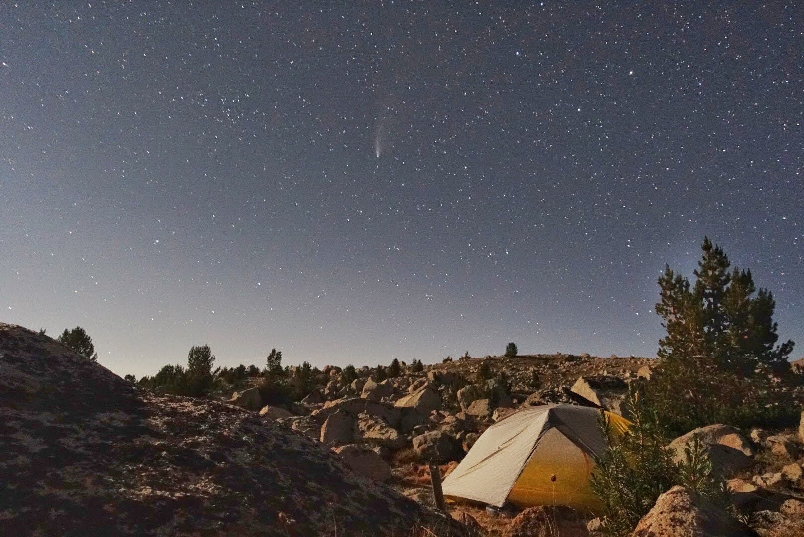
Comet Neowise and our home for the night
I woke up a couple of hours after going to sleep to the vast darkness of the wilderness. The sky was a awash with stars and Milky Way was visible. The biggest attraction of the night was Comet Neowise. With the moon having set, it was a prime opportunity to see a multitude of starts and the comet. The previous weekend, we had seen Neowise from our home in the Bay Area, however, the light pollution made it difficult to tease out in the night sky. Serendipitously, this first night of our trip was the comet’s closest approach to Earth. We have been fortunate to witness the profound beauty of the night sky in the wilderness, it is quiet bewitching. For some seeing the enormity of sky above can bring sense of disquiet, of insignificance, for others it brings a sense of calm, peace, and relaxation. This night was special with both the Milky Way and Neowise. After taking a few photos, Andrew returned the to cozy warmth of the sleeping bag and quickly returned to sleep.
STATS: 4.5 MILES (TRAIL) | 2635' NET ELEVATION GAIN | 2922' CLIMB | 287' DESCENT
Day 2 / Over Lamarck Col & Alpine Col, to Muriel Lake

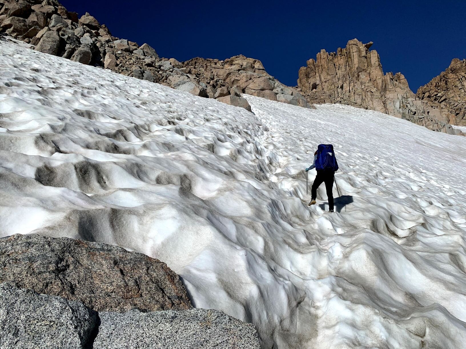
See, the Col is right there follow the cut in the snowfield
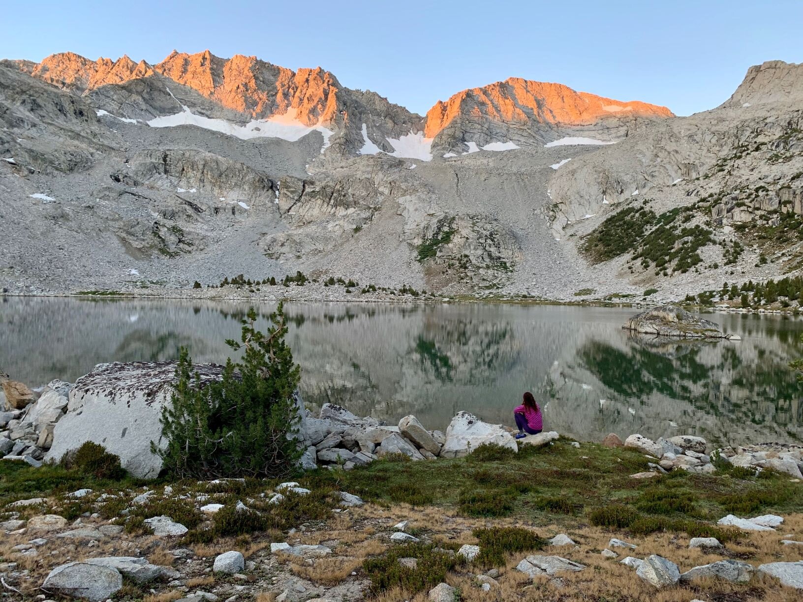
The morning was crisp and clear with a faint dusting of frost surrounding us. To the west the peaks of the Glacier Divide were kissed with alpenglow and the sun was rising over the White Mountains. We enjoyed brekkie in the welcome warmth of sunlight across our campsite. Rejoining the trail, we continued up the gentle scree slope and found ourselves near the tarn at the foot of the Col. Looking around, we were happy to have camped at our little knoll. Not only had it been more picturesque, more importantly, our views of Neowise would have been blocked by the mountain peaks.

Cheri at the top of Lamarck Col

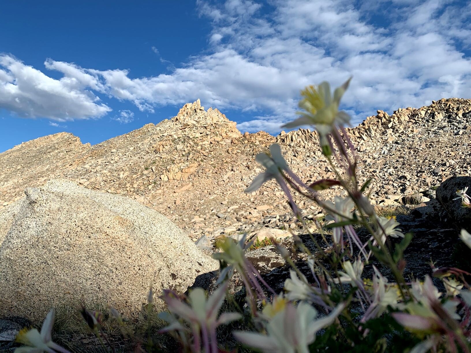
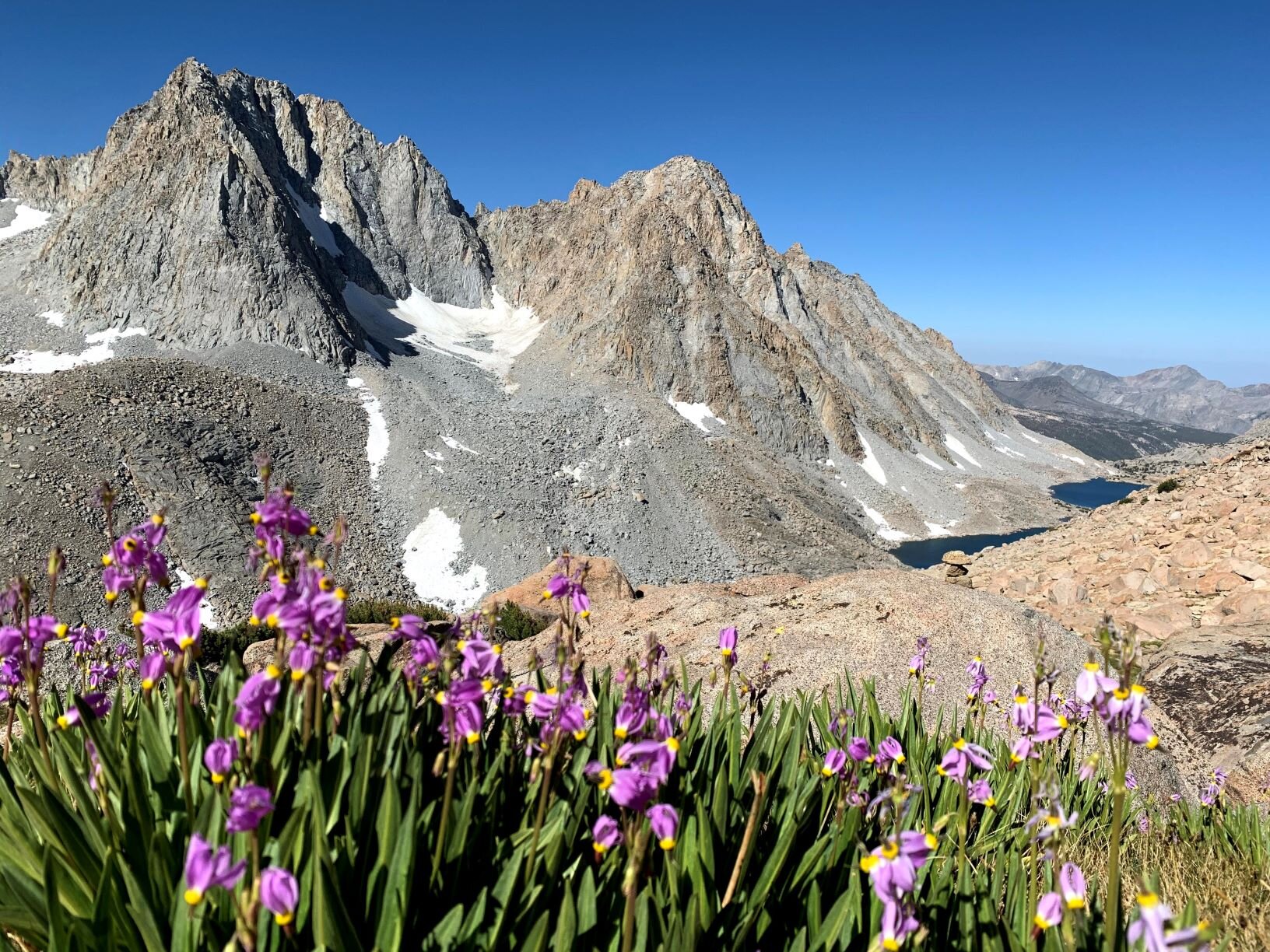
Shooting Stars (Primula jeffreyi) and Mt. Mendel above Darwin Canyon
To reach the Col, we had to travese and climb final an icy and suncupped snow field. Given the overall popularity of this approach, there was a well defined foot path through the snow. It was just a matter of making you sure you had safe and secure footing on the ice. We crested the Col, crossing from Inyo NF int0 Kings Canyon NP, and found a trail runner surveying the scene of upper Darwin Canyon below. As he took in the vista, we continued down into the canyon.
Cheri heading down into Darwin Canyon
At the head of this beautiful canyon are Mt. Mendel and Mt. Darwin. From these glaciated peaks, flows the sources of lake. On our side of the lakes, the way forward was less well defined compared to trail we had followed since yesterday. We zig zagged down a slope decomposed granite, talus, and little benches of grasses and wild flowers. It was a dazzling palette. Above us were blue bird skies that were reflected in the lakes below. The mountains was starkly tan and gray with white snow and glaciers. The vegetation was a mix of lush greens, and bright purples, yellows, and white of the Sierra Shooting Stars (Primula jeffreyi) and Sierra columbine wildflowers. We could have just stayed here and soaked in the view for the whole trip. However, we did have a destination for the night, so we pressed on. As we traversed down the slope and along the lakes, cairns dotted the landscape as reminders that we were most likely on course.

Paired Lakes below Mt. Goethe (Lake 11540 is on the right)
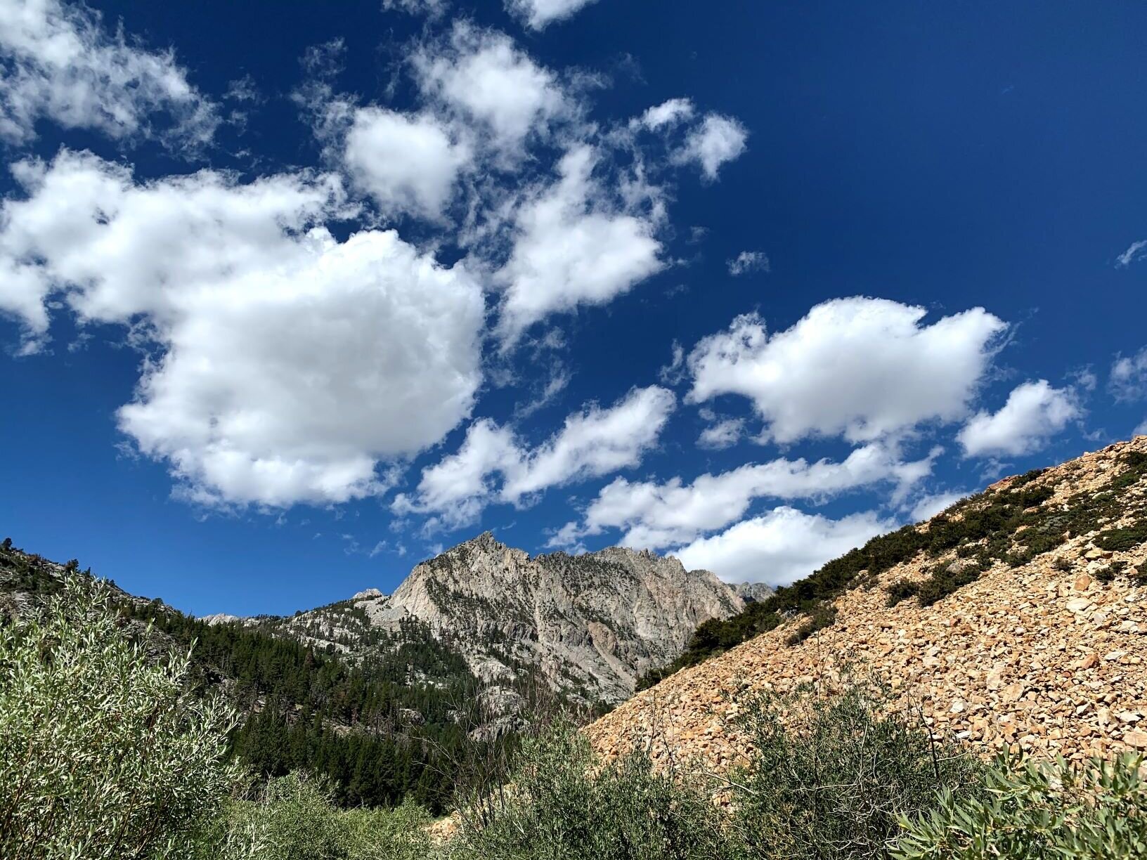
Approaching the last of the lakes, little fluffy clouds were off on the horizon. With enough time in the Sierra, you soon learn that these little innocent clouds may be just that, or they could be harbingers of much worse. By now we were on well defined use trail that would follow into Darwin Bench and eventually to Evolution Valley and the JMT/PCT below us to the south. Instead we struck out to North towards Mt. Goethe and Muriel Peak. The meadow slopes in the upper Bench were studded with more wildflowers, purple Lemmon’s paintbrush (Castilleja lemmonii) and seap monkeyflower (Erythranthe guttata) . At the next shelf we were again above treeline and there was much less vegetation. There were two massive lakes (Lake 11540 and another unnamed) and we skirted the southern shore of the first and crossed a wide isthmus between them.

A bright flash of color in the increasingly gray world, rock fringe (Epilobium obcordatum)
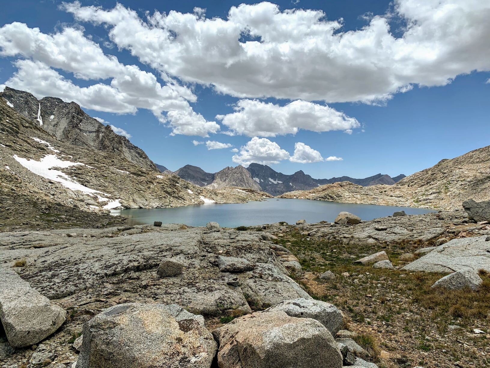
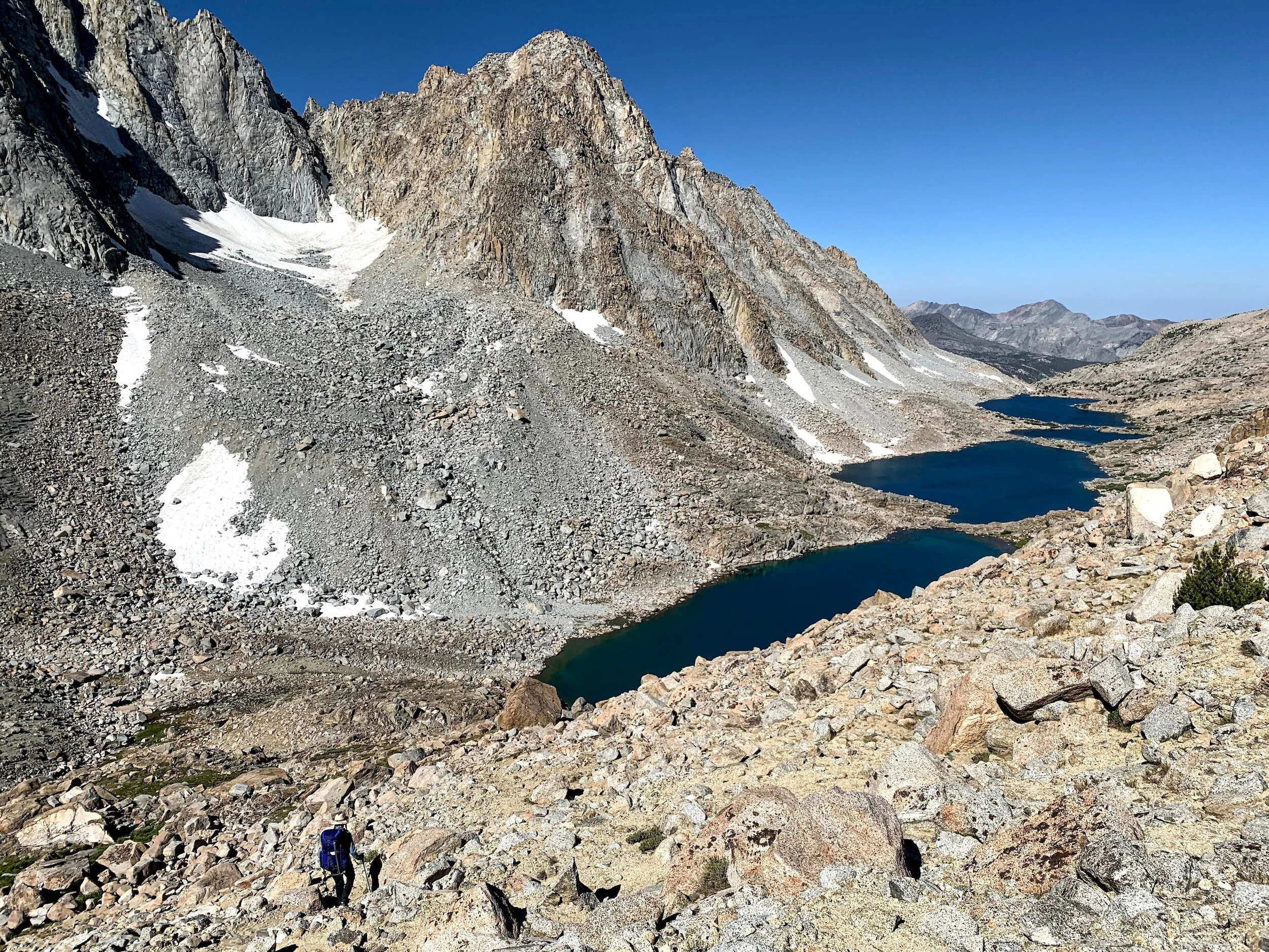
Above us, the clouds were no longer looking so innocent. They were congregating yet were still rather coy about their intentions. On the isthmus, we stopped to review our route and have snack. We had 400’climb up a slope to from these lower lakes to a third lake at the base of Alpine Col. Alpine Col is rated Class II. The consensus was to follow the western shore of Lake 11910 to best position ourselves for the climb to the Col. In hind sight, at the time the eastern shore looked like an less difficult albeit longer walk. Upon reaching outlet of Lake 11910, we surveyed the scene of Muriel Peak to our north and Alpine Col off of her left shoulder. Over her right shoulder is another route, The Keyhole. We could see that our path was mostly going to be a talus walk/hop from here to the and most likely down the north face.
Just a typical summer Sierra storm blowing through.
The increasingly ominously gray skies were leaving little doubt that there might be some percipitation in the near future. We kept moving forward as we were motivated to get going and not have to deal wet soaked granite. Soon however, we found a new challenge, there were steep snow fields right up to the lake shore along our intended path. The first we were able traverse, thank goodness for an ice axe, above the lake shore. The undulating talus fields surprised us with two more snow fields. They were both larger than the first and given their higher angles, not a good option for traversing. Ewe had to go down to try and follow the lake shore, Normally this wouldn’t be to difficult, however, the snow fields stopped just short of the shore. The snow fields were about a 5-7’ high which made the travel a little dodgy. The last of the three required using your ice axe as a swing to get over a large gap in the shore. Cheri was able to accomplish the swing. For Andrew being taller was of no help as the edge of the snowfield was at shoulder to head height and hanging overhead. He ended up trying to jump the gap and got rather wet in the process.
Normally this would not be a big deal, however, remember those clouds? As we sorted out the climb up to Alpine Col, the clouds finally let us in on their plans. The wind picked up as hails started pelting down.

In a pinch talus provides adequate shelter from the rain and an opportunity to change layers.
Fortunately for us, it was a fast moving storm with very small hail. We continued slowly up the slope of talus, the weather alternated between hail, light rain, and wind. We made our way to the Col and peered over the other side. Stretching out before us was a vista of stone, water, some snow, and clouds. The weather gods were favorable and there was still little to no rain as we proceeded down the talus field. The route description described following a ledge to the right and then taking a scree chute down at one point. We made our way down the talus and soon found the cliff edge. We followed along to right and thought we had found the chute. Cheri went first and she had to drop her pack down one particular steep section of giant talus. Andrew passed his pack down and then climbed down. After that little class 3 stunt, we both saw that a about 100-120’ further to our right was an obvious scree chute complete with faint foot path traveling down it. Oh well. We will know better for next time.

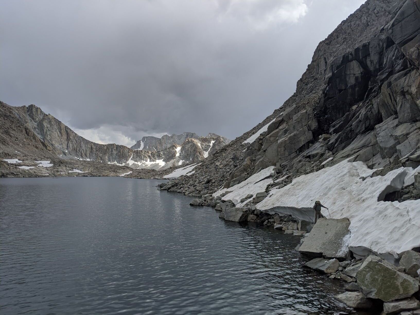
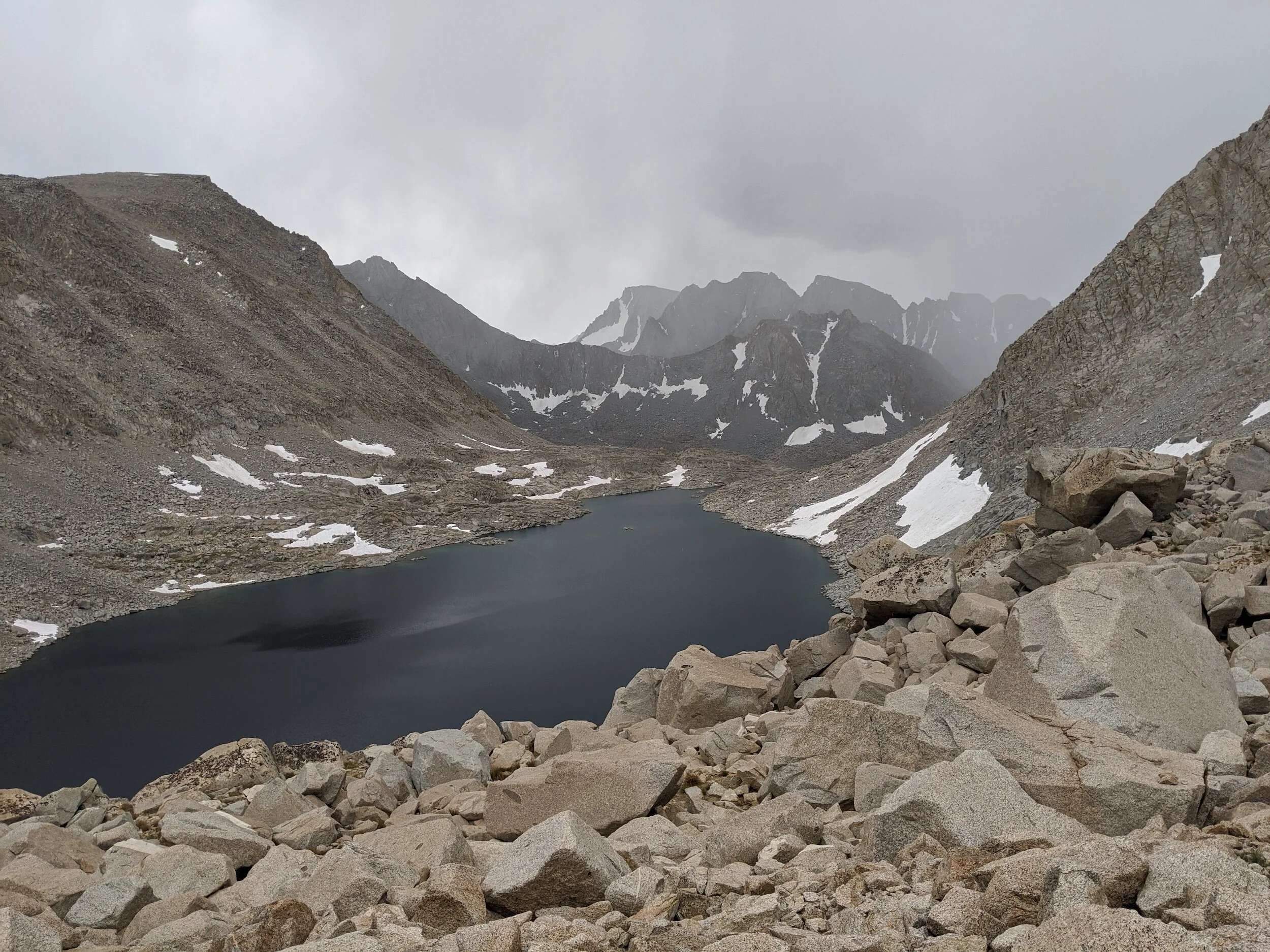
Stormy weather all around, Muriel Lake below the cliff ahead
Finally we arrived at the near shore of Goethe Lake and had simple level talus home along the south and eastern shores ahead of us. The teasing rain did finally start to come down more consistently. We took the time for a snack and to add both warm layers and rainproof layers to fight off the chill. At this point, we still had enough daylight to cover the miles to our preferred camping spot, but we weren’t sure about our energy levels. So far today, we had been seesawing around 11,000’, up over 13,000’, back down to 11,500’, back up to nearly 13,000’, and now we were back at 11,500’. On top of that we started the long talus walk in a steady rain. It was slower traveling then we would have liked and by the time we reached the far end of the little lake right in the outlet of Goethe Lake, we were both knackered.

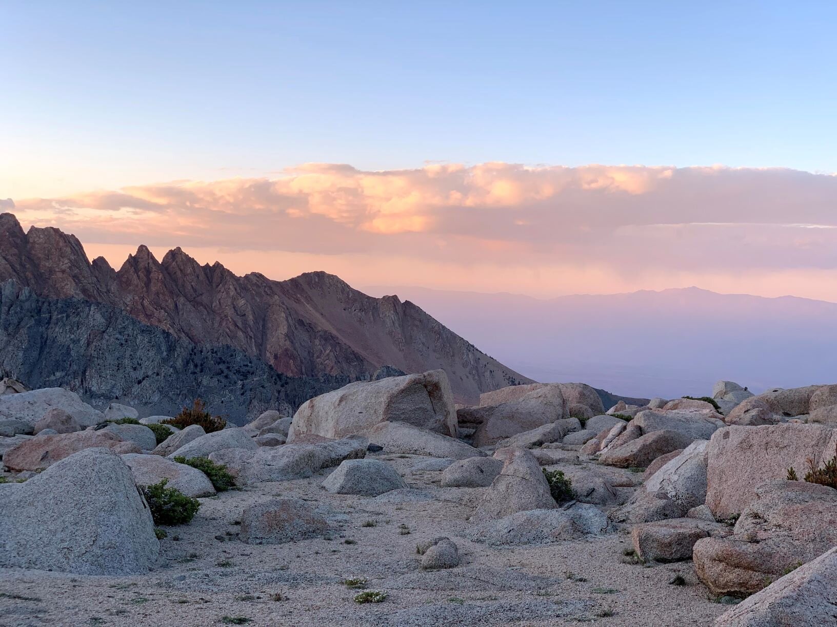
Golden hour on Mt. Humphreys from where we slept.
Although we it was only a short 3-4 miles, as the raven flies, to our ideal destination, it was not in the cards. We trudged down slope towards Muriel Lake, as it was the nearest campsite location. It is a fabulous location and we have camped at this lake before, however, we had wanted to avoid it. It is very close to Paiute Pass and consequently it’s very popular. Sure enough as we descended the ridge from Goethe Lake, we could see a handful of groups scattered around the lake. After crossing the outlet Cheri took a breather at the first flat spot we came across and Andrew scouted around. There were several spots on our shore of the lake and eventually he found one that was secluded from the other backpackers and sheltered from the wind by screen of whitebark pines (Pinus albicaulis).

Good night from the Range of Light.
Setting our packs down, we set up the tent and camp quickly in case the storm that followed us over Alpine Col kept coming. However, by the time we had the tent pitched and starting to collect and filter water, the storm clouds had blown out. Our efforts were rewarded with the beauty and warmth of an orange golden hour. We basked in the alpenglow on Mt. Humpreys, Muriel Peak, and Mt. Goethe. The day wrapped up with a spectacular sunset across from all of Humphreys Basin stretched out before us. With a hearty dinner eaten and weary soles we embraced our cozy sleeping bags as night fell.
STATS: 9.3 MILES (1.6 on-TRAIL, 7.7 off-trail) | 342' NET ELEVATION Loss | 2828' CLIMB | 3170' DESCENT
Day 3 / Muriel Lake to Packsaddle Lake, day hike to Lobe Lakes

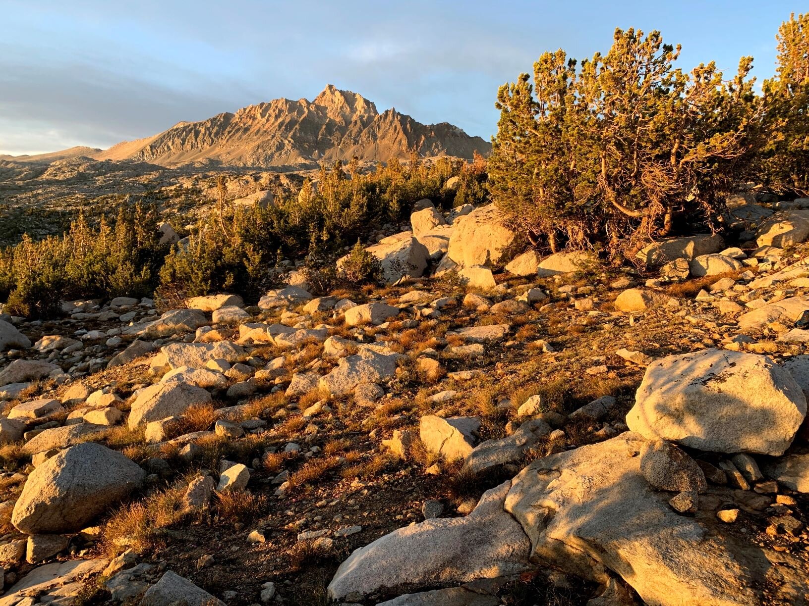
First light illuminating the Glacier Divide, the Pinnacles, Pilot Knob and the Mt. Humphrey group

Lemmon’s paintbrush and Cheri hiking along
We awoke to clear skies and the fatigue from the previous day erased by a good night’s sleep. The wide expanse of Humphrey’s Basin lay open to us ringed by the Glacier Divide to our south, the Pinnacles crowning to our west, Pilot Knob and the ridge up to Mt. Humphreys to our north. These open vista in the high Sierra are always breath taking. Today was scheduled to a be an easy day of some off trail navigation to a lake that we had seen on previous trips in this basin. We had a leisurely brekkie, broke camp, and made our way along the meadows along the outlet of Muriel Lake. More wildflowers were in abundance, lupines, gentians, and Lemmon’s paintbrushes. We meandered between meadow and forest following the gentle down slope. We would find numerous use paths, some we’d follow, some we didn’t as we skirted around the Golden Trout Lakes. Muriel Lake is near Paiute Pass and there is pack station near the trailhead. Given the proximity, it is no surprise that there are numerous use trails like an errant spiderweb across the basin.

One of many cascades on Paiute Creek
After passing these lakes, we followed Paiute Creek until we found a narrow spot to cross over it. A good break in the young whitebark pines and willows, with well placed boulders allowed for an easy crossing. On the southern bank, it was a more open forest, which made for easy walking. Our goal was lake tucked into one of the cirques of the Glacier Divide. On a previous trip over Paiute Pass, we had seen this lake nestled nearly magically in this cirque. It was early in the Sierra season and Paiute Creek was an impassable torrent of water. So our goal of reaching it was put on the shelf for a later trip. Leaving the creek behind us we traversed uphill and around a nose of the divide that lead us into a long open valley.

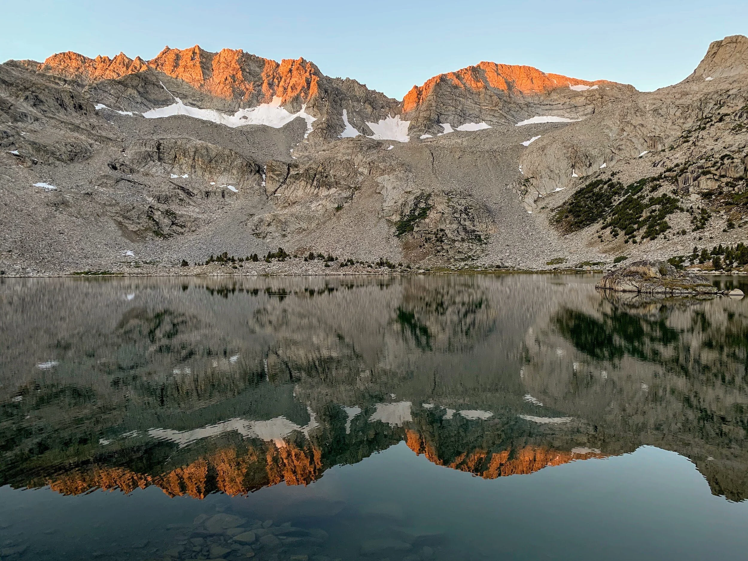
Packsaddle Lake and Matthes Crest and Galciers
Above us, we could see the Matthes Peak high above holding the remnants of Matthes Glaciers. As we ascended into the valley we came across a few dried tarn beds and then gradually arrived at Packsaddle Lake. Looking around, we had the lake to ourselves and we savored in the beauty of the wilderness. After scouting around we found a secluded spot on a little peninsula near the lake’s outlet. There was. rushing cascade of water from the outlet that fed into a small lake before winding down valley towards Paiute Creek. We found a sunny outcropping for a lunch break. While watching the sun glitter on the lake surface a raft of clouds started to develop over the Divide and we made sure the tent and rainfly were pitched and secure. We had still half of a day ahead of us so we decided to explore around. The northern wall of Divided is sculpted with multiple little valley bejeweled with lakes and we cut overland around the ridge to our west to the next set of Lakes. The traverse was through more deep mix of conifers and willows. Past the nose, we followed the slope to a series of shallow lakes (lower Loeb Lakes). We chilled out on a large boulder in the bright sun, yet to our west there was a rapidly progressing cloud build up. Thunder pealed and reverberated along the mountains above. We could see that it was still somewhat further away and it was still unclear which direction it was headed. Ultimate we decided to not follow our course to lower Honeymoon Lake and traced our footsteps back to Packsaddle Lake.

Packsaddle Lake with a storm brewing on the other side of the Glacier Divide

Yellow paintbrush, Matthes Crest, and gray skies
The rumbling storm continued for the next hour or so, before moving elsewhere in the Sierra. These brief thunderstorms are typically of summer in the Sierra. Generally, you will see them and they will move on elsewhere in the Range At other times, they come sweeping upon you. Again the weather gods favored us, and we were spared rain. The cloud cover fluctuated for the rest of the afternoon and slowly dissipated as we turned to evening.
We waited out the storm near camp. Cheri used the time to catch up on some old crossword puzzles. This is a favorite backpacking past time for her. Andrew played some solitaire and lizard napped in the dappled sunlight.

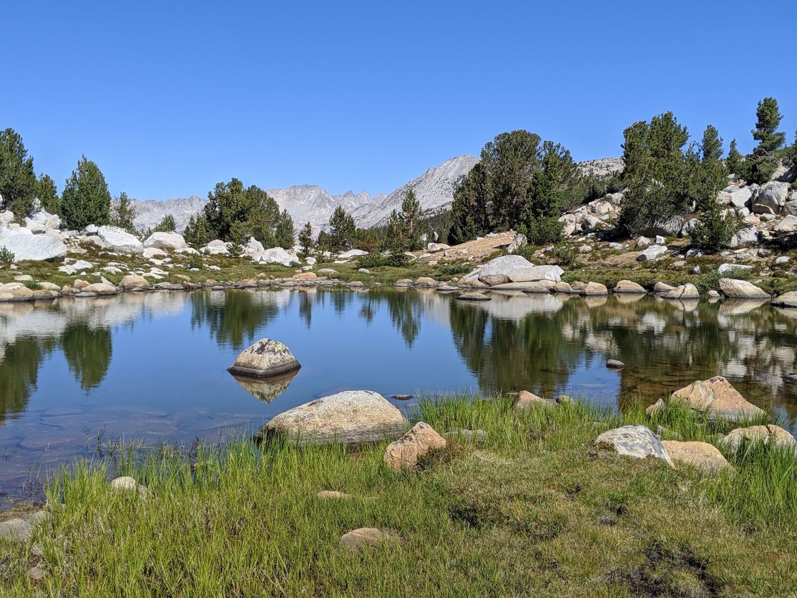
Mt. Humphrey reflected in an unnamed tarn
The storm blew itself out. We had a lovely late afternoon of hanging out on some granite outcroppings playing Yahtzee and cribbage. We took a break to make dinner and then returned to our granite perch. We had a quiet meal savoring both the food and having the lake to ourselves. That night as we drifted off to sleep, we enjoy the gentle rushing of the cascade near our campsite.
That night near midnight, I left my warm sleeping bag to get some photos of the stars and planets. Saturn and Jupiter were high above Matthes Peak with a blaze of the Milky Way behind them. To the north, the Adromeda Galaxy was above redhued Humphreys Peak. Soaking in all this beauty was lovely end to a day at a beautiful lake and I went back to get cozy in my sleeping bag and drifting back to sleep.

Andromeda above Mt. Humphreys
STATS: 6.1 MILES (off-trail) | 677' NET ELEVATION Loss | 765' CLIMB | 1442' DESCENT
Day 4 / Packsaddle Lake to Humphreys Basin exploration
Reflecting on more than Matthes Crest

Andrew and some lodgepoles
We lingered at Packsaddle Lake to absorb the quiet joy of the morning. It was peaceful to forget about everything going on and to soak in the tranquility and serenity of the changing light on Matthes Peak as we enjoyed our coffee and tea. Today was another short off trail day to cross over the north side of the basin. We followed our previous course and followed our footstep from the day before. They lead us back around the nose to our east and towards the creek crossing. This time we did find a different location a little bit further down stream from our previous crossing. This location was nestled in a pocket of sun surrounding by taller trees, although there were columbines to provide some color. We picked up another use trail and followed in up towards the more open portions of the basin.
Eventually we crossed the official trail that travels from Paiute Pass down to the canyon to eventually meet the JMT/PCT. Leaving that trail behind us, we followed up northern slope up towards Desolation Lakes. There several large names lakes scattered throughout this upper basin bounded by Paiute and French Canyons. We didn’t have a specific destination in mind, other than to stay on the eastern side of the basin as this would be last Wilderness night of the trip. We headed for Lower Desolation Lake and soon found a promising local for our tent near a tarn along the lake’s outlet. After some searching, we discovered a little secluded and sheltered space tucked in some whitebark pines and glacial erratics. We pitched and secured out tent and set out for another afternoon day hike. We were heading towards the Pilot Knob and an overlook of Knob Lake.

Cheri and columbines (Aquilegia formosa) at Paiute Creek

An ocean of lupines spreading out toward the Glacier Divide
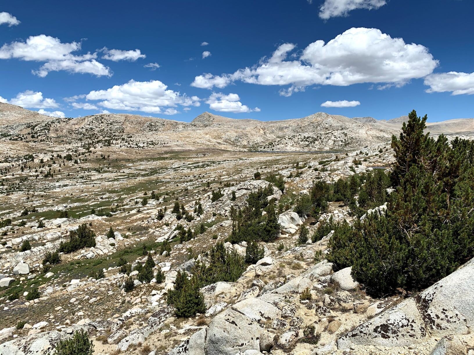
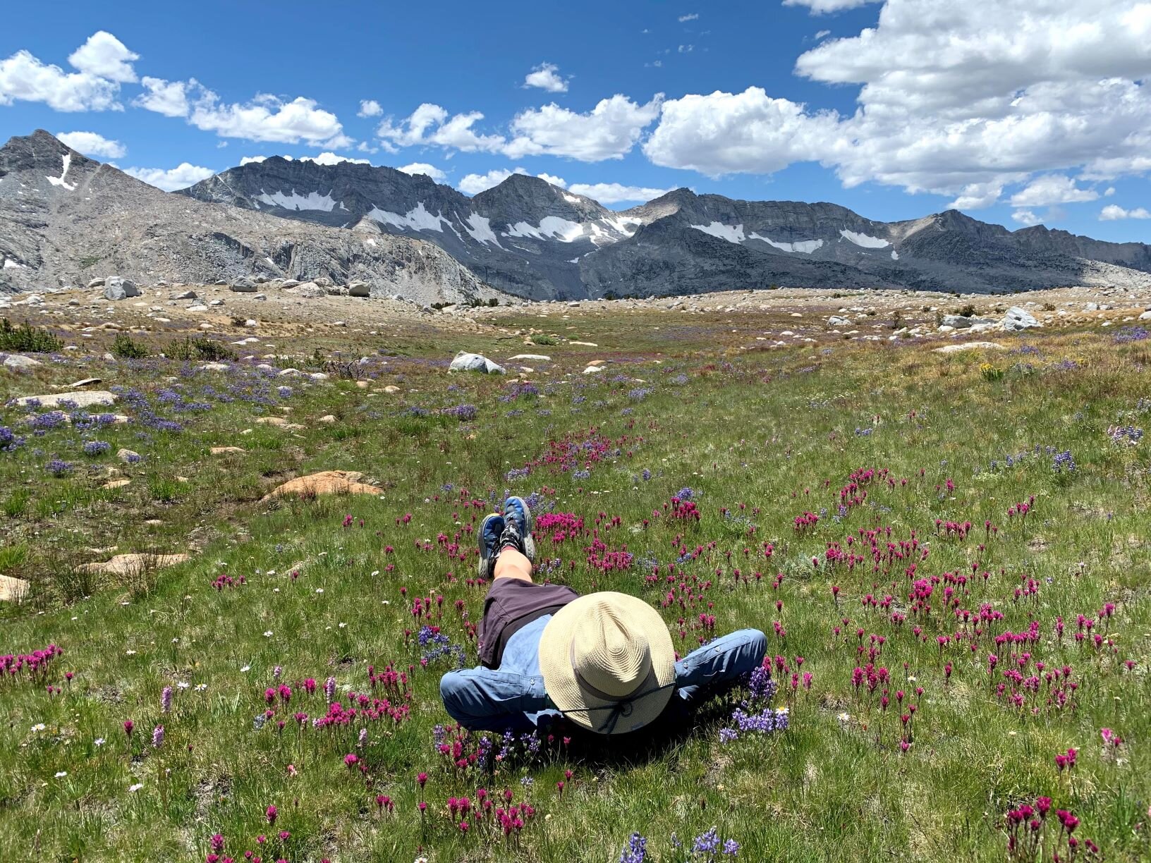
The terrain here was quiet different from everywhere else we had seen on this trip. There were very few trees and the ground had a lot of series of rolling hills with ridges of exposed rock. It looked like the miniature version of the Basin and Range topography that exists in the Great Basin just on the other side of the Pass. The biggest surprise up here were the fields of flowers, large swaths of Lemmon’s paintbrushes, lupines, and stone crops. We also had unparalleled views of the Glacier Divide to our south. We also had a persistent windy conditi0ns for the first time on the whole trip. As we made our way around above and below the lakes in the basin we reached the last ridge that overlooked Knob Lake. It was sitting as the end of shelf below the massif of Pilot Knob. It afforded us near panoramic views of the Mt. Humphreys, Glacier Divide, and the Pinnacles. The clouds had once again telegraphed that a weather change was going to happen and we made our way back to our campsite.

Summer Sierra storm bearing down on us. Probably a good time to deploy the rainfly.
Shortly after returning to our campsite we were treated to a thunder and lightning storm that built up on the southern face of the Glacier Divide and stalled there. While watching that storm, a second storm front came rolling in from the west and passed over us rapidly and the two storms pushed at one another until they dissipated the combined forces elsewhere. As the skies cleared in the early evening, the trout living in the little tarn near our campsite where feasting on flies and jumping nonstop.

Range of Light: Humphreys Basin Edition
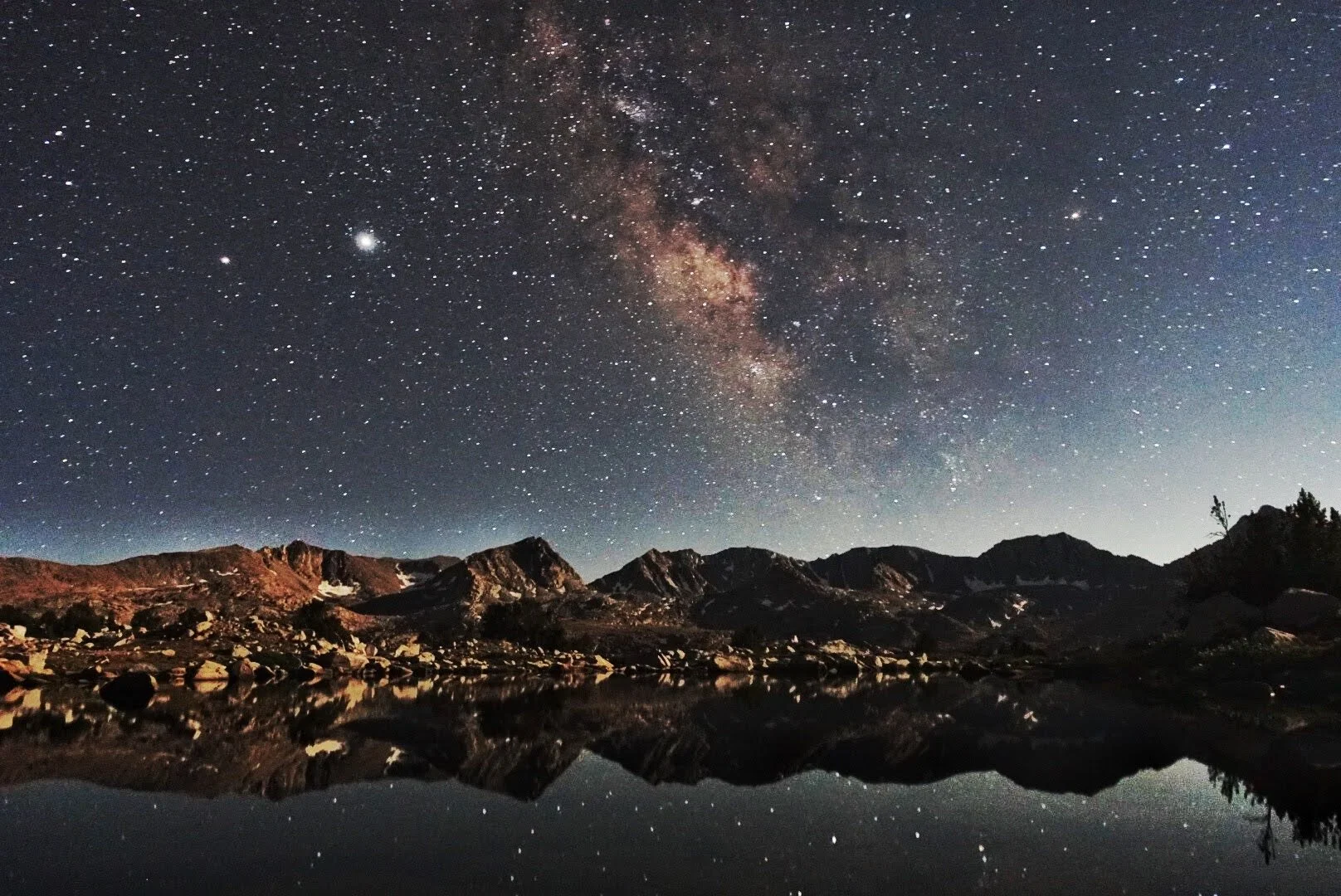
Saturn, Jupiter, the Milky Way, and the Glacier Divide
Having eaten our dinner, we took a stool near our campsite to enjoy the spetacular alpenglow along the Glacier Divide. We settled down with the fly on the tent for a little extra warmth and insurance against a surprise storm. Although we did keep the vestible doors open to let us still see the stars.
Andrew got up around 2200 to capture some more views of Comet Neowise and the Milky Way and planets. The tarn was glasslike and it provided to be an excellent mirror of the both the stars and mountains.
STATS: 9.5 MILES (off-trail) | 460' NET ELEVATION loss | 1759' CLIMB | 1299' DESCENT
Day 5 / Desolation Lake outflow over Piute Pass to North Lake

Marmots and their shenangians
We packed up from our lovely little spot and enjoyed the antics of a pair of marmots near our campsite. They were perched on some nearby erratics but also seemed intent on some discussion of their own. Making sure that there were no treats left for them we headed back towards Paiute Pass. Soon we found a use trail leading from Desolation Lake and we followed it back to the main trail. Having joined the trail we started the climb up to Summit Lake and then crested over Paiute Pass. We said goodbye to the wilderness behind us and started the trail back down to the trailhead.

Soaking in our last morning in the wilderness
There is always in my mind the balance of having enjoyed our time in the backcountry with a little wistful wishing that these people will be heading out for their own adventure. Hoping that they both have a wonderful time and are good stewards of this special place that we have left behind. Will they leave it better than they found it? Soon enough we had dropped down enough elevation that majestic Sierra pines were no longer the dominant species and we were under a canopy of Aspen and Cottonwoods. Sierra Lilies and Monkshood lined the trail as we reached the flats.

Heading out of the wilderness for now. We will be back soon.
Familiar sites greeted us as we came to the junction for the Lamarck Col route and the trailhead. Even more people were around now and we progressed from the campground to wide dirt road and the back to our car. While the trip was only 4 nights, it was a wonderful break from the pandemic.