I-10 / Cabazon to Idyllwild / Hurkey Creek Campground on Hwy 74 (45.8 PCT & alt miles via Mountain Fire detour)

Storm clouds brewing as we cross the desert.

Huckleberry and I found the friendly house in Snow Creek Village.
We crossed the windy desert flats of San Gorgonio Pass, leaving behind the interstate and the railroad tracks as we followed the tall sign posts that meandered towards the mountains. It continued to be partly overcast in the valley, and dense clouds still crowned the San Jacintos. Thankful for the cooler temperatures in this exposed terrain, we started a gradual climb up the mouth of Snow Canyon. We passed the small community of Snow Creek Village where numerous signs reminded us that all of their roads are private and trespassing isn't allowed, so we should stay on the one paved road that the PCT follows in this area. We were pleasantly surprised to come across a corner lot near the edge of the community with PCT emblems in their yard and on their mailbox. They had a small shaded park bench and a mileage post listing common destinations along the PCT. It was a welcome touch of hospitality and on a more typical hot day it would also be a wonderful brief distraction for thru-hikers headed in either direction. Beyond the bench, we passed a locked gate and continued to follow the paved road into land managed by the Desert Water Agency as it climbed towards the base of San Jacinto peak. We eventually reached a water fountain installed for hikers by the agency, where the trail departs the road. It is an incredibly nice gesture and we took advantage of the potable water to make our hot meal for the day and gather enough water for the rest of this afternoon and into tomorrow. We knew from the water report that there was no water for another 20 miles and we wouldn't reach that creek today.

I think they could have just said "Enter at your own risk."

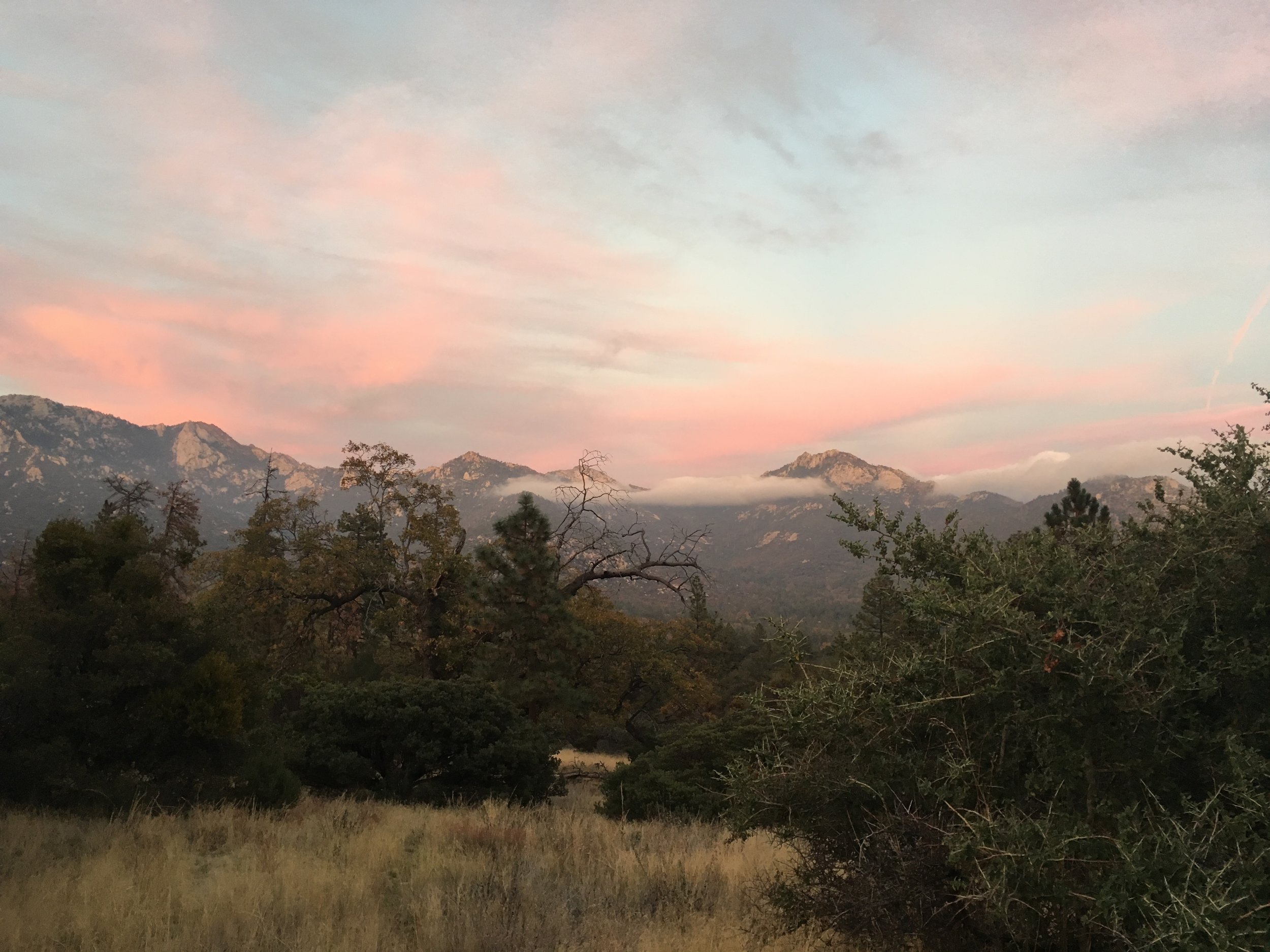
The rain storm brought us another rainbow in the desert. A welcome distraction from our ascent into the San Jacintos.

Meanwhile in the other direction, Huckleberry and I enter the storm zone.
Looking up, we saw that the summit remained enshrouded in grey storm clouds and I re-nicknamed San Jacinto Peak the Storm King due to this persistent crown of dark weather. The trail immediately started up a series of switchbacks and I will admit that the mountain seemed daunting at first. However, I was quickly relieved that the grade of the trail was civilized and not as difficult as it appeared from staring at the slope since yesterday afternoon. As we climbed higher, the weather got worse and we got a little of the precipitation that we had been expecting based on the forecast. It turned out to be more aggressive fog than actual rain and for that I was thankful. It was accompanied by plenty of gusty wind, but nothing like we have experienced elsewhere in SoCal. As the trail made its steady climb, we started to get more views of the surrounding desert and the San Bernardino range to our north. The storm system was clearly more active on that range and I was glad that we had already descended from those mountains. We made steady progress up the mountain and we were quite happy to pass our 'backup' campsite while it was still light. As dusk approached there were fantastic clouds both above and below us and a wondrously pink purple sky to our east. Soon the desert floor was awash with lights as it got darker and we could see that I-10 made a ribbon of moving light stretching out along the desert. We have grown accustomed to trail life where when total darkness falls it is "hiker midnight" and we are ready to seek a campsite and a warm sleeping bag, even though in the non-trail world it is only 7:30pm. In fact, pre-PCT we would be just getting home from work and making dinner at this time. Shortly after hiker midnight, we reached our 'goal' campsite. The wind had picked up significantly, and we were happy to find several protected options within a stand of large manzanitas. Since we had already resigned ourselves to setting up the tent in rain tonight, we were both happy that there was only a strong, gusty, and cold wind. It's all a matter of expectations.

After the wind storm, we were greeted with a glorious sunrise.

Two layers of clouds persisting over the valley between the San Bernardinos and San Jacintos.
The morning of Day 118 was clear and we could see the entire summit of San Jacinto Peak for the first time. It is a majestic mountain, and its bulk and height are almost startling when seen in contrast to the flat desert down below. From Palm Springs to the summit is a gain of >10,000'. We continued our climb up along the shoulders of Black Mountain and San Jacinto and transitioned from manzanita and mountain mahogany to forested slopes with stands of Jeffrey and Lodgepole pines and White firs. Although the rain had passed there were persistent high clouds filtering the sun, so it remained cool to even cold on the trail. It was pretty close to perfect hiking weather, as long as we kept moving. We could see that the mountain received much more rain at the higher elevations and we're glad we camped where we did. Down the western face, the valley holding Idyllwild was hidden below a blanket of fluffy white clouds. After a few hours we reached the Fuller Ridge trail head. To put this in perspetive, the trail winds its way up over 15.2 miles from the faucet, but it is a mere 4.3 miles between the two points as the crow flies! Along this exposed high elevation ridge we passed Castle Rocks, a gorgeous outcropping of granite with views of the San Bernardino mountains back to the north, and also gained our first glimpse of the terrain ahead of us to the south. Surrounded by our favorite trees, we enjoyed hearing a morning birdsong chorus and seeing the Clark's Nutcrackers, chickadees, and a few other birds that were unfamiliar to us.

Fog-like clouds lingering in the valley above Idyllwild.
Mid-morning we heard a familiar voice call out and saw that Jorts, a fellow SOBO, was a few switchbacks below us. He was the first SOBO we had seen since leaving Wrightwood and only the 3rd person we'd seen on trail since then. The three of us caught up on what's happened since we last saw one another on Mt. Whitney. He was planning to take a side trail down into Idyllwild and then head out back to the Paradise Valley Cafe to rejoin the PCT to get around the Mountain Fire closure. He has plans to finish the final 150-odd miles in 3 days! We will follow the PCT as long as possible and take a different detour to avoid the closure. We plan to cover the last stretch in just under 7 days. We exchanged phone numbers and said what would probably be our final trail goodbyes as he headed into town and we started our traverse across the shoulder of Marion Mountain.

Coulter Pine cone. These littered the trail down to the campground.
The views were incredible especially as the valley below was filled with thick clouds hiding the town of Idyllwild and sending wispy fog-like tendrils up each steep slope that never quite reached us on the trail before dissipating. Along this stretch we met a handful of day hikers and 2 NOBO section hikers covering the stretch from Paradise Valley Cafe to Big Bear, expecting to take 8-9 days. It struck us once again just how much mileage thru-hikers cover when our discussion brought up that our intended campsite for tonight was theirs of 2 nights ago, and where we spent the night before last would be their goal 4 nights from now. We enjoyed meeting them, and exchanged a few trail tips before continuing on past Saddle Junction and south towards Tahquitz Peak. Here there were some stalwart windswept and contorted Limber pines, which have a very narrow range. We had only encountered them along the Angeles Crest before now, and were awed by a huge slope covered nearly exclusively by these majestic trees. We left the PCT over Tahquitz Peak due to the Mountain Fire closure in place since 2013, and followed the South Ridge trail down towards Hwy 74. I soon discovered that every trail out of the San Jacintos is steep and riddled with switchbacks. This "unofficial" detour follows a route that is primarily used by mountain bikers and is part of the springtime Idyllwild Classic. Huckleberry and I agreed that this was a trail for some hardcore mountain bikers and we would not want to ride it, ever.
By now it was getting to be dusk and we were happy to have the narrow single track out of the way. The rest of the route to our campsite was an abandoned and eroded but relatively easy-to-follow trail over much gentler and more open terrain between a forest road and the back side of a county campground on Hwy 74 across from Lake Hemet. We arrived under cover of darkness and happily made dinner at a picnic table with water from a faucet, then were able to grab brief yet still luxurious hot showers before getting into our sleeping bags. We will be meeting Huckleberry's sister tomorrow for a half day in town filled with food, resupply, full showers, and laundry. It was wonderful to go to bed freshly showered and I did not even mind the evening chill. The next morning, we were able to sleep a little later instead of getting on trail in the pre-dawn light. It turned out to be the coldest night we've had in weeks, and we awoke to find a fine layer of frost on everything.
Last light on the San Jacintos as we made our way to Herkey Creek Campground.
These last three mountain ranges (San Gabriels, San Bernadinos, and San Jacintos) we've crossed are called "sky islands". They each hold high-elevation plant and animal species that cannot tolerate or survive the surrounding desert or semi-desert environments, and in this way are like island ecosystems. It felt like walking in pockets of the Sierra that have been transported to SoCal. We have also noticed, especially through the San Jacintos so far, similarities to the Ruby Mountains of Nevada. They are a sky island of the Great Basin, and the San Jacintos make up a portion of that vast area's western boundary. We were smitten by the Rubies on our first visit there just last summer, and we have been similarly delighted by what we have found so far in our first visit to the San Jacintos. It is especially bittersweet to enjoy these mountains since they will be the last that we will see on the PCT before our journey comes to an end in less than 10 days now. We have thoroughly enjoyed these peaks and all the surprises that they have shared with us.
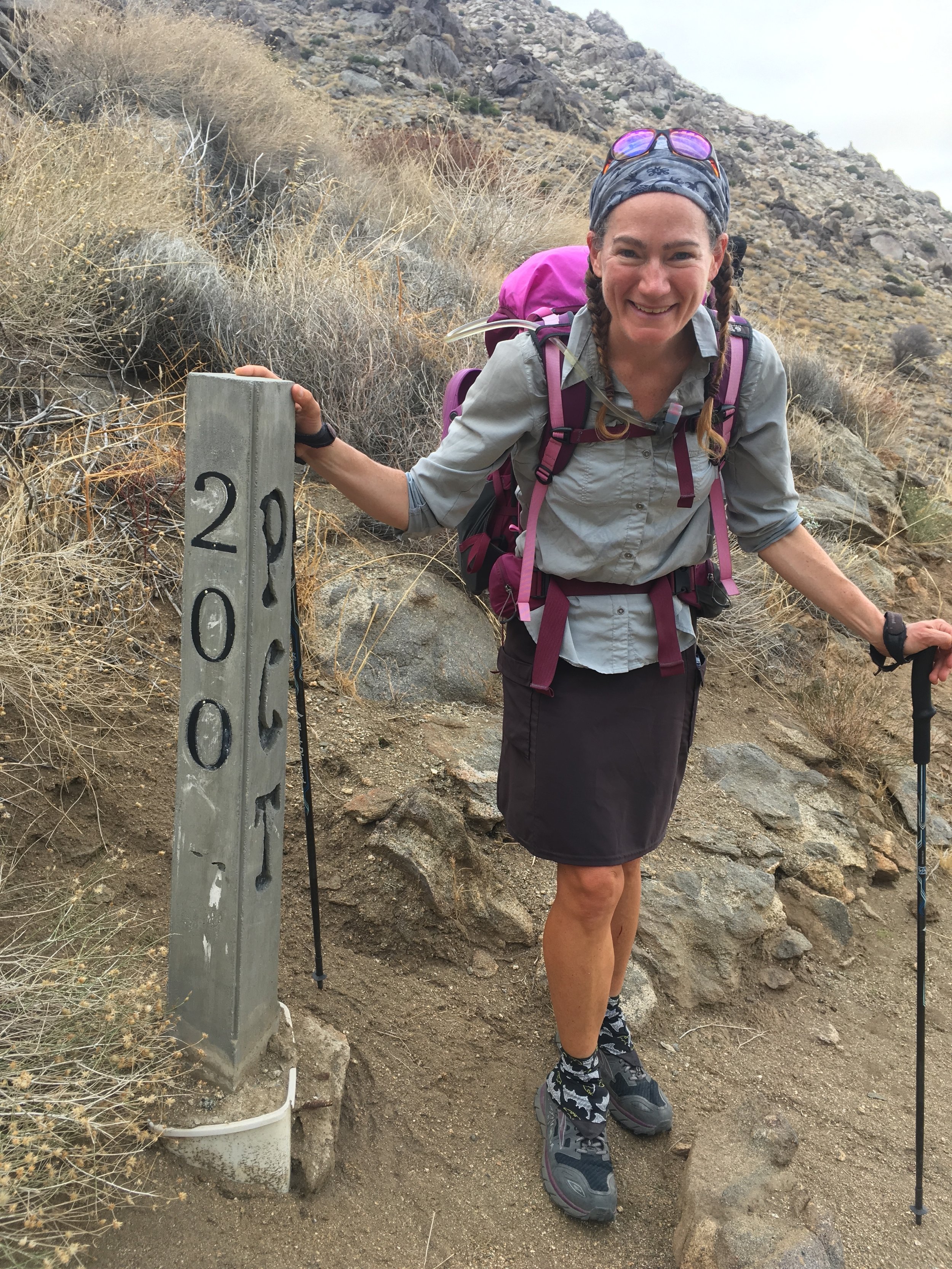
Hard to believe it, now we have less than 200 miles to go!
Milestones keep tumbling as well. On our ascent into this range, we came across a concrete post labeled 200/PCT/2450. We have taken one more step up the podium and crossed into the 100s! It feels surreal that we are getting so close to the end of this trek. As I have mentioned before, we are still enjoying every day on the trail, yet we look forward to completing our journey and returning to everyday life. Of course we will take some time first to rest and recuperate, but we both feel ready to pick up our usual lives again. It is a bit like reading an engrossing book - you are fulfilled while reading it and sad when it is done, yet you know that there will be other books to read and other adventures ahead.
-Macro
The morning we crossed I-10 we had only 10 days left in this journey. To commemorate, here's our "top ten" list of areas along our PCT hike that we plan to explore more in the future:
10.) Goat Rocks Wilderness, southern WA
9.) Sky Lakes Wilderness, OR
8.) Whitewater Preserve & the Sand to Snow Monument, southern CA
7.) Marble Mountain Wilderness, northern CA
6.) Area around Cutthroat Pass, northern WA
5.) Mt. Langley & the Golden Trout Wilderness, Sierra Nevada, CA
4.) San Jacinto Mountains, southern CA
3.) Seven Lakes Basin near Castle Crags, northern CA
2.) Upper Kern Basin via Harrison Pass, Sierra Nevada, CA
1.) Three Sisters Wilderness, OR