Idyllwild / Cedar Spring Trail to Warner Springs / Hwy 79 (55.6 PCT & alt miles via Mountain Fire detour)

Ready for a 4:30pm start at the Cedar Spring Trailhead, flouting fellow SOBO Happy Feet's theory: "If you can't get out of town before 2:30pm, you might as well just spend the night" (PC - Julie)
My sister Julie picked us up from Hurkey Creek Campground early on Day 119. We were eager to hop in the car to warm up numb fingers after packing a frost-covered rainfly and the rest of our gear in sub-freezing temperatures. Our Idyllwild town day started with breakfast at the Mile High Cafe. Everything was delicious, though their normal-person serving sizes were not up to thru-hiker standards. We headed for the laundromat next. It was a tiny place but the people were super friendly and used to hikers so they didn't bat an eye when we asked to use their restroom to change into raingear. Julie and I sorted resupply food in the parking lot while Macro kept an eye on the laundry inside (as if anybody would want our hiker clothes). Meanwhile we were both had a 'second breakfast' of persimmon bread, fresh fruit, cookies, and Halloween Twix courtesy of Julie, who somehow knew that a single restaurant breakfast wouldn't be sufficient. Armed with clean clothes we stopped in at the San Jacinto State Park campground in town for showers. We were impressed by the facilities which had the nicest showers we've seen on-trail by far, other than those in private homes and expensive lodges. At $1 per 4 minutes, it was a serious bargain. As icing on the cake, Julie brought big fluffy towels and toiletries, so I was basically in heaven. It doesn't take much to make a thru-hiker happy. Her husband Jeff joined us for a picnic lunch that was a huge spread of salad fixings, sourdough bread, avocados, and more fresh fruit. In a reversal of roles they dropped us off at a coffee shop to do internet things and went out for a hike themselves. We offered them our backpacks so they could pretend to be thru-hikers for the afternoon, but somehow that wasn't appealing. While we were lounging on the couch editing blog posts and checking email, a woman at a nearby table asked if we were southbound. Apparently even without backpacks, freshly showered, and in clean clothes we are that obvious. It turns out that she is a local journalist and freelance writer doing a series of pieces about the PCT and thru-hikers, and she was interested to hear from some SOBOs. She was a fun distraction though it meant we were less efficient with our own projects so that when Julie & Jeff returned we weren't even close to being ready. We finally left town around 4pm, incredulous that we had spent nearly 8 hours in town. Although it was a highly enjoyable day and we completed our most important tasks, it felt like we barely got anything done and still had no time at all to simply relax. In other words, it was a town day just like almost every other. The one huge difference this time is that before we left, we made arrangements for Julie to pick us up at the Mexican border in just over a week. It seems impossible, but here we are.

Mist coming into the valley looking back from the climb up Cedar Spring Trail

Lion Peak with clouds settled in over Lake Hemet and Idyllwild at sunset
The Mountain Fire detour requires either walking directly along the shoulder of Hwy 74 or on an informal dirt path very near the highway. We chose to skip this section and instead had Julie drive us all the way to the Cedar Spring Trail Head on Morris Ranch Road. From there we could walk just 2.5 miles of trail to re-join the PCT at the first point where it is open. Our latest start ever meant that we missed the heat of the day for the steep climb back to the PCT, and we were treated to a golden glow over the valley below as the sun sank towards the horizon and mist swirled into the lowlands. The trail was surprisingly well-maintained as it made wide, even switchbacks up the side of the hill through recently trimmed yucca and dense brush. Late season trail work is rare since there are far fewer users this time of year and winter is near, so we are especially appreciative of these efforts. As dusk fell the mist below us thickened to fog and brought a damp chill to the already cool air. On reaching the PCT, we started a rolling ridge walk towards Lion Peak switching back and forth between the two sides of the slope through small saddles. To our right was the mountain valley of Lake Hemet now filled with dense white clouds blocking any evidence of civilization. To our left was the flat desert far below, with not a wisp of mist in sight and city lights stretching out along highway corridors as far as the eye could see. Above us there was a sliver of a moon, Venus shining brightly nearby, and faint stars just becoming visible as dark set in. The wind picked up as we walked the final few miles by headlamp and by the time we set up camp beneath mature trees on the edge of Oak Canyon it was quite gusty and cold. We ate dinner in the tent with the rainfly battened down as a windbreak.

Macro in plenty of layers on a crisp fall morning headed out of the San Jacintos

These prickly pears have an amazingly wide range through SoCal ecosystems

A new flower! It also grows from cracks in the granite
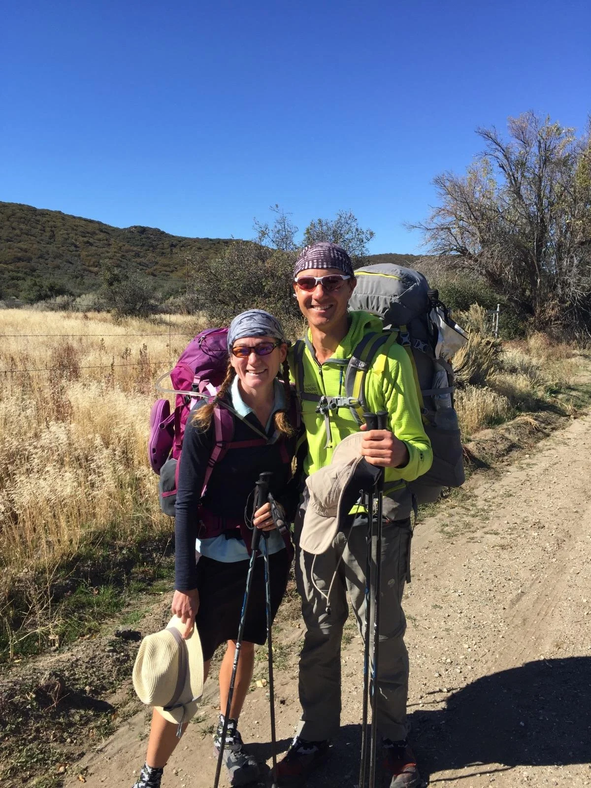
On Day 120 we made a gradual descent out of the San Jacinto foothills towards Hwy 74. The day started out quite cold. I even hiked in my warm hat and gloves for the first time in several weeks. The sky was clear and last night's wind had disappeared, so once we had direct sunlight we started removing layers and within a few hours it was a very warm day. We passed through swaths of live oaks along the rim of both Oak Canyon and Live Oak Canyon, then started to see a greater diversity of plant life and a transition to a hotter, drier ecosystem. Large granite boulders made an appearance and instead of dusty brown dirt, the trail tread here was pale white of sandy decomposed granite. A plant with bright yellow blooms that we hadn't yet seen along the trail was prevalent in the cracks of the boulders and other wildflowers were still in bloom. We dipped into a few dry drainages that must have water some parts of the year, and in these areas there were unlikely plant combinations. One corner of trail was populated by ferns, cactus, Coulter pines, and Black oak all growing together in a strange harmony. After this stretch of new plants and rocks, we dropped into standard SoCal chaparral and made our way to the highway through this familiar landscape. We had planned to stop in at Paradise Valley Cafe to refill water, and since we had to go there anyway we had been talking about staying long enough to have milkshakes, too. At the highway crossing we found an informal "mini-cache" of a few gallons of water, which would have been sufficient for our needs. After a quick discussion, we agreed that we both had our minds set on those milkshakes and decided to hit the Cafe anyway. We had heard a rumor that staff would pick up hikers if they weren't too busy and since it was mid-morning on a weekday, decided to give it a try and called. The Cafe is only 1.1 miles down the road, but we were delighted when the owner came to get us in a van saving us those bonus miles walking down the highway. The sign outside says "hikers, bikers, and horse riders welcome," and we would woleheartedly agree based on our reception there. While we were enjoying our real ice-cream chocolate milkshakes and basic French toast done just right (a 'second breakfast' of champions!), another hiker came in. We hadn't yet met Twister, though we'd seen his name just ahead of us in trail registers for the past few weeks. It turns out that he has flipped and skipped a bit, but has hiked SOBO through most of the Sierra and SoCal. His parents who live near San Diego have met him at several points along the way and had driven him here from Idyllwild this morning. We exchanged a few trail stories and of course jumped at the offer of a ride back to the trail, where they were already planning to drop Twister. We arrived just after 11am, with all water containers full and very happy stomachs.

Water tank at Mike's Place

Little free library at Mile 145
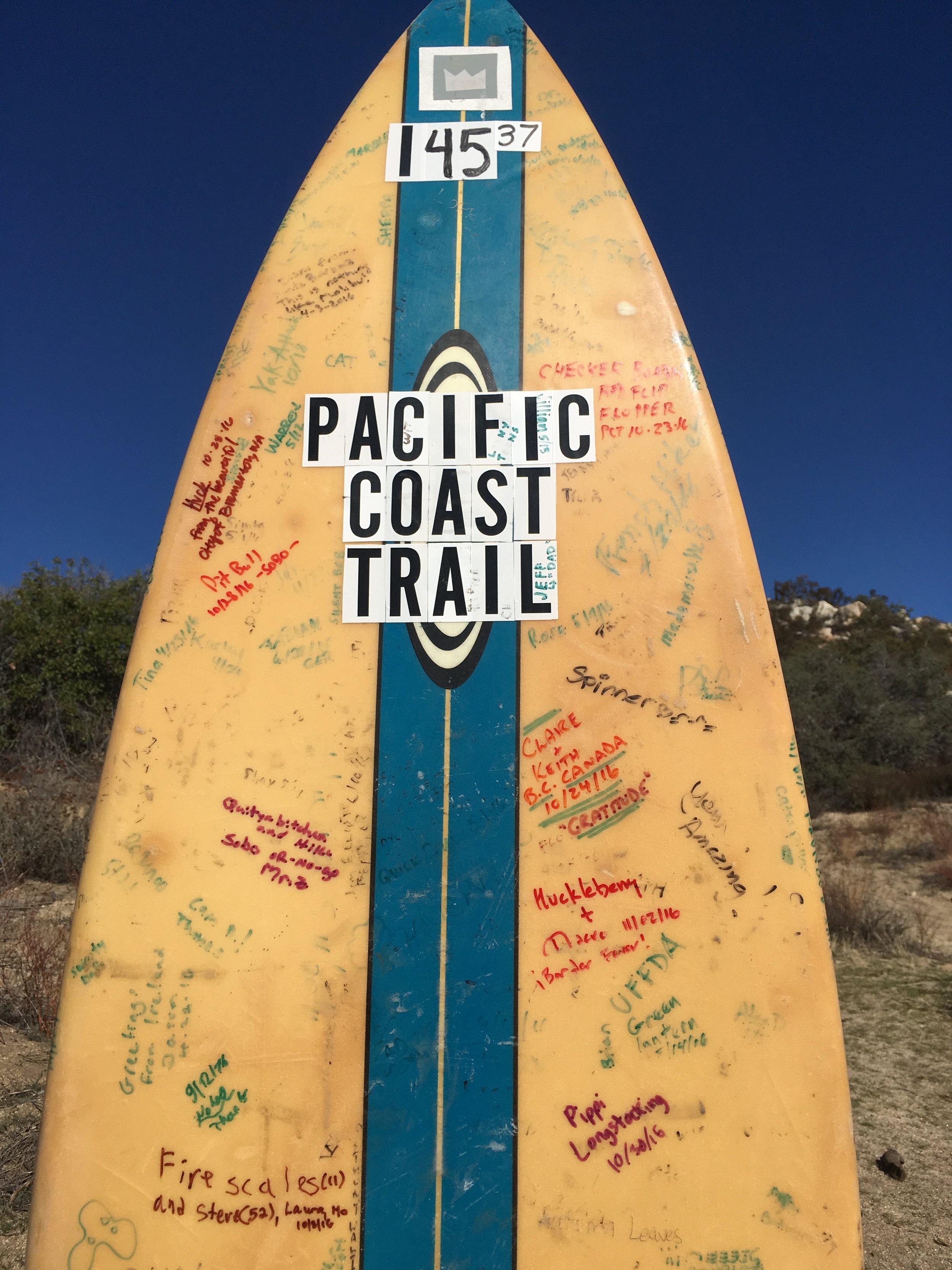
Huckleberry & Macro - ¡Border Fever! at Malibu East, or PCT Mile 145.37

We came across this weathered note on the trail, warning hikers about the "farmers" with greenhouses
After leaving the relatively lush and wet (for SoCal) San Bernadino Mountains, where the PCT follows the course of several creeks that are running well even late in the season, we have once again had to pay close attention to the location of our potential water sources. SoCal's PCT "Section B" stretches 100 miles from I-10 at San Gorgonio Pass to Warner Springs on Hwy 79. In this entire section there are only 2 natural sources that currently have water: San Jacinto Creek on the south side of the mountain, and a spring in the otherwise dry Agua Caliente Creek drainage a few miles north of Warner Springs. Due to mileage and timing, we didn't take water from either of these sources but instead relied on "man-made" water for all of Section B. After the Desert Water Agency's faucet in Snow Canyon, we picked up water in town at Idyllwild. Paradise Valley Cafe (1.1 miles off-trail, though we got rides both ways) is the next source, and the next reliable option is "Mike's Place." A hiker-friendly rancher named Mike has installed a large water tank in his driveway less than half a mile from the PCT on Chihuahua Valley Road, and though the water is not potable it is clear, comes out of a spigot, and doesn't go dry late in the season. On a hot day with minimal shade, we were surprised to come across a well-stocked water cache at mile 145, about halfway between Hwy 74 and Chihuahua Valley Road. A surfboard planted in the ground labeled "Malibu East" doubles as a trail register, a pair of picnic tables in good condition sits between young maple trees, there is a small free library of paperback books, and plastic bins under one of the tables held many gallons of water. The water report notes that this location is strictly an "emergency" water cache for NOBOs, but it seems that for us SOBOs (far fewer in number), it is regularly stocked at levels sufficient for general use. Although we weren't expecting to find water here and didn't officially NEED any, we took advantage of the available resource and shared a liter from our packs, then refilled from the cache before signing the surfboard and continuing south. We continue to be amazed at and grateful for the generosity of strangers along the trail. Our final water source of the section would be the school district resource center in the tiny town of Warner Springs, which has an outdoor spigot available to hikers and restrooms that are left unlocked all night.
Headed back on-trail after milkshakes for 2nd breakfast (PC - Twister's mom)

Chaparral plants

Dry hills south of Hwy 74

Umbrellas are a lifesaver on warm SoCal days

There's a little rat bastard growing here
Transition from chaparral to desert
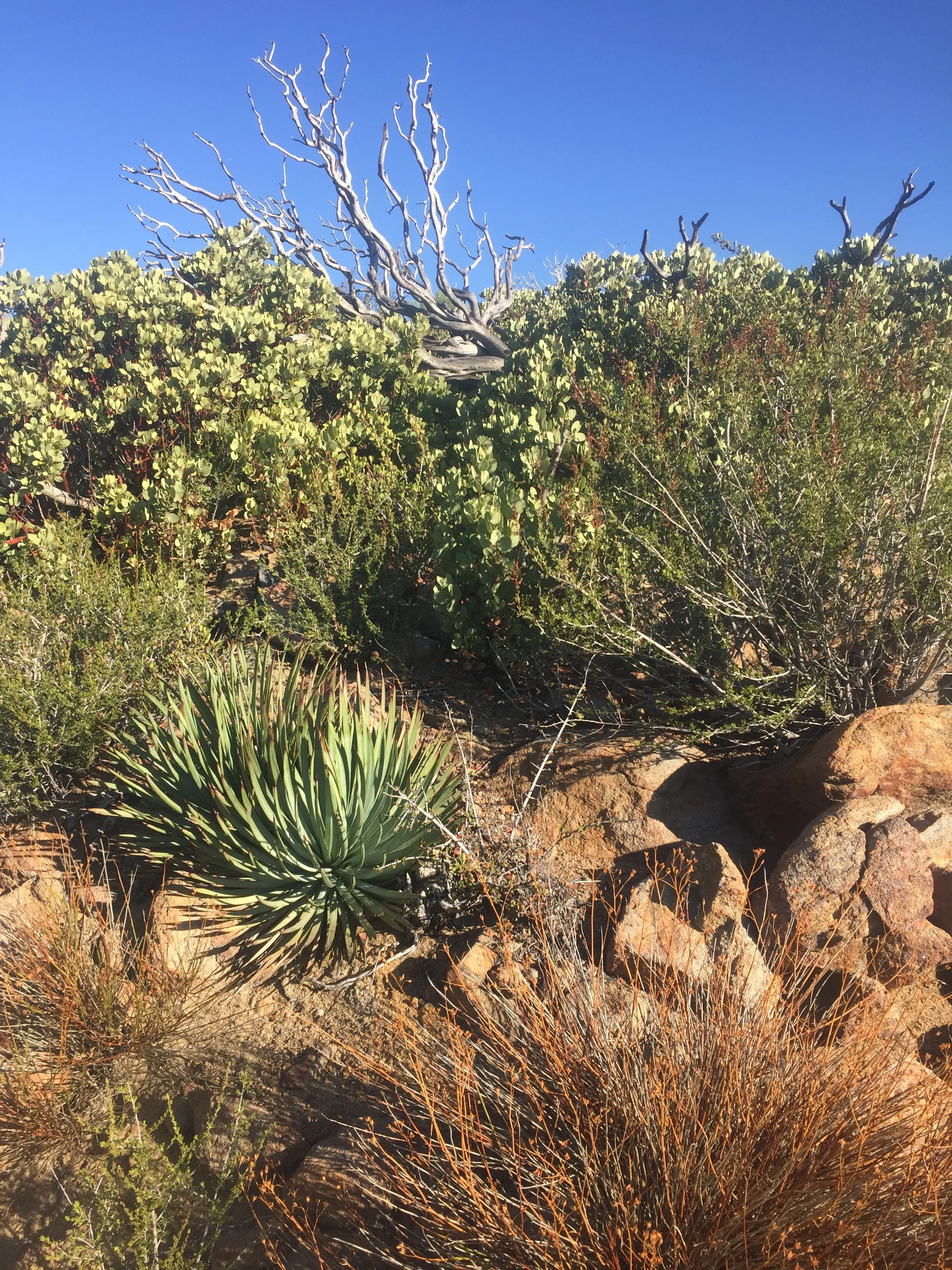
South of Hwy 74 after we left the Cafe, we started out in chaparral but quickly transitioned to desert terrain and soon entered the enormous Anza-Borrego Desert State Park. We were surrounded by cacti (predominantly cholla with a few others), yucca, and agaves. Many of the brush from Mission Creek made another appearance (sadly, this included our "old friend" that we nicknamed rat bastard), and several arid wildflowers. The day went from warm to hot, exacerbated by the lack of shade or any significant breeze. We made liberal use of our trekking umbrellas to mitigate the heat and were glad that we did not walk through this section in NOBO season, when the temperatures were probably at least 20 degrees warmer. The trail traverses around a long series of ridges, dipping in and out of every drainage. We remarked on how remote it feels out here, especially for SoCal. Although we can occasionally see a greenhouse on a hill or a house in the distance and there are plenty of dirt roads, cell service is limited to ridge tops and there are no communities visible from the trail. We enjoyed the desert landscape, especially the barrel cactus which we are seeing along the trail for the first time. The young ones are particularly striking, with bright pink spine that seem impossibly long for the size of these little round guys. We walked past both Nance and Tule canyons, filled with deciduous trees and other lush green growth as the only clue that both have flowing water in some months of the year.

Morning golden hour as we head towards Bucksnort Mountain

Looking back from Combs Peak towards our long traverse

Granite boulders and deep blue sky to rival the Sierra, but plants give it away as SoCal

It's fall in the Agua Caliente drainage
Sunset in the oaks nearing Warner Springs
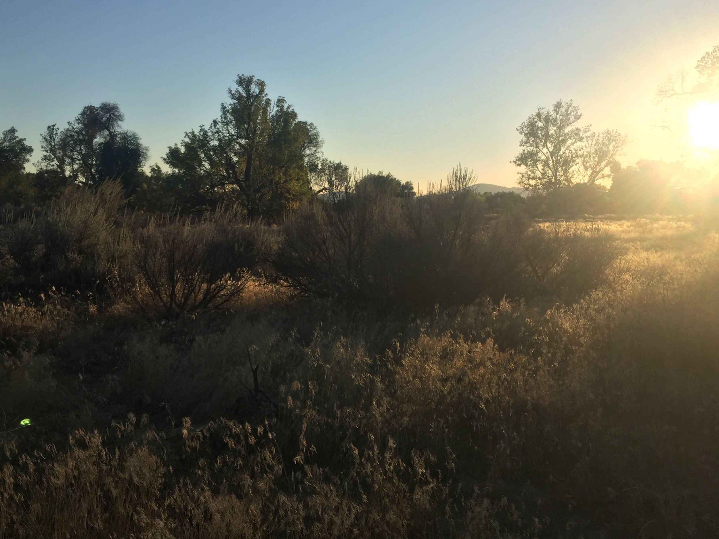
We camped among manzanitas just below Rim Rock Ridge on Day 120, and got an early start the next morning to complete the several mile-long traversing climb along Bucksnort Mountain the next day. As we gained in elevation we left the desert plants behind and transitioned back into endless hills of chaparral. Combs Peak was our high point for the day, then we started our long descent towards Warner Springs. As we came out of the hills we dropped into the drainage of the dry Agua Caliente River. This sandy shallow canyon is filled with oaks, maples, and knee-high vegetation, all with yellow-orange falling leaves, flowers long gone to seed, and browning stalks. Walking through desert plantscapes and chaparral hills on the last few clear sunny days, it is easy to forget that it is November, but among the deciduous trees of the river valley there is no doubt that even in southern CA we are well into fall. We crossed what would have been the river several times, and ultimately left the drainage behind for low rolling hills of dry grass speckled with huge mother oak trees. The sun dipped below the horizon as we made our final approach to the town of Warner Springs. We walked the final mile to the resource center by headlamp. It was a happy surprise to find that the parking lot was lit at night, there was a picnic table where we could cook our dinner, and the open bathrooms had lights, heat, and running water. It doesn't take much to make a thru-hiker happy.

Only 150 miles left to hike?!

To get to Riverside County from here, you'd have to head north - we are in San Diego County!
The milestones are now dropping like flies as we inch closer to the Mexican border. We passed the 150-mile marker on Day 120, which was also our "countdown" Day 7 based on the current itinerary. Both distance and time seem impossibly short, and it is hard to believe that after such a long journey we are now within a week of its end. The morning of Day 121 we entered San Diego county, California's southernmost and the last we will cross on our hike. And as Macro put it as we hiked along, on Day 121 we also passed the 121-mile marker. This is the only time in our 4-month trip that our day and remaining mileage will coincide. Each day we receive updates from others who are reaching the border, and it brings home the fact that we are nearly there ourselves. While we will miss the trail, we are also ready to be done hiking and return to our usual lives. We started the trail in early July and have since walked through 3 states, 4 full moons, and into November. At first we went to sleep at night under the Summer Triangle, watching Cygnus the swan fly through the Milky Way. Now we are watched over by the mighty hunter Orion with Betelgeuse shining brightly above our tent. As the days grow ever shorter and the holidays approach, it feels only natural that we are wrapping up this journey of ours. In the early spring we were debating whether to grab this potential window of opportunity and follow our dream of a PCT thru-hike this season. It seemed terribly risky to both take a mid-career sabbatical at the same time, with no guarantee that our lives would be the same when we returned. A good friend assured us that when we got old(er), we would never look back on our lives and regret not working more. He wondered, on the other hand, how we would feel if we never actually got around to hiking the Pacific Crest Trail. As it now happens, we will not have the occasion to find out. In less than a week, we will have completed this incredible journey and long-time dream of ours, and will be heading back home to see what the universe has in store for us next.
- Huckleberry
We have been doing plenty of reminiscing as we hike these past few days. In talking about town stops and food, we came up with our top ten favorite "town food" establishments along the PCT.
10.) Zoey's Ice Cream, Ashland, OR
9.) Pine Shack Frosty, Chester, CA
8.) Pupfish Cafe, Bishop, CA
7.) Paradise Valley Cafe, near Idyllwild, CA
6.) Cascade Locks Ale House, Cascade Locks, OR
5.) The Garden, Stehekin, WA
4.) Dotty's Cafe, Etna, CA
3.) The Bakery, Stehekin, WA
2.) Aardvark Express, Snoqualmie Pass, WA
1.) Koehnen's Bakery, Tehachapi, CA