

Border Fever

Pleasantly Surprised In the San Bernadinos

Alone On the Trail But Never Far From Civilization

A Paradigm Shift
Chicken Spring Lake to Kennedy Meadows General Store (48.6 PCT miles + 0.5 Bonus Miles)

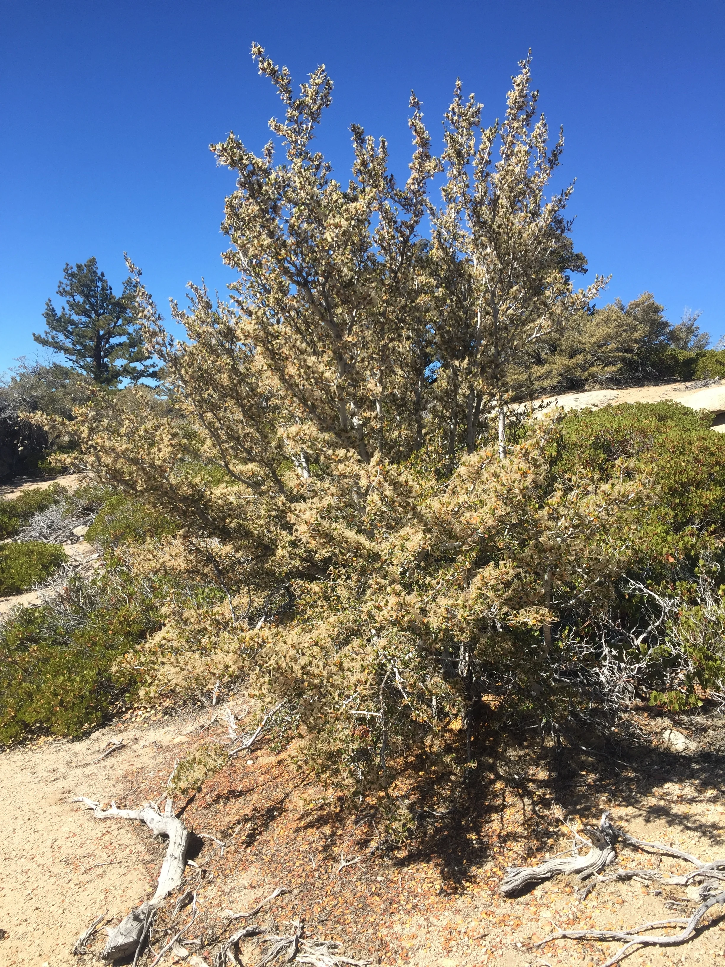
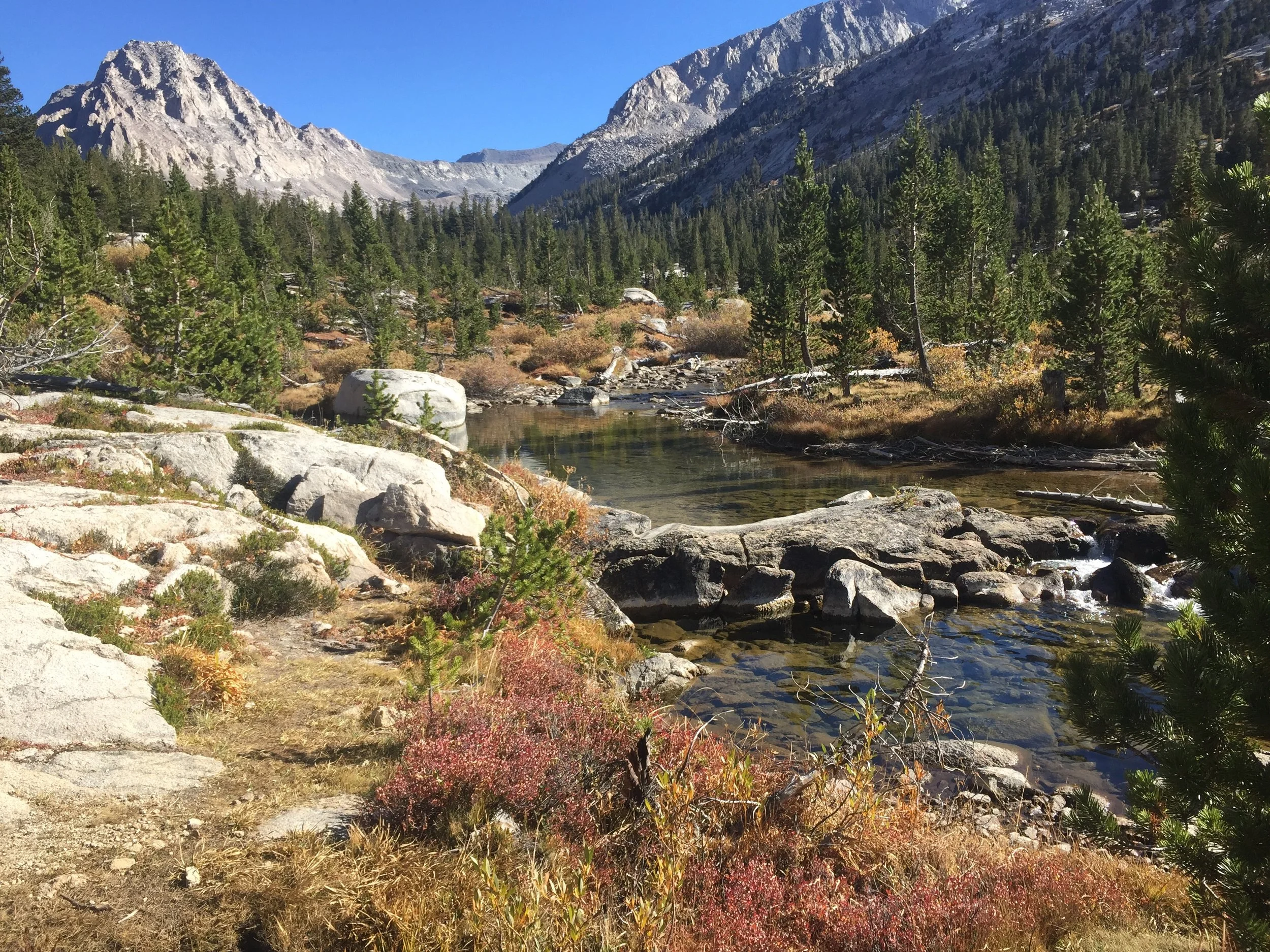
Slope of Foxtail pines in the southern Sierra
This final stretch of the southern Sierra Nevada marked a transition in more ways than one. We are leaving the high country for good, entering the much drier terrain of the southern CA mountains and desert, embarking on a huge stretch of trail we have never visited, and starting the final section of our thru-hike. While we built some extra time into our itinerary to enjoy the heart of the Sierra with shorter-mileage days (and account for potential foul weather), leaving these mountains also means a return to our usual thru-hiker schedule. We feel the weather changing as the year goes on, and the end of summer is a distant memory that we passed on the trail many weeks back. Even as we come down out of the high mountains, it is clear that we are hiking steadily into the fall.

Chicken Spring Lake is the last we'll see in the Sierra Nevada

One of many high meadows as we head towards the southern reaches of the Sierra Nevada

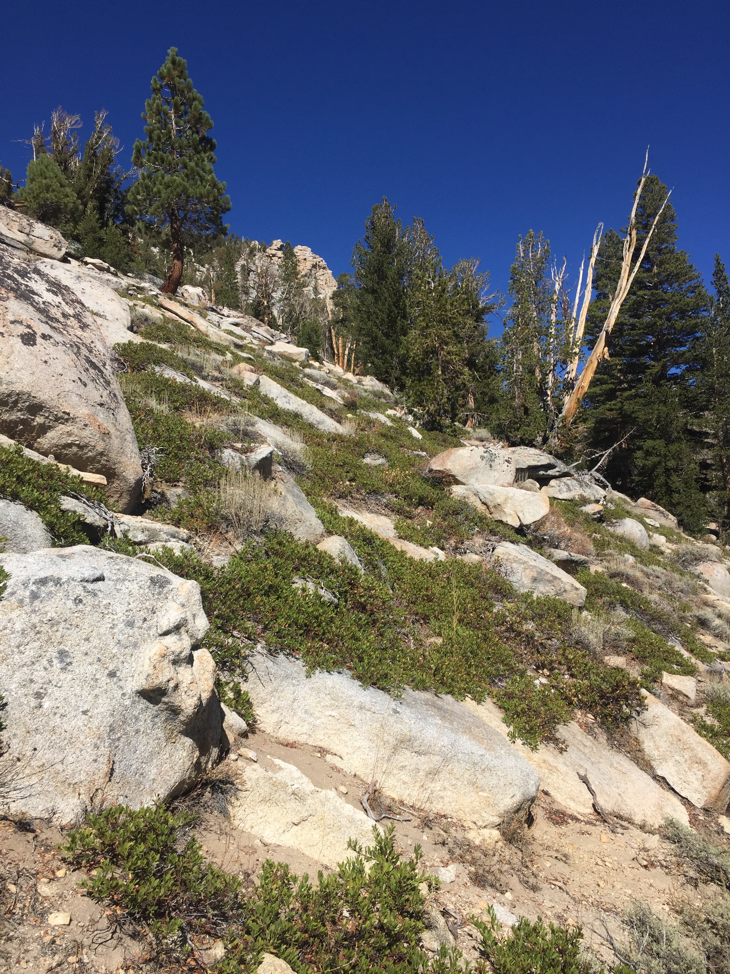
We didn't expect to find this terrain so far south
Leaving Chicken Spring Lake, we expected to see the last of our Foxtail pines and granite. It turned out to be a longer and more beautiful transition out of the Sierra Nevada than advertised by other hikers. The trail stayed around 10,000' for much of the afternoon as we dropped to Cottonwood Pass, traversed around Trail Peak, and crossed the saddles of both Trail Pass and Mulkey Pass. Foxtails did remain the dominant conifer on these forested slopes though they now intermingled with nearly as many Lodgepole pines, and there was less sand and exposed granite with more organic soil and more undergrowth along the trail. We were no longer surrounded by high peaks in every direction though back to the north could still see the craggy and treeless mountaintops of southern Sequoia NP. Instead, we had long views to more gentle and tree-covered slopes across wide expanses of yellow meadows on the valley floors a thousand feet or so down below. Although the maps show streams and ponds in many of these meadows, they all appeared dry from our vantage point with no evidence of actual water or even swaths of green plants that would suggest wet ground. This lack of water is a big change from the past several weeks, and is something we will need to get used to as we enter dry southern CA. The outlet of Chicken Spring Lake had been bone-dry (and looked as if it hadn't had water all season), though the lake itself was fine. The next on-trail water source was only 4 miles later at Poison Meadow Spring, a shallow trickle of clear water across the trail that ran into a willow-choked meadow. In the heart of the Sierra Nevada, we wouldn't have given this difficult-to-collect flow a second glance as a water source and in fact we passed it by. I imagine that within only a few days we will look back and remember how fresh and clean this water looked, and wish for something so nice. There was an off-trail spring a few miles later in Dutch Meadow that was reportedly flowing but we continued on to Diaz Creek, almost 10 miles from the lake and our destination for the night as it was the only water source with camping options nearby and just the right distance for our day. Trail guides list this creek as a "reliable source even in dry years" and recent hikers reported flowing water, a good source to fill up in an otherwise dry section. The creek itself is 1/10 of a mile off-trail, and we arrived just at dusk. What we found was a wide and deep river channel through the dry meadow but only a narrow and lazy flow of shallow water along the bottom, choked by grasses and surrounded by cow pies. There were sticks on the ground arranged in an arrow and spelling out "water," and Macro headed in that direction to find a reasonably clear section of flowing water that was about 4" deep that he could collect from, but it was a wake-up call to us both that this was now considered a "good" water source. We definitely have to reset our expectations as we head further south.

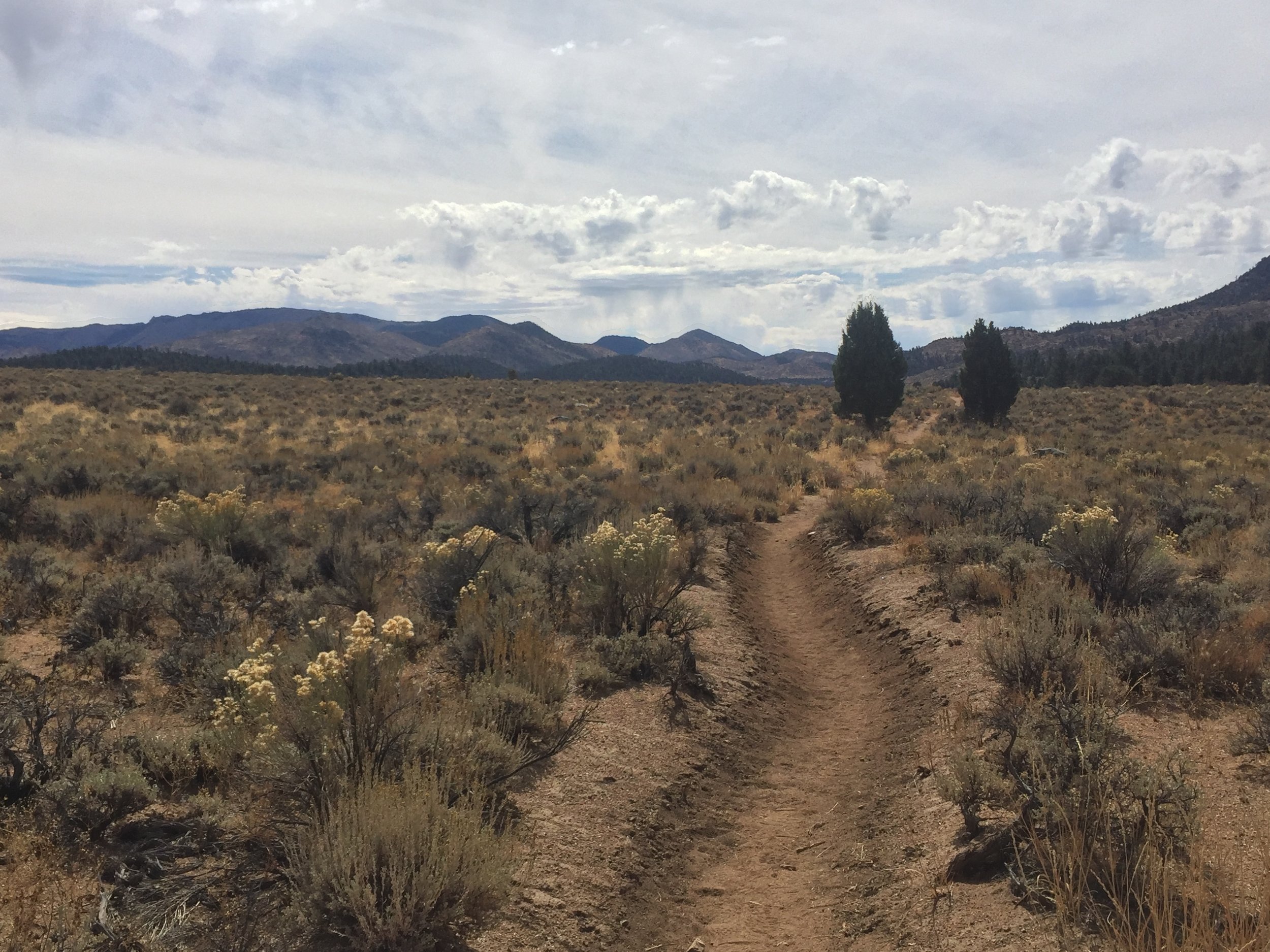
Hiking across the high plateau approaching Diaz Creek
The terrain between Dutch Meadow and Diaz Creek became more sparse and desert-like. The Foxtail pines persisted but were spread much further apart, grew from white sandy soil, and were more likely to be stunted and contorted like their close cousins the Bristlecone pines. It was fitting, then, that we even caught a few glimpses of the White Mountains to the east as that dry range across the Owens Valley is one of few places on earth that the Bristlecone pines grow. Along with these sparse and scenic pines there were patches of sage, gnarled remains of old downed trees, and tiny high desert wildflower plants as the trail meandered past mounds of exposed rock on the wide plateau above what we would soon discover to be Diaz "Creek". As the sun went down the evening light was spectacular on the wide spaces, pale earth, and dramatic shapes of this high desert terrain. The sky towards the east became many shades of pink and purple while the trees and rocks around us took on an otherworldly glow. It felt like we were walking through some hybrid of a Georgia O'Keefe painting and an Ansel Adams photograph. We would have loved to linger until dark, but instead hurried to reach our campsite and alleged water source. In retrospect, our little spot at Diaz Creek was beautiful. It sat just across the creek from a hill covered in rounded boulders and desert brush that became silhouetted by the moonlight and made a great backdrop for the Big Dipper and all of the stars. In that moment of Day 95 as we were setting up the tent and making dinner, we were more focused on the fact that it wasn't terribly flat, it was surrounded by dried cow pies, and the water situation was suboptimal at best. By the next morning, we had recovered from our disappointment an did appreciate our surroundings once more before hitting the trail (with all containers full of clear, treated water). The night had been plenty cold, and we started hiking in layers as per usual.

A glimpse of the Owens Valley from the Golden "Trout" Wilderness, complete with golden Foxtails

Flowers growing from rocks add color in this high arid terrain

The terrain gets more desert-like as we lose elevation from the Owens Valley overlook
Heading south from Diaz Creek, we climbed immediately and meandered along high ridges through open forest of Foxtail pines. The terrain remained dry and there were many outcroppings of rounded granite, often pink in color. The sky was clear and brilliant blue, and as the sunlight hit us we started removing layers of clothing. We joked that while this was the Golden Trout Wilderness, we hadn't passed nearby a single water source that would support trout of any sort since Chicken Spring Lake, and today would be another 25 mile stretch between on-trail water sources. On the other hand, there were plenty of Foxtail pines and in the brilliant sunshine they often took on a golden tone. We decided that a much more appropriate name would be the Golden Foxtail Wilderness, and continued to enjoy the trees that were the new namesake of this area all day. Near the top of our morning's climb we found ourselves on an open ridge surrounded by tall stacks of rounded rock with deep cracks. Around every corner were clear views to the Owens Valley thousands of feet below and the White Mountains beyond. We lollygagged there a bit to take in the contrast, but had a long day planned and soon continued on to drop to our lowest elevation in days, just below 9000' at Death Canyon Creek. On the way down we transitioned from Foxtails alone to Foxtails with Lodgepoles, then with Jeffreys, then with Western juniper, but were surprised to see the Foxtail pines persisting through all of these ecosystems. It once again felt quite desert-like with sage, rabbitbrush, greasewood, mountain mahogany, and plenty of pale sand and rounded rocks. As we left the exposed ridge and dropped into the valley the temperature also increased and I was actually hot for the first time in weeks. Fortunately, there was a bit of a breeze and this kept it tolerable. I realized that this was another transition that would have to be made. Although the nights will still get cold, the days are bound to be much warmer in southern CA than we have been used to in the high country. It was no surprise to us that Death Canyon Creek was dry, and we weren't in need of water so we didn't investigate the nearby spring 2/10 of a mile off trail that was reported to be running and instead continued on towards our goal of the South Fork Kern River.
Mountain mahogany and manzanita in the lower reaches of the Golden Trout Wilderness

View north from the shoulder of Olancha Peak

We're really out of the mountains now. Headed towards the South Fork of the Kern River in golden hour light.
We stayed on the valley floor past Gomez Meadow and a few seasonal creeks (one muddy & fetid puddles, one bone dry), then climbed over the shoulder of Olancha Peak. This mountain had been prominent to the south since Cottonwood Pass, and provided the last reason to get over 10,000' in the Sierra (and likely for the remainder of the PCT). The day was quite warm by now and we started our climb by making a long ascending traverse across sage-covered slopes, once again thankful for a light breeze and our wide-brimmed hats. It struck us both that the terrain around us had clearly transitioned to that of the foothills as we were exiting this mountain range, and yet the trail was making a steady climb up the tallest thing around. It felt like a last hurrah of sorts, and as we rounded a corner and entered one last forest of Foxtail pines growing among white granite rock we both slowed our pace to appreciate what would probably be the last example of this ecosystem. Sure enough, we soon crested the shoulder and started a long descent out of these mountains altogether. The remainder of this afternoon on Day 96 took us across dusty and sage-covered slopes, through forests of Jeffrey Pine, across the dry creekbed of Cow Creek multiple times, and finally to the rolling high desert sage-covered "meadows" surrounding the Kern River. We could see the glimmer of water on the surface of the river from way up above, and recent hikers had reported 4-6" depth and good flow, so we were hoping not to be disappointed. We meandered through the sagebrush for the final mile, unable to see the river and wondering what we would find. As we approached the arching steel bridge over the channel, dozens of swallows flew by and it seemed to be a good omen. There was a swath of green grass on either side of the river and sure enough, there was water and it was flowing. Make no mistake, this is Tulare County which is better known for its cattle industry than its pristine waterways. The river was filled with slime, had foam in the eddys, had marshy grass-choked edges with plenty of cow pies, and 6" would have been a generous estimation of its average depth. But there were surprisingly large trout in the deepest areas, the water was indeed flowing well, and we found a few rocks along the shore that provided places to collect drinking water and rinse ourselves off in the clear-ish water. With our re-set expectations, the South Fork of the Kern River looked like heaven on this evening. We found a sweet spot in the trees just above the bridge, not too far from where Just Mike was setting up his own tent. This SOBO that we met a few nights ago at Crabtree Meadow is the only other person we've seen today. I suspect that as we head into the long waterless stretches of southern CA late in the year, we'll once again get used to having the trail nearly to ourselves. It was the first pleasant night we've had for several weeks, and we sat outside our tent eating dinner without even wearing our down jackets.
By the Numbers- Our campsite above the South Fork of the Kern River, at just below 8000', is the lowest elevation we have been at since north of Sonora Pass nearly 2 weeks ago. Even so, it is still nearly 500' higher than the highest point the PCT reaches through all of Oregon and Washington.

Headed south the morning of Day 97 from the first crossing of the Kern River

Crossing Crag "Creek" with no evidence of water
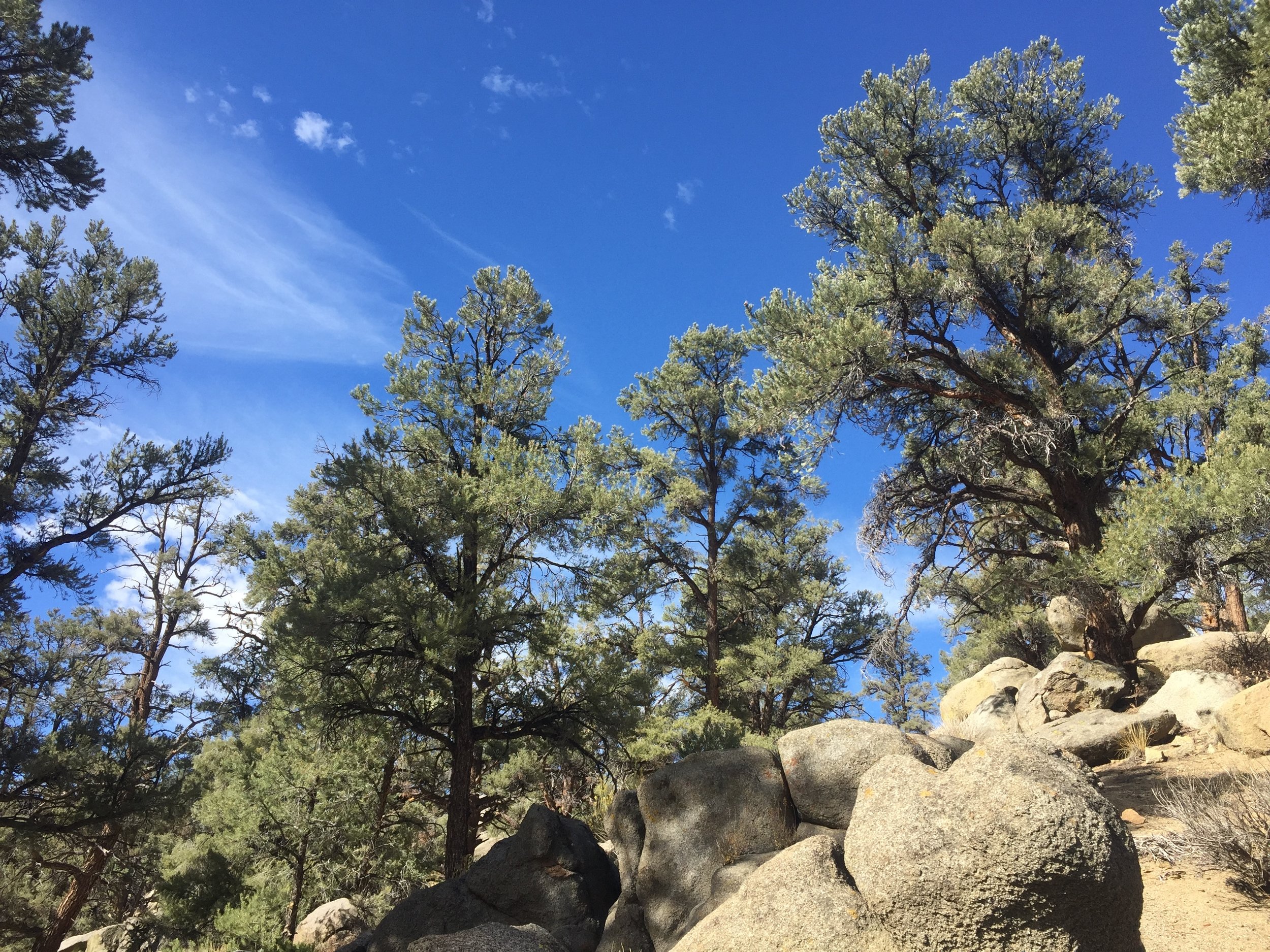
Pinyon Pines in the South Sierra Wilderness
We got up early on Day 97 to find the temperature well below freezing. The down jackets quickly came out and we packed up camp with numb fingers and toes, as has become our custom. We leapfrogged through the morning with Just Mike and got to know him a little better. He is the oldest thru-hiker we've met, and it was fun to hear how his experiences along the trail have differed from ours. We are now in the South Sierra Wilderness and while it no longer feels like the Sierra Nevada we know, the terrain is certainly beautiful. We enjoyed high thin clouds as we walked first over low, rounded hills of sage and Jeffrey Pine then traversed along steeper slopes of bright yellow, orange, and green desert plants contrasting against the bare and charred tree skeletons from a previous fire. By 10am we were ready to transition from multiple warm layers to the lightest clothing we are carrying, with sun hats and sun gloves for protection in this shade-less terrain. It seems that our new normal may be freezing nights and hot days, but fortunately we are well-versed in costume changes. We crossed Crag Creek (bone dry, just a ravine of willows and green grass) and made one final transition as we climbed onto slopes suddenly covered in Pinyon pine. This tree is unique in that it is a single-needled pine, and its grey-green needles and dark bark made a perfect visual contrast against the pale blue sky filled with thin high clouds. The Pinyon pine is found all across the Great Basin, and apparently also in the southernmost foothills of the Sierra. It is the source of edible pine nuts, and walking through these trees sparked memories of hunting for pine nuts with my great-aunt and uncle as a kid. I remember putting the cones into burlap bags, and Macro reminded me of a recent backpacking trip we took in Nevada's Great Basin NP. Reading the fine print at the visitor's center there he learned that there is a personal daily limit on pine nut/pinyon pine cone collection, and it is measured in number of gunny sacks! Apparently that is the container of choice for wild pine nuts. We crossed the South Fork of the Kern River once more, and this time its water looked clear and tumbled over large rounded rocks in a channel surrounded by Pinion pine, greasewood, and other native species. It seemed more fitting of its designation as a "wild and scenic" waterway, and it would have been hard to believe this was the very same river we camped next to last night.

A few miles from Kennedy Meadows we are officially out of the Sierra
The last few miles into Kennedy Meadows, clouds building to the south
The clouds continued to build as we hiked the final miles into the small high-desert resort community of Kennedy Meadows. We could see rain coming from many, but it was the type that never reaches the earth. It was visually dramatic, but did nothing to add to the dry terrain. We left the South Sierra Wilderness, passed through a small and deserted campground, and crossed several ATV/jeep tracks in the sandy sage-covered valley floor. Once we reached the paved road to Kennedy Meadows, we left the PCT and walked the final distance to the General Store together with Just Mike. The 3 of us were the only hikers there, and we all enjoyed ice cream bars and availed ourselves of the shower and laundry facilities. The shower was one of the most basic on the trail, but at $3 including towel, soap, shampoo, AND conditioner and without a timer it felt like heaven. I wasn't joking when I told the friendly and low-key guy behind the counter that it was the best $3 I've spent in a month. The washing machine was slow but worked as well as you might expect on a pile of dirty hiker laundry. There was no dryer but our clothes dried quickly on the line behind the store with the combination of desert air and afternoon wind. We picked up packages from friends, including a generous donation to the hiker box from Sue (some contents have already been claimed & appreciated!). SOBOs Wrong Turn and Eastwood came in, having summited Mt. Whitney the day after us and camped about 5 miles north of us last night. We gave them the lowdown on the place, including no cell service or WiFi, which meant we couldn't do much other than hang out. Fortunately, the store has a large deck and they didn't seem to mind us taking over their outdoor tables.

Happy hikers at KMS: Huckleberry, Macro, Eastwood, Wrong Turn, Just Mike (PC- Cynthia)
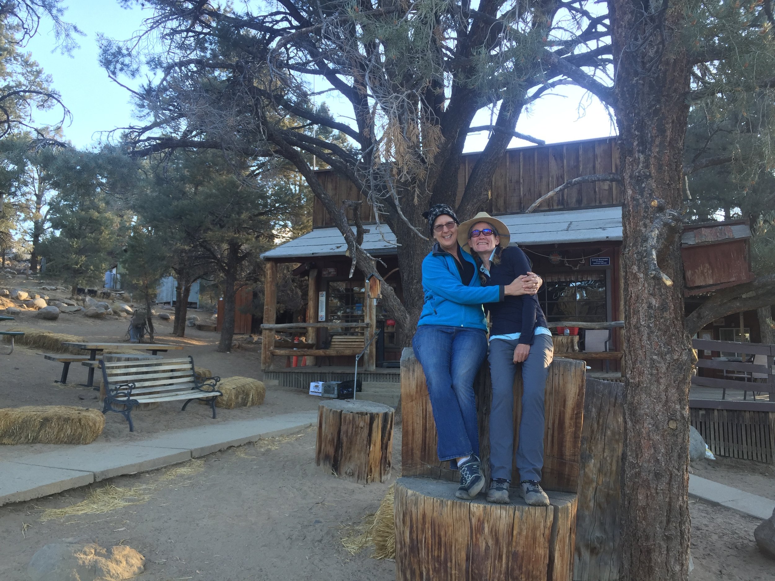
Cynthia & Huckleberry at KMS General Store
Right about then Cynthia drove up and of course arrived with enough food for a small army. All 5 SOBOs sat around a picnic table at KMS enjoying her famous vegetarian lasagne, a fresh salad of greens and Brussels sprouts, crackers, cheese, hummus, cucumbers, and a berry pie. We were not surprised by her generosity and cooking talent, but the other 3 were blown away and couldn't believe their great luck in happening onto this feast. We all discussed our plans for the next stretch of trail and particularly the water situation. Eastwood shared a printout of a recent water report from Bishop since none of us could download it here and hadn't thought to plan ahead. The others retired to their tents behind the store while we continued to catch up with Cynthia over the sorting of our resupply, and Macro adjusting his anticipated replacement backpack. We were surprised to learn from the maps that Agua Dulce, our next planned stop, is nearly 250 miles away. Somehow our itinerary listed it as a much shorter distance and while we had sufficient food between this resupply and the last, we had no desire to carry 9-10 days worth of food in our packs, especially with the weight of the water we'll certainly need in these dry stretches. After looking at our options, we decided to split the carry and make an intermediate stop in the town of Tehachapi about halfway between here and Agua Dulce. It would be cutting it close to try to mail a package from here, but Cynthia kindly offered to hand-deliver the box of second-half food & supplies to Tehachapi before she heads back home tomorrow. I'm sure we could get a thru-hike done without friends and family, but it wouldn't be nearly as enjoyable and would certainly be much more difficult. We have so much appreciation for Cynthia and every single person that has contributed to this amazing journey. It seems incredible, but tomorrow we head south from Kennedy Meadows and officially start the final stretch of our PCT hike as we enter the Southern California section.

Sitting atop Glen Pass, looking at the stormclouds we'll be racing to Kearsarge
Fun Facts- There were many spectacular days through the Sierra Nevada, so it was difficult to pick a favorite. But we both agreed on Day 90, when we went over incredibly beautiful Glen Pass then raced the snowstorm to Kearsarge Pass and by some serendipity found a trail angel right there in the Onion Valley trailhead parking lot who would drive us all the way to Bishop. Our favorite trail dinner was vegetarian paella with fava beans, artichoke hearts, and fennel which we initially cooked for a dinner party with friends, and dehydrated the leftovers and enjoyed on Day 87 in the upper reaches of Palisade Canyon. Our favorite campsite was on Night 86 at Evolution Lake, where we thought we had the entire basin to ourselves and were treated to classic Sierra evening light on the surrounding peaks.
By The Numbers-
We left Hwy 49/Sierra City late in the day on Day 70, and hiked into Kennedy Meadows South early afternoon on Day 97, taking just shy of 4 weeks to complete the Sierra Nevada section of the PCT.
We covered 493 PCT & alt route miles and 35 bonus miles during this stretch passing through 10 different wilderness areas, 3 national parks, and one national monument.
We took our third zero of the trip in Bishop on Day 91, and excluding that day hiked a median daily distance of 20.2 miles.
Our longest-mileage day was on Day 76, when we hiked 28.6 miles from Echo Lake to camp at Lily Pad Lake in the Mokulumne Wilderness, also the only place we slept tentless.
Our shortest hiking day was Day 72, when we neroed into I-80/Truckee with 9.9 miles.
Our highest-elevation campsite was at 12,254' on Night 92 below Forester Pass, while our lowest-elevation campsite was at 5273' on Night 70 along Milton Creek not too far south of Sierra City.
We slept a total of 9 nights between 7000' and 9000' in elevation, 7 nights over 10,000', and the remainder between 9000' and 10,000'.
With the weather getting colder we now pitch the tent with the rainfly every night, as it offers both warmth and some protection from the wind. We slept without it 7 nights in this section, but not once since a Night 84.
- Huckleberry
Into the Home Stretch of our Home Range
Fall in the High Sierra
Red's Meadow to Selden Pass (41.7 PCT & alt route miles)

The 1992 Rainbow Fire was started by a lightening strike and burned a broad swath of hillsides above Red's Meadow

One of many small meadows along Deer Creek
After one more delicious fresh breakfast on Day 84, Hillair, Michael, and Lola walked with us from Red's Meadow campground to the PCT. A signpost listed mileage to various points, and we were notably much closer to Mexico than Canada! Having left Cookie in Mammoth, we set off on the trail by ourselves. We climbed through the burn zone of the 1992 Rainbow Fire with great views of the peaks in every direction. It struck us that we both remembered this stretch as hot, dry, dusty, and interminable from our JMT hike of 9 years ago, but it seemed rather scenic and took us less than an hour to get through today. We quickly settled into a rhythm of hiking and although we enjoyed the energy that Cookie brought to the past 4+ days it was also nice to be on our own. We haven't spent much time in this area of the Sierra Nevada and that JMT trip was the only time either one of us has been on this stretch of trail. It was interesting to compare memories and see how they differed. Beyond the burn zone we meandered along Crater Creek past several small meadows showing signs of fall with golden grasses and wildflowers gone to seed, passed the intensely red-orange Red Cones and a trail junction to Mammoth Pass, then continued to gain elevation through forested slopes. We were surprised not to find anybody else on the trail, especially so close to Mammoth-area trailheads on a beautiful fall day. The sun was shining, the sky was clear, and with a slight breeze the temprature was perfect. There was not one day hiker, casual backpacker, trail runner, JMT hiker, section hiker, or thru-hiker. It seems impossible, but we walked all day on the JMT in late September without coming across a single other person. In peak backpacking season we half-jokingly refer to this trail as the JMT superhighway. The potential for solitude in the late season is but one of many reasons we love fall in the Sierra.
Distinctive crags above Duck Lake are just becoming visible. And that deep blue Sierra sky!
Purple Lake with its deep purple streak of rock

Virginia Lake would make a great camp spot any time of year, but it's especially pretty in he fall
As we neared 10,000' in elevation, the forest opened up and we gained views of the distinctive rock formations above Duck Lake, which were familiar to me though Macro didn't remember them. The trail doesn't go to the lake itself, but we stopped at the outlet and had a leisurely lunch on this glorious day. Thanks to Hillair & Michael, our meal looked nothing like standard thru-hiker fare and instead consisted of fresh multi-grain bread, apples, avocados, carrots, radishes, bell peppers, and a local cheese sent from home by one of my ceramics studio-mates. There were cookies too, but we decided to save them for post-dinner dessert given the size of the bounty. These treats would not fit into our bear canister so they had to be enjoyed on our first day out, and enjoyed they were! After lunch we remained at roughly the same elevation traversing through granite and open lodgepole forest to reach Purple Lake on a high shelf in the next recess over. The steep rocky slopes above this narrow and intensely blue lake have a large vein of dark purple-ish rock and we wondered if this was the origin of its name. Macro recalled that there was a rock glacier beyond Purple Lake, and that we had been underwhelmed by its appearance on our JMT hike. As we climbed though the long narrow saddle to Lake Virginia we walked below steep walls of green rock supporting tall Whitebark pines, and Macro remembered that I had been excited by the hues on our last visit. I didn't share his memory, but I'm a sucker for good rock and green is my favorite color, so it seemed reasonable. I certainly stopped for my fair share of pictures in this colorful saddle today. We also saw the rock glacier, which is interesting in concept but to us looked much like any normal moraine of pale pink granite talus with no visible snow or ice, and made our way to Lake Virginia beyond. This large lake is positioned between two steep and blocky pale granite prominences, is surrounded by meadows that were red and gold on this fall day, and sits at the edge of a wide shelf giving an infinity pool appearance to its far shore. In late afternoon light it was simply stunning, and with nobody else there it would have made a great spot to camp. Since we wanted to get more miles in after our last two short days, we gawked at the views and took plenty of pictures but ultimately hiked on. Macro pointed out that we had camped at this spot on our JMT hike, what was then a 2-day hike from Red's Meadow! We marveled at the difference in these two trips, and once he mentioned it the campsite did start to feel familiar.

Cream and orange- colored Red & White Mountain dominates the ridgeline before we drop down past Tully's Hole to Fish Creek
We crossed the granite knoll on the far side of Lake Virginia and came out onto a high ridge where we had clear views of surroundings peaks, including the rounded but vibrantly colored (and aptly named) Red & White Mountain. With today's rainbow of colors, it seemed as if even the rocks wanted to get in on the festivity of fall in the high country. Far below us, Fish Creek made lazy S-curves through a wide golden meadow edged by thick forest. We started a long series of switchbacks to drop ~1200' to the banks of the creek, then followed it downstream through the adjacent woods as the banks narrowed. The creek became steadily more unruly until it entered a granite-walled canyon where it tumbled across the rock before heading down towards Cascade Valley. The trail here was cut into the granite a ways above the waterline, and we were surrounded by huge Western junipers that seemingly grew from the tiniest cracks in the rock. As the canyon wall became steeper, we crossed Fish Creek on a steel bridge and settled into a campsite in a clearing on the opposite shore with views of the sky and surrounding rocky knobs. It was a treat to arrive before dusk. As we ate dinner, we wondered how long it would be before we saw another person on the trail.
A conversation with Hillair over the past few days got me to thinking about our fellow SOBOs, and how they came to be thru-hikers. Here's the rundown on a completely non-scientific sample of those we've met. Several recently finished degrees (4 doctorate, 2 masters, 2 undergrad) and are hiking the PCT before starting their next degree or career. Some are early-career professionals who were able to take a leave of absence or are likely to find a comparable position when they return (3), or who were looking to make a big change and are using the trail as a catalyst (5). Many (8) are twenty-somethings who have been working a string of non-career jobs and will find the next one post-trail. Most but not all of these are college graduates, and plenty have student debt. Two more do contract work in the healthcare sector and schedule assignments around their hiking plans. Another two are self-employed late-career professionals (one creative, one real estate) with flexibility to be away for several months. One is a late-career professional whose kids just finished college, leaving him & his wife empty nesters. Only one is a retiree, and at 66 is the oldest we've met that is likely to finish in a single season. He is well on-target to complete his hike in about 4.5 months, though he does say he wishes he'd thought to do this 40 years ago. We have not met any other mid-career professionals, but it seems unlikely that we're the only ones. There are a handful of other SOBOs we've crossed paths with whose backgrounds we don't know, and plenty more hiking either in front of us or behind us that we haven't yet met (and may not). One thing is certain, and that is that every single thru-hiker has made a series of choices and sacrifices to be here on the trail, and most have an interesting story behind why they decided to hike the PCT. As to why they chose to hike SOBO, nearly everyone I've asked mentions the draw of being around fewer people (in contrast to the hordes who hike northbound each year). Grateful Red, who has hiked twice as a NOBO and is going SOBO this year, says that SOBOs are simply far cooler people. If you press him on the matter he'll admit that there are plenty of decent NOBOs, but says you have to wait 1000 miles until the posers, partiers, and general losers are weeded out before you get a chance to meet the good ones. In contrast, every SOBO you meet is worth hanging out with... at least that's the word on the street. I don't know if this is true, but we've had a great SOBO experience so far. I wonder when we'll run into our next SOBO, and who it will be.
The Sierra Nevada section of the PCT is considered by many to be the most beautiful of the entire trail, but it is also thought to be the most challenging. The elevation is much higher here than anywhere else along the PCT, and the long roadless stretches limit resupply options. SOBOs have to contend with the potential for early fall storms, and generally have a goal of crossing Forester Pass (the highest point on the entire trail) before the first significant snowfall. Another difficulty is that many common resupply points have closed or are difficult to access after Labor Day, the exact time when most SOBOs are in the Sierra. Tuolumne Meadows store and post office closed for the season the day we were there, and the shuttles to Yosemite Valley had already stopped operating. Red's Meadow Resort is on-trail and open until October, but bus service to nearby Mammoth is done for the season. Vermillion Valley Resort (VVR) on Lake Edison is open through early October, though the ferry isn't running so reaching the resort means hiking about 6 bonus miles each way. Towns along the east side of the range don't close, but the probability of catching a ride from a remote trailhead drops dramatically as the year wears on, and of course there are bonus miles to hike to even reach those trailheads. Talk among SOBOs for weeks has centered around Sierra plans. Where to resupply? How much food to carry? How cold will it get? Side trip to summit Mt. Whitney? What date to reach Kennedy Meadows South (the official end of the Sierra)? There are as many strategies as there are hikers, but it seems that many SOBOs plan to hike through the Sierra as quickly as possible, to minimize the amount of food they have to carry and reduce their chance of being caught in an early season storm. Another common plan is to camp at the lowest elevations possible, since temperatures are likely to be warmer and many hikers have gear and clothing that are marginal at best for high country conditions (we know of one SOBO hiking with a 40-degree sleeping bag!). When we talk to SOBOs about the Sierra, there is so much fear and a resulting desire to rush through this section. In contrast, when we talk to locals the uniform consensus is that fall is the best time to be in the high country, while it is still beautiful but after the crowds have gone home. And then there are the JMT hikers. They typically cover this ~220 mile stretch of trail in 20-21 days, in contrast to the 10-14 days that most PCT thru-hikers plan to take. We haven't run into a single JMT hiker who raised any concern about the lateness of the season, the cold nights, or the potential for storms although most we've passed won't reach Mt. Whitney for a good week or two after we plan to get there. On the other hand, it is common for JMT hikers to carry 10 days of food at a time (most thru-hikers are loathe to carry more than 4-5), they typically have sufficient clothing and gear to be prepared for any normal conditions, and their trip isn't quite so monumental as a thru-hike so an unplanned exit might not feel like such a letdown. We even ran across a foursome of southbound JMT-ers who were carrying camp chairs, and were still sitting in them at their campsite by the shore of an alpine lake after 9:30am when we hiked by! In any case, we feel pulled in two directions. We have made good time on our thru-hike so far, and are well on-track to complete the entire trail in about 4 months. The goal of completion is very important to us. On the other hand, the Sierra Nevada is our home range, we are very comfortable in fall conditions here, and the last thing we want to do is rush through our favorite terrain in what may be its most beautiful season due to fear of potential storms or reluctance to carry a heavy food load. We are already carrying warmer clothing and more robust gear than many thru-hikers, and have friends who have generously offered to assist our resupply plans so we are not at the mercy of transportation schedules and resort closures. Our fairly conservative itinerary requires an average of 17-18 miles daily through the high country, quite low by thru-hiker standards but nearly twice what a JMT-er or casual backpacker might cover. And still. We find ourselves constantly pulled towards the higher mileage that has been our norm over so many weeks. What if the weather changes? What if we never catch up with our friends? Shouldn't we push just a bit further? When will we be over Forester? Will we have time to summit Whitney? When will we reach Kennedy Meadows South? It has been a surprising struggle to stick to our plan, though it does help that we have pre-arranged meeting times with friends at our resupply spots so there is no point in getting there early. We will probably put in more miles in the early days of this first long stretch to buy us flexibility later in case the weather changes, and this means that our time to lollygag coincides with some of our very favorite high country. We are even planning to zero in Independence, just north of Forester Pass. SOBOs who are currently behind us will probably catch up and may get ahead of us as we decrease our daily mileage, take time to hike bonus miles each way over Kearsarge Pass, and spend an entire day off in town with friends. Although it seems impossible that a single day can make that much difference, that little voice in each of our heads wonders if taking a zero day through the Sierra in early October might be a folly we come to regret. Only time will tell. For now, we are focused on enjoying every day in the high Sierra during this spectacular (though sometimes challenging) season. We currently plan to summit Mt. Whitney, but have been to the top twice before and will leave it as a flex option so in case the weather worsens we could use that extra day to hunker down or head south sooner.

One of several lakes on the successive shelves that lead to Silver Pass from the north

Wildflowers are still in bloom even in late September at the higher elevations as we near Silver Pass

Following the trail over the final shoulder before dropping down to Silver Pass
Even at our relatively low elevation (9200') campsite along Fish Creek, the night was cold and the morning of Day 85 was frosty. We have been putting the fly on the tent nearly every night for warmth and/or protection from the wind, and need to keep our hydration reservoirs inside our backpacks with air blown into the tubing to prevent freezing overnight. As we have so many mornings of late, we both started hiking in multiple layers. The trail climbed immediately, but even with this exertion we didn't start shedding clothes until the sunlight hit us several miles into the morning. The northern approach to Silver Pass is classic high Sierra terrain, with heather and low grasses and plenty of blocky white granite along with stands of Whitebark pines that grow shorter, more gnarled, and more sparse as the elevation increases. The trail climbs up through a series of low shelves, each holding a brilliant alpine lake, and all of this is set against a backdrop of the deepest blue Sierra sky. The Silver Divide's string of white granite peaks and ridges practically sparkled in the sun on this clear fall day. Near Squaw Lake, the lowest and smallest of the lakes, we came across our first person - a northbound JMT hiker who had camped just on the far side of the pass at Silver Pass Lake last night. We continued our climb, ultimately crossing a shoulder above Warrior Lake, then dropping down about 200' to the actual pass.

Silver Pass Lake and the broad Meadow of Silver Creek, with just a few innocent puffy clouds overhead

Fall colors on the hillside, and more clouds as we follow the path of Silver Creek towards the edge of the canyon

As we descend through glorious fall colors to the North Fork of Mono Creek, the sky has turned positively ominous
From the pass we had amazing views down the broad valley carrying Silver Creek, brilliant in its fall colors of golden yellows and deep orange reds. As we walked through the nearly-flat upper portion of the valley we noticed puffy clouds starting to form above the ridge to the west, and saw a low layer of grayish clouds off in the distance to the southeast. The temperature remained pleasant, cool but perfect for hiking with only a light breeze. Before long, we started a gradual descent across granite and open forest along Silver Creek. This transitioned into a steep switchbacking drop of 700' down the canyon wall to the North Fork of Mono Creek. As we lost elevation we walked through broad swaths of aspen whose leaves had turned yellow, orange, and even a deep shade of red. Their leaves fluttered in the wind, which had picked up in conjunction with building clouds to the south and a sky that looked positively ominous in the direction we were ultimately headed. We wondered if we might see some rain, but the sky directly above us remained clear as we continued our descent along with the creek towards Quail Meadows and the trail junction for Edison Lake/VVR. The North Fork flows in wide sheets across broad granite aprons, and at this lower elevation we found ourselves once more in an open forest of giant Jeffrey pines and ancient Western juniper. Just above the meadow we came across Deb and Larry, an older couple from the Seattle area roughly halfway through their 30-day John Muir Trail hike starting from Cottonwood Pass. They had spent the night at VVR, a common resupply point for JMT/PCT hikers, and confirmed that Pitbull had also been there and left very early this morning. I inquired about their weather and they just shook their heads. Apparently they had several days of bitter cold (like us), and hiked through snowstorms on both Mt. Whitney and Forester Pass (the highest points on the trail). On the subject of weather, the sky above us had turned completely grey and remained especially ominous to the south. We had all heard a forecast calling for clear days through next weekend, which wasn't looking very accurate at this particular time. I noted that the Sierra often has afternoon rain that clears up within a few hours, and we all hoped that these clouds didn't have any more than that in store for us. With that, we wished them a good hike and continued down the trail. With Pitbull less than half a day ahead of us, we wondered if we might see him after all over the next few days. It seemed unlikely, but with trail dynamics you never know.

Golden hour light on the Mono Divide reflected in a pool of Bear Creek
I'd never really thought about the name VVR, as we didn't resupply there on our JMT hike and weren't stopping in this year either. We both remembered a very steep, long, and rather unexciting climb after the trail junction for the resort, and on our map noted that the north wall of the deep valley was named the Vermillion Cliffs. Looking up, we saw craggy cliffs of pink granite reaching towards the grey sky and realized that these must be the namesake for both the valley and the resort. We crossed the North Fork once more, this time on a steel bridge, and passed a young pair of southbound JMT hikers who had just bundled up in rain gear. We asked where they were headed for tonight and were surprised that they answered "over the pass, and then somewhere." Our plan was to camp at Marie Lake on the near side of Selden Pass, and given the long climb ahead of us it seemed unlikely we'd arrive before dusk. While many thru-hikers walk by headlamp through darkness, it would be very unusual for a JMT hiker to do so. In any case, we quickly pulled away from them on the lower switchbacks and never saw them again. Macro pointed out that they may have meant somewhere beyond the top of the climb, rather than the actual pass. Neither of us remembered the lower part of the climb being filled with aspens, and on this fall day their leaves were brilliant yellow and fluttered madly in the wind that accompanied the rapidly changing sky overhead. Beyond the aspens, we entered a rather non-descript forest but were happy for the cool temperatures and lack of significant precipitation. We occasionally felt a few errant raindrops, there was obvious rain in the distance, and in many places the trail was wet from recent rain, but we remained generally dry and as we crested Bear Ridge in the late afternoon the sky was already clearing. The trail climbs along Bear Creek for a few miles, and we enjoyed golden low-angle sunlight on the Mono Divide as we walked. While we haven't been on this stretch of trail since our JMT hike, we have explored many trail-less basins in the Mono Divide just east of the JMT/PCT on multiple backpacking trips, so most of the peaks are familiar. Bear Creek itself was a pleasant companion, its clear waters alternately running over streambeds of rounded stones, flowing across wide sheets of granite, or burbling through tangles of downed trees atop blocky rock. We found it interesting that this wide but currently shallow and tame creek is considered the most dangerous ford for NOBO PCT hikers. It is the single most common reason that many NOBOs flip north of the Sierra until the snowmelt is complete, and has been the source of many near-miss incidents. Of course, swollen with snowmelt and surrounded by snow on either bank it would be a different creature altogether. This evening it was a straightforward dry shoes rock-hop to the far shore, to continue our climb to Rosemarie Meadow where the sun dipped below the ridgeline.

A frosty morning along the shore of Marie Lake

Morning light across Marie Lake looking towards the east into the Mono Divide

Morning light across Marie Lake from our campsite, looking north towards the Silver Divide
We hadn't wanted to do any headlamp hiking in the high Sierra, but knew that Marie Lake (10,500') would make a stunning campsite and decided to press on to our desired destination even if it meant arriving after dark. Strangely, we didn't specifically remember the spot from our JMT hike but had visited this sweet lake a few seasons ago during a trail work PCTA service trip and were looking forward to pitching our tent there. It sits on a high shelf just below Selden Pass and has stellar views all the way north to the Silver Divide. There was alpenglow on nearby Gemini and the Seven Gables and pink sky above as we started our final climb from the meadow, and as expected we had to pull out both headlamps and warm layers for the final mile. Having not seen anyone on the trail all afternoon, we were surprised to come across several people setting up camp at the north end of the lake. We continued on and found a sweet private site on a wide peninsula further south, protected by a stand of Whitebark pines and several large granite boulders. As I was rinsing my dusty legs in the lake, a 10" trout with bright red markings swam into the shallows nearby. It didn't shy away from my splashing or the light of my headlamp, so I sat and watched it for a bit before returning to our camp to make dinner. After eating we stargazed briefly but soon retired to the tent and our warm sleeping bags. While the late September days can be pleasant in the high country and we have enjoyed the Indian Summer-like conditions of the past few days, the nights are uniformly cold and getting colder. Day 86 was another frosty morning, though the early morning light was magical and Marie lake provided perfect reflections of the surrounding peaks on its wide flat surface. We set out early for the pass in multiple layers as usual, and enjoyed the relatively easy 400' climb over white granite through more windswept Whitebark pines. As we remembered from our last visit, the views in every direction were stellar. This past section of trail has not been as familiar to us as the areas around Lake Tahoe and through Yosemite. However, as we continue south we will enter a stretch of the Sierra Nevada that we have visited countless times, and it feels like we are heading home.
- Huckleberry


