Hwy 2 / Wrightwood to Grass Valley Creek (51.3 PCT Miles)

A rainy mini-section hike of the PCT on our otherwise zero day
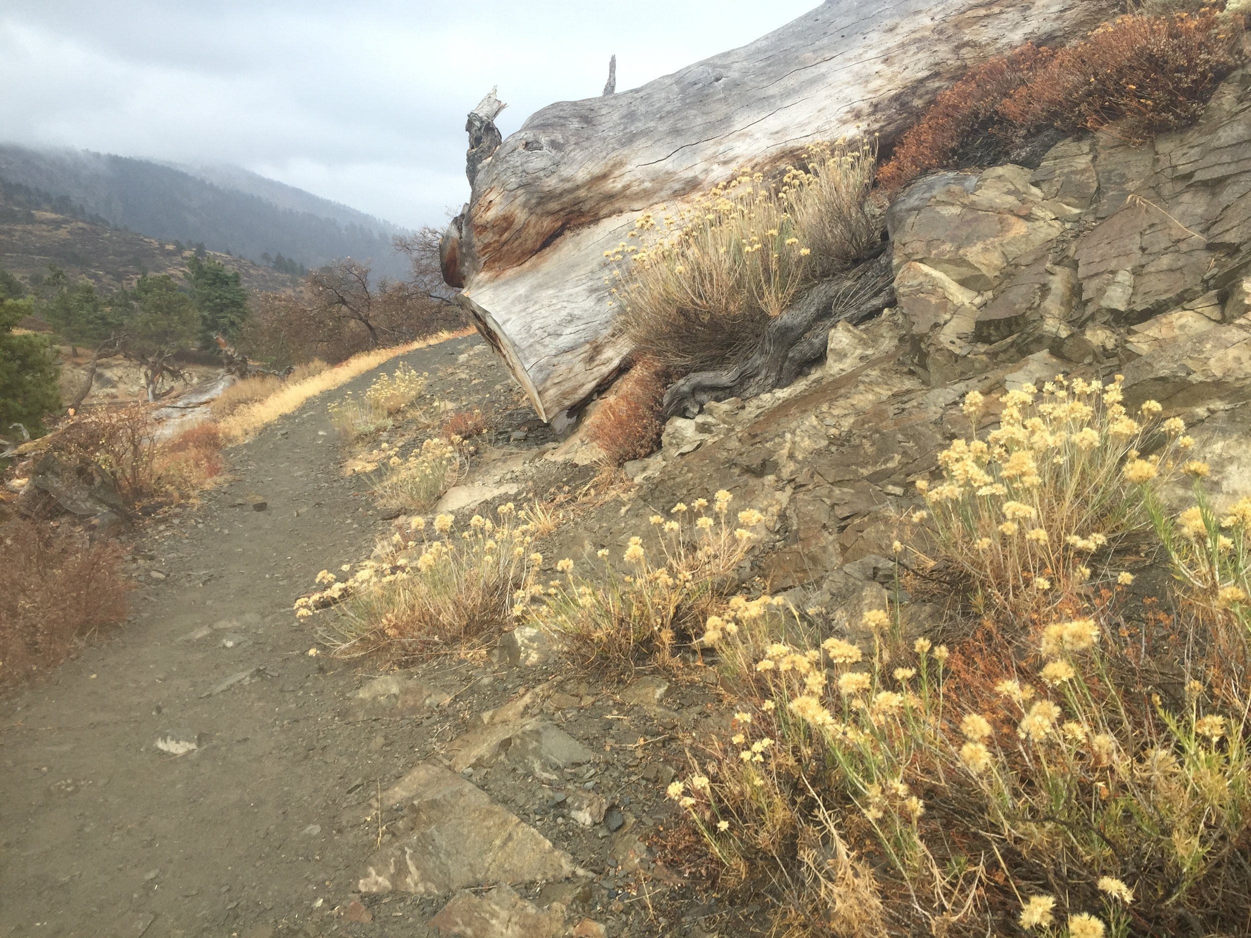
Grey skies contrast well with the late October blooms near Wrightwood
It rained steadily from late afternoon into the evening on our zero day in Wrightwood, and we were glad to be indoors. We heard from Happy Feet and the guys that they had stayed overnight at the Glenwood scout camp, finding it too hard to pass up the offer of food and beer. As a result, they had more miles left to hike, found themselves drenched by a "Noah's ark-style deluge", and ended up bailing after the Baden-Powell switchbacks when a day-hiker offered them a ride from Vincent Gap on Hwy 2. They still got into Wrightwood late, and we had dinner plans with Anna & Clark, so we didn't end up crossing paths in town. We wondered how Cookie, Pippi, and Gramps were faring in the storm as they had headed out to the trail in the late morning. It rained all night with several rounds of thunder and lightning. On the morning of Day 111 there was only an intermittent light drizzle. Over breakfast Anna suggested that we stay another night to let the storm pass completely. Her offer was tempting, but we are so close to the border now and there are still mountains to get through, so we packed our backpacks to head out. There would not be any water sources between Wrightwood and I-15 at Cajon Pass, 27 miles away. We had planned to carry sufficient water to dry camp somewhere short of the pass and stop in for water the next morning, but Anna & Clark wouldn't hear of it. They wanted to bring us water somewhere on the trail so we wouldn't have to carry so much, and consulting the maps we all decided on Swarthout Canyon. The trail crosses a well-graded dirt road less than a mile from a paved road, and Clark was familiar with the spot. It would be 22 miles of hiking for us, and we planned to camp less than a mile beyond our rendezvous point. We asked them to bring 2 gallons - enough to cook dinner, have water for breakfast, and most likely have enough left over to fill our reservoirs so we wouldn't have to take the side trip to the gas station at Cajon Pass the next morning at all.

Setting out into a foggy wet morning at Inspiration Point on Hwy 2 (PC - Anna)

Bits of hail in a hollowed log at the top of Wrightwood ridge

A huge puddle near the trail is a rare sight in SoCal

Views north from Blue Ridge

Dry landscape along the ridge line traverse towards Gobblers Knob
Our hike started at Inspiration Point on Hwy 2 outside of Wrightwood, where we had completed our mini section with Anna the afternoon before. When we arrived at the trail just before 8am there was thick fog, gusty wind, and a light rain. Anna said she felt terrible "putting us out" in weather like this, but we donned appropriate layers and raingear and assured her that we had hiked in much worse. After hugs and a few pictures, we waved goodbye. Heading up the trail we were reminded of WA, where we had thick mist or fog nearly every day for the first few weeks of our journey. The dry yellow grasses were the main visual reminder that we are now in the forest of Southern CA, where there hasn't been rain for over 8 months. We passed by the chairlifts of the Wrightwood ski slopes, empty chairs swinging in the fog, also reminiscent of WA where we hiked through several ski areas. At the top of the ridge, the wind was strong enough that we had to use our hiking poles to brace ourselves. Here at the higher elevations we also saw small piles of hail accumulated from last night's downpour. We had periods of rain, one just heavy and persistent enough that our socks started to get wet through our shoes, but each time we resigned ourselves to a soggy day of hiking, the rain would stop and the wind dried our outer layers. There were huge puddles of water along the trail and on several dirt roads we crossed, quite a novelty after several hundred miles of desert hiking and through this 'dry' section. Despite the accompanying wind and chill, the fog was magical and in my mind highly preferable to the heat of the past few days. Mt. Baldy's summit remained obscured by low clouds, but by late morning there were patches of blue sky and we had removed raingear and most of our layers as the day warmed up. We enjoyed fast-moving clouds and filtered sunlight with long views off of Blue Ridge and along the meandering high ridgeline traverse as we made our way towards Gobbler's Knob.

The hillside is strangely red-orange, a warning of the burn zone just around the corner

Foggy skeleton forest

a few yucca plants are partially spared near a forest road in the Blue Cut Fire burn zone

New grass in the Blue Cut Fire after the first rain
We came around a corner to find a steep hillside tinted an unusual shade of red. At first we thought it was a trick of the sunlight through the clouds, but soon realized that it was fire retardant on the trees and surrounding ground. Around the next corner we entered the actual burn zone of this summer's Blue Cut Fire, which started near Cajon Pass and caused Clark & Anna to evacuate for an entire week. The fog had settled back into the burned slopes, and blanketed us as we walked through an eerie skeleton forest thoroughly blackened from the recent blaze with no signs of life. The weekend's rains were the first since the July fire. We were grateful for the lack of dusty soot, but all of the water had caused significant erosion and debris flow along large stretches of trail. We found ourselves navigating small ravines, piles of rock and dirt, and newly downed tree limbs. There was a strong smell of wet smoke, akin to walking through a giant fireplace whose blaze had just been doused with water. The trail passed through nearly 10 miles of the burned area. At first we were fascinated by the stark silhouettes against the fog, and marveled at the variation in degree of destruction on different slopes and with different vegetation types. After a while we tired of the smell, my ankles complained about all of the loose & irregular side hill terrain, and we just yearned for some intact ecosystem with living plants. When the fog lifted we gained views to Lone Pine Canyon below, red-orange Ralston Peak across the canyon, and I-15 beyond. The sky was light behind us but remained dark to the east and as the clouds advanced our way it seemed likely we would have more rain. It became clear that the entire stretch of Upper Lytle Creek Ridge traversed by the PCT had been involved in the fire, and the burn area extended to the freeway in the distance with only a few long narrow fingers of intact vegetation reaching up the slopesthat had been spared. We could see where Swarthout Canyon Road came off of the paved road far below but with the winding of the trail around every contour of the steep hillsides, we were still several trail miles from our meeting point. As we started a gradual descent from the ridge top we found areas with fresh new growth, both green grass along the trail and new shoots from the base of charred brush. A few lower ravines were filled with young ferns, creating a swath of verdant green against the otherwise blackened landscape. It seemed that this must have developed in just the past 48 hours, following the rain, evidence of nature's strong urge to prevail over human-caused destruction (the Blue Cut Fire was human-caused, and thought to be intentionally set). It started to rain again, sprinkles at first then growing heavier. With the degree of erosion and debris already present after just a single rainstorm, we wondered if this stretch of PCT will even remain open after an entire season of winter precipitation. Unless there is significant regrowth and some major trail tread repair soon, on these steep hillsides it seems at risk to become yet another Southern CA fire closure that lasts for years, awaiting resources to restore the trail.

Nature is resilient, as evidenced by this fresh growth in the Blue Cut Fire

Evening light over Lone Pine Canyon and pink Ralston Peak looking north, green finger of intact vegetation on the hillside
We could see Clark & Anna arrive about 30 minutes early as we continued our descent. From our vantage point we also scoped out areas on the far side of the road that looked flat enough for camping, and were happy to see a finger of spared vegetation that looked promising. We arrived to the road right at 5:30 in a moderate rain. They opened the back end of the car, where there were 2 gallons of water as promised. However, they insisted that we put our backpacks into the car instead of taking the water and implored us to come back home with them. Anna had already been on the trail south of the road and reported that there were flat spots for tenting and even a water cache, but the entire area was sooty and muddy and smelled like smoke, no place for camping in the rain in her opinion. In general I'd have to agree with her, but we do have plans to get to our next resupply and this requires higher mileage over the next few days. We thanked them for their concern but said we really needed to be on-trail by 6:30am tomorrow and would be fine here overnight. Clark said it was an easy and short drive from home and he'd be happy to bring us at whatever time we wanted. And with that, we were out of excuses so we hopped in the car for a bonus 3rd night in their comfortable home. We headed straight to the Grizzly Cafe in Wrightwood for a delicious dinner, then home for showers (our 2nd of the day!), hot tea, and relaxing before bed. It struck us both that what took us nearly 10 hours to hike, we covered driving in just over 10 minutes. It didn't rain much in town that night, but it was still great fun to see them again and their guest room is far superior to a wet tent in the middle of a burn zone. This bonus night in town marked the only time on trail we have slept in the same place for more than 2 nights. As promised, we were back at Swarthout Canyon before 6:30am. They both accompanied us down the trail to the cache to add the 2 gallons that we no longer needed so that other hikers might us the water.

Morning light on the Ralston Peak traverse, looking south towards the San Gabriel Mountains

Pink-orange rocks stand out against the blackened earth and remind me of pit-fired ceramics

Sandstone formations along the RR tracks near I-15

This is how we get under the RR tracks
It was getting light just as we started hiking on Day 112. We quickly passed the narrow strip of intact plants near the road and were back in the burn zone to traverse through the pink sand of Ralston Peak. The pre-fire vegetation must have been less dense here as the ground was not charred between well-spaces black skeletons of yucca and low brush. Today's sky was perfectly clear, in contrast to yesterday evening, and we enjoyed the glow of the morning sun on the pale slopes. The trail follows a narrow ridge south of Ralston Peak, then meanders towards a series of dramatic sandstone formations as it nears both the train tracks and the busy I-15 freeway in the Cajon Pass corridor. We crossed one set of tracks at grade, and another through a large culvert. We walked under the freeway in a large concrete tunnel that also serves as a drainage channel, our shoes becoming caked with thick mud from the recent storm. We passed the famous sign with mileage to the nearby McDonalds (closed for renovations after the fire), and were happy to skip the bonus miles and instead continue through narrow Crowder Canyon into the hills on the far side of the freeway.

View back across I-15 towards Mt Baldy and the San Gabriels

So much destruction from the Blue Cut Fire, both of nature and of man made structures like this

Finally, some intact desert after nearly 20 miles of burn
We were a little surprised to find that the fire was nearly as extensive on this side, and in the blazing sun we walked another 10 miles or so through the burn zone as we climbed further into the hills. Finally we reached an intact desert landscape near Little Horsethief Canyon, and stopped for lunch in the shade of tall brush. We climbed over Cleghorn Ridge, thickly forested with dry brush interspersed with maples and oaks, then dropped down the other side towards Silverwood Lake. The day was one of the warmest we've had in Southern CA, and without much in the way of breeze it was sweltering on the climbs. I'll admit that I yearned for the fog and wind and even the rain of yesterday.

Partially burned cactus and one of the many trains that go through Cajon Pass

Looking back at our route under the I-15 freeway
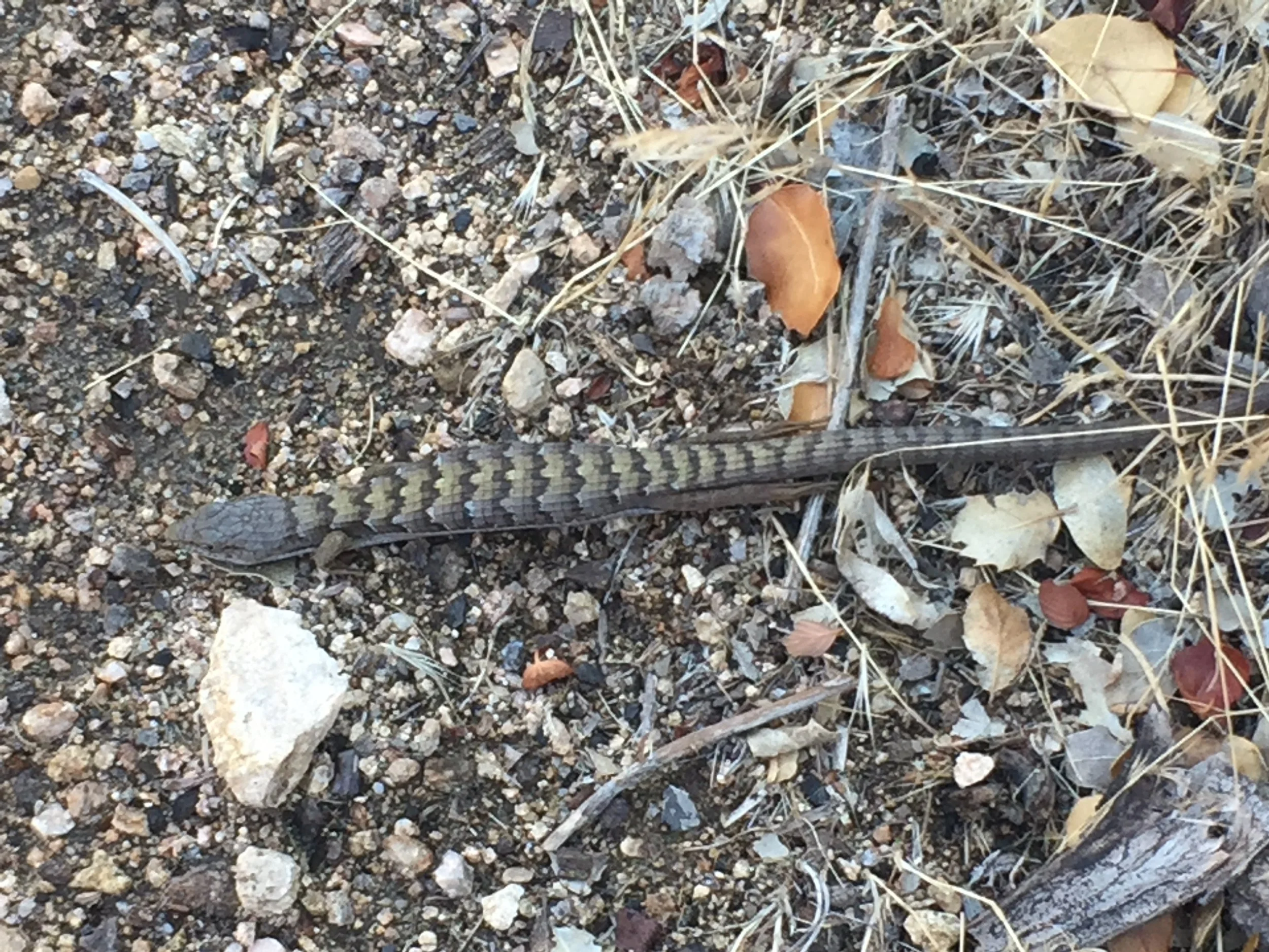
Don't take this guy home

Macro heading through endless burned foothills, always near high-voltage power lines
Over this 50-mile stretch of PCT we didn't see a single other trail user. We know that Happy Feet and the guys left Wrightwood in the late afternoon of our Day 111, and remain about 15 miles behind us. Cookie, Pippi, and Gramps left about a half-day ahead of us, and we haven't heard of their progress. Although we have been completely alone on the trail, we are surrounded by more signs of civilization than we have seen along most of the PCT. Leaving Hwy 2 near Wrightwood, we passed two ski areas and two drive-in campgrounds, all deserted. We crossed numerous roads, both dirt and paved, and for much of this stretch we have seen and/or heard the traffic on I-15, by far the busiest highway we have encountered on-trail. The railroad tracks adjacent to the freeway are busy, with trains every hour, and we have been able to see and hear them for miles in either direction. Even in the long stretches of trail that wind through empty hills there are high-voltage power lines, and we have had nearly constant cell service. In the several miles of trail above the shore of dammed Silverwood Lake, we encountered a shocking amount of trash in the adjacent brush. Signs near road crossings implore day users not to abandon household pets, or to take wildlife home with them. We even see graffiti spray-painted on rocks. After Silverwood Lake we crossed the outlet of a dam, walked past a power plant, and found ourselves once again on the shoulder of a road, though thankfully only for a short stretch. When we settled into our campsite high on the hill on Day 112, we could see the headlights of cars on the road through Grass Valley below, the winding of traffic on I-15 in the distance, and the glow of city lights far out in the valley towards the horizon. It is a strange contrast to hike in solitude through these SoCal hills while surrounded by evidence of how many people are going about their decidedly different daily lives very near by.

Distant mountains from the mixed forest of Little Horsethief Canyon

Silverwood Lake, surrounded by intact vegetation but unfortunately also plenty of litter

This retaining wall survived, but is no match for the erosion of the past weekend's rains
We left the foothills of the San Gabriel mountains on the far side of I-15 and could see our next destination, the San Bernadino mountains, rising in the distance. It was dusk by the time we finally crossed the paved road leading to the day-use area of Silverwood Lake, and as we put on our headlamps we were surprised to see signs warning us of recent fire activity with debris flow and erosion possible. Macro recalled that Anna told us of another recent fire nearby and in the dark we entered the area affected by the Pilot Fire, contained just one day before the Blue Cut Fire broke out this summer. As with the larger Blue Cut area the rain had soaked the soil so we had no dusty soot but a strong odor of wet smoke with significant new erosion and debris to navigate. After just a few miles of doing this by headlamp, we found a campsite near the dry Grass Valley Creek that wasn't completely blackened and set up our tent for the night. Sleeping with the smell of a fireplace all around us, we were especially grateful that we had lucked out of not sleeping in a burn zone the night before.

PCT sticker marking this culvert as part of the trail

A burnt but still readable trail marker fared better than many others in the burn zone
Spending time with several other thru-hikers recently, we have noticed a subtle shift. Common conversation openers used to be about start date, hikers known in common, or resupply plans. Now, the most common question is "when do you plan to finish?" Neemor & Grateful Red have already reached the border, and knowing that people we've spent time with (albeit briefly) are done hiking really brings home the fact that we are very near ourselves. We find it interesting that some hikers speed up once the border is near, wanting nothing more than to be done. Others slow down, taking more time in towns and hiking fewer daily miles than they have the entire trail, not wanting the journey to end. We plan to keep our pace unchanged, intending to enjoy these last few weeks on-trail but also wanting very much to return to our regular lives once this journey is complete. We have also been thinking about how few SOBOs are still hiking, and how many either significantly altered their journey or abandoned it altogether for various reasons. Counting all of the people we have personally met in our time on-trail, we came up with 48 who started either as SOBO thru-hikers or LASHers of >1000 miles. Including us that makes 50. Only 25 have finished or seem likely to finish the distance they set out to do this season, while the rest are either off-trail or are still hiking but have skipped large sections without an opportunity to make up those miles this year. This isn't a scientific sample of course, but 50% odds of finishing aren't that great, and it makes us realize how lucky we are that both of us are still on-trail, having made a continuous thru-hike from Canada, and are on track to complete this journey together just about 2 weeks from now.
After that, I'm planning to sit down for a good long while.
- Huckleberry