Mill Creek Fire Station to Hwy 2 / Wrightwood (49.3 PCT & Endangered Species detour alt miles)

Huckleberry on the traversing climb into the San Gabriel Mountains.

Poodle Dog Bush, cute name for a plant whose touch is worse than poison oak.
We left Agua Dulce the morning of Day 108 with a ride from trail angel Mary to get around the Sand Fire closure. We didn't arrive to the new trailhead until after 11am, and with this late start and hiking up the exposed slope late in the morning we were quickly reminded that this is SoCal and it is hot. The trail climbed quickly as it traversed around slopes recovering from previous fires and we were thankful for any and all shade, even if provided by burnt snags or sharp embankments in the hill. Despite the day's the heat and the previous burn, we were happy to be heading back into the mountains and were looking forward to discovering whatever the San Gabriels had in store for us. Looking out over the steep slopes, I saw a small fox dash below us to find some shade herself. The only other creatures we saw were the ravens flying overhead. Throughout the burn area we saw Poodle Dog Bush, the scourge of SoCal burn zones, growing all along the trail. Fortunately for us, most of the plants had died back and the new growth was still in small shoots, so it was easy to avoid. It also has a distinct and pungent smell, warning us of its presence nearby.

Wildflowers still in bloom.
Soon we were at the end of the burn zone and also in the higher elevations. We appreciated the cooler air and more plentiful shade, and walking through familiar trees like Jeffrey pines and Live oaks. Along the way, we met a couple from Sacramento who were section hiking. We struck up a conversation about her hat from "Way Too Cool" a popular 50k trail race in our home region, and learned that they are chipping away towards a goal of completing all of the CA PCT by day hiking several short sections while vacationing here in SoCal. Up until this point, Huckleberry and I had only met section hikers who were backpacking on the PCT and hadn't thought that there might also be day-section-hikers. In areas with numerous trail heads and scarce water we could see how it would be an appealing option. We saw them again the next day as they were headed down from Mt. Baden-Powell as we were heading up. They were surprised to see us a good 20 miles from where we'd first met, but our mileage is quite ordinary by thru-hiker standards.

Still finding some fall foliage down here in SoCal.

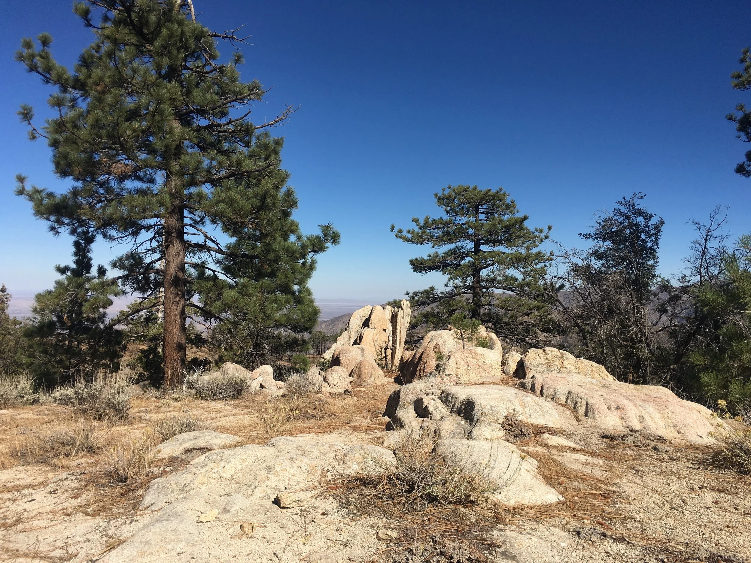
Sunset over the Angeles Crest.
Towards dusk, we reached Camp Glenwood, a Boy Scout campground. Three guys were camping there for the weekend, and we asked them about the site. They were all 2nd-generation officers for the organization founded in the 1950s to manage the site which now serves both Boy and Girl Scouts and any other youth groups who want to use the camp. We learned that the Angeles Crest Highway (Hwy 2) was built by the CCC in the 1930s. When the original club members acquired the land, they moved the old school house from an old CCC encampment nearby to use as the main building, and it has since been maintained in its historic state. The site has a spring-fed water tank that is maintained for the camp's use, and is also made available to hikers on the PCT. The guys were intrigued to chat with us because we were the first SOBOs that they had met, in contrast to the hordes of NOBOs they see passing through each May. After our impromptu history lesson, we had to reluctantly decline the offer of a beer and a place to camp for the night as we had 7 more miles to hike (now in the dark) to stay on schedule for our Wrightwood arrival where we would stay with friends and have our final zero of the hike. As has become part of the new normal, we hiked into the night and enjoyed the cooler weather until we arrived at Cooper Canyon Trail Camp. We were happily surprised that on a Friday night in October just 3 miles from Hwy 2 near Los Angeles, we had the large campsite to ourselves.

If you have to walk a road, at least the Angeles Crest Hwy has views.
Jeffery pines, old friends that we are happy to see.
Day 109 started with a hike up to a car campground to follow one option for detouring around a closed section of the PCT. This particular closure is to help protect the Mountain Yellow-Legged Frog that was listed as endangered in 2012, and means that 4 miles of trail is closed. The "old" official detour is 4.9 miles, of which about half is on the shoulder of the Angeles Crest Highway. The newer official detour is all trail but is over 20 miles long, replacing ~7 miles of the PCT. Like most hikers we chose to take the shorter route that misses less of the actual trail, despite a stretch of road walking. On this Saturday morning we found the car campground stuffed to the gills, yet the road was quiet. During our 2.7 miles of walking along the highway, we saw 18 vehicles and 1 cyclist and all but a single car car were on the opposite side of the highway. In retrospect, we were lucky that we had a later start the day before because our initial plan had been to stay in this packed campground (it had water faucets) vs the one we did stay at (dry), and it would have also put us on the road walk before dawn. As the day continued we climbed towards the upper reaches of the Angeles Crest and found more of our old friends as Jeffrey, Sugar and even Lodgepole pines were growing on the high elevation slopes. We also discovered a new pine that is only found in Southern CA and Baja California, the Coulter Pine. It is a long-needled pine that produces the world's heaviest pine cone, sometimes up to 8lbs! We were confused at first because the cones we saw on the ground looked similar to those of Gray Pines but there weren't any of the right trees around. We finally saw some cones still on their trees, and realized it was a different species altogether. The bracts of the Coulter pine cones have a distinctive curled point, like an elf shoe or a Thai slipper. We learned about the species at the Grassy Hollow visitor's center in Wrightwood the next day. The Lodgepoles along this stretch have developed the fantastically contorted shapes that we see so often in the High Sierra, and this was a pleasantly familiar sight after seeing so many unfamiliar plants in this region.

Yucca or another related succulent create these wonderful geometric patterns.

The view of Mt. Baldy and the San Antonio Massif.
Passing Islip Saddle, we were struck by a contrast of sorts about these mountains. They are a range of extremes. When California was part of New Spain/Mexican Province/early statehood, these mountains were home to many of the bandidos who preyed on the locals. The most noteworthy was Tiburcio Vasquez who used these mountains and the Vasquez Rocks (named after him) near Agua Dulce as a refuge from law enforcement. Now it has a more pristine reputation as a mecca of Boy Scouting with Lord Robert Baden-Powell (the founder of the scouts) and his namesake mountain here. At the saddle trailhead we saw several groups of scouts getting ready to head out for backpacking trips, and a mile up the trail we passed a group of scouts headed home after an overnight trip. We stopped for lunch break at Little Jimmy Campground and met another group of scouts out for a beginner trip, 2 miles each way and one night in camp. We chatted with one of the parents and she told us that this would be the first backpacking trip for most of the 10-13 year old scouts. We were impressed that they all had bear canisters and that the adults were standing back and letting the kids organize their lunch. It was a little entertaining to watch the process, akin to herding cats, and they were finally getting ready to start serving lunch as we were wrapping up to hit the trail again.

Huckleberry and I on the summit of Mt. Baden-Powell.

The Wally Waldron Tree, a Limber pine, estimated to be at least 1500 years old.
We continued up the ridgeline enjoying the balance of sun and wind that helped to keep the temperature just right. We admired all of the windswept trees along the crest and just as we reached the spur trail to the summit of Baden-Powell, we saw a sign for the Wally Waldron tree (& named for another historical figure in scouting), a massive contorted Limber pine that is estimated to be over 1500 years old! From there we took the short spur trail to the summit and enjoyed commanding views of Mt. Baldy and the rest of the crest before heading down. Unlike the 8+ mile ridgeline walk from Islip Pass, we dropped precipitously down endless switchbacks to Vincent Gap in under 3 miles. This marked our penultimate crossing of the Angeles Crest Highway for the day and we headed over one last 1000' climb to meet our Wrightwood hosts, Anna and Clark, at the Grassy Hollow Visitor Center just as it got dark. It had been breezy enough on our Baden-Powell descent that we stopped to put on a warm layer then, and once the sun went down it got quite chilly so we're glad to see them waiting in the parking lot as we descended the small hill towards the center.

Huckleberry, Clark, and me in front of the Grassy Hollow Visitor's Center.

Anna and I on our PCT hike to Inspiration Point.

5 thru-hikers and a host family of 4 makes for a big table at Rick's Roadhouse.
It turns out that Cookie had arrived in Wrightwood only a day before us and stayed for a zero, so we made plans to have breakfast before she got back on-trail. We knew that Wrightwood is a small community, however, what would be the odds that we'd be staying 2 blocks away from one another? Her host family picked us up, and we found out that two other thru-hikers, Pippi Longstocking and Gramps were also staying with them. We all had a wonderful breakfast feast at a local instutition, Rick's Roadside Cafe. It was good to finally meet these fellow hikers whose names we'd seen in trail registers for months. After our delightful meal, we headed back to Clark & Anna's comfortable home to enjoy our zero day. What this really means is laundry, showers, organizing resupply, catching up on our blog, email, bills, and otherwise getting in touch with the real world before heading back to the trail. We did make a day trip back to the visitor's center in daylight, to see the displays (where we learned about the Coulter pine) and to meet Anna & Clark's fellow center volunteers. It had been cloudy all day and a light rain was already falling, but Anna still joined the two of us for a very short southbound section-hike of the PCT from Grassy Hollow to the next Hwy 2 crossing at Inspiration Point. We decided to walk this little bit today so we can start hiking right at the highway tomorrow. As luck would have it, the wind became stronger and the sky finally opened up with some actual rain just as soon as we headed out, so we were all pretty wet and a little chilly when we reached Clark at the car just a mile later. We were even luckier to be returning to their place for hot tea and brownies, instead of hiking further, because the rain came down in earnest for the rest of the day and well into the evening. It looks like the storm may blow through tonight, and leave us with perfect conditions as we head out towards Cajon Pass tomorrow. We seem to have very good timing when it comes to stormy weather and town days.
-Macro