
“Lamoille Canyon is the Yosemite Valley of Nevada. Except with 3 billion fewer visitors.”
Location
Ruby Mountains, Nevada, USA
Mileage
~40 miles on-trail, ~20 miles off-trail
Total Climb: 19,703' total descent: 18,010'
Days: 6 Season: early july
Year: 2015
Starting & ending trailheads
Green Mountain / Lamoille Canyon
Basecamp Town: Elko, NV

Map: USFS Ruby Mountains & East Humboldt Wildernesses (Humboldt NF), 1994

GuideBook: None

Best Website: backpackingintherubymountains.com
Pre-Trip:
The Rubies had been just at the edge of our mountain radar for years. Cheri's parents were raised in NV, and we're both big fans of the Great Basin and its wide open spaces. Nobody we know personally had been (in recent decades), and it always seemed like such a long drive for such a small range. With the ongoing drought in CA and resulting dry conditions in the Sierras, we decided that 2015 would be our year for road-trip backpacking and a chance to visit a few new ranges. Then @rachidphoto (a photographer whose work we've loved in Backpacker magazine and follow on IG) posted tantalizing Ruby Mountain pics from a shoot he did for a Nevada State Bank gig. And the planning began in earnest.
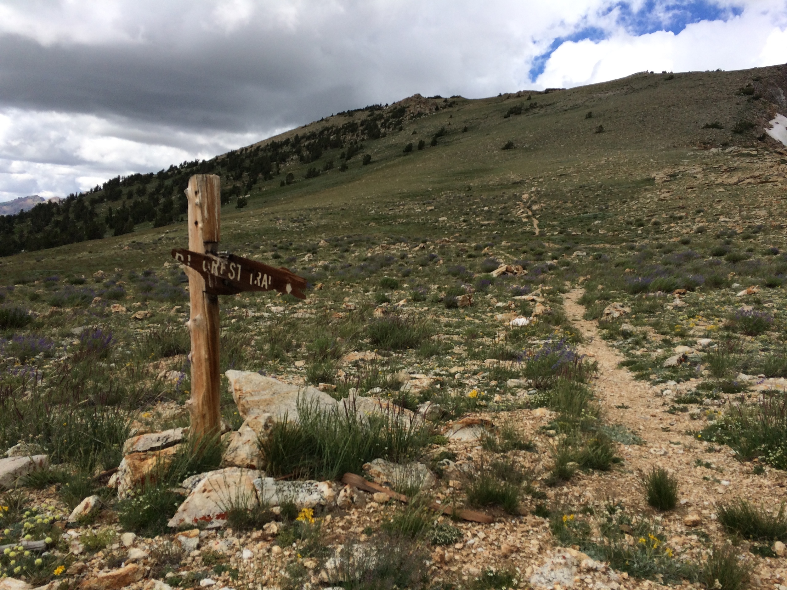
We quickly learned that the Ruby Mountains are not really on anybody's radar. And that is just the way we like it, though it does complicate long-distance trip planning a bit. Map options are fairly limited: either generate your own from Topo software, or buy the "classic" USFS fold-up (last updated in 1994). At least the USFS version is waterproof, shows all of the forest roads, and can be ordered online through the Humboldt-Toiyabe district site. We discovered that the Ruby Crest Trail, a National Recreational Trail, provides a 32-40 mile (no two sources seem to agree on a distance) route through the major ecosytems of the Rubies along the crest of the range's southern portion. The Rubies are a steep, narrow range punctuated by deep canyons containing relatively few trails, and the wilderness area is surrounded by a patchwork of private lands with complicated access options. So it made sense to use the Ruby Crest Trail as a starting point for our trip, and we hoped to augment with some cross-country travel to maximize exposure to the range during our first visit. There are a handful of sites online with beta on the Ruby Crest Trail, but we found Bill Homan's site invaluable. He's shared a wealth of hiking info that covers the entire range and includes cross-country routes complete with map files, annotated pics of unmarked passes, and intel on water sources and spots to camp. Updated road conditions are on his FB page. We spent hours poring over his trip reports and ultimately settled on what he calls the "Lakes Loop," visiting several canyons and 9 of the 14 named lakes in the range. We decided to hike the Ruby Crest Trail from south to north, but detour around Bill's loop and ultimately arrive at Lamoille Canyon via the Island Lake trail. This would require reversing the direction of his loop, and we emailed him to see if there would be any major complications with this approach. He was generous enough to reply that he hadn't done the route in reverse but that it shouldn't pose a problem. Now we just had to sort out transportation logistics for a one-way hike located 500+ miles from home.

Jiggs Nevada, Population 2 (we only saw horses)
We wouldn't miss an opportunity to road trip across the Great Basin & back, so we knew there would be no flights involved in the trip. But both trailheads are fairly remote, with no public transportation to either. Where would we leave our car, and how would we get back to it without a long backtracking hike? It turns out that there are a few outfitters in Elko that offer a shuttle service for Ruby Crest Trail hikers. To be fair, the drive from Elko to Lamoille Canyon (30 miles) to Harrison Pass (60 miles, including a good portion on dirt road) and back (another 50 miles) is no quick trip. But the prices seemed fairly high, and we were planning to start on the 4th of July (a major holiday). We didn't receive a response from Cowboy John to our online inquiry, and we decided the universe was suggesting a different approach. Sure enough, a friend who enjoys a good long drive offered to follow us to Elko, drive with us to Lamoille Canyon to drop our car, then shuttle us to the southern trailhead before heading back home. Wow!
A cozy corner at Cowboy Joe Coffee in Elko NV (w/robust WiFi!)
A few final details: The Comfort Inn in Elko made a perfect spot for final gear adjustments and a solid night's sleep before our hike. The Blind Onion seemed a strange combo of bowling alley, bar, pizzeria, ice cream parlor, and local meeting spot but served perfectly respectable pizza (half-price for happy hour!) and introduced us to the very tasty Bristlecone Brown Porter from the Ruby Mountain Brewing Company. We loved the vibe at Cowboy Joe, where we had good strong coffee & tea before heading out the next morning. Elko itself is as you might expect for a small city in northeastern NV, enough said.
And with that, we were off to the mountains early in the morning of the 4th of July (missing Elko's Basque Festival).
Day 1 / Green Mountain to Overland Lake

Rock formations between Harrison Pass and the Green Mtn TH
After dropping our car at the Lamoille Canyon trailhead (spectacular views & hard to believe this is only 30 miles from Interstate 80), we made the drive south to Harrison Pass. Cynthia's car is 2WD, so she left us there to walk the final 2.8 miles to the Green Mountain trailhead along a rutted jeep track. We donned backpacks around 8:45am and waved goodbye as she headed back to San Francisco.

Tipton Peak and a cairn that confirmed we were still on-trail

Cheri on the ridge between N & Middle forks of Smith Creek
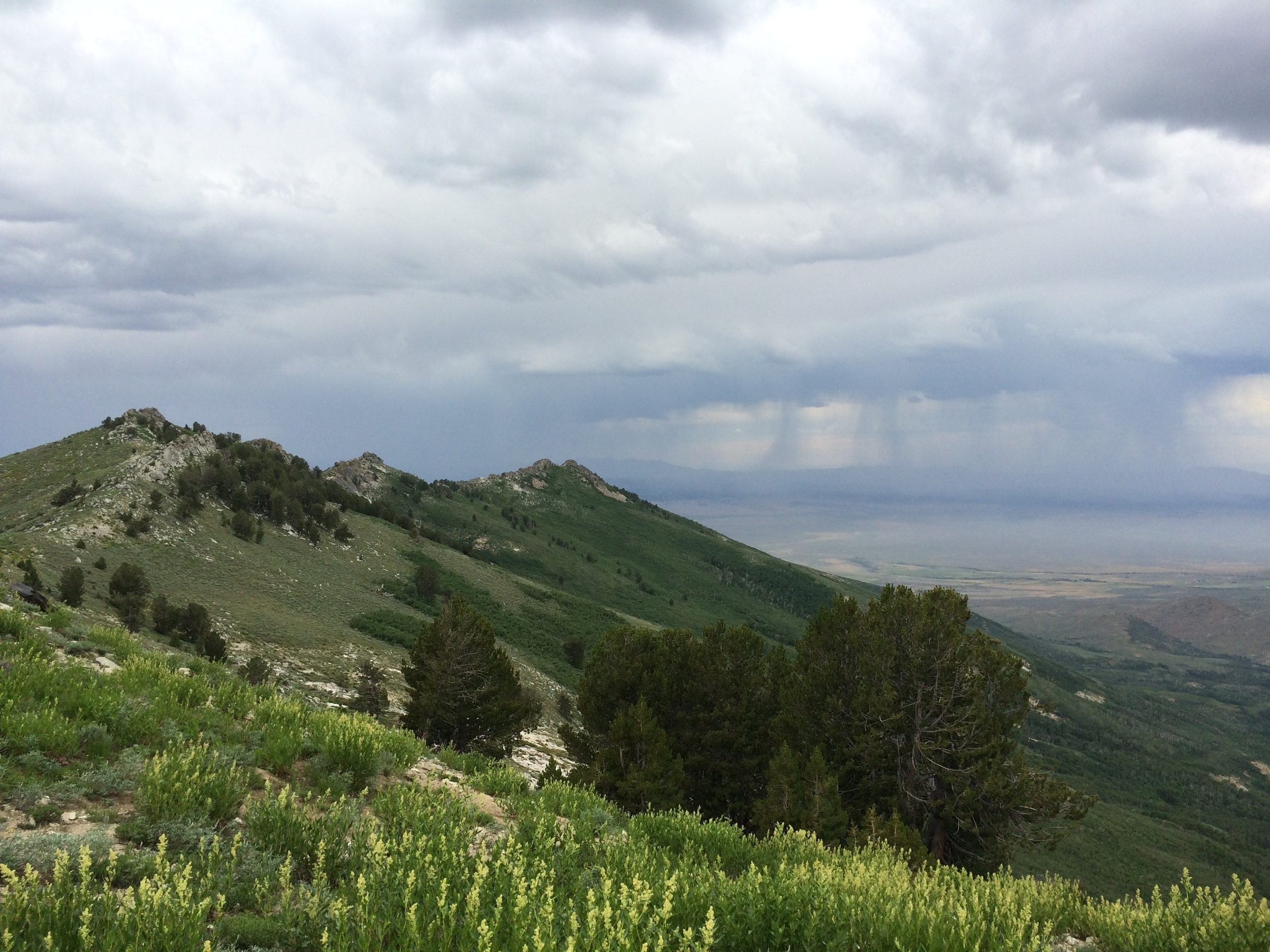
Despite our early start and the ~8000' elevation, there are no trees and we found the July heat sweltering. We passed a few ATV riders on the dusty road and wished for a little shade for the steady climb. Neat rock formations and great views towards the west provided a fine distraction as clouds gradually began to replace blue sky. Upon reaching the Green Mountain trailhead proper, we were happy to see stands of aspen for their shade. Instead, we found that walking in and out of these groves over several ridges brought bugs and humidity but little relief from the heat. The Ruby Crest Trail crosses into the wilderness area just over a mile from the actual trailhead and we soon discovered that the "trail" was more of a "suggestion" through the dense growth on these western slopes. We crossed McCutcheon Creek and passed a junction for a poorly maintained lateral down the canyon of the same name. The air was starting to cool as we continued to climb, and storm clouds were building in the distance out over the Great Basin. Each time we emerged from the trees it was to slopes of brilliant green, covered by a riot of wildflowers. We occasionally came across a large rock cairn, often the only confirmation that we were in fact on an established trail. The sky grew more ominous and the wind picked up with every exposed slope. The wind-driven rain reached us around 2 pm, and we crossed the first two forks of Smith Creek in raingear through a downpour. The "trail" was either overgrown by tall grasses and flowers or aspen-choked as it dropped into one drainage after another. Although the squall lasted only an hour, we became progressively drenched by the wet greenery through the afternoon.

We earned increasingly alpine views as we followed a long green traverse towards the headwaters of the north fork of Smith Creek. This transition to the high country felt complete when we reached the series of switchbacks that took us above the treeline and towards the pass leading to Overland Lake, our day's destination. The first major snowfield across the trail sat just above 10,000' in elevation and came with a great view of King Peak. From there it was not far to the high point of the pass, and our final descent to the lake. Overland Lake and its smaller unnamed neighbor, nestled in steep crags on the eastern slope of the range, made for stunning views as we picked our way down rocky switchbacks into the chilly alpine evening. We remarked on the contrast from our surroundings just 10 hours earlier, and also that we hadn't seen any other hikers all day.

Overland Lake sits on a high shelf on the Rubies' eastern slope
As we neared Overland Lake we could see tents and realized we would have company. There are several nice sites scattered above the eastern shore, near an abandoned cabin, and we easily found a spot with some privacy. It turns out that there were two other parties, for a total of ~6 other people, but in no way did we feel crowded. Overland Lake is easily reached from an east side trailhead, via a short ~4 mile walk (albeit with 2600' elevation gain) and apparently sees relatively heavy use.
We set up camp at 6:30 pm, nearly 10 hours after Cynthia left us at Harrison Pass. One day in, and we were already starting to fall for the Ruby Mountains.
Stats: 17 miles (trail) | 10 hours | 2337' Net Elevation gain | 6074' climb | 3737' descent
Day 2 / Overland Lake to Favre Lake

A setting moon framed by rising fog above our Overland Lk camp

Andrew at the base of the Overland Creek cascade
We unzipped the tent to find low fog drifting down from the shelf above the lake. The fog lifted as the sun rose and we had dramatic golden hour lighting for our morning camp chores. We hit the trail by 7:30am and continued to enjoy exceptional morning light as we passed the Overland Lake trail junction and reached the eastern slope of the range. We didn't need water at the Overland Creek crossing but stopped to enjoy the wildflowers surrounding this small cascade against a dramatic grey sky. The next section of trail makes long traverses across steep green slopes punctuated by large outcroppings of grey rock and small stands of conifers, and it feels reminiscent of the Dolomites. From a closer vantage point we discovered that the green slopes were actually teeming with the bright colors of nature's fireworks (wildflowers galore!). This side of the range didn't seem affected by yesterday's rain, though the trail is much rockier and might have just drained quickly. In any case, it was a treat to walk with dry feet and without raingear. The gently rising traverse around the basin of the Overland Creek drainage was one of the most pleasant sections of the entire Ruby Crest Trail. The sky was constantly changing and always filled with an amazing array of clouds. We noticed an uptick in the wind as we completed this section and prepared to cross back over to the west side of the range.

Ruby Mountains or Dolomites? Cheri contemplates.

The Ruby Crest Trail zigzags north along the spine of the range
At the head of Long Canyon the vegetation suddenly switched to high alpine tundra, reflecting the extreme weather that batters the spine of the Rubies as wind whips across from one large flat valley to the next. We were treated to constant strong winds and a view of the trail undulating along the length of the spine as it headed north-northeast towards broad Wines Peak in the distance. The range drops off steeply to the east from this spine and in contrast stretches out into rows of long, broad canyons to the west. Less than 10 miles wide at this point, the Ruby Mountains are perfectly positioned to catch some serious weather from the Great Basin below. We donned our raincoats for some protection against the relentless wind and enjoyed the continued sky drama while bracing against gale-force gusts for several miles. With the cool temps, it was a non-issue that this entire section of trail has no water access. We spent each short break tucked in behind a boulder or below a small rise. The trail was quite faint in areas but we could always see the route ahead and had no difficulty following it. There are fabulous views of many named peaks in this section, and despite the relatively flat trail we were undoubtedly deep in the high country of the Rubies.
We were elated to reach Wines Peak (at 10,893' the highest point on the Ruby Crest Trail), if only to pass around to its northwest side and have a decent windbreak. The true peak is only 30-40' from the trail and apparently has a summit register, but we didn't investigate. We were not surprised when the wind picked up the minute we started our descent, exposed to the steep eastern edge of the range on what we not-so-affectionately named "hurricane plateau." The trail in this (fortunately short) section was overgrown by ankle-high grasses and the ground was peppered with large and hidden rodent burrows that collapsed underfoot with every step.

View north from Wines Peak across "Hurricane Plateau"
We were relieved when the trail dropped down from this broad exposed saddle into a forest of mature limber pine. As we headed towards North Furlong Lake the trail became increasingly muddy from recent snowmelt and there were numerous downed trees to navigate. The lake itself is located a short distance from the RCT down a lateral trail, but we weren't much interested in setting up camp in a bog. We decided to press on to Favre Lake, which we had heard is one of the gems of the Rubies. The trail makes several switchbacks to climb a small ridge between the two drainages, and these had been badly damaged by erosion from previous hikers and horses taking shortcuts. We tried to follow the intended route through disturbed, sandy soil though it was getting late and we were eager to reach our campsite for the night. The trail descended the far side of the ridge via long switchbacks through vegetated slopes into the Kleckner Creek drainage. It may well have been lovely at another time, but to us it seemed a patchwork of mud, melting snow, and downed trees with evidence of heavy horse traffic and only a very few wildflowers in bloom.

Golden hour on the saddle above Favre Lake
We reached famed Favre Lake to discover that it was nearly entirely surrounded by mud, grass, & low brush and generally not notable in any way (we're told the fishing is first-rate, though this didn't concern us as we weren't carrying tackle). It did have a nice tent site among trees on the southern shore and we stopped there to consider whether to make the short climb to the cirque containing Castle Lake instead. As we discussed our options, a couple with their dog (the first people we had seen since leaving Overland Lake) passed us on their way towards Castle Lake. And so it was decided, we would camp right there at Favre.

Alpenglow on the upper cirque surrounding Castle Lake
We set up our tent around 6 pm and were treated to perfect golden hour light on the grassy saddle above Favre Lake coupled with alpenglow on the upper cirque in the opposite direction. That evening light show, along with the solitude of our campsite, redeemed Favre Lake and cemented our favorable first impression of the Ruby Mountains.
STATS: 14.7 MILES (TRAIL) | 10.5 HOURS | 94' NET ELEVATION GAIN | 5202' CLIMB | 5108' DESCENT
Day 3 / Favre Lake to Liberty Pass, then to Echo Lake via Kleckner Creek & Box Canyon

Looking across towards the outlet of Favre Lake

Lake Peak commanding attention beyond Liberty Lake
We had planned to leave the Ruby Crest Trail at Favre Lake, but not without a visit to Liberty Lake and the pass beyond. We ate breakfast as steamfog rose from the lake's surface and melted into a clear blue sky, and we watched a few clouds multiply at the far end of Kleckner Canyon. After stashing our packs, we headed around the far shore of Favre and over its grassy saddle rather than taking the longer Ruby Crest Trail. In fairness to Favre Lake, it IS a scenic spot and especially when seen from above. We marveled at this little blue gem set in its bed of green on the lip of a long wide valley. Yesterday it was a swampy puddle and today it's a sweet little infinity pool... what a difference 12 hours and a change in perspective can make. In any case, the route was marked here and there with cairns, and we followed a light use trail in places. Near the outlet of Liberty Lake we found a decaying sign for Favre Lake pointing back the way we had come. This unmaintained trail (one of many in the Rubies) doesn't appear on the USFS map, but obviously sees some degree of foot traffic. Liberty Lake is a stunner with its deep blue-green waters surrounded by rock slabs and sandy patches. There were plenty of sweet flat spots, all deserted, and we wished that we had pushed on just a bit further to camp here instead of at Favre. At least we'll know for the next trip. We rejoined the Ruby Crest Trail here, and followed it to the slabs high above Liberty's north shore. The view from this spot may be one of the finest in the entire range, or at least the most iconic. Lake Peak rises in the distance, and from the perfect spot both Favre and Castle Lakes are also visible. We chilled on a slab, basking in the beautiful morning and enjoying the ever-present cloud show. Not a bad place to be at 8 am on a Monday morning!

Snow Lake Peak and Lamoille Canyon from Liberty Pass
We continued north on the Ruby Crest Trail to Liberty Pass (10,400') hoping for views of Dollar Lakes and/or Lamoille Lake, but they are all obscured by ridges and we decided not to make a descent just to see them. We did have a pretty glimpse down Lamoille Canyon, and sweet views of knobby Snow Lake Peak. Plenty of large snow patches covered the ground at the rocky pass, and we met a trail runner from Elko out with his 2 dogs for some morning miles (the only person we would see all day, and the last person we would see in the Rubies until the morning we walked out). He remarked that it was a rare treat to have clouds! We didn't much believe him, as we had been treated with a sky filled with nothing but spectacular clouds every minute of each day since arriving in this little range. We wished him a good Monday run, snapped a few pictures, then looped back on the Ruby Crest Trail all the way to our packs.

Upper Kleckner Creek and shooting stars in bloom

Larger cairn among wildflowers on the saddle between Kleckner Canyon to Box Canyon
Our next task was to locate the unmaintained trail that leads down Kleckner Canyon. The outlet of Favre Lake had widened into a veritable wetland, great for shooting stars and other wildflowers but suboptimal for keeping feet dry. A dilapidated sign leaning against some willows marked our junction, but plenty of overgrowth made following the Kleckner Creek trail a bit challenging. Fortunately, our main goal was to stay on one side of the creek and head down-canyon, and this was easily achieved. Numerous downed trees and plenty of thick undergrowth slowed our pace but didn't pose any significant difficulty. Intermittent evidence of previous horse travel, the occasional campsite, and a rare but welcome cairn confirmed that we were on the right track as the canyon widened. The obvious saddle into Box Canyon on the far slope helped in navigation. We selected a spot for creek crossing that required only a modicum of bushwhacking through willows and found ourselves on a sandy/grassy slope absolutely covered in wildflowers. We started a rising traverse towards the low point of the saddle and soon enough came across a steady stream of small cairns (and an occasional giant one) indicating that we had re-joined the official "route". The slope was not terribly steep but the loose, sandy soil commanded constant attention and we were happy enough to reach the top. The distant clouds from the early morning had found some friends and now congregated over us, casting large shadows on the canyon walls. We were glad for the bit of shade and they still looked white and reasonably friendly. It was 12:30 pm, a respectable time for lunch, and we enjoyed it atop the saddle with a birds-eye view of Kleckner & Box Canyons.

View down Box Canyon as we start to ascend the drainage towards Echo Lake

Descending to Echo Lake, from below the upper steep section
After our leisurely stop, we followed a few more cairns along the saddle's crest before dropping into Box Canyon. In spite of a well-defined path, this descent proved to be much less friendly than our gentle, grassy climb up the other side. A not-too-recent burn left all of the trees charred and/or downed and the ground loose due to loss of plant cover. Any new growth was of the dry/thorny variety, the slope was steep, and flies buzzed around us as we slid our way down the tight & dusty switchbacks of the informal route. Somehow our mood started to match the terrain and we couldn't wait to reach the verdant canyon floor. The topo map shows several spots where the creek flows along wide flat areas and we made a tentative plan to camp for the night along the creek near where we would ultimately climb out of the canyon towards Echo Lake. As we got closer to the base of Box Canyon, the willows grew thicker and the path became less distinct. This posed no real navigational challenge because once again we only had to find a route down-canyon along one side of the creek or another until we reached the correct drainage. However, the thick undergrowth made for a bit of a slog and it quickly became apparent that there would be no perfect campsite in Box Canyon worth spending a leisurely afternoon. We decided to make a full day of walking after all and save our free afternoon for a different time and place. We reached the base of our drainage around 2:30pm, triple-checked the map to ensure we were heading the right direction (no cairns since crossing the river), then pushed on. We had a decent climb ahead of us and knew there would be no option for water until Echo Lake, so that became our firm destination for the night. From the far saddle this drainage had looked rocky, steep in sections, and a bit sobering overall. Fortunately (and as is often the case in cross-country travel), the terrain was much less imposing from up close and offered no real technical challenge despite a long and constant ascent. By making and achieving short visual goals (ie. next rock, far tree) we gained significant elevation in a relatively short time and started to once again enjoy wildflowers, scattered trees, and long views down Box Canyon to the valley beyond. The clouds continued to build overhead, and the temperature dropped. We welcomed the cooler air for our steady climb but also worried about the descent into Echo Lake, which appeared quite steep on the map and would likely be challenging in any significant rain. We were fooled several times as the drainage leveled before climbing again, but ultimately reached the final saddle above Echo Lake around 4 pm. Looking over the edge at the lake was a bit daunting, as the upper part of this descent is in fact very steep. Fortunately, the rain held off as we picked a line through this challenging but short section under an ominous sky. From there it was a matter of fairly standard route-finding over a combination of scree, talus, and grassy gulches, often following small but frequently-placed cairns that helped us avoid several small cliffs as we made our way to the lakeshore.

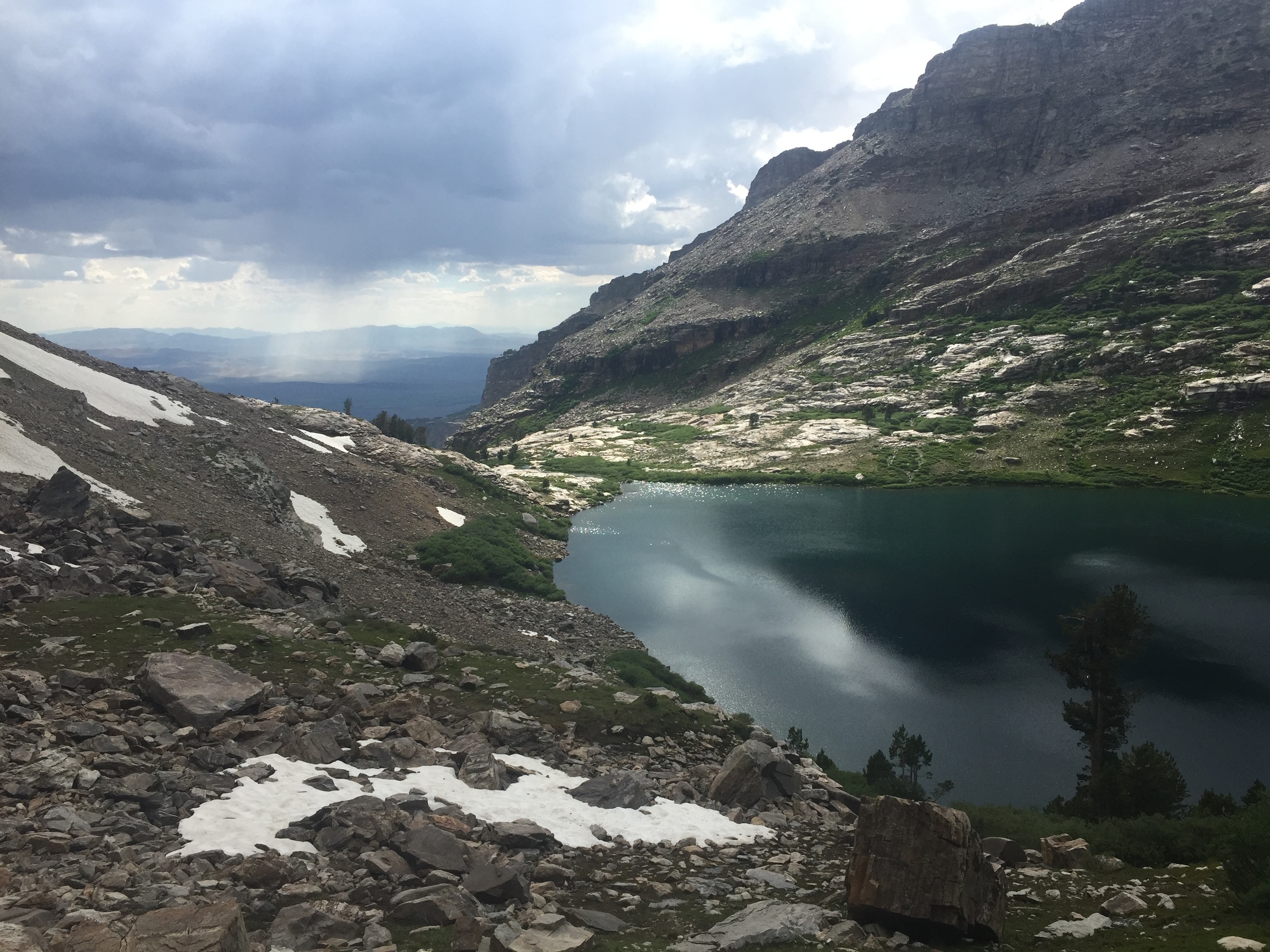
Echo Lake, 9820' according to this old sign near the outlet
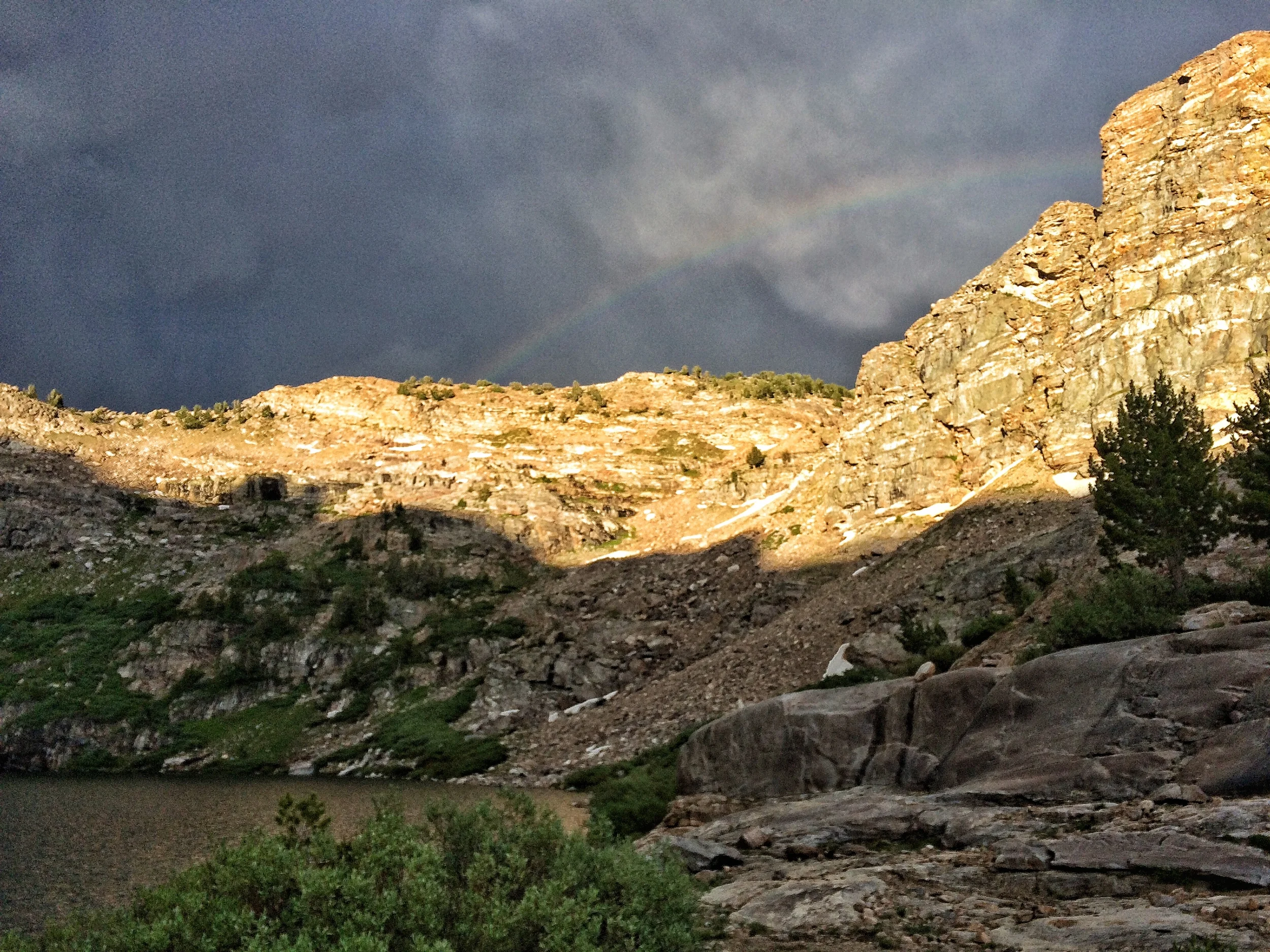
Post-storm rainbow and last light of day in Echo Lake cirque
Echo Lake happiness
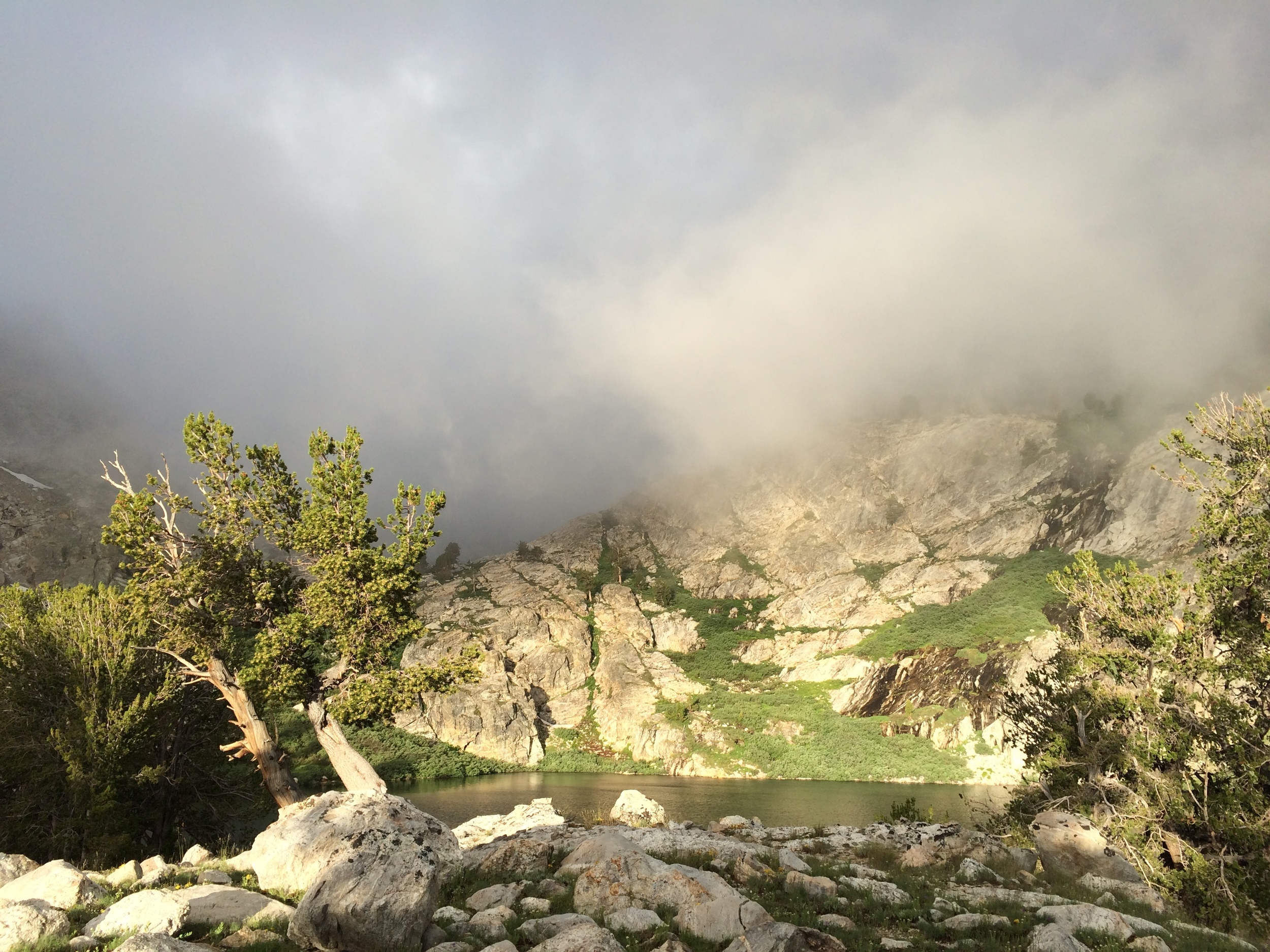
Echo Lake is the largest lake in the Ruby Mountains, and would surely be in stiff competition with Liberty Lake for most famous if it weren't so hard to reach on foot. It sits high in a small cirque surrounded by craggy peaks and overlooking the flat valley to the west. Summer had not quite arrived in the cirque, and we walked past green shoots pushing up through patches of snow as we followed the south shore towards the outlet. For the first time in the Rubies we were swarmed by mosquitos, to the point that we grabbed out our bug netting for protection. A chorus of thunder accompanied our hurried selection of a sweet little spot to pitch a tent from several options on the west shore. No sooner had we thrown on the fly and tightened the lines but it started to sprinkle rain and quickly progressed to an outright downpour. We took shelter from the storm for about an hour and emerged to a prolonged sunset light show rivaling some of our favorite evenings in the Sierras. We wandered around in the post-storm glow after dinner and were treated to a rainbow finale just before dusk. Although we were the only ones at the lake, there was plenty of evidence that others had been there, and none of them were any good at Leave-No-Trace principles. Some litter was overt trash, and much more consisted of rusty, broken, and/or forgotten items that were probably useful to somebody's camp at one time but now were eyesores in this otherwise pristine wilderness site. This was the first instance of such a problem we had seen in the Rubies and it was a big disappointment, for we still had a few days to go and most of the items were large and not easily packed out by us. We didn't let this ruin what was otherwise a magical evening of solitude at a most beautiful spot.
We spent plenty of time gawking at beauty and route-finding today, so if you are looking for stats keep in mind that this was a beautiful and enjoyable but not highly efficient day.
STATS: 4 MILES (TRAIL) + 5 miles (off-Trail) | 10.5 HOURS | 273' NET ELEVATION Gain | 4028' CLIMB | 3755' DESCENT
Day 4 / Echo Lake to Right Fork Canyon

Clouds reflected in a a glass-like pool, early morning
Elephant's Head & Shooting Star with peaks reflected in the outlet of Echo Lake
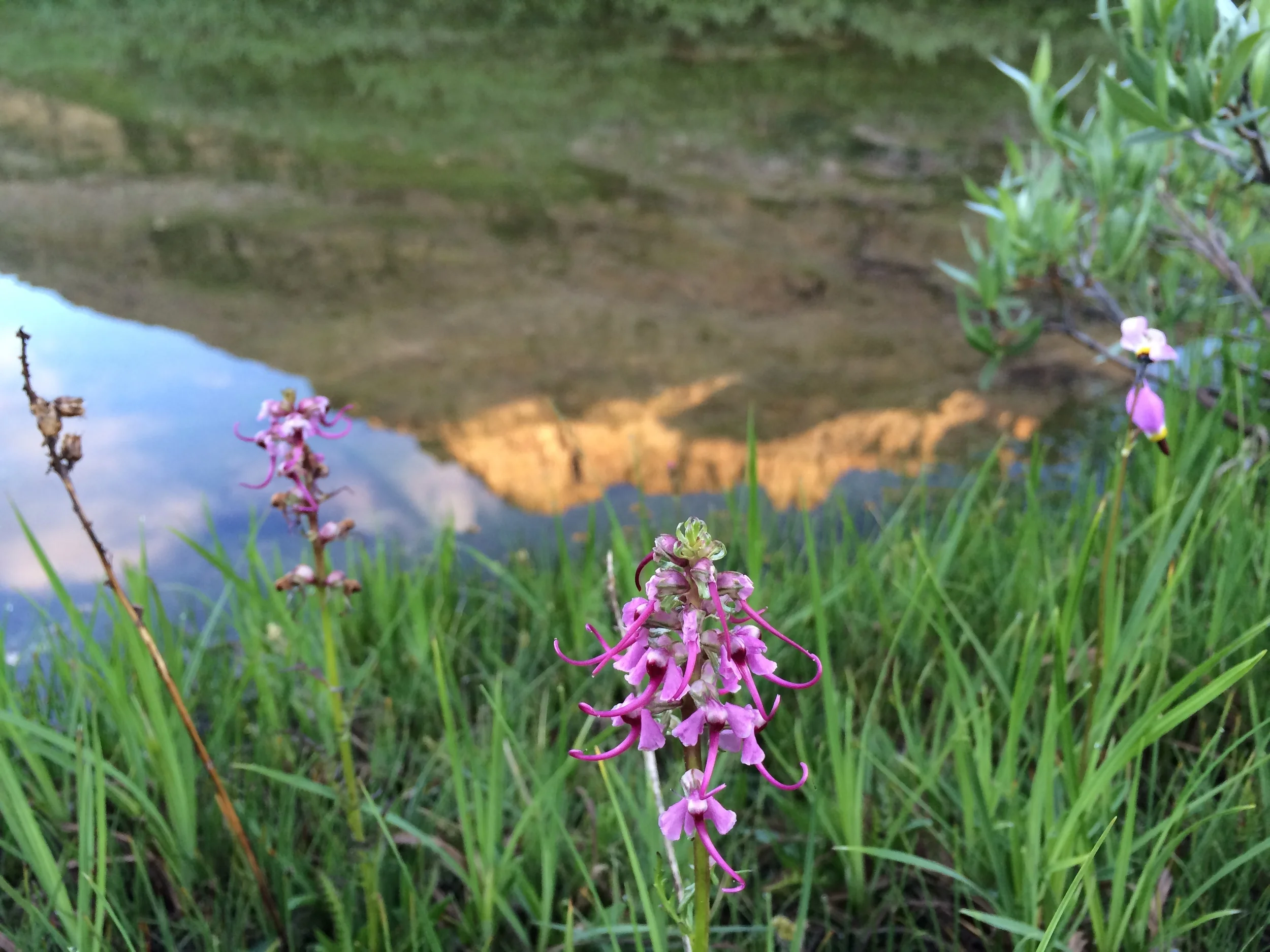
The day broke with nearly clear skies. As first light hit the walls of our cirque, it appeared that the unsettled stormy weather we'd experienced since Harrison Pass may finally have moved on. The outlet of Echo Lake starts as a braided network of rivulets and shallow pools eroding into the rocky ledge that contains the lake. Morning light on the water brought stunning reflections all around. We meandered past to look out over the edge to the Great Basin far below. Despite the lingering snowfields on the far end of the lake we found several small clusters of blooming wildflowers near the mouth of the cirque, including both elephant's head (Pedicularis spp) and shooting star (Dodecatheon spp).

Cheri taking in the majesty of the Ruby Mountains.
We ate breakfast at the lakeshore and studied the map to plan our route. We would have enjoyed spending all morning at Echo Lake but knew that today's hike would cross more challenging terrain, and a few days in the Rubies had taught us to take advantage of any clear weather. We had GPS waypoints from Bill's website and tried to match his (reverse) route description to our day's general course. With sun overhead and surrounded by friendly-looking clouds, we made our way back to the base of the saddle across Echo Lake. Climbing the generally cairn-marked slope was easier than yesterday's descent (likely due to a combination of fresh legs, full stomachs, good weather, and familiarity with the terrain), and we made good time to the saddle's crest. We surveyed the rocky terrain, consulted the map, and picked out what appeared to be a faint use trail traversing the shoulder of the ridge. It looked to be at the right level for our planned route, so we followed along. The path soon disappeared as the ground changed from rocky slope to steeper sandy soil with low grass and sage and the occasional windblown tree. Rocky outcroppings provided expansive views across Box Canyon and to points south including much of the range we walked on the Ruby Crest Trail. To the northwest, we caught a brief glimpse of Ruby Dome. Although it's the highest peak in the Rubies and was only a mile or so away, it had been hidden until now by the crags surrounding Echo Lake.

Andrew traversing high along the wall of Box Canyon
The combination of steep slope and sandy soil with loose rock and limited vegetation made for rather tricky footing and we picked our way slowly along this traverse high up on the north wall of Box Canyon, staying below a section of small cliffs. We would occasionally come across a short section of use trail or a human footprint. These disappeared as quickly as they appeared and were difficult to distinguish from sections of game trail and their wildlife tracks. We were hoping to see mountain goats in the Rubies, or even some bighorn sheep, but had no such luck despite the volume of hoof prints we passed. The terrain became more challenging and we had to focus closely on each step across a short but difficult section consisting of very steep and loose ground. Upon crossing the next shoulder we were relieved to find easier footing and a more gentle slope in a wide, U-shaped drainage covered by a meadow of grassy plants with small yellow-white flowers. The ground itself was quite uneven with numerous mounds & holes, but the dense vegetation and low-angle slope made for more decent travel. Several mule deer seemed surprised to see humans. Beyond this sloping meadow, we climbed another small ridge to find a lone cairn surrounded by purple penstemon and a smaller succulent with yellow flowers. We took an elevenses break (we stop often for snacks, just like hobbits) on this knoll. Just below us to the east was a pretty little unnamed lake, more like a shallow tarn in a large patch of sand, on a shelf in upper Box Canyon. In the other direction, we could see out towards the Great Basin.
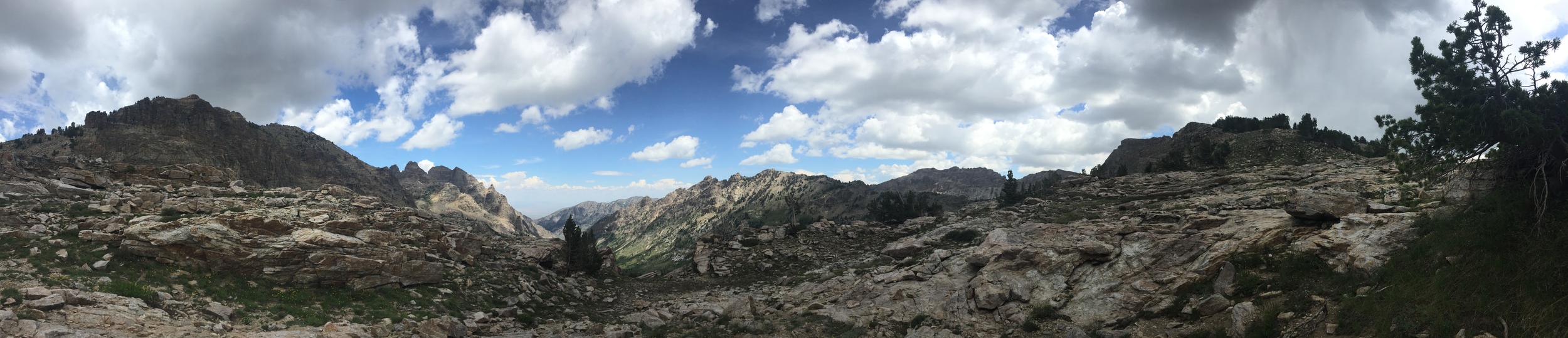
Panorama looking roughly north from our elevenses knoll between Box Canyon and Right Fork Canyon
The clouds that had accompanied our high traverse up Box Canyon were amassing into a gang and no longer looked innocent or friendly. The sky remained blue directly above us, but we were otherwise surrounded by storm clouds in various shades of grey. We had planned to meander out the next shoulder for a peek down at Box Lake, but given the shift in weather we decided to head straight over the saddle into Right Fork Canyon so that we wouldn't be high on canyon walls in the middle of a storm. Sure enough, we heard the first rolls of thunder in the distance as we lifted our packs. The temperature dropped and the wind picked up, but the walking was still pleasant enough as we made an easy traverse to the next saddle. We thought we might drop down to Goat Lake, find a campsite for the night, and spend the remainder of our afternoon exploring the surrounding area.

This is not Goat Lake. Marshy pools in upper Right Fork Canyon and rainstorm out over the Great Basin.

Our campsite in upper Right Fork Canyon below the saddle to Box Canyon
Right Fork Canyon gradually opened before us as we easily made our way down over large, rocky shelves. There were no cairns to follow, and a few large snowfields kept the route-finding interesting. Overall, this descent was much smoother and far less technical than our previous day's drop into Echo Lake. Goat Lake isn't marked on either our paper or GPS maps, and we decided it must be the larger of the two lakes in the upper reaches of the canyon (spoiler alert: it isn't). We continued out along a broad finger that splits the head of the canyon into two separate drainages as we worked our way towards "Goat Lake." We passed a large, flat, and well-used campsite protected from the wind by large trees and a big rocky slab and made note of it as a back-up plan, then continued onwards to the large lake. After scrambling up, over, and down various large outcroppings of rock interspersed with seasonal runoff and marshy spots choked with thick stands of willows, we came to a large scree field. We expected to find access to the lake on the other side, so we forged ahead. About halfway across we got our first view of the "lake." We were dismayed to see that it was a collection of small swampy ponds choked in a veritable forest of willows and no place to spend a night, let alone a long free afternoon. Our hopes for an afternoon swim were dashed. We turned back and negotiated the same obstacles to reach our "back-up" site from earlier. No lake here, but it boasted a nice flat tent site of decomposed granite, some protection from the wind, majestic trees, and great views out Right Fork Canyon. Runoff from the persistent snowfields meant there was water nearby, too. We set up our tent in sprinkles of rain, but the clouds were moving so quickly that we never had any sustained precipitation. Instead, we spent several hours exploring the immediate area and enjoying a sweet combination of trees, wildflowers, rock, and sky made more scenic by constantly changing clouds and periods of distant lightning. The rain that threatened never arrived, and the clouds ultimately settled into a densely overcast sky for the evening.

A pleasant if stormy afternoon in upper Right Fork Canyon
P.S. After our return, we learned that Goat Lake is actually the tiny lake in the western fork of upper Right Fork Canyon. The larger "lake" in the eastern fork is in fact marked as marsh/swamp on our GPS map (USGS quads) if you zoom in close enough, and is indicated by a broken blue shoreline on the printed USFS map (also noting marsh)...guess we should have studied the maps a bit better. Oh, well. We'll visit Goat Lake on our next trip to the Rubies.
STATS: 4.5 MILES (off-TRAIL) | 5.5 HOURS | 74' NET ELEVATION GAIN | 2314' CLIMB | 2240' DESCENT
Day 5 / Right Fork Canyon to Island Lake via Thomas Canyon

Andrew and the last traces of our campsite in Right Fork Canyon

Cheri crossing the endless small talus of Mt. Fitzgerald's shoulder as the high clouds coalesce above

Cheri navigating a patch of snow in one of upper Thomas Canyon's many short but steep chutes
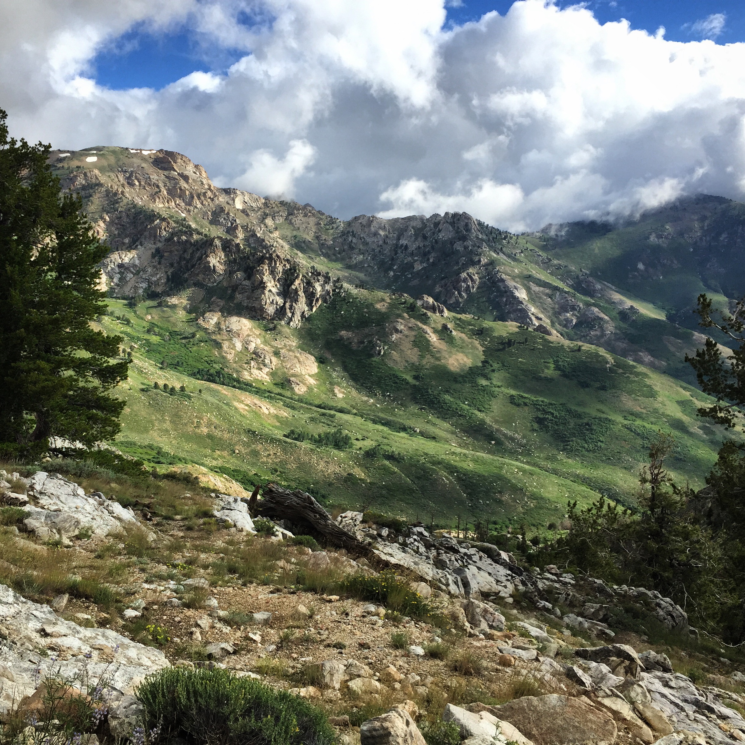
It rained on and off all night, quite heavily at times, but the morning brought a clear blue sky with only a few high wispy clouds. Plan A for the day involved crossing the two most challenging passes of our trip and spending the night at Island Lake with just a few easy miles left for our final morning. The proximity of Island Lake to our car provided a completely respectable Plan B - camp somewhere in Thomas Canyon tonight and plan a fresh morning assault on the final pass, which was likely to be the technical crux of our entire week. We were efficient in our morning tasks, not wanting to waste a period of good weather with plenty of challenging terrain ahead. The temps were noticeably cooler than previous mornings, and the high clouds were quickly coalescing. As we packed up, we kept a constant eye on Mt. Fitzgerald and towards the loose scree field along its boulder line that would be our first obstacle of the day. We stayed a bit higher on the slope above "Goat Marsh" (ie. unnamed swamp) today, and preferred this route. The rocks were bigger and still not entirely stable, but the slope was less steep and it felt less exposed than walking in the loose scree below. Our progress was steady (if not terribly quick) across what looked short on the map but felt like an endless expanse of smallish talus. We were surprised to come across a large plastic section of snowmobile wedged between rocks, deep in what we believed to be pristine wilderness. Only after returning home would we learn that most of Right Fork Canyon was excluded from wilderness designation in the Rubies, allegedly due to strong lobbying from local tourism groups including a heli-skiing operation that makes heavy use of these slopes in the winter with equipment that wouldn't be allowed in the wilderness. We reached a mossy grotto on the far side of the rock, and were glad to have a stretch of easy footing as we worked our way up a series of grassy gulches and ramps covered in shooting stars and other blooms. Just below the saddle this pleasant terrain gave way to large but stable talus and we focused on route-finding to minimize the amount of scrambling required to navigate these huge rocks. We reached the crest a bit higher in elevation than the low point of the saddle and realized that staying this close to the slopes of Mt. Fitzgerald would add significant difficulty to our descent. A combination of talus-hopping and scrambling took us to the low point, and then down the first 100' or so until we reached solid ground in upper Thomas Canyon.

From this point our goal was to reach a small beaver pond at ~9,500' by means of several short chutes that would allow us to bypass a few small but still imposing cliffs. We were happy to have Bill's waypoints in our GPS and frequently compared these to the terrain around us as we tried to minimize difficulty while maximizing efficiency. We left the grey sky behind in Right Fork Canyon, and the immediate storm threat seemed low. Thomas Canyon opened below us as a vast green expanse dotted by rocks, trees, and little bits of water. We remarked that each day spent in the Rubies seemed more beautiful than those that came before. Was this a function of increasingly scenic terrain, or more the effect of crossing one rugged canyon after another nearly completely unmarred by evidence of previous human use? Hard to say. Route-finding required our constant attention, but the walking itself did not pose much difficulty. We passed several little seeps surrounded by wildflowers, enjoyed more trees than we had seen in days, and reached the beaver pond (really, a series of connected pools) around 10 am - just in time for a first morning snack. The clouds were starting to build on our side of Mt. Fitzgerald and we had a great view out towards the Lamoille Valley down-canyon. A large shoulder obscured the far wall of Thomas Canyon, so we couldn't yet see the pass that would be our route to Island Lake. We balanced on downed logs and rock-hopped across the wet shelf containing the ponds, then started up the broad shoulder beyond. By now the wind was picking up and the clouds were more grey than white. It was early in the day so there was no question that we would stick to Plan A, but we were still eager to make it over that second pass before any storm that might be brewing. The terrain was not challenging, but our muscles were starting to feel the cumulative elevation gain from the past few days and we took several breathers during the short climb.


Cheri sets out across the final shelf in Thomas Canyon towards the distinct but somewhat ominous notch leading to Island Lake
We reached a sweet knoll with twisted pines and welcomed the opportunity to enjoy elevenses sheltered from the wind, then continued across what turned out to be the last large, flat shelf in Thomas Canyon. Finally the rock face that separates Thomas Canyon from the cirque holding Island Lake came into view - and was it ever daunting. We already knew that it would be the technical crux of our hike, but from where we stood it looked downright scary. The notch itself started high up on a steep rock face, and reaching it would require an exposed traverse around the headwall of the canyon over what looked to be loose and steep terrain. Hmmmm. We regrouped with the map, consulted Bill's annotated picture showing two passable routes (but confirming our suspicion regarding the location of our pass), and took a deep breath. Bill describes that he prefers the more obvious notch to the north (yellow line in his pic) when ascending because it is easier to find and has less scree. The wider and less distinct notch to the south (orange line) provides an easier descent from Island Lake but does offer an alternate ascent route from our direction if desired. We decided that while the north notch looked more ominous, we liked the idea of more stable footing and made a plan to follow his yellow route if possible. Repeating the mantra to choose each step wisely and remembering that terrain often looks worse from far away, we put one foot in front of the other and resolved to walk straight to the base of the chute with no more breaks.

Andrew starting up the final part of the upper chute from Thomas Canyon

The notch is much easier to see from the Island Lake side, and the sky is less threatening
As promised, the walk around the head of Thomas Canyon was not technically difficult. The exposure occasionally felt harrowing as the ground could be loose and the floor of the canyon is quite conspicuously distant. It never feels dangerous enough that a fall would be fatal, but you could certainly break a femur with a misstep in parts, and neither of us wanted to ruin the trip like that. We worked our way across loose scree, over small rock outcroppings, and between scattered small stands of mature but stunted pines. The storm was definitely building and we felt the urgency of climbing that chute before it started to rain (or worse), since there was no comfortable place to take shelter or any safe spot to camp on this side of the pass without a substantial backtrack (or downclimb). We were both hungry and chilled, and did not consult the GPS or map when we had a short rest along the final cliffs near what we thought to be the base of our chute. We tentatively made our way to the obvious (from our perspective) notch, with more scrambling than expected, and looked up to see a 5-6' tall nearly solid rock wall before the chute opened up into what seemed like passable terrain. Cheri nearly cried. On a sunny day, not tired, and without a thousand foot drop or better just below us, we might have had no difficulty using footholds and cracks to navigate this obstacle. But right here, and right now, it was essentially impassable for us. We sat down against the wall and had a snack, knowing calories always help in situations like this. We both agreed that even if the upper chute was the more desirable route, this didn't matter if we couldn't both access it safely with our packs. We were not carrying rope or any other technical gear, and decided that we would have to backtrack to the wider, looser, southern notch to cross over towards Island Lake. As we made our way back along the base of the cliffs, Andrew pointed out what appeared to be another chute, not far from the one we had just left. We consulted both map and GPS waypoints and discovered that it was actually our target route, which we had passed by without realizing. This boosted spirits considerably, and although the chute was indeed steep it was clearly walkable terrain with a minimum of scrambling and no actual climbing required. We made steady progress and soon we were both at the top with a first view of Island Lake, just after 1 pm. Technical crux, done! Rather than spending time at the windy notch, we started right down with a goal of a swimming in the lake for the afternoon. With our long days of hiking on the Ruby Crest Trail, the storm at Echo Lake, and our failure to actually find Goat Lake, we were feeling overdue for a good swim and Cheri was determined not to let the weather get in her way.

Aptly-named Island Lake from the Thomas Canyon pass

The descent towards the marshy pools above Island lake felt long but posed no challenge in terms of terrain, and we enjoyed new views with a backdrop of dramatic sky. It started to rain as we reached the greenery around these pools, though there was still plenty of blue sky so we didn't take the precipitation seriously. Soon we came across cairns and followed them to Island Lake then around its northern shore. The rain started coming down in earnest, but rather than stop to gear up we pressed on to the far side of the lake, where we expected to find campsites. Sure enough, there were many spots among mature trees both near the lakeshore and up on a knoll above the lake's outlet that had obviously been used for camping. This was the most evidence of human use we'd seen in days, and it felt a bit jarring. That said, all of the sites were clean and we had the entire area to ourselves. We made quick work of selecting a site and setting up the tent, then hopped in to stay dry and eat a very late lunch. The rain stopped within several minutes, so we left the ten to survey the scene. The sun was shining through a small hole in the clouds, Cheri decided that it was still warm enough to swim, and she made a beeline for a large boulder at the lakeshore. Andrew was hesitant but ultimately joined, and we both had an extremely refreshing, if short, swim. We got out and dried off quickly, then changed into warm clothes as the skies continued to darken. We had just enough time to put things away in our packs before rainfall drove us back into the tent for a late afternoon card game. This rain came down more heavily, and thunder clapped all around us. Before we knew it, serious balls of hail were hitting the fly and collecting around the tent.

Lamoille Canyon from the ridge above our Island Lake campsite
We enjoyed our little shelter, relieved that we had made an early start of the day and also happy for the small window of swimming opportunity. The storm ultimately let up long enough so that we could cook and enjoy dinner outdoors, and we were shocked that nobody else arrived at the lake that evening. Island Lake is less than 2 easy trail miles from the most popular trailhead in the entire Ruby Mountains and we expected to see heavy use from dayhikers and overnighters. Perhaps a stormy mid-week day early in the season is the perfect time to go for a little solitude at this sweet lake. We wandered around our hill to get the best views of Lamoille Canyon as the storm clouds settled into low mist. It rained again overnight.
STATS: 5 MILES (off-TRAIL) | 8 HOURS | -225' NET ELEVATION change | 1995' CLIMB | 2220' DESCENT
Day 6 / Island Lake to Lamoille Canyon

Puddlegram in a boulder near Island Lake, with a reflection of the pass to Thomas Canyon
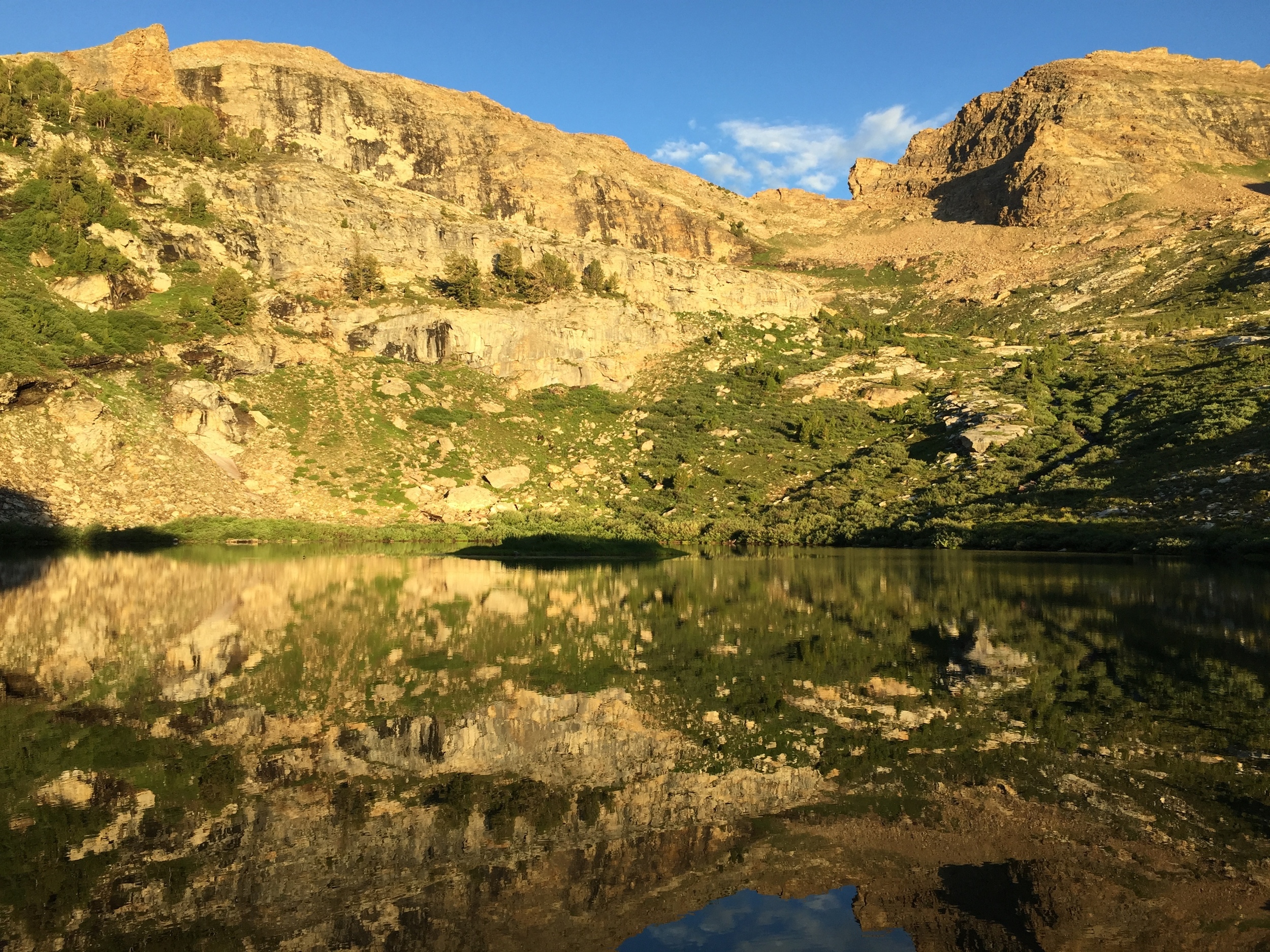
Andrew woke up early to find that the storms had cleared out overnight. While Cheri caught a little more sleep, he headed down to Island Lake to scout for the best morning light. He reached the shore just as alpenglow highlighted our pass from Thomas Canyon and its entire ridge. Golden warmth had soon spreading across the entire cirque and a few small clouds, tinted pink from the low angle sunlight, hung around the edges. The lake was nearly still though a light breeze started to play across its surface. Large boulders at the shore held puddles of water from the previous day's storms. One these puddles provided a near-perfect reflection of that morning light, more than appropriate for our last morning in the Ruby Mountains.

Early morning light on the cirque over Island Lake

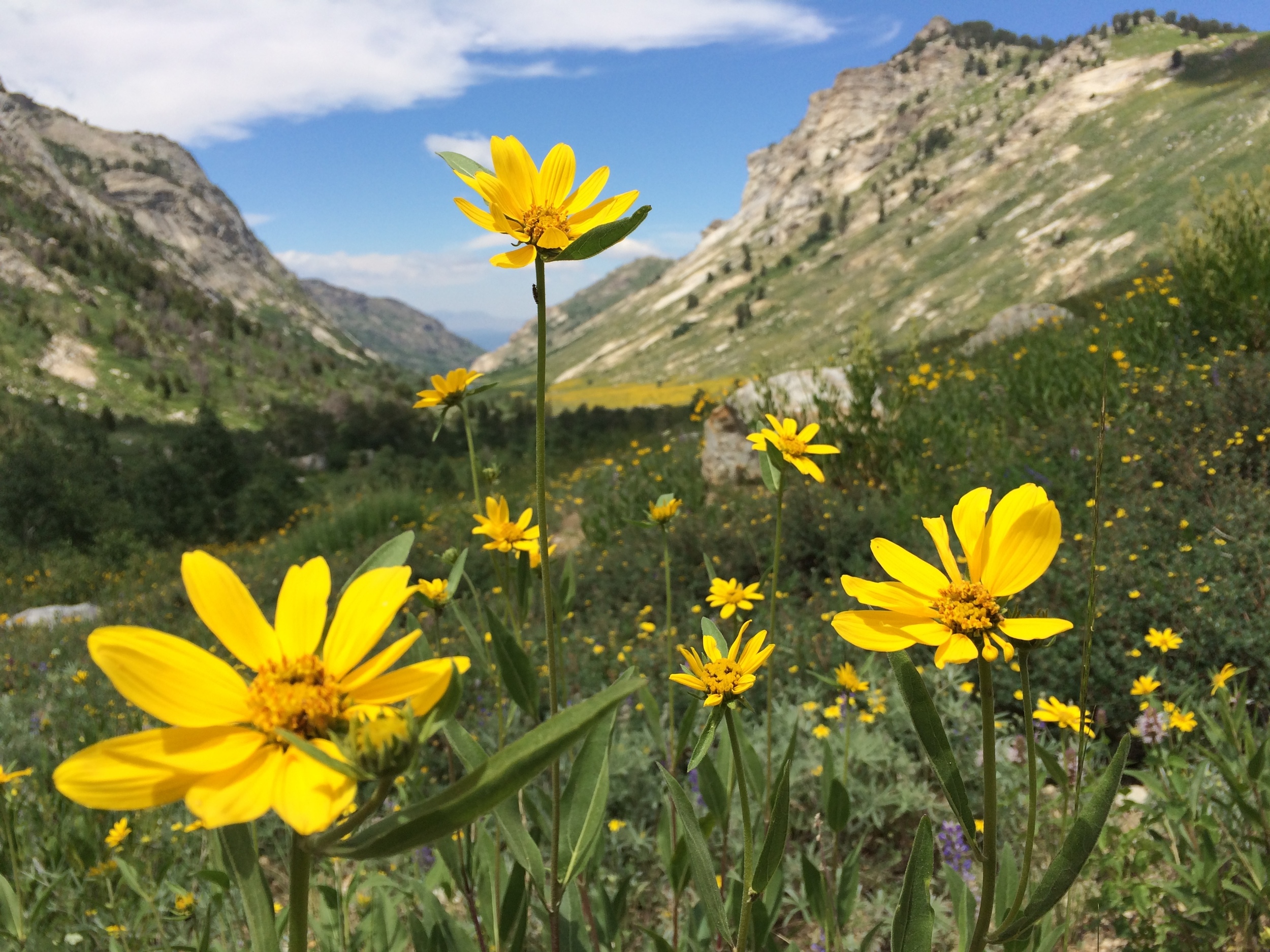
Giant Mountain Larkspur and other wildflowers in Lamoille Canyon.
Andrew returned to the tent site and persuaded Cheri that the morning light beat the warmth of her sleeping bag. We walked around the shore of the lake for another 30-45 minutes taking in our spectacular surroundings for a wonderful finish to our time in the Rubies. We left the stove packed and skipped hot drinks, grabbing a quick and cold brekkie, since we were less the 2 miles from the trailhead at Road's End in Lamoille Canyon. The trail made several switchbacks and crossed the outlet of Island Lake a few times before finally settling in on the south side of the drainage. We made good time on this well-maintained, downhill trail. We came across a trail runner, marking our first human contact since Liberty Pass (it seems that this end of the Rubies is popular with runners). He passed us again on his way back down, and we found out soon enough that he coached XC for the local high school and was warming up before his team's workout. We quickly warmed up as the sunlight reached our side of the canyon and we descended across an open grassy hillside increasingly covered by wildflowers. We passed another two women out for a morning stroll but otherwise had the trail to ourselves and remarked at the contrast between remote eastern NV and our usual haunts in volume of trail users (orders of magnitude). We reached the parking area as the coaches were wrangling a herd of high school athletes towards the Liberty Pass trail with last-minute instructions on trail etiquette (kudos!).
There we were, 6 days later, at our car and the northern terminus of the Ruby Crest Trail. We had a fantastically successful first visit to the Ruby Mountains, which will forever be known to us as the Range of Clouds. We shed our backpacking clothes in favor of t-shirts, shorts, and flip-flops and headed out of Lamoille Canyon under a blue sky with (always) perfect clouds above.
STATS: 1.8 MILES (TRAIL) | 1 HOUR | -860' NET ELEVATION CHANGE | 90' CLIMB | 950' DESCENT
Post-Trip:

Mt. Wheeler in Great Basin National Park, Nevada
We enjoyed strong coffee, hot tea, and a delicious warm second breakfast at McAdoos in Elko. They were gracious about our dirtbag appearance and we overheard patrons at an adjacent table scheming their own outing into the Rubies, so they must be used to the likes of us. Their bathroom sink proved sufficient for a quick clean-up before heading south along the eastern side of the Rubies towards our next adventure in Eastern Nevada, a few days in Great Basin National Park before a long drive home.