Hwy 36 / Chester to Hwy 70 / Belden (44.5 PCT Miles)
We enjoyed our second zero of the trip near Chester at my parents' place, though we are learning that zeros are not exactly relaxing. It is true that we hiked no miles, and spent most of our hours sitting down to let our feet and bodies rest. But while sitting, we were completing the mountain of tasks that stack up during many long days of hiking with only spotty internet access. Laundry, showers, and sorting our resupply food are a given along with a litany of emails, catching up on bills, and keeping up with our blog and social media. Fortunately there was plenty of food and great company. A few days back on the trail, Macro and I had been going back and forth with food we wanted to eat while in town. When my parents asked if we wanted anything in particular while we were there, I sent them the entire list! It will surprise nobody with parents to hear that they made sure to stock all 24 items, though we were barely staying longer than a day. On top of that, the raspberries in their garden were ripe (one of my favorite fruits). I jokingly told a nephew that although I'd love to eat some, harvesting would require walking and since this was a zero day I'd only be sitting. The next thing I knew, he and his brother came in with a large colander full of freshly picked berries for me. With service like this, it was very hard to leave. We had originally planned to hike through to Truckee without a resupply but after this last stretch from Castella, we realized that 6-7 days of food at our current volume of consumption added to the weight of water really impacts our hiking speed. My mom graciously offered to meet us on a road midway to Truckee, so we split our resupply into two portions and are looking forward to seeing her at the Quincy-LaPorte Road in a few days.
Speaking of family, we have been fortunate to have such great support from both of ours during this journey. Macro's family delivered our resupply through the state of WA, and my dad has mailed all of our resupply boxes. The packages always get there before us, have each included a few tasty extras, and when we email any special request we know it will happen. This might seem like a simple thing, but we've met several hikers who are stuck waiting on a box to arrive or who have nobody at all to mail out spare gear or clothes. We are thankful for the effort that he puts in to this important logistical piece. We are also moved by the number of friends, other family members, and people we haven't even met yet who have contributed in some way. It seems that taking a mid-career wilderness sabbatical strikes a chord with so many people. Even those who don't see a way to make a PCT thru-hike themselves feel the pull of such a journey, and have been generous with their time and resources in support of our hike. We appreciate every care package, night in somebody's home, ride to/from town, resupply delivery, meal, note of support, email, text message, and blog comment.

The official PCT midpoint post, about 8 miles south of Highway 36
Stuffed with delicious and fresh food, it was hard to tear ourselves away (my favorites were mom's cinnamon bread, ripe peaches & raspberries, and avocado toast). Somehow we made it back to the trail at Hwy 36 by about 8:30am on Day 66. We waved goodbye and headed back into the forest. The weather forecast was for several hot days before a potential storm that might even drop snow in the Sierra on Day 70, and we were happy for the shade. After passing Soldier Creek, the only on-trail water we would see all day, we made a gradual but steady climb until we reached the official halfway marker about 8 miles from the road. It's just a small post with mileage to Mexico and Canada printed on either side, but there is a trail register and we stopped for a few pictures and to sign our name. We always look through to see who's ahead of us and this time there were a few surprises. Grim, who we hadn't seen since northern WA, signed in early this morning just 5 hours ahead of us! We had heard that he had skipped from Ashland to Etna due to the Gap Fire, but didn't realize he had been so close behind. Neemor and Grateful Red signed in the evening we left them, as expected. A SOBO named Pitbull who we haven't yet met was here yesterday, after being a day behind us at Castella. Beanstalk is now 4 days ahead of us after our zero, and there were a handful of section hiker names we didn't recognize. Along with social media posts, trail registers are a primary means of tracking where other hikers might be. It struck us that we have gone from being near the front of the SOBO mid-pack, to being near the back of the continuous SOBO thru-hikers. With the trail closed from the CA/OR border to Seiad Valley due to the Gap Fire, many hikers found it more convenient to skip south from Ashland all the way to Etna, putting them 4-6 days closer to us than they were before. Plenty of others looked at the calendar and decided to flip down to Walker Pass (near Bakersfield) from Ashland or elsewhere in OR and complete the Sierra section NOBO before it gets any later in the year, with a plan to flop back to Walker once they've reach their initial departure point then finish the trail SOBO through southern CA. So now there are only a handful of SOBOs behind us, some who skipped the fire closure and others who made it through. Everybody else is headed north towards us and we will pass them somewhere in the Sierra.
A clearing near the post provided views of Lake Almanor and from there we broke out onto an open manzanita-covered slope. As we walked we reflected on reaching the official midway point. Although we can't know the exact spot that marks the midpoint of our own hike until we are finished, there was something momentous about passing that little post in the ground. Neither of us has ever doubted that we would finish the hike, but getting more than roughly halfway makes reaching the southern terminus feel like a near certainty. We also agreed that we feel fortunate to be at this point on the trail in early September, just a few days from the official end of northern CA and the start of the high, mountainous Sierra section. We haven't yet had to detour or skip sections of trail due to fire closures, and don't feel any push to flip-flop since we have friends who will resupply us through the heart of the Sierra Nevada (transportation options are very limited after Labor Day and several common resupply spots will soon close) and are comfortable hiking this section of trail in our "home range" even late into the typical backpacking season as summer turns to fall. We have really enjoyed the continuity of hiking from one region to the next in sequence as both the year and the miles progress, with an opportunity to see each transition in great detail. It would only be with great reluctance that we could give up this important aspect of our thru-hike, so we are glad we do not feel pressured to do so.

Butt Mountain and views of distant Mt. Lassen

Rocky outcropping, sparse trees, and manzanita-covered slopes

Sage, pale sand, and dark volcanic pillars
After a short stretch through manzanita we walked through open forest along high ridges, with great views of Mt. Lassen and Brokeoff Mountain. There were huge piles of slate-like rocks flaking off of ridgeline formations, and we had lunch under one of these "mountain xylophone factories" near a stand of Western white pines. The sky was deep blue and clear of visible smoke for the first time in days, and the trail meandered from one ridge to the next. We dipped into short stretches of thicker forest but for the most part had long views in one direction or another. After passing Butt Mountain with its broad yellow-green slopes we transitioned into a much drier terrain characterized by dry, sandy slopes with sparse plant growth, individual trees, and plenty of dark rocky outcroppings.

More rock stacks, this time sedimentary

Dried mule ears make a soft rhythm section in the wind

Windswept Jeffrey pine on a high slope approaching Humboldt Summit
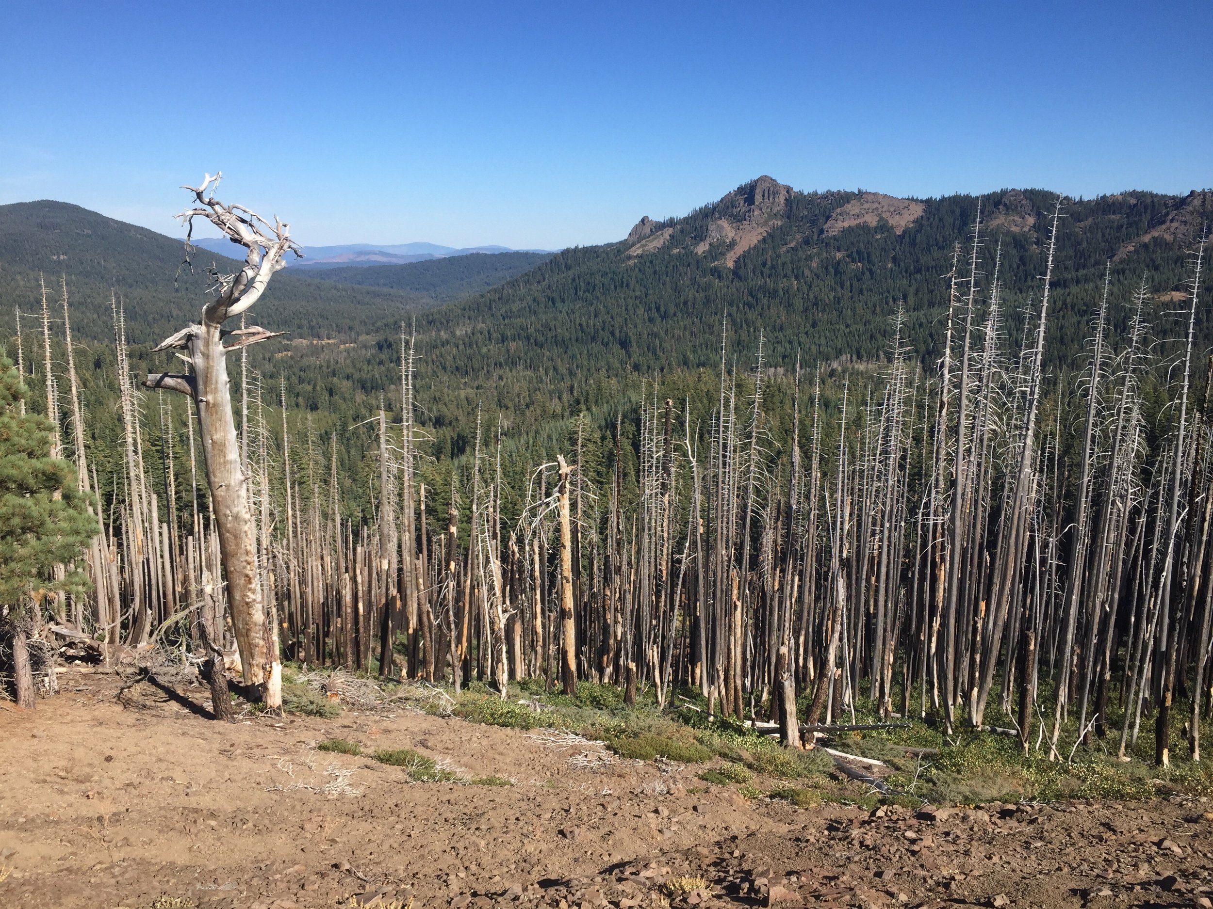
Looking north across the burn zone
Much of the rock stood in bulbous columns that would fit right into a Dr. Seuss book, and made a great counterpoint to the silver sage, windswept Jeffrey pine, orange buckwheat, and pale earth. We noted the transition from volcanic rock to sedimentary in the mid-afternoon, though both made similar formations and were hard to distinguish from afar. The most common plant on these exposed slopes was mule ears, whose usually supple and leathery leaves were brown and crisp at this high elevation in early September. Wind rattling through the dried leaves sounded like a distant rhythm section keeping time with our hiking pace. At one point the wind whipped over a narrow ridge and kicked up a tall dust devil that whirled across the trail right in front of us. With the clear sky and otherwise hot sun, we were plenty happy for even this stiff breeze. We passed short side trails to a few nearby springs, but didn't need water and didn't stop. By late afternoon we hit and old burn zome, and the low angle sun shone on the pale white snags.

ToeCutter is so happy we showed up, and is reluctant to let us slip from his grasp

We are on our way to Mexico, and here's a sign to prove it as we leave Humboldt Summit
We hadn't seen a single hiker since leaving Hwy 36, and were just discussing that this would be the first day in weeks that we hadn't seen anybody at all on the trail, when we approached Humboldt Summit and saw an SUV parked at the trailhead. There were 3 low-slung chairs nearby at the rim of the overlook, with a great view of Mt. Lassen and the ridges from whence we came. I was headed across the road to the trail on the other side but Macro read a small note left in the dirt: "free beer for thru-hikers 100ft, just give a shout." We decided to wander over and say hi, and were greeted effusively by 60-something ToeCutter (PCT NOBO, circa late eighties) who was elated to see his first hikers of the day. He and the two friends had been at Burning Man, and decided to extend the magic with a meandering road trip home. With the current heatwave in the valley (he said 107F predicted in Chico today) they headed to the summit hoping to provide some trail magic, not realizing how few thru-hikers would pass at this time of year. He practically dragged us to the back of the SUV, and implored us to help ourselves to anything from either of two large and full coolers but especially cold beer. We were happy for a Sierra Nevada each along with apples, string cheese, and dill pickles. We sat down to socialize, unaware that our arrival had set in motion a spinning wheel. A constant stream of stories thinly connected by the threads of outdoor and adventure came flowing from ToeCutter, without any need for us to give more than the occasional nod. We met his two friends from Germany, who offered "we do not say much, since we are with somebody who talks plenty." Enough said. ToeCutter was a generous guy, and highly entertaining, but we had miles to go and our little interlude meant we would likely be reaching camp after dark. Macro had finished his beer and I discreetly poured the remaining half of mine into the dirt, and we stood to go. We graciously declined offers of firing up the BBQ for dinner, providing water so we could camp there, and even a few beers to go ("you can pour it into ziploc bags if you don't want to take the glass bottles"), though we happily accepted a bag of Triscuits for the road.

One final knoll before we drop back into the forest headed for the Butte County high point

Sunset as we complete our day's hike towards Humbug Summit
We enjoyed evening golden hour on more of those mystical rock stacks as we climbed away from Humboldt Summit and meandered through one final open ridgeline filled with twisted and stunted Jeffrey pine. From there we crossed several forested slopes, passed the non-descript knoll that is apparently the high point of Butte County (according to the sign) and dropped down through dry meadows at dusk before turning on our headlamps for the final mile or so to Humbug Summit. We reached Cold Springs, a piped spring and our campsite destination, to find ourselves alone once again. We wondered when we would see our next SOBO.

Cold Spings is piped for easy collection

High grassy meadow

Buckwheat flowers and cool rocks

Macro checking out the firecracker flowers
On Day 67 we got an early start, anticipating another hot day and knowing we would drop to a low elevation at Hwy 70. The first several miles were pleasant rollers across a high open plateau covered with wide swaths of young replanted trees. There have been many blowdowns in the forest since Humboldt Summit, and it was good to see regeneration. We were surprised to see a hiker in front of us just as we started the climb to Frog Mountain, and met Windroamer - a section hiker who started at Hwy 299 and is hoping to make it to Yosemite. He carried both front & back packs and was not moving quickly, so it seems unlikely that we will see him again. He did say he had camped with Pitbull the night before last and we wondered if/when we might cross paths. On the far side of Frog Mountain we had another rolling stretch but this time through dramatic high country with deep red flaky rock, stunted Lodgepole pine, and wide meadows filled with golden grasses and dotted with occasional firecracker flowers or asters still in bloom. The sky was a clear deep blue, and we were happy to be done with the smoke that had followed us for so many days. The day was warm, but pleasant with the breeze and the stunning surroundings.

One of many creeks on the way to the Feather River Canyon

It looks like it's gonna get hot as we continue our descent

The North Fork of the Feather River

Some old mining equipment at the trailhead

Historic Belden Town bridge over the north fork
We started our long and gradual descent towards the north fork of the Feather River at Hwy 70, and transitioned through a number of different ecosystems. The most obvious change was a proliferation of creeks as we dropped first into a forest of Douglas fir and Incense cedar and then through stands of Sugar pine and finally into mixed forests with dogwood and maple. We crossed Chips Creek a few times as it tumbled down the canyon and appreciated the natural air conditioning of the rushing water over tumbled river rocks, though there was plenty of algae and we wouldn't have chosen this for a drinking water source. Lower still we passed our last creek and came into open slopes of oak and scratchy brush. The heat increased and the bugs came out as we descended. Although there are no mosquitos this late in the season, those little flies that hover around your face darting in to your eyes, nose, and mouth are prolific at the lower elevations. Although they don't bite or sting, they drive me nearly mad and since I don't know their real name I just call them terrorists. After a few switchbacks I gave in and put on my headnet so I could stop swatting at them and concentrate on the terrain. Several miles from the highway we entered an old burn and the remaining descent was on exposed slopes in blazing sun with minimal breeze. The lower we dropped, the hotter it became. Between the bugs, poison oak, and sweltering heat it was reminiscent of the approach to Seiad Valley. We knew there was a short road-walk through Belden Town then a stiff climb up the other side of the canyon. My only hope was that the old fire hadn't jumped the river, so that we might have some shade on that ascent. We walked under some high-voltage power lines and were just a hundred feet or so above the highway and river. I was hopeful we were nearly to town but then the trail turned and made a circuitous 2-mile path (including another ~500' elevation gain & loss) to the next canyon, upstream to a footbridge over Indian Creek, and back down the other side complete with hordes of flying terrorists. We finally dropped to the road at the historic Eby Stamp Mill trailhead, across from the old Belden Town bridge.

Belden Town, in a nutshell
By the time we reached Hwy 70 it was after 3pm and I was nearly melted from the heat and constant exposure. The air was still and at 2000' in elevation it was in the high nineties even at this time of day. As we walked across the bridge I looked down to see a group of people sitting on lawn chairs right in the water of the Feather River and was quite envious. Belden is a tiny little town, really just an old resort with hotel rooms and a few cabins and a small RV park, along with a few abandoned buildings from the mining days. It was a little creepy, though the people were friendly enough. We saw another thru-hiker in front of the resort, and finally got to meet Pitbull. He was just headed out, with a plan to hike another 10 miles, so we chatted briefly before he left. Although we also planned to make the climb out of Belden this afternoon and camp about 6 miles up the trail, I was concerned about the heat in combination with the climb and suggested that we buy a bag of ice to help keep us cool. Macro was dubious, but it was only $2.50 for a 7# bag so we added it to our other purchases (Otter Pops 4/$1, Kern's nectar $2.50, two ice cream bars $4 each). We headed out to a picnic table in the shade and filled our reservoirs with as much ice as they would hold, then filled our hats and my sportsbra with the remainder. While we were eating and distributing ice, we were approached by a middle-aged guy drinking Coors Light while waiting for his cabin to be ready for check-in. He asked if we were PCT hikers, and was excited to learn that we were hiking the entire trail. He was clearly well into his case of beer but was an enthusiastic supporter of our hike, exclaiming that it was on his bucket list for when he retires and all he has to do is stay healthy until then. I'd have to admit that he didn't appear as though he could hike even 500 miles in his current shape, though we refrained from pointing that out and wished him luck as he did to us. His wife just shook her head as he told her he was going to hike the entire Pacific Crest Trail. You never know what somebody might do.
-Huckleberry