Mazama Village at Crater Lake to Hwy 140 (51.4 PCT & Alt miles, + 2 undesired bonus miles)

The forested trail south of Hwy 62 seemed to be made just for us, other than our vizsla welcoming committee that we saw in the first 5 minutes.
After a leisurely brekkie at the Annie's Creek restaurant, we headed back to the laundry area to reclaim our external battery from the wall outlets. There were several new NOBOs opening their resupply boxes and they quickly generated a de novo hiker box against the wall with their discards. My haul was two foil pouches of buffalo-spiced tuna, a bag of nut-heavy trail mix (while many thru-hikers eat trail mix constantly, it's a novelty for us) and salted caramel GUs (oddly enough, I've actually been jonesing for GUs on-trail). We were filling our water bottles and about to head out when we saw two familiar faces coming across the parking lot - Happy Feet and Delta. It had been 9 days since we saw them, or any other fellow SOBOs, so of course we delayed our departure for a brief reunion. We learned that Long John went off-trail in Bend due to shin splints, and is waiting for them in Ashland (where he was planning to finish his section hike) before they continue south into CA. They had camped at Grouse Hill last night and hit the trail early today to catch the sun rising over Crater Lake from the rim. They confirmed that they hadn't seen any other SOBOs, and thought that we were behind the early-starters and speedsters by several days but apparently ahead of everybody else. We gave them the low-down on showers & laundry, and told them about the brownies we got from a friend. It turns out they were hoping to successfully pick up a package addressed to Long John in his absence, as his girlfriend had sent blondies and it would be a serious shame to let them go to waste. Delta and Long John (cousins) are always being mistaken for brothers on the trail, and he had a picture of Long John's ID, so it seemed likely they'd be successful. We wished them luck and said we had to get on it as we had 21+ miles to go in the blazing heat and it was nearly noon. They had initially planned to resupply and head out later today, but when we told them the first water source was 18-19 miles in, they seemed to be re-considering. On that note, we set out across the parking lot and hoped to see them on-trail in the next few days.

The SOBO reunion at Mazama Village. L->R: Happy Feet, Huckleberry, Macro and Delta
In the many days since we last saw any fellow SOBOs, Huckleberry and I have been discussing where everyone might be, it's a bit of a game to see if we are correct. The trail works in mysterious ways, so you never know - we didn't know how long the guys had planned to stay in Sisters/Bend, so thought there was a 50-50 chance they were still behind us. Now we know. Here is what we know (or guess) about the others: Beanstalk and Kangaroo (aka Dustin) are ahead of us by a few days, though Kangaroo will soon be off-trail via Etna for a week and will likely catch up to us later. It seems unlikely we'll catch Beanstalk, but anything is possible. Nuthatch (@nuthatchheadedsouth) and Sherpa (@benwacha) likewise are off-trail (via Bend) to attend a wedding and will return but are considering flip-flopping the Sierra so who knows when/where we'll see them next. The girls have split up and based on IG posts, Spice Rack (@tangertots) is 5-6 days behind us, Candy Cane (@alyssf) is a day or so back from that, and presumably Crusher is also somewhere in that vicinity. F-Stop (@michaeldeyoung) is off-trail to help his wife with an injury and plans to return to hike OR, so we may not cross paths. Liam we haven't seen or heard from since Stevens Pass but based on another SOBO blog it seems that he may be "Red Runner" and if so is about a week behind us now. The French Connection (@incase_we_die) is working their way through OR, last post from Ollalie Lake a day or two ago (trail names Refill & Dirt Arrow, unknown if the others have them yet). We assume Grim is somewhere behind us, and hope he is still on-trail and that his knee pain hasn't derailed his triple crown attempt. We haven't seen Maurice/Wrong Turn since he headed into Portland via Cascade Locks and assume he is behind us, though could easily be wrong as he hikes fast and we don't know his resupply plans. Jesse & his dog Luna we haven't seen since before Trout Creek and it seems likely they are still behind. The rest of the "dirty dozen" cum "wolf pack" is working their way through central OR, several days behind us based on social media. Our little group of SOBOs has certainly spread out in the past 6 weeks. It strikes us as pretty funny when NOBOs we pass say things like "there are SO many SOBOs this year." Sometimes we smile and let it slide with a comment like "I think there's more of everybody this year" (just how many years have they thru-hiked for comparison?), other times we ask how many they've passed, and they reply that they've seen 2, or 3, or 4 in the past week. Strange, since we've seen 40, or 50, or 70+ NOBOs every single day for the past several. Hmmm. In any case, there are far more of them than there are of us, and we feel a different kind of bond with our fellow SOBOs.

A ridgeline! Happy to almost have some views again.

Dry grasses bowing to the breeze amongst the ghosts.
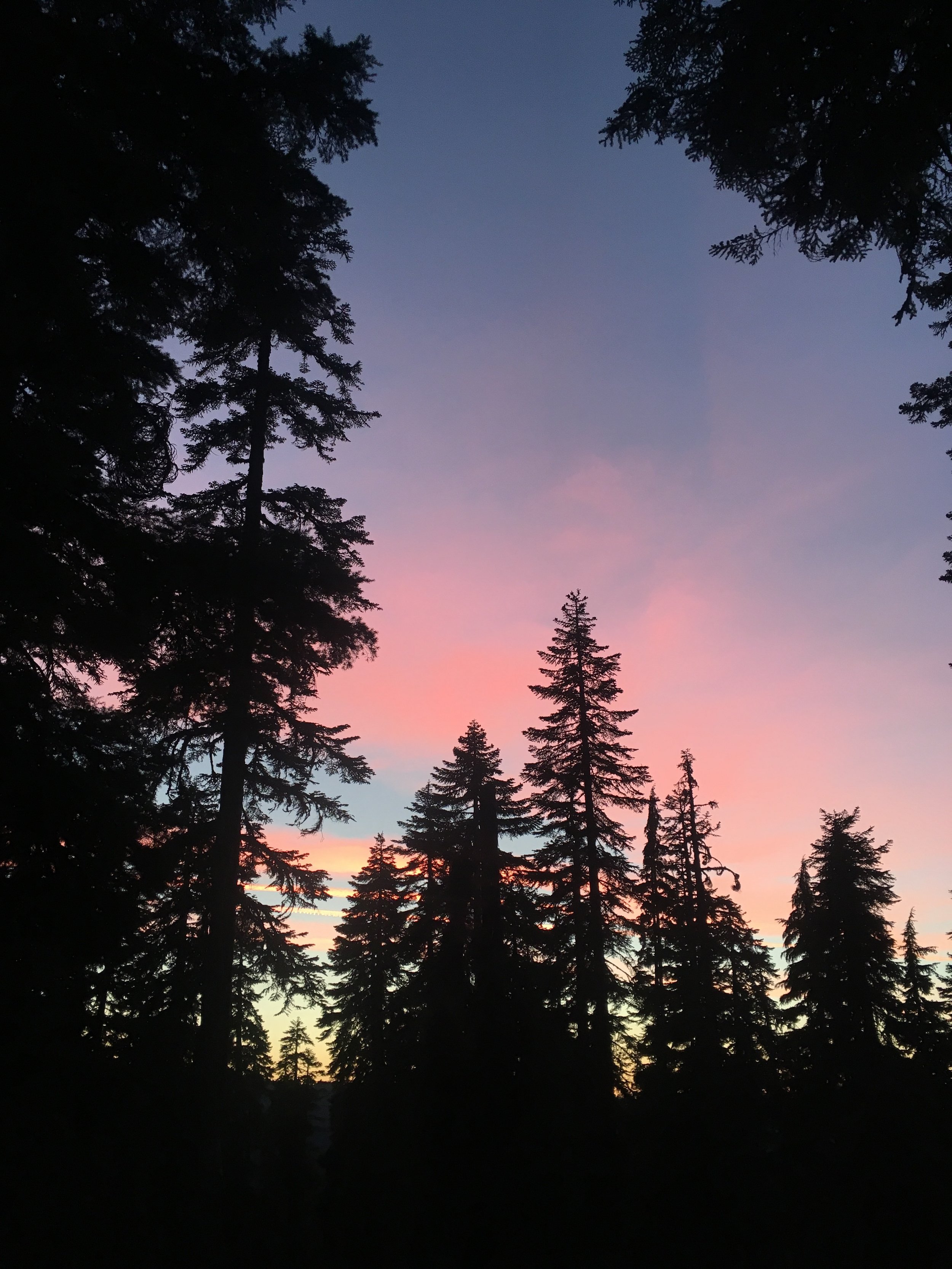
We left Mazama Village and bushwhacked through forest up a steep but thankfully short hill to the shoulder of Hwy 62, having been unsuccessful at locating the "guard-rail alternate" that allowed us to avoid backtracking. We didn't save any time by this approach in the end, but did get there. The trail then took us through more forest similar to what we had seen at the northern end of the park. Apart from seeing one very energetic vizsla running happily all over the place with some day hikers, the early miles were uneventful. We had been told that blowdown started just beyond the park boundary and sure enough we had to navigate downed trees as soon as we entered the Sky Lakes Wilderness. At first we were rather underwhelmed by this new wilderness region. While we were on ridgelines with good sky views and passed through several high meadows, nothing was all that spectacular considering that we still had Crater Lake on the mind. It seemed to be a relatively dry forest despite its watery name and struck us as funny when we noticed on the map that we would even walk through a region called the Oregon Desert. As the afternoon progressed we entered another burn zone. It was the beginning of golden hour so the soft light gave everything a more colorful and pleasant appearance. There was also a persistent breeze that took the edge off of the blast furnace heat. We hadn't seen any hikers for a while and the only sounds were the breeze in the trees, the creaky swaying of forest ghosts (our term for burned snags) and the "clack, clack, clack" of the California grasshoppers flitting about underfoot. It was all strangely serene. As we hiked further into this burn zone there were two other things I noticed. First, many of the features and peaks listed on the map were actually visible, but would have been obscured by the forest if it were still full with original growth. Second, this burn zone had the most prolific regrowth of new trees amongst ghosts that we had seen anywhere on our journey so far. It was fantastic to see.
Fun Fact: In National Parks (managed by USDI) trail crews are allowed to use chain saws in the wilderness, while in wilderness areas within US Forest Service land (managed by USDA), chain saws are prohibited along with all other mechanical devices, so blowdown has to be either hand chopped or sawn, usually with a two-person cross-cut saw. So when you seen 40" diameter downed trees cleared from a trail in the USFS wilderness lands, be very thankful to those whose incredibly hard work went into clearing the trail.

The new generation sheltering under the gaze of the ghost generation

Every burn zone in OR has had bleeding hearts blooming in the harsh dry conditions. Yet, at plant nurseries it's sold as a water loving shade tolerant plant. Hmmm...
Cirrus clouds capturing the sunset light that we couldn't see. It made for a tranquil evening climb.

Devils Peak under a starry sky.
As the late afternoon progressed, we had returned to intact forested slopes. There was still blowdown that we had to negotiate that slowed our progress, but was not otherwise difficult to navigate. We passed two NOBOs in the early evening who let us know that we'd be done with blowdown in less than a mile and would have clear trail for another 5-6, but tomorrow would find a 10 mile stretch of "terrible" blowdown. They were somewhat frustrated by how it was slowing their pace and were a little disappointed when we told then that it continued off and on to the park boundary. As we went our different ways, I commented to Huckleberry that this is what we would call starter blowdown vs what we encountered in WA. These trees have all been down long enough for established user trail detours to exist, none are large enough in diameter to pose a serious challenge, and are infrequent with only rare combos of multiple downed trees in a row. Anyhow, we were happy that we would soon be clear of them for a bit. As evening progressed and we still had miles to hike, we were very happy for the distraction of ripe huckleberries on the trail! We had not seen any since Shelter Cove and were missing our little trail snacks. It was also starting to get dark enough that we pulled out our headlamps for the last few miles. Similar to other nights we had small swarms of insects attracted to the light and there were toads on the trail we had to make sure not to step on. At least the toads have a bright white stripe that runs along their backs making them easy to spot. Finally around 9:30PM we arrived at our intended campsite near a creek just below Devils Peak. We found that 3 tents were already set up in the obvious spots, so we located the least marginal of the remaining space, pitched our tent, and set about filtering water and making dinner before crashing into bed. As I was finishing the water filtering, the moon rose and discovered that our campsite had some spectacular views of Devils Peak. I set up our camera to capture some long exposure photos before heading to bed.
Dawn over Devils Peak and the promise of a good day.

Geographical timeline. Next stop on our journey will be the far side of Mt. McLoughlin.

Huckleberry walking through the newer burn zone. May these ghosts be patient as they wait.
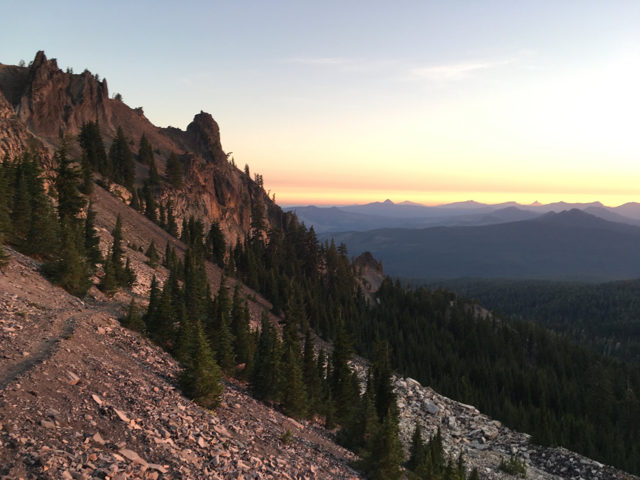
Day 46 started way too early. We had made a plan to aim for our longest distance day, ~36 miles, and planned a pre-dawn start. We enjoyed the cooler morning temps through the climb over the shoulder of Devils Peak and got to see sunrise from a high rocky traverse as we approached Shale Butte. It was a stunning morning. We finally saw the many lakes for which the wilderness is named, as the trail weaved in and out from one slope to another. My previous low opinion of this wilderness was replaced - it became a sleeper hit. We walked through a very recent burn zone after the morning ridge traverse and it was a pretty amazing contrast to the one we had hiked through just yesterday... a potent reminder yet again that regrowth will take a long time. We also saw our next mountain landmark, bulky Mt. McLoughlin dominating the horizon to the south. As we descended from the ridges, we hit that stretch of blowdown we'd been hearing about since Shelter Cove. Although the well-established user trails around the obstacles eliminated any real challenge, our progress was significantly slowed. We found several patches of ripe huckleberries lining both sides of the trail, a welcome diversion as we knew there wouldn't be any edible fruit once we leave Oregon for northern CA. As we hiked on, the day grew hotter and hotter, and the combination of a late night and early start were catching up with us. We made it up to the shoulder of Mt McLoughlin much later than we expected and realized that our initial plan of 36 miles was ridiculous given the conditions and our state. We settled on Plan B, to get water at a creek just 4 miles down trail, make dinner there, and hike another hour or so before making dry camp somewhere on the flanks of Brown Mtn to pull off at least a ~29-mile day.
At the junction with the summit trail, we ran across a section hiker/completer from Eugene (trail name GoDucks,) who had just started at Hwy 140 heading north to Hwy 138 (Shelter Cove). We had a snack and chatted for a while, leaving at 4pm with a plan to be at the creek/highway by 5:30. As we left, he let us know that the trail was 4 miles of gentle and smooth downhill to the creek and Hwy 140. He said if we needed water sooner, there was a closer trailhead with a creek, that is the way he came in. We were both exhausted and happy for a downhill hike and the prospect of a short break and dinner before the final miles. We waved goodbye and headed down the trail. Just 0.2 miles later, we made a simple but big mistake and took the wrong trail. We saw the sign that said trailhead pointed downhill and followed it down a steep and rocky trail, thinking that trailhead meant highway and GoDucks had an interesting idea of gentle terrain. We passed the wilderness boundary much sooner than expected and within 20 minutes came to a creek. At that moment, we realized we'd made a mistake as it was far too soon to have gone 4 miles. Sure enough, we had arrived at the wrong trailhead via a steep 1-mile trail, and now had to trudge back uphill nearly to where we had our short break. In that moment the wheels came off of our day and we realized that we had expended any energy we had for the hour of post-dinner hiking in this little 2 bonus-mile mishap. Having used up the reserves of our energy and daylight hours on the mistake, we settled on Plan C which was just getting to the creek to camp and call it a day. We knew that food and sleep were the cure for our current dilemma and that tomorrow would be a better day. At the junction we saw that the sign on the other side of the tree was clearly marked both PCT and Hwy 140. We reminded ourselves of the lesson to pay attention especially when tired, and resolved not to fall into this trap again.
"Now blessings light on him that first invented sleep! It covers a man all over, thoughts and all, like a cloak; 'tis meat for the hungry, drink for the thirsty, heat for the cold, and cold for the hot. 'Tis th current coin that purchases all pleasures of the world cheap; and the balance that sets the king and the shepherd, the fool and the wise even."
~Miguel de Cervantes

The seed heads of the flowers we called carrot lilies under Shale Butte.

Shale Butte a photo I took just before the ill fated step on the slate xylophone.
While enjoying all of the scenery walking just below Shale Butte this morning, I took a small mistep on the shale lined trail and a rock flew up to hit the inside of my right ankle. It was one on of those "Ouch! Oh, that's going to hurt" moments. Sure enough, as the day and miles wore on, it proved to be painful but functional. I was walking though it and modifying my steps to account for the discomfort. I was replaying that moment in my mind, why did I take that step, why did I not see that rock, why now, all sorts of not-so-helpful thoughts poured through my mind all afternoon. I found that it felt reasonably okay until we stopped at our break and chatted with GoDucks. Once we stood up, my right ankle was quite stiff and sore. I made it down to our campsite and after setting up our tent, took off my shoes to see that just below my right ankle the foot was pretty swollen. Taking a page from Huckleberry's playbook (thankfully she's back at detente with her feet), I hobbled around our campsite and soaked my feet in the creek. I found myself drinking tons of water before dinner and it struck me that after two long days I felt pretty dehydrated and knackered. After dinner, I went to bed and took some ibuprofen, not knowing whether or not my ankle would be a simple problem, a deal breaker for our trip, or something that would be OK but with lingering complications. Fortunately, the few times times I woke up during the night the ankle felt better and I had more flexibility. In the morning, while it was still somewhat swollen it was so much better. Touch wood, it looks to be a minor injury. Onward to Ashland, where we will zero in preparation to finish up Oregon and head over the border.
-Macro