Mt. Laguna / Laguna Mountain Lodge to the Mexican Border (42.3 PCT & alt miles)

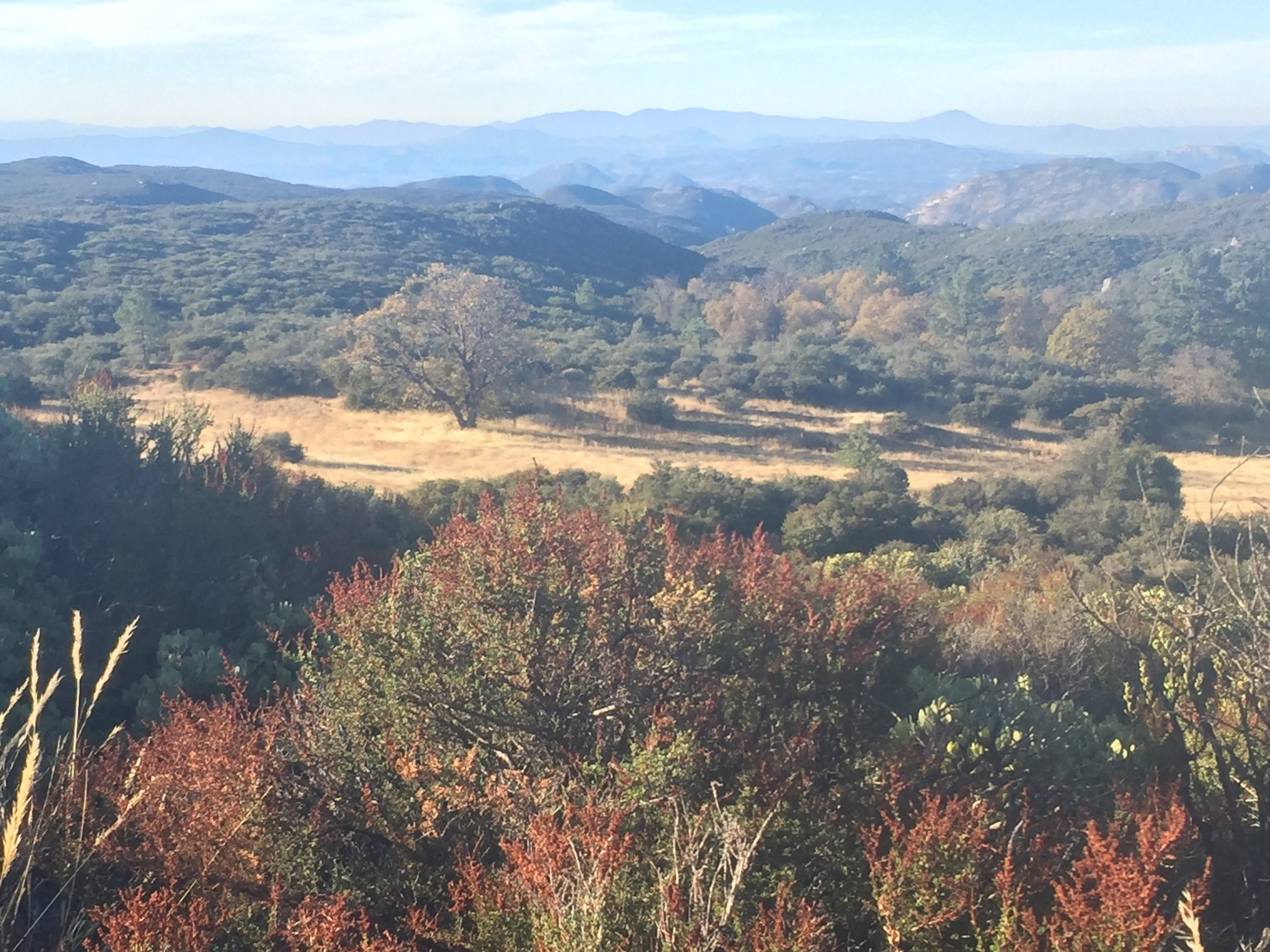
Golden fall colors in the oaks and dry grasses around Mt. Laguna in early November
When we left Idyllwild we expected that it would be our last town stop of the journey. We would break up the 160 remaining miles into six 25-mile days and a final 10-mile day to the border. We'd swing by Mt. Laguna to pick up our resupply package for the final few days, but didn't intend to stay there. Looking at our maps in conjunction with the water report, we realized that this initial plan didn't mesh well with available water sources and potential campsites. Instead, we decided to increase our mileage for the initial days then hike just 10 miles into Mt. Laguna, where we would stay at the Laguna Mountain Lodge for an unexpected late-trip nero. This would set us up for a long-ish hike to Hauser Canyon the next day, and just 15 miles (waterless) to the border from there. At first we weren't certain that we would really want to take so much time off so close to the border. It turns out that after 4 long, hot days of hiking combined with dry camping each night, we were both ready for showers and a little leisure time. When we arrived at Laguna Mountain Lodge in the late morning and rooms were available, we didn't hesitate to take one. Spending an entire sunny but crisp fall afternoon in Mt. Laguna without much to do was a perfect recharge for the final miles of our journey. After a meal at the Pine House we stopped by the legendary Mt. Laguna outfitter to check it out. Being so close to the border, this is the first resupply spot for most NOBOs and a place where many purchase new shoes and/or gear after realizing that what they started with won't work for the next ~2610 miles. The hiker box here is famous for overflowing with enough discards early in NOBO season that you could completely outfit yourself for a thru-hike from its contents. We walked in and found ourselves in a tiny windowless space crammed from floor to ceiling with gear and clothing. From somewhere in the back corner a girl asked if we were runners in town for the race. We must clean up well despite all of the miles because she was surprised that we were actually hikers. Upon hearing that we were SOBOs she asked if we started from Canada (yes), then followed up with the surprisingly common question that has become a running joke between the two of us: "Oh, are you Canadian?" Usually we just smile and say "no, we're from near San Francisco, we just chose to hike the PCT southbound" or something equally benign. Today, in this renowned PCT-friendly shop and just 3 days from the end of our journey, I couldn't help myself and blurted out "Why do people always ask that? Do NOBOs get asked if they are Mexican just because they started hiking at the Mexican border?!" She looked a little sheepish, admitted that she'd never been asked that herself, and agreed that it did seem like a silly question. We all had a laugh and learned that she NOBOed last year. She met her now-boyfriend (a fellow NOBO) around Warner Springs, and although they live in San Diego they come up some weekends to help out in the shop. We were the only customers around, and had a good time exchanging stories of gear and the trail with the pair of them and the owner Dave. Browsing the tiny store we were amazed at how well-stocked it was. Anything we could imagine wanting was there, and all at fairly reasonable prices. Of course we didn't make any purchases just ~40 miles from the border, but could imagine how this little place could feel like a candy store to inexperienced backpackers with inappropriate gear who arrive just a few days into their journey and suddenly have an opportunity to make changes.

Sunrise on the PCT headed south from Mt. Laguna
Meadows, oaks, and chaparral as far as the eye can see after leaving Long Canyon behind

In SoCal, chaparral usually includes at least a smattering of yucca

Looks like even the cactus are showing a little fall color (they didn't want to be left out)
I tried not to pay attention to the clock time when the alarm went off on day 125. Somehow, being indoors instead of in a tent highlights the fact that we are getting up very early now that daylight savings time has ended, even though our waking hour based on "sun time" has not changed. We left our room key in the night-drop and headed back towards the trail in the pre-dawn light. The Desert View nature trail led us back to the PCT, where we arrived just in time for sunrise over the desert. Shafts of sunlight filtered through the oak trees with their yellow leaves, making a perfect fall scene as we followed the contour of the hill through mixed forest. The trail made a gradual descent through chaparral, then dropped into Long Canyon where we crossed the dry creek bed and continued down its drainage for a mile or so passing maples, oaks, and thick vegetation all showing signs of the late season. The sky was clear and the early morning was nice and cool. As we left the canyon behind for more chaparral-covered hills, the day grew quite warm and we pulled out sun hats, sleeves, and gloves well before noon. We were happy for even an intermittent and light breeze in this exposed terrain. When we dropped down to cross tree-filled Fred Canyon, we took advantage of this short stretch of shade and had a very early lunch sitting on a large downed log. It was a short climb to the next saddle where we suddenly had a strong cell signal and could see the broad curves of the I-8 freeway cutting through the hills down below us. Beyond that, the buildings of Cameron Valley surrounded by their bright green patches of irrigated land completed the reminder that in SoCal, we are never too far from the trappings of civilization.

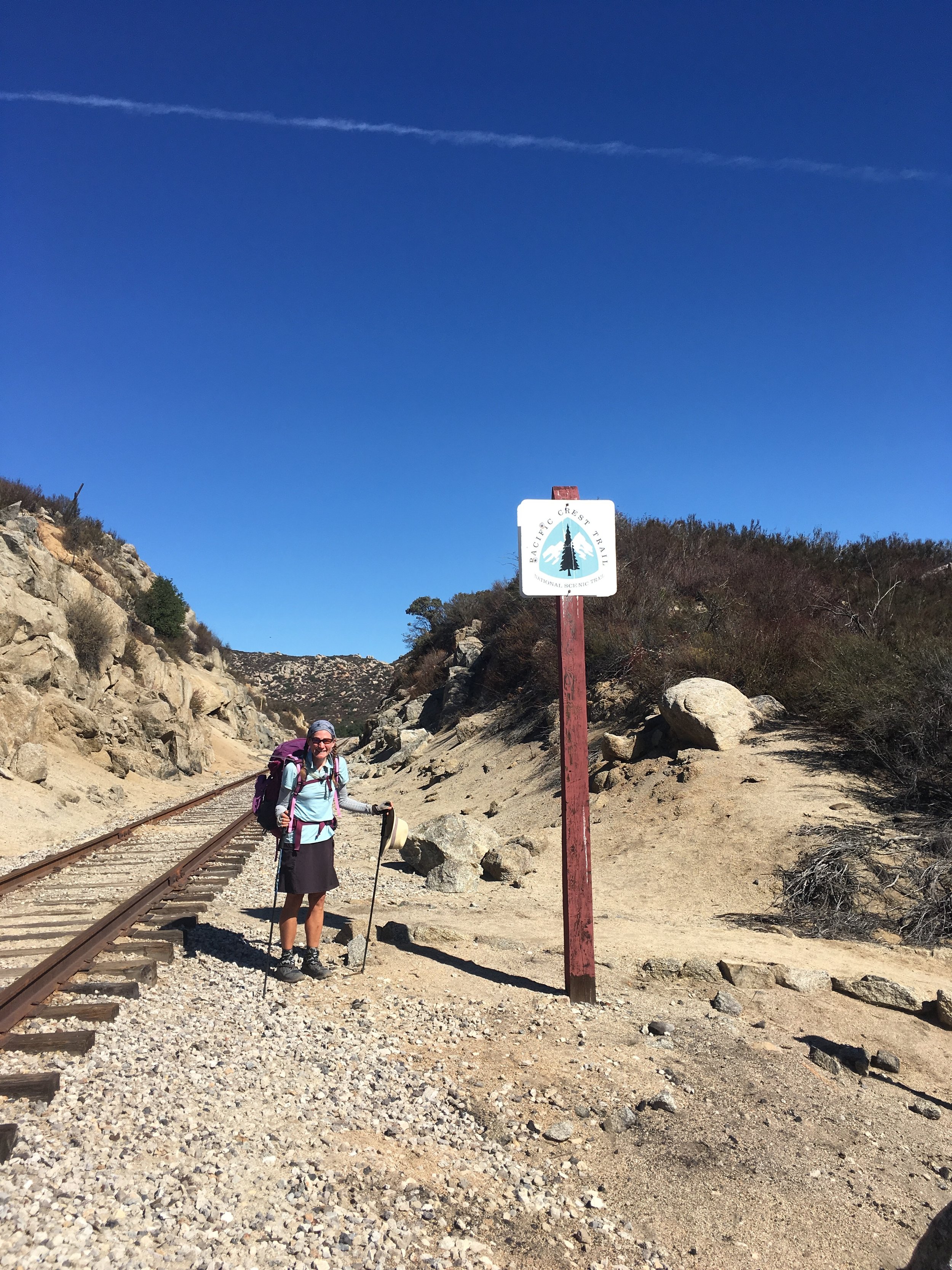
PCT trail marker at the Kitchen Creek Road crossing

Rock formations above Kitchen Creek

You'd never know a busy interstate freeway is just around the corner from this view along the Kitchen Creek drainage

The PCT passes under I-8 alongside sage and mature Cottonwood trees
After a hot, dry, rocky traverse overlooking the freeway (but far enough away that we couldn't hear its noise), we crossed deserted Kitchen Creek Road and dipped back into the steep hills of the Kitchen Creek drainage for a few more miles of nature under thin, wispy clouds. The creek and falls are currently dry, but a wide swath of cottonwoods were a sure sign that water sometimes flows. The trail here is surprisingly well-shaded by tall manzanitas and quite scenic with dramatic rocky outcroppings all around. On a hot Monday afternoon in early November, we were surprised to come across a pair of day hikers, guys in their mid-20's. They asked where we were coming from and upon hearing Canada, they replied not with the dreaded question but instead with "Wow, you're the real deal! And you're almost done!" It was a little refreshing not to have to explain ourselves for once and we were buoyed by their positive energy. Not long after that, we ran into a couple heading north with backpacks and gear that looked like they could be thru-hikers, but the season was all wrong. When asked where they were headed they replied that they didn't know, a sure sign of a long-distance hiker. We stopped briefly to chat and learned that they were doing a long section hike from the border to Hwy 58/Mojave. They inquired about snow levels and at first I was confused since they weren't going as far as the Sierra Nevada. Macro realized before I did that they meant in the SoCal ranges, and they were happy to hear that there wasn't any snow yet from the recent storms. Upon learning that we were bona-fide SOBOs coming all the way from Canada, they gave us "congratulations in advance, to be saved for use tomorrow" at the Mexican border. We wished them luck on their own hike and after leaving them remarked that we hadn't seen many people on the trail through most of SoCal and this seemed an unlikely spot for a cluster of hikers, so close to the freeway. We came out of the manzanita and had started our final descent towards I-8 when we saw yet another hiker, a guy with a larger build carrying just a day pack and covered up against the sun. He had stopped to rest as we passed and we commiserated briefly about the heat. We were 20-30 yards beyond him when he called out that he had a question that might seem funny, but had we been hiking near Vincent Gap a few weeks ago? The day before it rained? Of course we had been, and after a short exchange realized that we had shared a brief conversation on the trail there as we headed up Mt. Baden-Powell and he was on his way down. He had been on a short backpacking trip from Vincent Gap to Islip and back again, and recognized us from my hiking skirt. We remembered talking to him since although there were a slew of people on that stretch of trail, most were day hikers and he was the only backpacker not accompanied by a group of Boy Scouts. We all marveled at the coincidence of a second meeting this far south and he was impressed to learn that not only had we been walking since our first encounter, but we had started way back at the Canadian border in early July. With a huge thumbs up from him and intel that the Boulder Oaks trailhead just beyond the freeway had bathrooms and water, we continued along. We were funneled between a chain-link fence and barbed-wire fence down several short switchbacks towards I-8. Where the trail actually passed under the road was more scenic than most major road crossings as we followed the cottonwood-shaded path of Kitchen Creek well below the elevated interstate.

The bridge over Cottonwood Creek (dry)

Granite knolls surround the Lake Morena area
Once we crossed I-8 it really hit home to both of us that we were on countdown Day 2, and very close to the completion of our journey. The only section of the SoCal PCT that either of us had been on prior to our hike is the few miles between the Lake Morena campground and Buckman Springs Road, where we went for a trail run a few years back when we were down here for the Day Zero Kick-off event (ADZPCTKO). Seeing this stretch of trail on our current map page suddenly made very real the fact that we are within striking distance of the border. With this realization, we made good time through the dry fields of Cottonwood Valley. We walked very close to a high school and fire station as the trail parallels the road for a mile or so, but few cars passed by. We recognized the white brick arches of the Cottonwood Creek bridge as we walked underneath in the sandy dry creek bed. Its underside was lined with muddy swallows nests, reminding us of the pedestrian bridge across the South Fork of the Kern River. It seemed so long ago that we came out of the Sierra Nevada and crossed that bridge en route to Kennedy Meadows. The trail climbed up and over a granitic hill covered in low brush and yucca. From the high point we could see that where Morena Reservoir was already just a shallow puddle a few summers ago, it is now just a grassy field as the CA drought continues. Despite the heat we kept up a great pace as we planned to stop for dinner and water at the campground, had heard the store up the road sold ice cream, and had a serious case of "smelling the barn" at this point.

There's just a small pool of water in Morena Reservoir down by the dam, and it shimmers at sunset
We arrived in Morena Village before 4pm and headed straight for the Oak Shores Grocery, where indeed they had ice cream, and each enjoyed a small double-scoop cone while hiking back to the campground as the sun dipped below the hills. There were a few RVs scattered through the large campground, but it was otherwise deserted and we commented on the perfectly raked ground around each fire ring. We cooked and ate dinner at a picnic table, then refilled our water and set out for what would be our last night on-trail. The early evening light was magical with pinks and oranges in every direction as we climbed up another granite knoll. From this vantage point we could see that there is actually some water in the southwestern section of the reservoir near the dam, and it glittered with the reflection of sunset. We donned headlamps for the final few miles into Hauser Canyon, a series of steep switchbacks down the side of rocky Morena Butte. Even in the dark the air remained warm and we didn't need any extra layers tonight. We found a campsite among mature oaks near the dry creek bed and went to bed early, both a little incredulous that tomorrow would be our last day of hiking.

Yep, unexploded military ordnance would keep me on the trail

Various dangers of the desert, en español

Another sign co-opted as an informal trail marker

About 2649 down, and just ONE little mile left to hike
Throughout this hike we have noted differences between our own SOBO experience and that of a typical NOBO. The SoCal section is our last, but it is where most PCT thru-hikers start. While we began our hike deep in the wilderness of northern WA with no roads, cell signal, or buildings for over a hundred miles, their early trail is never far from dirt roads and power lines. As such, some of the most recognized "sights" of the early PCT miles are signs rather than natural features, and we have seen countless pictures of these icons over the years. On Day 125 we passed one of them, a (misspelled) sign warning of unexploded military ordnance in the area. Hikers are advised to stay on-trail, and not approach or touch (!) any explosives. Posted near a picturesque knoll topped by a mature oak and surrounded by tall golden grasses, this sign seems especially incongruous and we couldn't help but have a small laugh at the oddity. According to our map, the sign was placed after a Marine helicopter crashed nearby in 2009, scattering munitions. Climbing out of Hauser Canyon the morning of Day 126 we reached unpaved S Boundary Road and came across another well-known sign. This one depicts various dangers of the desert with several warnings in Spanish including "not worth it" (No vale la peña), presumably directed towards immigrants from beyond the border as most thru-hikers would not necessarily speak Spanish. One of these signs has been spray-painted with "PCT" and an arrow pointing to where the trail departs the road. Once again, the origin of the sign is not a laughing matter but it feels so foreign to our early hiking experience that we can't help but stop and take a few pictures. The final iconic sign is the green highway-type marker near Rancho del Campo reading simply "Mile 1" with a PCT sticker below. There is no controversy here. We have been looking forward to reaching this one for a very long time.

Morning on the south rim of Hauser Canyon

So many burn zones along the PCT in SoCal

New shoots surround nearly every charred stalk in the Border Fire burn zone

Landscape near Campo
Our final day on trail was one of our hottest in SoCal, and there was very little shade once we crested the edge of Hauser Canyon. We walked through broad chaparral-covered hills in the bright sun, and wondered if we could see Mexico. Without knowledge of the surrounding hills, it was hard to tell which ones might be beyond the international border. We started at our usual early hour and by mid-morning were already in the single digit mile points. We walked through a small burn zone from a 2010 fire, apparently caused by stranded undocumented immigrants whose signal fire got away from them, and also an adjacent and much larger burn zone from the Border Fire that occurred in June of this year. Although it was hot and still sooty from the recent destruction, we were happy to see green shoots already emerging from the base of the charred skeletons through much of the affected area. We started our gradual descent towards Hwy 94 and the nearby train tracks, happy to have at least an intermittent breeze as the temperature climbed. Leaving the burn zone behind and turning eastward I saw a rust-orange fence stretching across the next set of hills, marking the US-Mexico border. It was 10:30 and we still had just over 4 trail miles to hike, but we could finally say that we could see Mexico from here!
The final set of railroad tracks, near Hwy 94

SOBO numbers 40 & 41 (PC - Julie)

Signing the trail register

Julie & Macro headed to the car on the US side of the international border
We picked up the pace knowing that we were really and truly almost there. We crossed our last set of RR tracks and our final highway, and passed a pair of day hikers between there and the small town of Campo. The trail goes through an older part of town filled with derelict homes, and joins a paved road for a short distance past a shuttered "juvenile ranch facility" overgrown with weeds. Not long after we departed this road on a trail, we heard a car slow behind us. Macro laughed, saying some local was probably about to offer us a ride for the last 1.22 miles. We turned to look when the car honked and saw Julie, with impeccable timing as she drove to meet us at the border. She rolled down a window and we all had a laugh as we agreed that she would continue driving and we would of course walk. As we had for the past 15 miles, we saw an amazing amount of Border Patrol activity in this final stretch of trail. Helicopters flew slow and low overhead, and we were passed by countless agency vehicles of all types. There was no mistaking the fact that we were steadily approaching the Mexican border, and it couldn't be more different than our experience at the opposite end of the trail. We reached the southern terminus marker early afternoon on November 8th, exactly 4 months after leaving the Canadian border on our southbound hike. The wind had picked up and it was positively gusty as we stood at the monument. We pulled out the register, found that we were SOBO thru-hikers #40 & 41 to sign in this season, and made our entries. We sat atop the monument for a good long time despite the wind and blowing sand, savoring the end of this incredible journey.
- Huckleberry

We are most definitely thru-hikers, and this hike is now through!
We leave you with one final top ten list, entitled "You Know You're a Thru-Hiker When..."
10.) 20 miles seems like a short day of hiking
9.) You never turn down an offer of food (or beer)
8.) Your gear includes at least 3 of the following: SmartWater bottle, silver trekking umbrella, Altra shoes, Dirty Girl gaiters, Z-rest sleeping pad, Sawyer Squeeze filter
7.) You'll get in a car with almost anyone to avoid walking a few bonus miles
6.) A 3-minute shower, even without soap or towel, is a luxury
5.) You'll spend any amount of money on "town food" but are loathe to pay for a place to spend the night
4.) Any flattish spot near the trail big enough to lie down in qualifies as a campsite
3.) Idahoans are a food group, hot sauce packets are a commodity, and an avocado is pure gold
2.) If you're wearing rain gear, it probably means your clothes are in the laundry
1.) You are somewhat gaunt and look vaguely homeless, but wear expensive shoes
Morning golden hour in the San Felipe Hills, and the only ocotillos of the entire hike
Fun Facts- Our favorite day in SoCal was Day 123, when we descended from the San Felipe Hills in magical golden hour morning light through ocotillos and countless cholla along with baby barrel cacti, crossed the desert plain to Granite Mountain, and climbed from there to Garnet Mountain with fantastic views to the Salton Sea and all the way back to Mount San Jacinto under a desert sunset. Our favorite trail dinner was Thai red curry with sweet potato and kale over flattened rice, which we enjoyed on Day 120 surrounded by manzanita at Rim Rock Ridge in Anza-Borrego Desert State Park. Our favorite campsite was on Night 100 under a Joshua tree south of Bird Spring Canyon where we had the most spectacular desert silhouettes against a star-filled sky.
By The Numbers- We left Kennedy Meadows the morning of Day 98, and reached the southern terminus of the PCT at the Mexican border around noon on Day 126, taking exactly 4 weeks to complete the Southern California section of the PCT. We covered 674 PCT & alt route miles and a few bonus miles during this stretch passing through 7 different wilderness areas, 3 state parks, and one brand-new national monument. We took our fourth zero of the trip in Wrightwood on Day 110, and excluding that day hiked a median daily distance of 25.9 miles. Our longest-mileage day was on Day 101, when we hiked 31.2 miles from that magical desert campsite to set up our tent among oaks in Back Canyon north of Hwy 58 / Tehachapi. Our shortest hiking day of the section (and the entire trip) was Day 119, when we neroed out of Idyllwild with just 5.4 miles. Our highest-elevation campsite was at 8134' on Night 115 near the Coon Creek Cabin in the San Bernadino Mountains while our lowest-elevation campsite was at 2258' the very next night in the Whitewater Preserve. We slept above 7000' in elevation just 3 nights, between 5000' and 6000' for 12 nights, and below 3000' another 3 nights, with the remainder between 3000' and 5000'.