Mt. Whitney Summit round trip and south to Chicken Spring Lake (15.5 PCT miles & 16 bonus miles )
All trails lead to Mount Whitney.
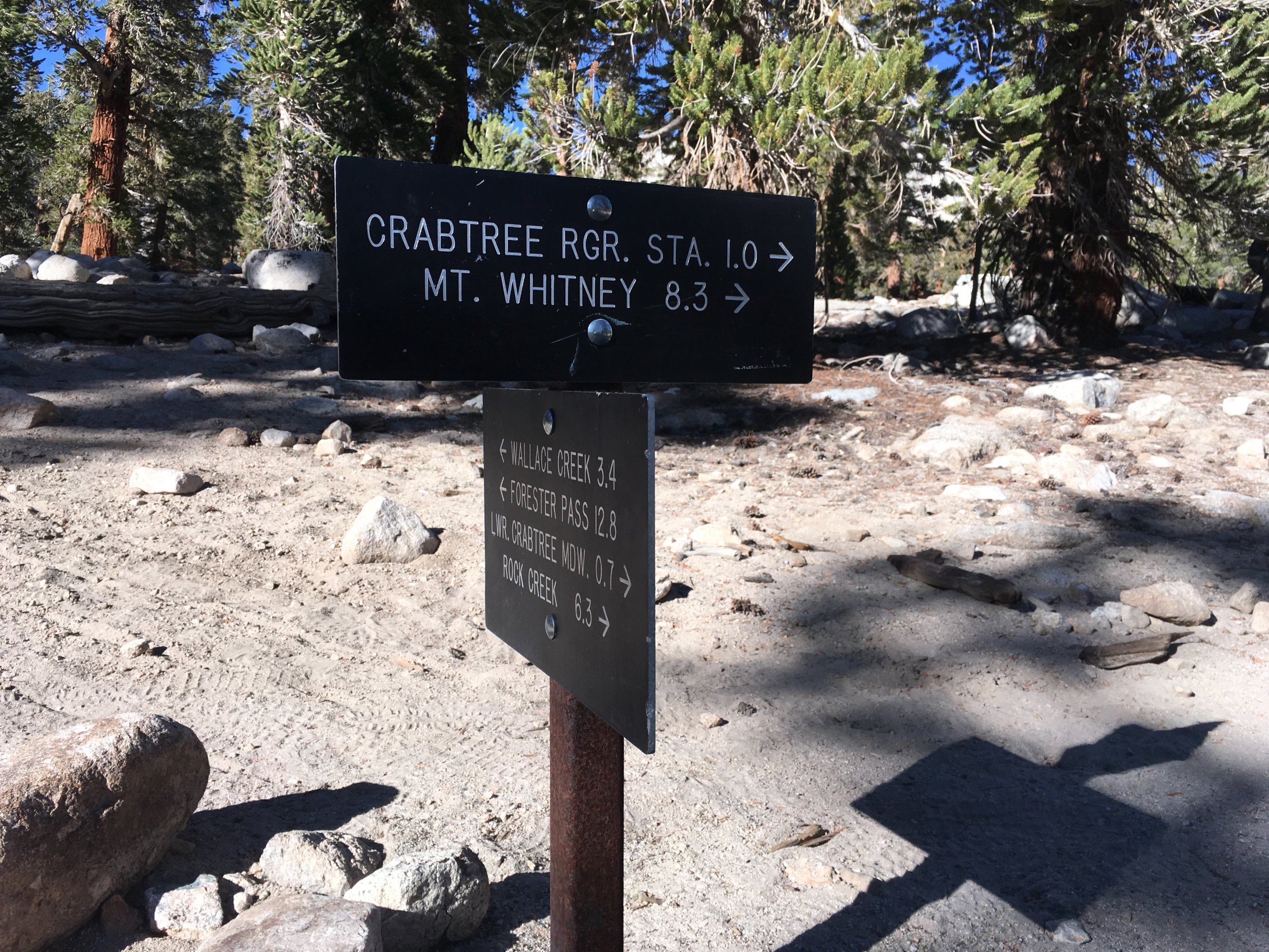
After departing the PCT, we followed the JMT towards Mt. Whitney. We passed the junction for the Crabtree Ranger Station and the familiar sight of the red plastic bin containing WAG (Waste and Gel) bags. Everyone entering the Whitney zone with an intent to exit the east side via Whitney Portal Mt. Whitney is required to carry a bag that is essentially a human litter box. The National Park Service has determined, correctly, that a LOT of people climb Mt. Whitney and that means that there is a lot of, ahem, waste, in a fragile environment full of rocks with little space to bury said waste. So in the Whitney Zone "pack it in, pack it out" is taken to an extreme. Used bags are disposed of in a dumpster at the trailhead, preventing all of that waste from accumulating on or near the summit. It seems strange the first time you use one, but it's really not any worse than packing out toilet paper or any other trash except the larger size of the bag. Anyhow, back to the trail junction. JMTers complete their hike at the summit and exit over the east side, so they get WAG bags. Since we plan to make a day trip to the summit via the west side then continue south on the PCT, we are exempt from the requirement (otherwise, we'd have to carry our personal portable litterboxes all the way to our next resupply for disposal).

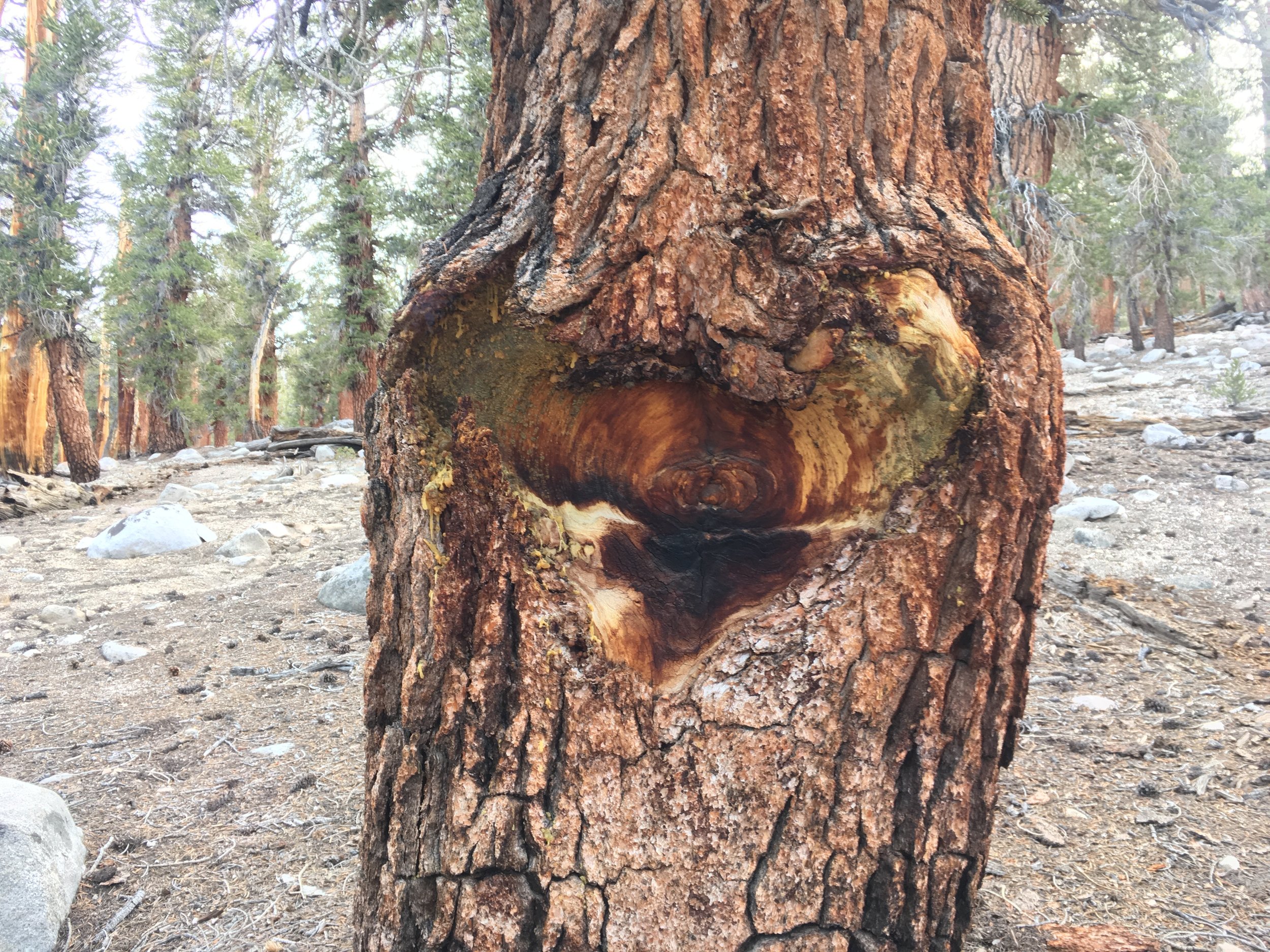
Foxtail pines, they are a marvel whether dead or alive.

Night sky over Mt. Whitney from the granite apron just above our campsite.
Moving along from the junction we hiked up past many beautiful Foxtail pines, many of which were twisted into fantastical shapes. The trail meandered along granite slabs and shelves and followed a couple of meadows before reaching Timberline Lake. This small lake near treeline is closed to camping, and the trail runs right along its northern shore. The next lake up, Guitar Lake, is the most common staging area for summiting Mt. Whitney from the west side. During peak summer season it can be a veritable tent city, possibly rivaling an Everest Basecamp. We didn't expect quite so many people in October but still prefer a little privacy and didn't want to carry our full packs any higher than necessary. We opted to cross the inlet creek of Timberline Lake and found a quiet and secluded off-trail campsite nestled in some lodgepole pines between granite slabs with views of Mt. Whitney and Mt. Hitchcock just above us and the Kaweahs far to the east. We arrived in the late afternoon and got our camp chores completed just as the sun was going down. Although the day had ultimately been quite warm, It cooled off quickly, and we retired to the tent to have dinner as has become our norm on these cold October nights.
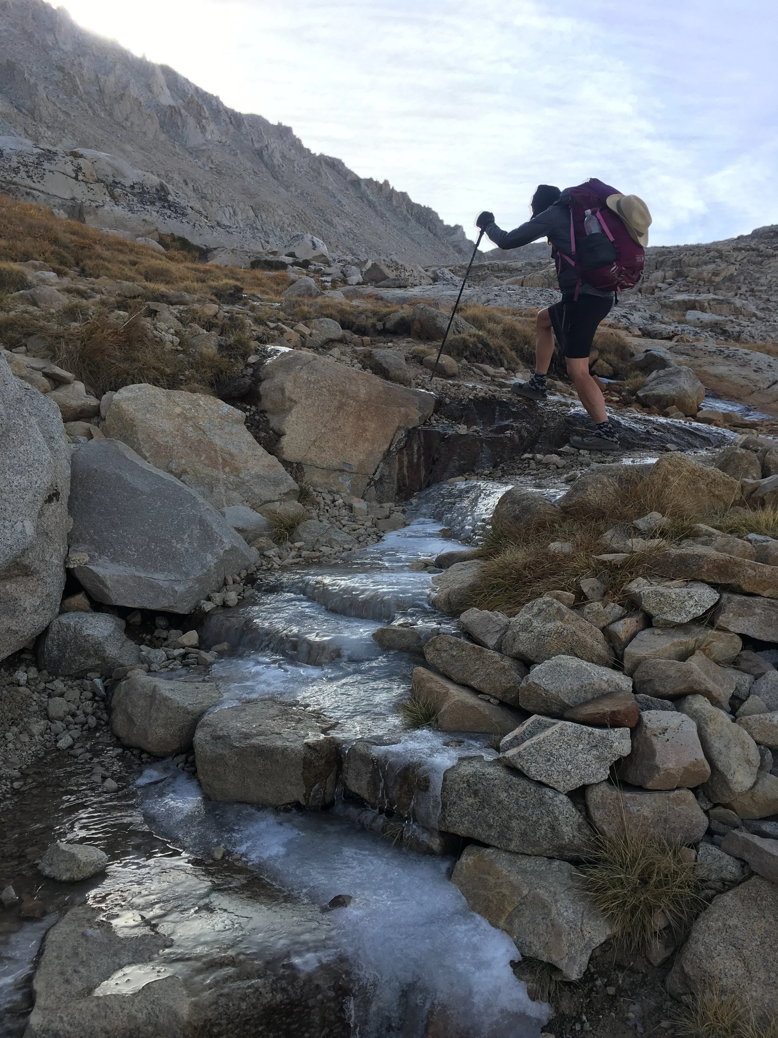
It's been cold in high country. Just a little ice on the trail today. No worries for Huckleberry.

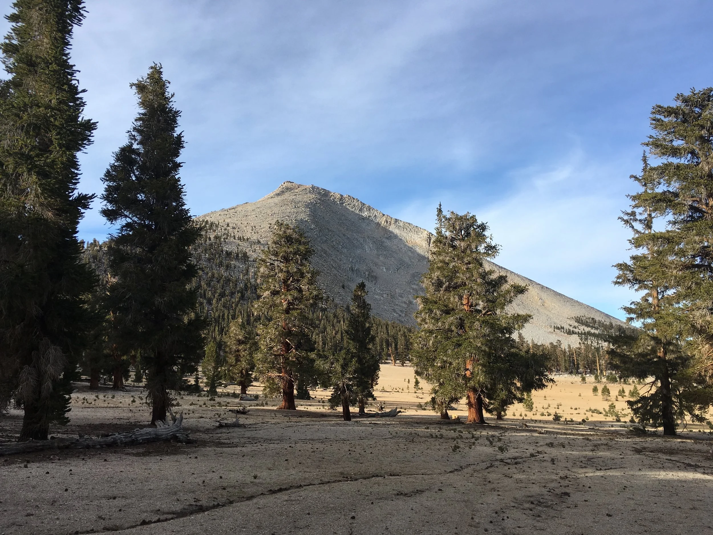
Mount Hitchcock and Lower Hitchcock (left) and Guitar (right) Lakes from the shoulder of Whitney.
This will be our third time summiting Mt. Whitney, and we are very excited that the October weather is cooperating so we don't have to skip the opportunity as we are passing right by. We started up the trail, first climbing to Guitar Lake, and were surprised not to see anyone there. Although it is late season, we'd seen enough JMT hikers on the trail in the past few days that we figured some of them would be there. As we climbed a bit higher, we did see a few people milling about that must have been camped out of sight as we passed by. The summit trail is well-constructed and generally makes for straightforward walking other than the elevation gain. This morning after a cold night we found thick sheet ice covering several stretches of the trail above Guitar Lake, just enough to make the big granite steps a little more interesting. We were still glad to get above the seeps that provided the substrate to make ice. Higher still, once we had reached the main switchbacks, we gained a full view of the deep green Hitchcock Lakes and it was still enough that the surface of the upper lake perfectly reflected Mt. Hitchcock. Just before we reached the junction of Trail Crest, where the east and west side approaches meet, we came across two hikers who had camped in a slightly protected (3' tall walls of rocks stacked to reduce wind) bivy site far up on the mountain. No doubt they had gone up to see the sunrise. On our own JMT hike, we had camped at Guitar Lake and Huckleberry was confused to see stars moving on the mountain when she woke up before dawn. She soon realized it was fellow hikers headed up early to see sunrise. While there is an appeal to this approach, we have opted on each of our summits to start at a decent morning hour and enjoy full sunshine instead.

Along the Whitney summit trail, Huckleberry heading towards the summit.
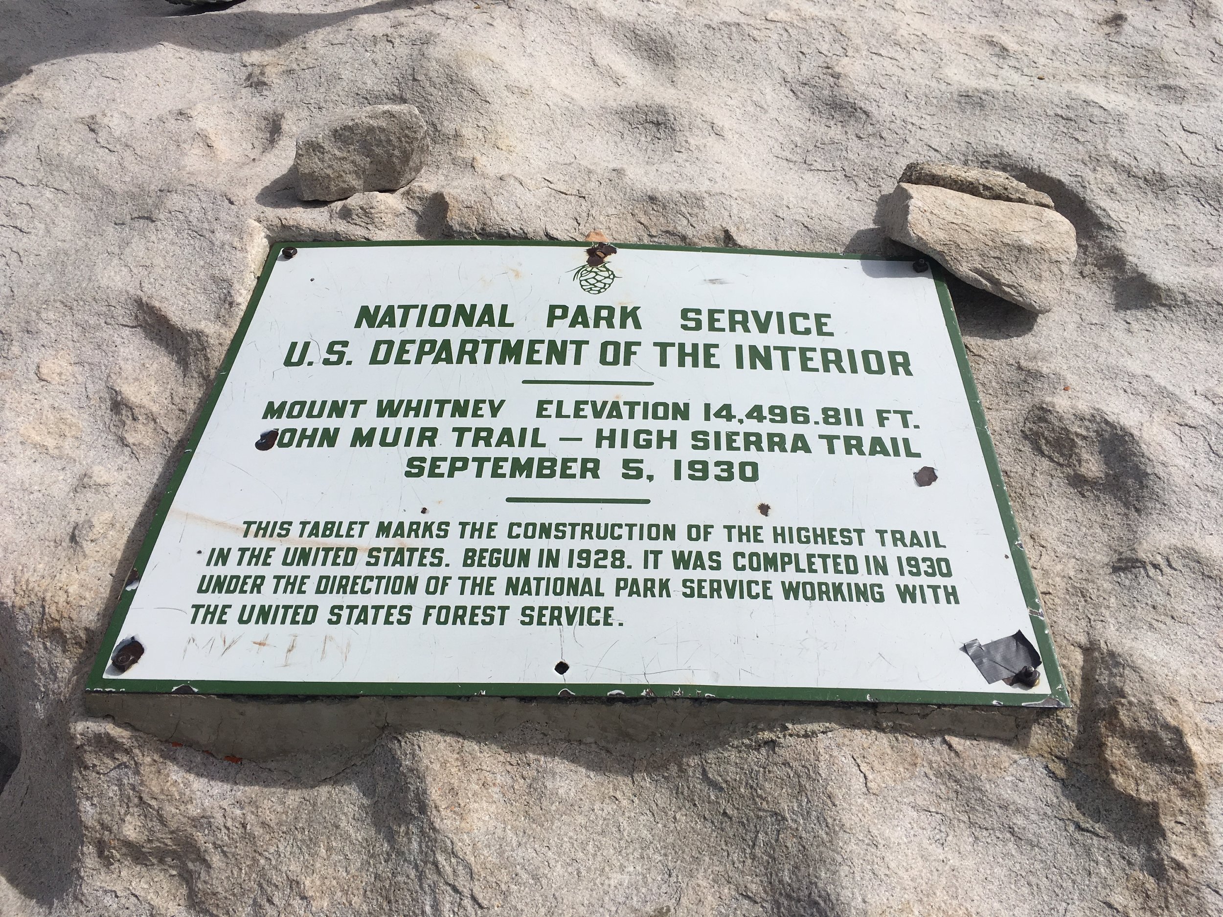
Officially at the top of California.
Continuing up the final ~2 miles to the summit, we saw several people on the trail headed in both directions. About halfway up we ran into Jorts (aka Mats) and a non-thru-hiking friend. We had not seen Jorts since he blew past us headed up Grider Creek out of Seiad Valley, and figured he was miles and miles ahead of us. Turns out that the trail works in mysterious ways, he'd taken some more time off-trail, and here we were on Whitney on the same day. At the summit we ran into two PCT NOBOs from last year, Hot Mess and Iron Chef, who with their non-PCT friend OMG had just completed the lowest to highest route (Death Valley to Mt. Whitney) over 7 days. To make it a little more interesting, they came up the mountaineer's route instead of just walking up the summit trail. Shortly after we arrived, a couple from Canada who we'd seen at a coffee shop in Bishop also came over the edge of the mountain having ascended via the mountaineer's route with a guide. The weather at the summit was perfect. It was sunny, warm enough for shirtsleeves, and with NO WIND, which seemed incredible for October. Just 5 days ago there was a snowstorm, and we've been colder at the summit in peak season. We hung out on the summit for close to an hour, and all told saw at least 50 people between the time we arrived at Trail Crest and the time we departed. Even after seeing all of the hikers we've passed on the trail the past few days, it felt like being at Grand Central Station. Two hikers from the Tahoe area we had chatted with on the way up graciously offered their extra food before heading down, and since thru-hikers never turn down food we scored a king-size Snickers and a big Kind-type bar. Thanks!

Polemonium eximium, Showy Skypilot, endemic to the Sierra. Only lives above 10,000'.
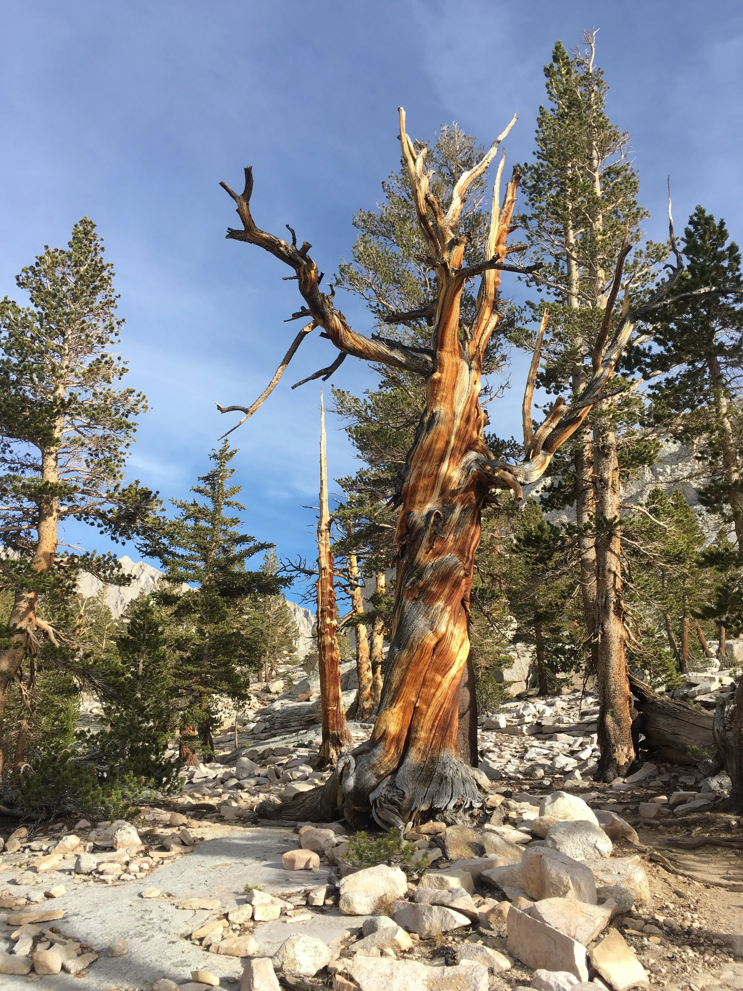
There are so many Foxtail pines that are not camera shy.
Eventually, we headed back to our little basecamp, and were glad to find that most of the ice had melted from the trail on the way down. We packed up our gear and were headed back towards the PCT when we ran into two more SOBOs, Wrong Turn and Eastwood. We had known from others that they were a day or so behind us, but had not seen Wrong Turn since we camped with him the night before reaching Cascade Locks and had met Eastwood briefly back at Mazama Village (Crater Lake). They asked about camping options and we shared intel on our secluded spot. They were grateful to hear this, as a fellow SOBO recently had gear stolen from the bear locker near the Crabtree ranger station during their Mt. Whitney side trip and they didn't want to leave gear in plain sight. Surprisingly, we did not see Beuna Vista, Sally and Sarah as we headed out. They had planned on camping at Guitar Lake that night for a summit the next day, and we were hoping we'd cross paths on the trail, though perhaps they got a late start. Hopefully, they had a spectacular day atop Mt. Whitney too.
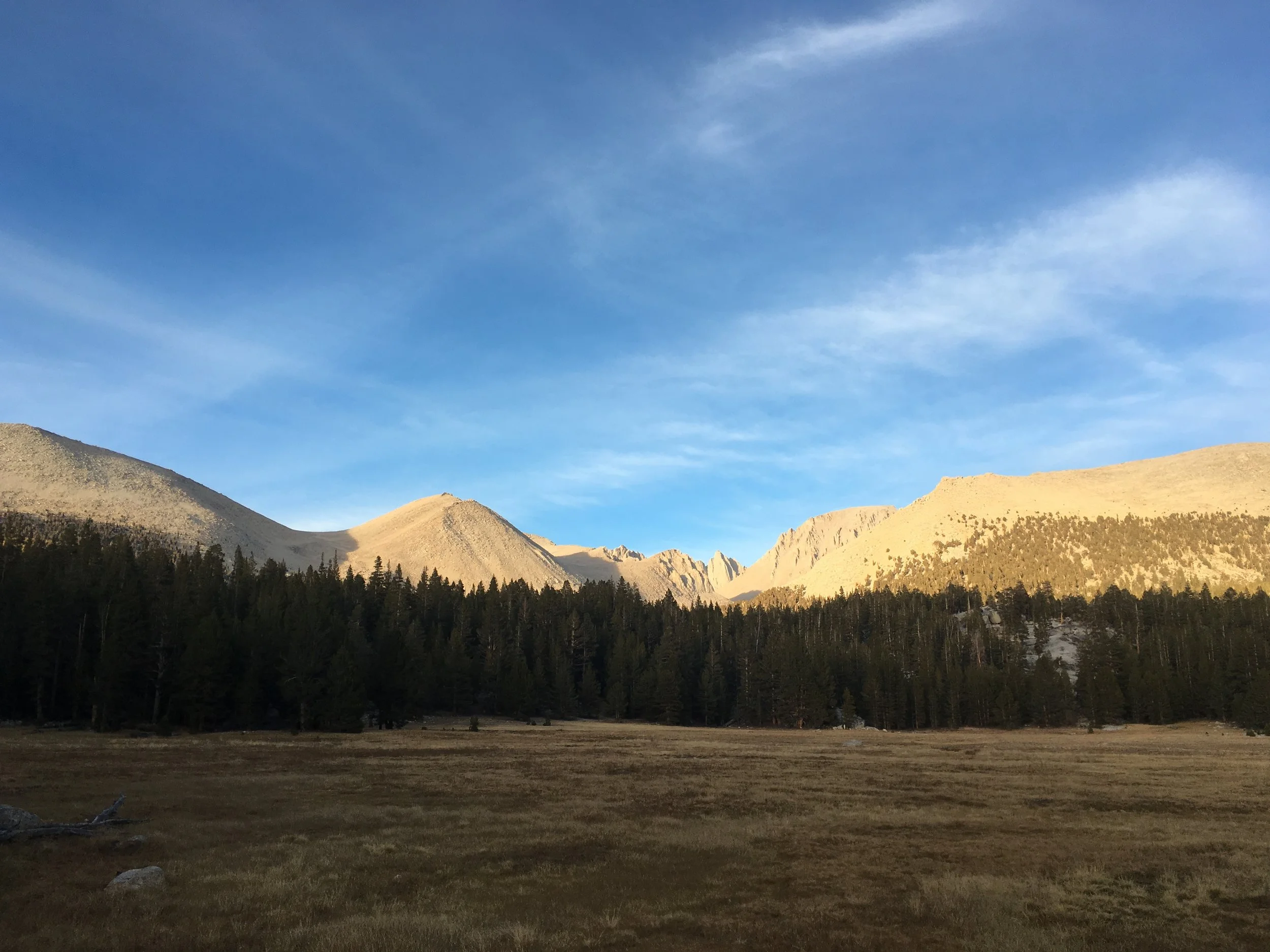
Mount Whitney from Crabtree Meadow.

A burnt Foxtail framed Huckleberry as she heads out of the Sierra.
At the junction with the familiar red bin, we turned south towards Crabtree Meadow and here we made the transition from the familiar to the unknown. Through most of the Sierra, the trail has been familiar from previous trips but from here on south, it will all be new to us. The trail followed Whitney Creek down a small ravine before opening into a large dry meadow with stunning views of Mt. Whitney. We found a great campsite near the creek and met another SOBO, Just Mike, who was camped nearby. It was a very pleasant evening, chilly but not so much that we were able to dine al fresco instead of in the tent for a change.
Last hurrah of the Sierra, Mount Guyot, granite basin and Foxtail pines.
The Sierra definitely has our hearts, we'll be back soon.

Chicken Spring Lake, southern gateway of the Sierra.
The next morning, we started our path south again and were surrounded by slopes of granite boulders, erratics and slabs that were just littered with enormous foxtail pines. They were the predominant trees for most of the day, other than some occasional Lodgepoles in the higher elevations. We walked across a large plateau and then crossed the shoulder of Mt. Guyot before dropping down to Rock Creek. Here there were Jeffrey pines and Western junipers and it felt like a fitting farewell to the Sierra to see all of our favorites in such a short distance. Crossing Rock Creek ww walked through the last low valley in Sequoia NP, then we climbed back onto a ridge similar to the one we had left, made of nothing but granite and Foxtail pines below a deep blue Sierra sky. We traversed around several basins (including a barren one named Siberian Outpost), then crossed the boundary between Sequoia National Park and Inyo NF's Golden Trout Wilderness on a high granite shoulder. This entire morning was like an encore performance by a favorite band. Just when we thought we were leaving the high country for good, we walked through more amazing blocks of granite and even more spectacular Foxtail pines. Finally, we turned one final corner and could see Chicken Spring Lake below and Cottonwood Pass beyond it on the next ridge. The Foxtails up on the ridge above the lake were so disfigured by the harsh conditions they could easily be mistaken for their cousins the Bristlecone pines. The lake itself sits in a small cirque, surrounded by granite and more upright Foxtails. The outlet stream was bone-dry, but otherwise it could have passed for any other alpine lake in the heart of the Sierra. We could see why NOBOs are smitten by this place after spending weeks in the desert, and often consider it the "true" start of the Sierra Nevada. For us, it marks the start of our transition into Southern California, the final section of our journey.
-Macro