“Oh, you’re one of THOSE”
LOCATION
Yosemite National Park, CA, USA
MILEAGE
27 trail miles (a few over snow)
TOTAL CLIMB (& DESCENT): ~10,340'
DAYS: 3 SEASON: Late April
STARTING & ENDING TRAILHEADs
Snow Creek / Yosemite Falls
Basecamp Town: Groveland, CA
Map: Tom Harrison Yosemite High Country Trail Map

Website: www.nps.gov/yose/planyourvisit/snowcreektrail.htm
Pre-Trip

Goofy morning mirror-selfie at the Hotel Charlotte
Cheri had to be in Fresno for the evening the last Thursday in April, and this seemed like a perfect excuse to get out for a late winter weekend backpacking trip. We would make Groveland's Hotel Charlotte our basecamp to allow us a decent night's sleep and an early start Friday morning. The trip was planned months in advance. In the interim, our lives were turned upside down by the loss of our dog Sula and other major happenings, so that by the time late April rolled around it seemed impossibly complicated and a bit frivolous to go away for an entire weekend. In the end, we decided we would just make it happen one way or another. Work was crazy for both of us, and we found ourselves up late putting together gear and food on Monday and Tuesday, hoping that we weren't forgetting some essential item. We pulled into Groveland around 10:30pm, headed up to the room, and fell into bed. There aren't many lodging options close to the Hwy 120 Yosemite entrance, and we found the Hotel Charlotte to be perfectly serviceable. It's an historic building with all of the quirks that come along with that, and prices are typical for being "close" to Yosemite. While not cheap or fancy, it has friendly staff and clean rooms and free basic breakfast buffet. It served our needs perfectly.
Yosemite Valley was sunny, warm, and already filled with people Friday morning. We headed for the visitors center to pick up a wilderness permit (backcountry quotas aren't in effect until May so we weren't worried about availability). There was a short but slow-moving line of foreign visitors looking for day hike recommendations from the volunteer and front-country ranger staffing the desk (Mirror Lake, Valley Floor Loop, Vernal Falls. Repeat). We let the couple behind us go first when the volunteer became available, thinking that the ranger might have more info on snow levels and general trail conditions. Until we heard her warning a European couple against the Yosemite Falls hike, saying she'd done it last week and it "made her tired just thinking about it". So much for any trail insight! We were up next, & when we asked for a wilderness permit she sounded relieved to tell us that the wilderness office had opened early this year, just today, and she couldn't issue a permit. We headed a few doors over to get in what we assumed would be another line. We were happily surprised to find 3 rangers behind that desk and only a couple of backpackers, so we stepped right up. The ranger who issued our permit didn't know current snow levels in the Snow Creek drainage, but did have good info on possible campsites, slopes that typically hold later season snow, etc. We went through the backcountry principles and verified that we had a bear canister and just like that we were ready to hit the trail.
Day 1: Yosemite Valley to Snow Creek Drainage
We parked in the trailhead lot between Curry Village and Happy Isles, and felt very out of place as we unloaded our packs from the car. We had snowshoes, ice axes, and big foam sleeping pads strapped to the outside of our backpacks. On this warm spring day in the valley, everybody else was wearing shorts & flip flops and carrying a selfie stick. We fielded several questions about how to hike to Vernal falls, how to take the shuttle, and where to find Mirror Lake - apparently we looked so out of place they assumed we must know something. We helped as best as we could, then headed out along the road ourselves. We walked past Happy Isles (the shuttle stop & trailhead for Vernal Falls) then Mirror Lake. Several people asked where we planned to snowshoe, and we overheard many parents explain our gear to young hikers (with varying degrees of accuracy). The crowd thinned considerably beyond the Mirror Lake restrooms and we passed just a few more groups before the Snow Creek junction.

Snow Creek at the Tenaya Lake trail junction
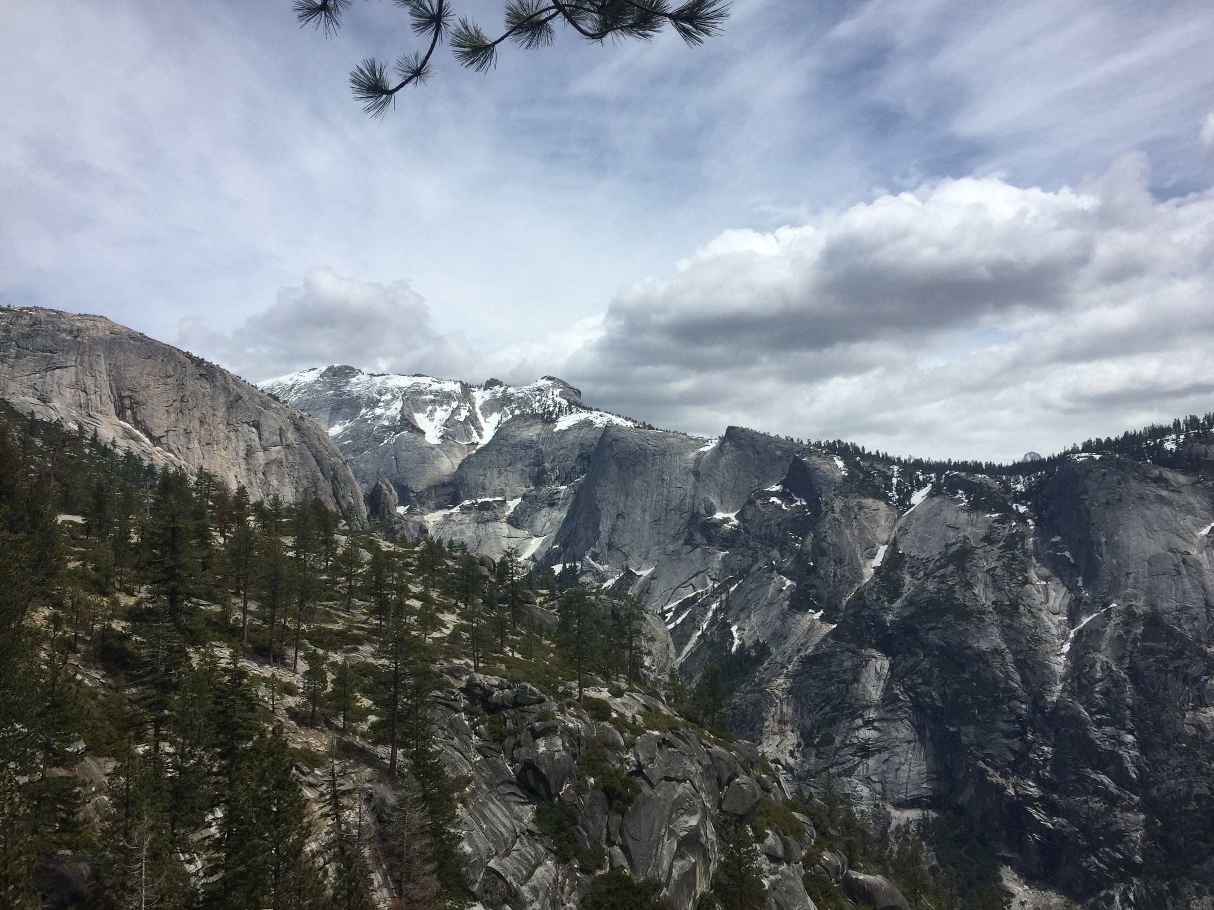
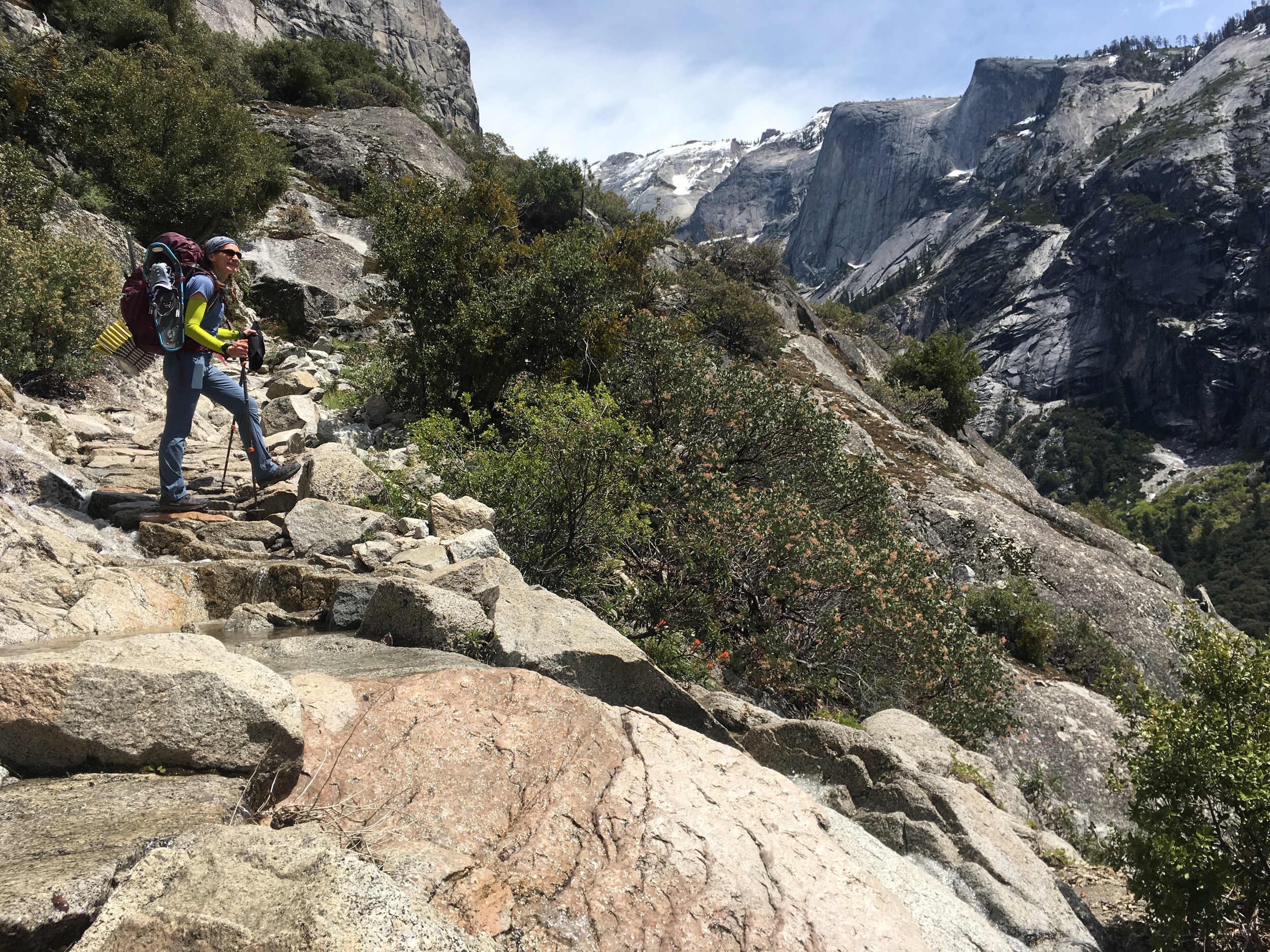
The lower section of Snow Creek trail is shaded and we had a constant breeze, but the significant climb (2600' in 2.6 miles) meant our progress was steady at best. We didn't see a soul in the first 2 miles and were surprised to find that the trail had already been logged out from winter's treefall. As expected, there was no snow to be seen as the trail switchbacked up the exposed southern face of the valley wall. We were actually surprised to come across two pairs of dayhikers heading down just as we reached the top of the switchbacks. The second pair commented that there was a ton of snow up there, and we were glad to hear we weren't carrying all of the gear for nothing. Those would be the last people we'd see today. Beyond the top of the switchbacks we started to see patches of snow in deep shade (around 6500'), though there was no snow across the trail before the Tenaya Lake junction. We stopped at the footbridge just beyond that junction for 2nd lunch and both put on a warm layer, as the morning's cool breeze had somehow become a cold wind. We didn't stay long as the sky was filling with dark clouds and we remembered the ranger's forecast of daily afternoon thunder-hail.

Snow Creek Falls, mid-afternoon
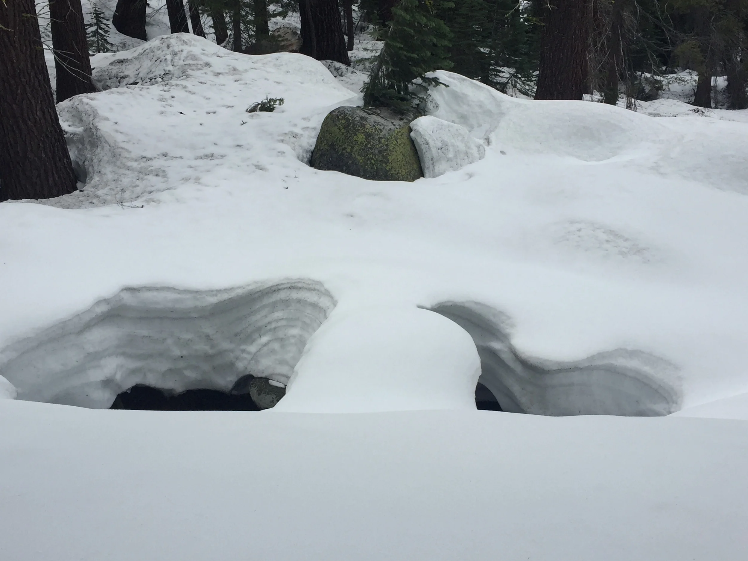
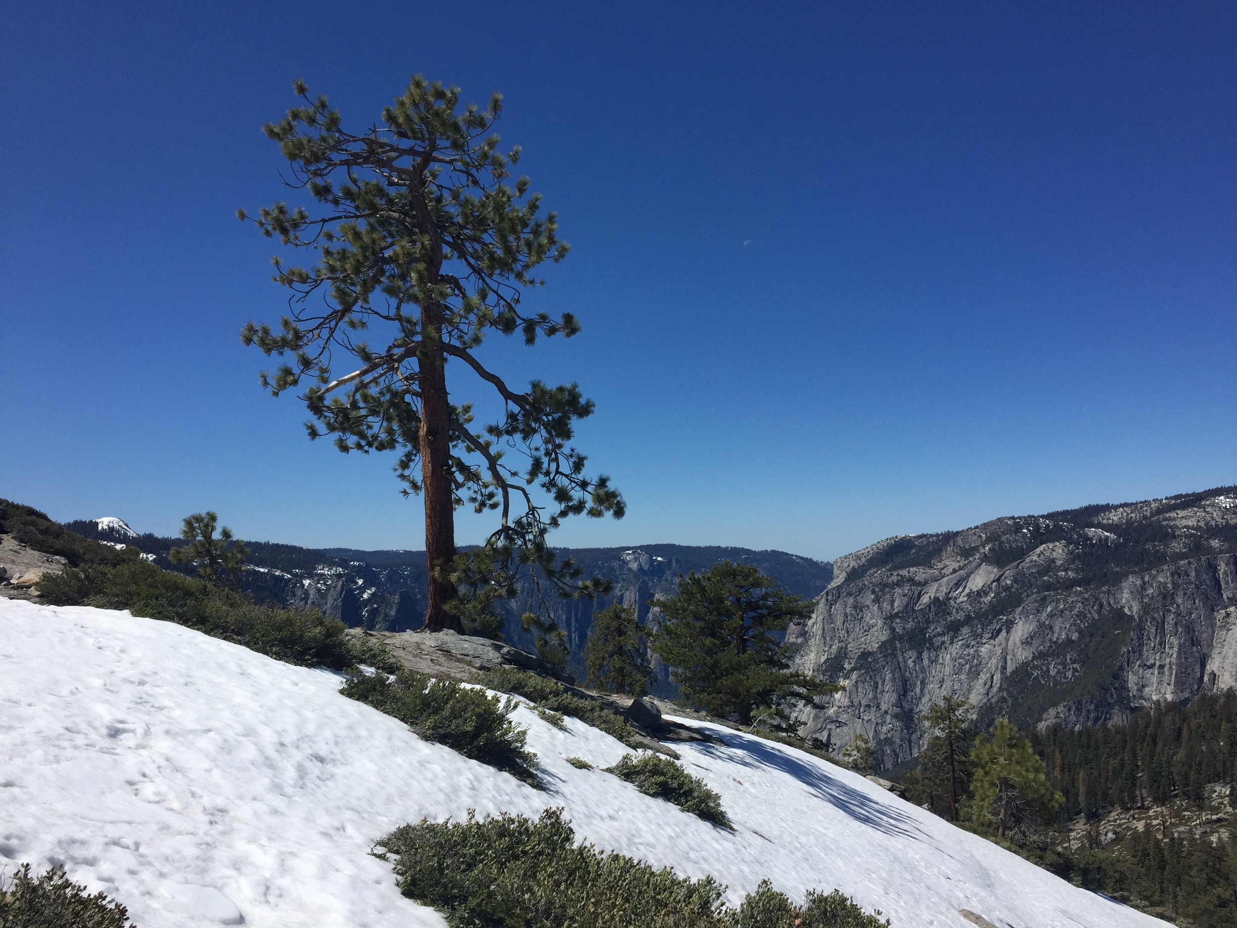
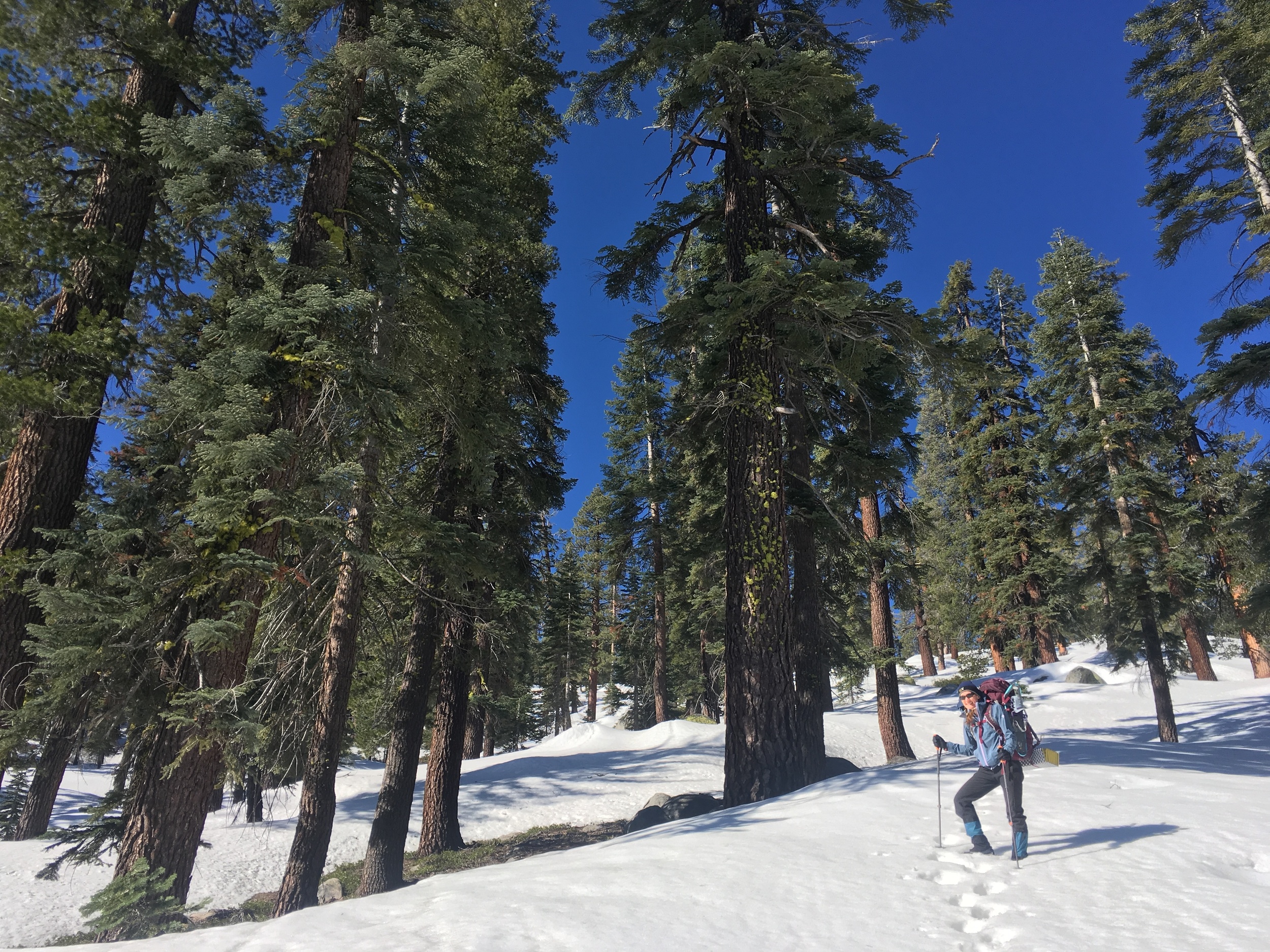
Large snowdrifts on the far side of the creek quickly coalesced into solid snow cover, with no evidence of footprints heading up towards Tenaya Lake. In contrast, the Snow Creek trail was still easy to follow through the forest across intermittent snowdrifts, with fresh boot tracks. The snowdrifts became progressively deeper and longer and by ~6900' there were no more patches of dry ground. The boot tracks must have been from our dayhikers, because they turned back at this point. From there we relied on terrain, frequent GPS checks, and an occasional short stretch of old faint boot prints in the crusted snow to confirm we were headed in the right direction. It was easy walking as we sunk in only a few inches with each step and the slope remained gentle. We didn't see any tree blazes, so we were probably not exactly on-trail, but we followed the contour of the hill and reached Snow Creek Falls without difficulty. We used a dry sandy patch near the shore to marvel at the water rushing between snow-covered rocks. The trail climbs from there and we put on both gaiters and micro spikes for the deeper & steeper snow.

Deep, soft snow over big rocks and downed logs along the upper Snow Creek drainage

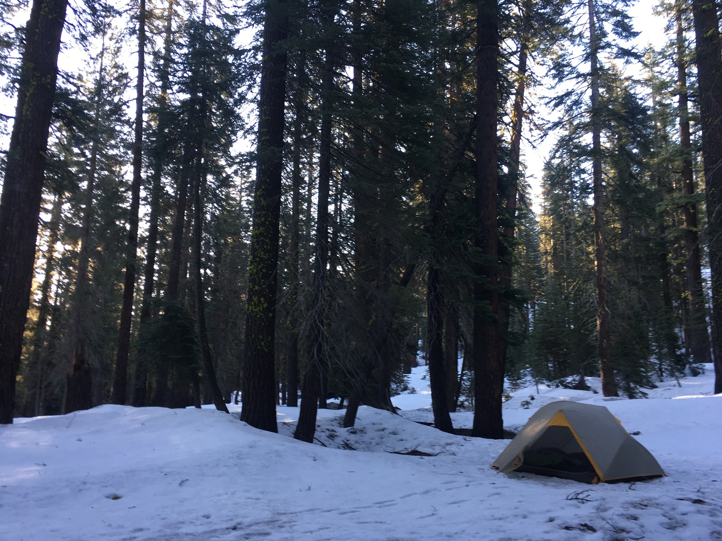
Chilly! Cheri contemplates the cooking area at our campsite before caving in and grabbing her giant down jacket.
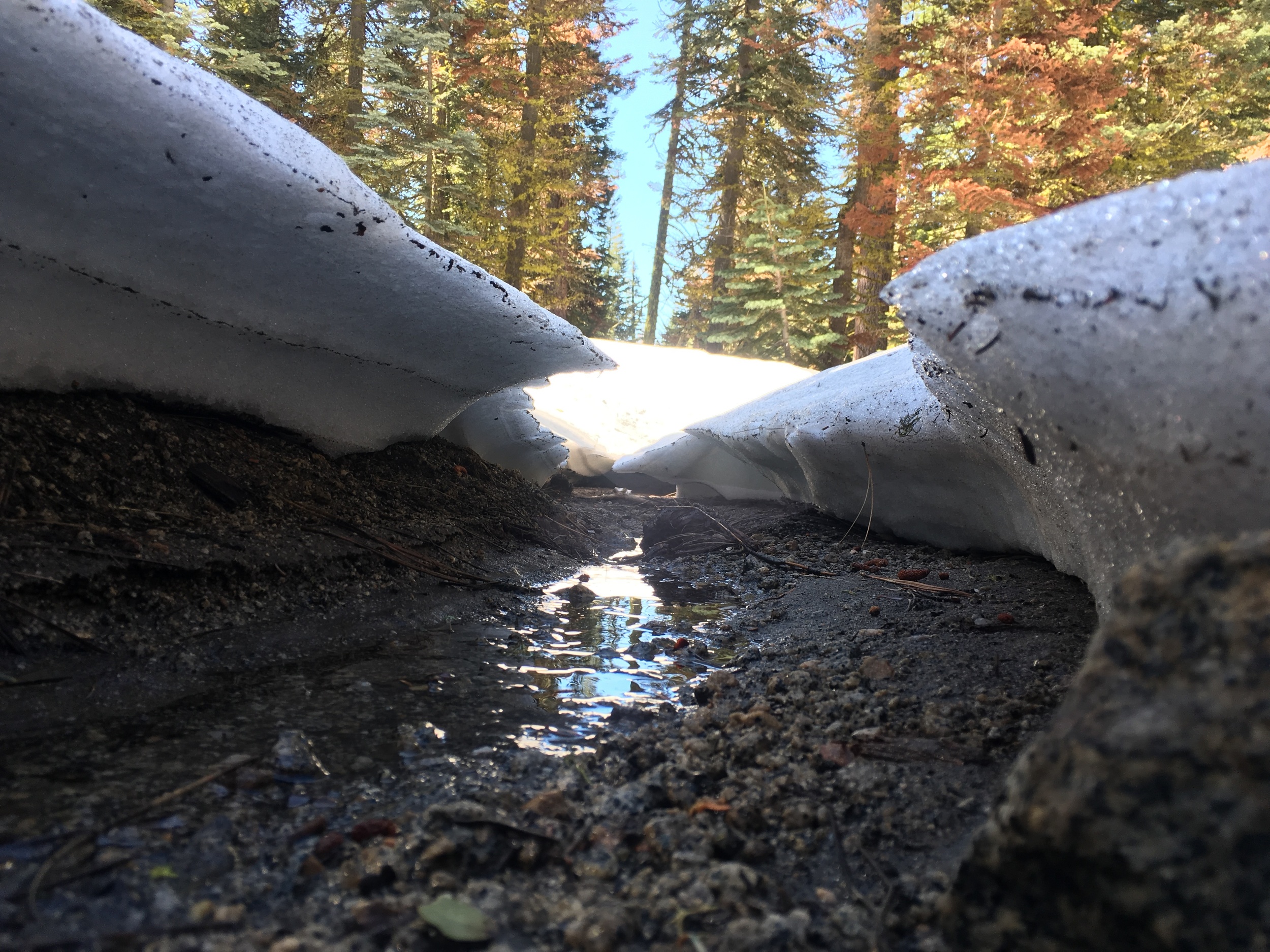
After an initial climb the terrain levels and there was a section of exposed dirt trail on the open hillside. We removed our microspikes but kept our gaiters on, as we soon walking on snow again. The faint boot tracks headed towards the creek, too close for our comfort as the many snow-covered boulders and downed trees made for treacherous footing in the soft afternoon snow. We left the boot tracks behind and stuck to the general location of the trail to work our way up the slope, with frequent GPS checks in the deep forest. We crossed fresh bear tracks a few times but saw no evidence of humans. We had no problem with traction but stopped to put on snowshoes after after sinking into deep snow up to our thighs a few times. Walking became more awkward but also more secure, and we moved more confidently through the snow-covered forest. Around 4pm we reached a flattish area (~7700') with running water audible in the direction of the drainage. We knew from the map that if we went much further we weren't guaranteed running water until Lehamite Creek. Melting snow is a hassle, so it was an easy decision to camp here for the night. Our spot was a small clearing in the otherwise dense red fir forest where we could see the sky, and a few of the larger trees were ringed by bare ground we could use for sitting, cooking, etc. Snow camping at its finest! The clouds had continued to darken all afternoon and were now positively threatening so we set up our tent quickly in the cold wind, had a quick energy-boosting snack, and headed off in the direction of what we hoped would be accessible running water. We were camped only a few hundred feet from the stream, though our route there was made longer by snowy obstacles. We found some faint boot tracks in the snow near the creek and followed them downstream to a small area where the running water came out from under the snow. We filled up and trudged back to camp on snowshoes to set about making dinner. We both wore every layer of clothing we brought and were still chilled as we prepared dinner, a "deconstructed lasagna" from Backpacker magazine that can only be described as cheesy warm goodness. Melted smoky mozzarella, fresh grape tomatoes, and warm noodles in a tomato sauce could not have tasted better! We were in our sleeping bags by 7:30 and closed the vestibule.
Distance 10.9 miles | Total Climb 5928' | Total Descent 2278'
Day 2: Snow Creek Drainage to North Rim above Castle Cliffs, with North Dome side trip
Cheri headed up Indian Rock with that deep blue Sierra sky
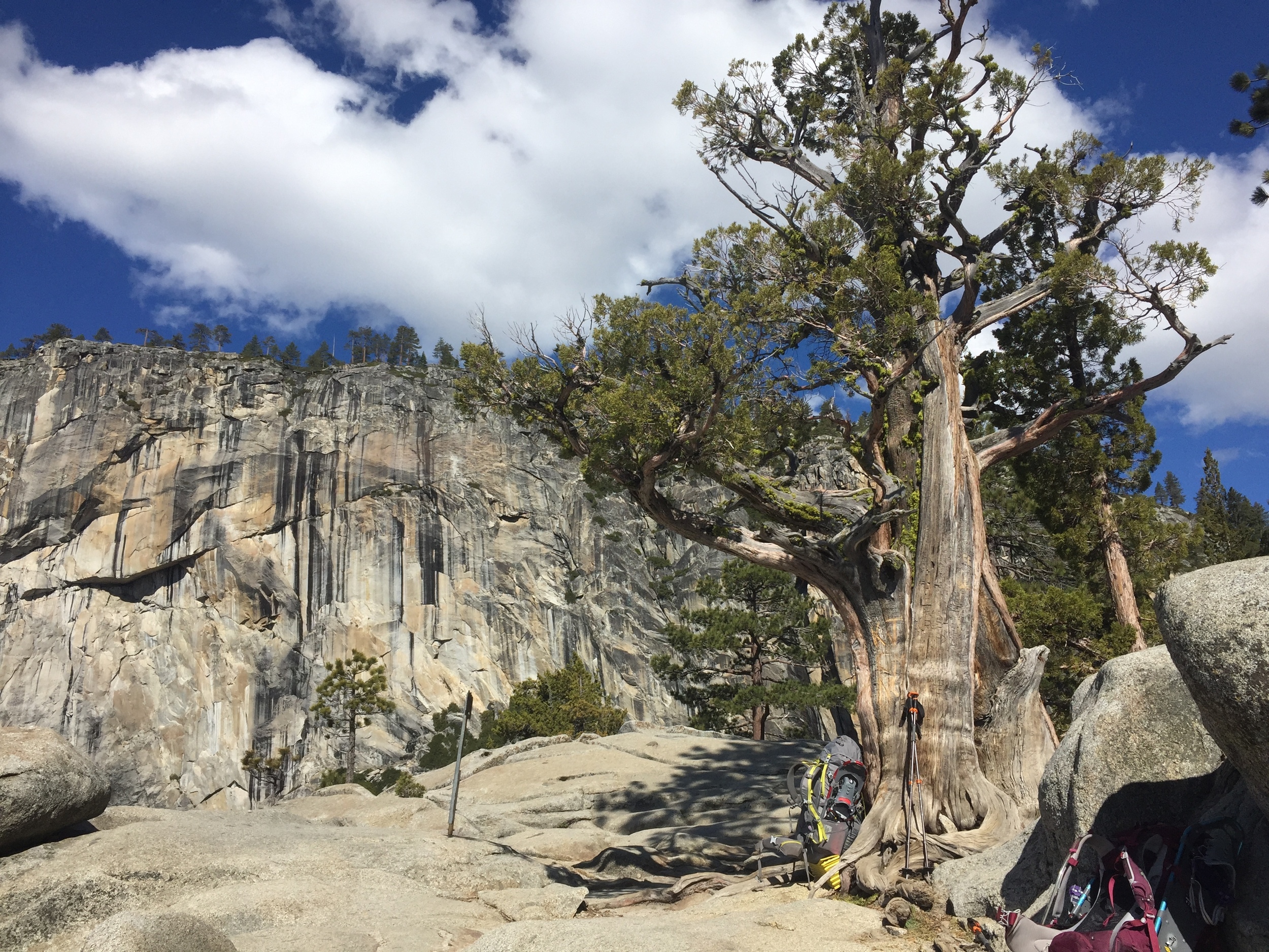
We were woken up in the middle of the night by several short flurries of precipitation, which turned out to be dry corn snow. There was no significant accumulation, but the morning broke with a grey sky and cold wind. Andrew got up early as usual and started our "luxury" breakfast of scones baked fresh in the Outback Oven. We enjoyed them with coffee and tea and hung around in our warm clothes as long as possible. Finally, we decided that if we were going to get any miles in today we'd best break camp and get to it. No snowshoes needed this morning on the frozen, crusted snow though we occasionally sunk in up to an ankle. We followed faint tracks for a bit and put on our microspikes as the slope increased. The cold wind continued but the clouds cleared to reveal that classic deep blue Sierra sky. We started up a steep hillside until a map-check revealed that the tracks were headed straight up Indian Rock, while the trail we wanted actually followed its lower contours. We took a few pictures before traversing across the slope towards the saddle leading to Lehamite Creek. Given the cold wind and deep snow we decided to head down the creek rather than take the higher elevation Indian Rock trail past North Dome.
Runoff along the Lehamite Creek trail
We passed two trail signs at the junction, one in bare soil near a tree and another just barely exposed above the snow. We left the wind behind as we started a steady descent along Lehamite Creek, and it wasn't long before we started to cross patches of bare ground. We removed our microspikes and soon even the large snowdrifts petered out. Snow lingered in patches of shade, but there wasn't much on the trail itself. Early spring runoff filled the creek, which meandered down the drainage near the trail. The protected slopes on its far shore held more persistent large snowdrifts, and we were glad not to need snowshoes on our side of the creek. We walked into a relatively recent burn zone, and came across the junction with the North Dome lateral. It wasn't even noon, so we decided to head up that direction for a view.
We didn't feel like snowshoeing, so we left our packs behind and just carried water, a few snacks, poles, microspikes, and GPS/map. We planned to turn back if the terrain or weather got more serious than that. With soft and deep snow up to the banks of the runoff-swollen creek, finding a good crossing was a little tricky. Once on the other side we discovered that the trail was actually quite easy to follow between large snowdrifts. Further up from the creek it became even more exposed with large sections of bare ground. The sun was warm but as we climbed the chilly wind found us again, and afternoon clouds were building overhead. With no recent tracks in the snow, we assumed we'd have our little vista to ourselves. The small Indian Canyon and Royal Arches creeks were easily crossed despite 2-3' of snow up to the edges of each, and it didn't take long to reach the exposed granite below the final climb to the plateau adjacent to North Dome. The climb itself was snow-covered and we put on microspikes to prevent slipping down the long unprotected slope. This precaution turned out to be unnecessary, as the exposed snow had softened from the sun and we sunk in several inches with every step. The promontory provides spectacular views of Half Dome, North Dome, Sentinel Dome, and points beyond in every direction. Unfortunately it also provided ready access to the now cold & biting wind, so we didn't spend too much time wandering around before we hunkered down on a rock to eat some lunch. We were surprised to hear voices, which came from a sizable group of hikers who were carrying large packs but turned out to be out on a day trip to North Dome from Yosemite Creek. They continued on to North Dome, and we headed back down the trail to our own packs. We passed a few more hikers coming up the trail, none of whom had overnight gear with them.

Cornbread, Madras lentils, and Miso with a view like no other

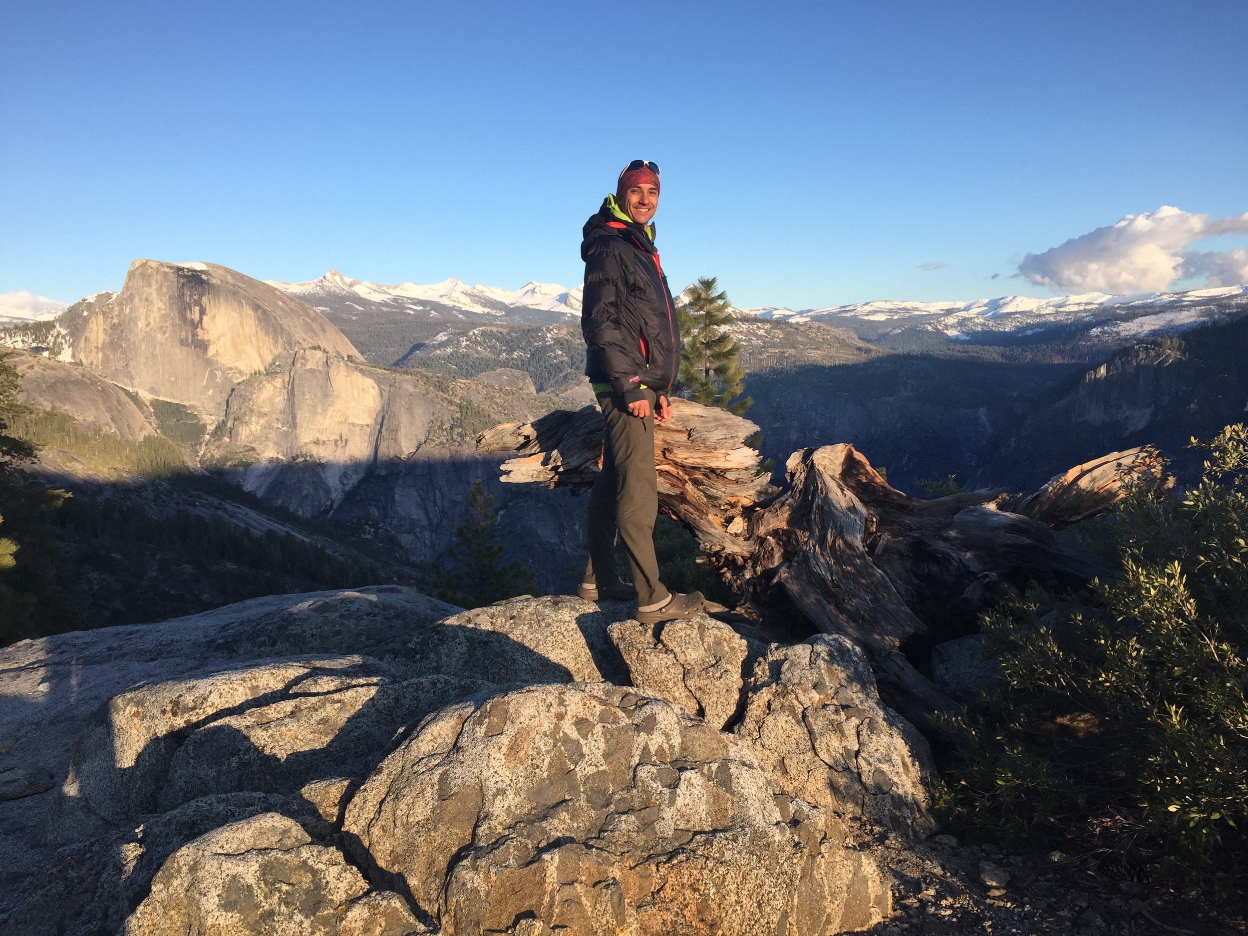
Half Dome and alpenglow on the Clark Range
On returning to the trail junction & our packs, we came across a trail runner making the loop from Yosemite Falls to Snow Creek trail. He had nothing but an endurance vest on him but seemed fit and confident. We shared beta on the trail conditions and he continued on towards the snow as we dropped further down the Lehamite drainage towards the edge of the north rim. The views opened up as we came out of the forest but the exposure also brought a steady wind with a cold bite. We meandered along the trail marveling at the views to the south- Clouds Rest, Half Dome, the Clark Range, Mt. Starr King, and Buena Vista Crest. We stopped at one lookout and talked to a pair of backpackers who had just come up the Yosemite Falls trail and were considering camping there for the night. They had 4 nights of food with them but no real plan. They asked if we'd done "the loop trail" though they didn't know actual trail names or where said loop was on their map. They figured they didn't mind walking on snow as long as the trail was still obvious and didn't have any snow equipment with them. They were young and looked fit, but when we described the snow conditions we'd come through they seemed fairly hesitant. We wished them a good trip and continued on. Only 5-10 minutes later we came across another spot along the rim with a fantastic view and a sweet protected site for a tent. Although it was barely 1pm, we realized that if we continued further we'd soon drop down to Yosemite Point and then to Yosemite Creek. There was very low probability that we'd find another site so perfect, at least not without a crowd. The only downside to the spot was a lack of nearby water. Since it was early in the day and just a ~1000' drop to Yosemite Creek, we set up our tent and then hiked ~30min down the trail to fill up with water at the creek. We passed oodles of day hikers from Yosemite Point on down, and were glad to have the quiet little upper point to ourselves.
We spent the rest of the afternoon soaking in the view and testing out some of our PCT tech gear (bluetooth keyboard, etc). Dinner featured Outback Oven cornbread and was enjoyed during evening golden hour light as we watched alpenglow bathe the peaks surrounding us. As dusk approached, we heard voices coming up from the rocks below us. They were debating about whether to ask us where the trail was, and which direction towards the valley. We assumed it was day hikers out far too late trying to return to the Yosemite Falls trail. It turned out to be the two backpackers camped just up the rim from us that we'd met earlier in the day. They didn't recognize us at first and asked where we'd come from. We said we came up Snow Creek and they said they had been thinking of going that way but in light of the snow levels were thinking of just taking a day hike to North Dome tomorrow then heading down. They casually asked if there were any trails nearby, trying to bluff their way out of being lost. Andrew pointed out the trail, the direction to their campsite, and reminded them that we'd met in the afternoon. As they walked past our packs with snowshoes etc we heard the quote of our trip, "You have snowshoes? Oh, you're one of THOSE." They went on their merry way, and we had good chuckle at the whole exchange. The last visitors to our site before we headed off to bed were a pair of large, inquisitive, and rather bold ravens who checked out our cooksite and tent. They reminded us of the New Zealand mountain parrots (Keas) that we encountered on the Milford Track.
Distance 9.2 miles | Total Climb 2746' | Total Descent 3092'
Day 3: North Rim to Yosemite Valley via Yosemite Falls and Valley Loop trails

Manzanita blossoms, Jeffrey Pine and Sierra Bluebird sky
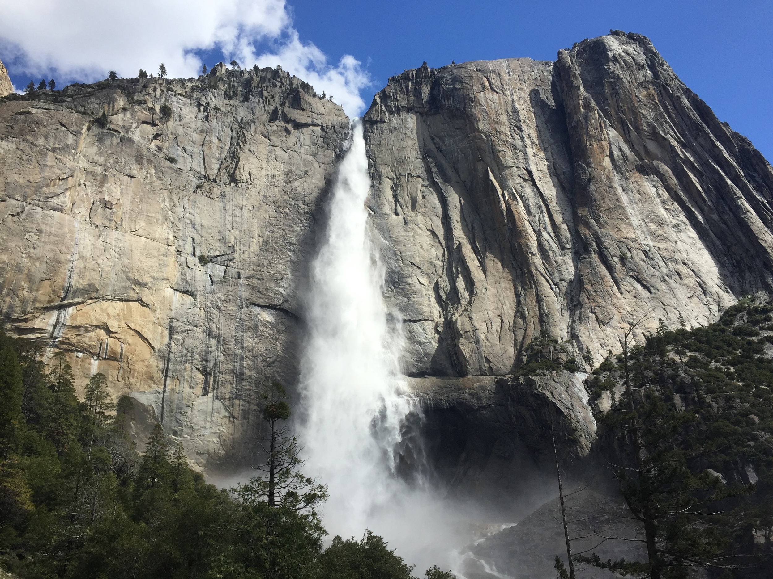
A constant wind was our companion for the night and were were glad that the rain fly kept most of that cold off of us. The morning greeted us with clear skies and the grey dawn quickly changed to quintessential Sierra bluebird with the occasional innocent cotton ball cloud. Andrew made our coffee and tea to ward off the morning chill, then he finished the prep work for the egg scramble/soufflé in the Outback Oven. While that was baking, Cheri found the perfect spot and we enjoyed the hot drinks and the sun rise over the ridges. No winged guests this morning, however, a lone coyote did make a brief appearance before he ambled along. After this leisurely brekkie and we packed up our camp and headed down to Yosemite Point. A major contrast to the previous afternoon, where it was teaming with day hikers, it was serenely quiet. Downwards, we took the switchbacks to take us along Yosemite Creek and over the foot bridge. A spur trail leads out to the upper falls overlook and we headed out. We figured we would have the place to ourselves, it would be too early for all but the most ambitious of day hikers, and we were not disappointed. With the snow melt, there is a tremendous amount of water thundering over the edge of the falls.

Andrew gazing fondly at Clark Range, wishing to be back there
We met our first day hikers as we headed back along the spur trail. This started a guessing game of how many people we would see as we hiked down (spoiler alert: a lot), let's just say that we both underestimated the total. The trail soon crosses another little creek and then quickly follows numerous switchbacks as it winds down a small chute between the granite walls. Upper Yosemite Falls would pop in and out of view as we continued the descent and after reaching the bottom of the chute, the trails swerves back towards the pool from the upper falls. The air was heavy with drifting mist and the ground wet. We continued a little ways along before stopping for snack break and counter day hiker 100.


Cheri hiking the switchbacks towards the base of Yosemite Falls
Hearing all the different languages and/or accents of English people were speaking, it was great to see so many enjoying the National Parks, and Yosemite in particular. While we often prefer the serenity of being in the backcountry being dwarfed by the grandeur surrounding us, we are equally happy seeing so many from so far appreciating the beauty of our public lands. Living so close to this hallowed ground, we are very fortunate to explore so often here. Each time we are here, we see something new. Onwards and downwards we continued and the number of people seemed to grow exponentially. Most seemed excited to be out on the hike, a few look like they had been coerced by family and friends, and a very few were deep in negotiations with stubborn individuals about the benefits of hiking and/or that there is great view around the corner. Perhaps not everyone was having a happy day after all... Around this time that we gave up on counting all the day hikers, the last firm number was 282 (we saw ~300-350 by the time we hit the trailhead sign). Many of the hikers headed up had questions- "how far were the falls?" "is the rest of the trail as steep as this section?" "will my shoes have enough traction for the rest of the hike?" "Where did you guys start?" We answered them all as best we could and headed towards the trailhead.

Upper Yosemite Falls from the trail
After all the long descent we joked if we would be able to walk on flat ground again. We passed the tent village of Camp 4, and made our way along the paved trail network to Swinging Bridge over the Merced River. On the far side, we picked up trail leading over to the Chapel to connect over the Valley Loop Trail. Looking around, we noticed that there had been a significant cloud build up over Yosemite Falls and the entire Eastern edge of the Valley. It was still sunny and warm, so we did not give it much thought. Along the trail we passed the Sierra Club's education building (the former LeConte Memorial Lodge) and the residential housing and then Curry Village. On the way to Happy Isles, we took the turn off to our car at Trailhead parking.
After changing into some clean, non-hiking clothes, we got into the car and looped back through the Valley on our way home. A light rain started, and was pretty constant by the time we passed the Falls. After leaving the park, we passed the Rim of the World Vista on Hwy 120. On previous trips it has been barren ochre landscape after the devastation of the Rim Fire, and it was great to see the hills green again . We stopped in Groveland and grabbed a late lunch enjoying the warm sun, however the entire Eastern vista was a wall ominous grey storm clouds over the Sierra. Fortunate timing indeed for our Snow Creek trip.