
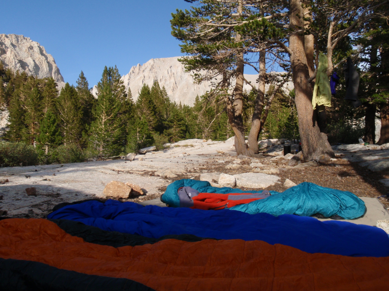
“By the NEW definition of respectable...”
LOCATION
Sierra Nevada Mountains, California, USA
MILEAGE
145 on-trail (~61 miles one-way to Whitney Summit, then ~84 miles to return with a minimum of backtracking)
DAYS: 13 SEASON: Mid-August
STARTING & ENDING TRAILHEAD
Crescent Meadow, Sequoia N.P.
Map: Tom Harrison Mt. Whitney High Country Trail Map (& now there's an APP for that)GuideBooks: Sequoia National Park & Kings Canyon National Park by Mike White from Wilderness Press
Website: nps.gov/seki/planyourvisit/high-sierra-trail.htm
Day 1 Crescent Meadows | Day 2 Buck Creek | Day 3 Precipice Lake | Day 4 Moraine Lake | Day 5 Junction Meadow | Day 6 Mt Whitney Approach | Day 7 Sandy Meadow | Day 8 Lake South America | Day 9 Junction Meadow | Day 10 Colby Lake | Day 11 Ranger Meadow | Day 12 Tamarack Lake Leisure | Day 13 tamarack Lake
Pre-Trip:
Given that we were set on doing a specific route and a 'popular' trail at that, we reserved our wilderness permit in advance to ensure that space would be available for our party of 3 (Cheri's youngest brother joined us for this trip). Knowing our permit would be there waiting, we had the luxury of a daylight arrival and no need to join the usual first-come-first-serve line before dawn. We still left home dark and early on Day 1 to pick up Mike in the east bay, then continued on towards the mountains. It's a long drive to the southern Sierra, and our plan was to grab the permit by late morning then hit the trail and cover some decent mileage in a half-day of hiking. As luck would have it, we arrived at 12:05 to discover that the Lodgepole wilderness office closed for lunch between noon and 2pm. Of course all permits must be issued in person by a ranger, and the trailhead is another 20 minutes down the road from Lodgepole, so we would not be starting our hike until at least 3pm. Ugh. This was not an auspicious start to our second-longest backpacking trip ever (and our greatest number of days without re-supply). We pulled lunch out of our packs and lounged around the visitor center to wait.
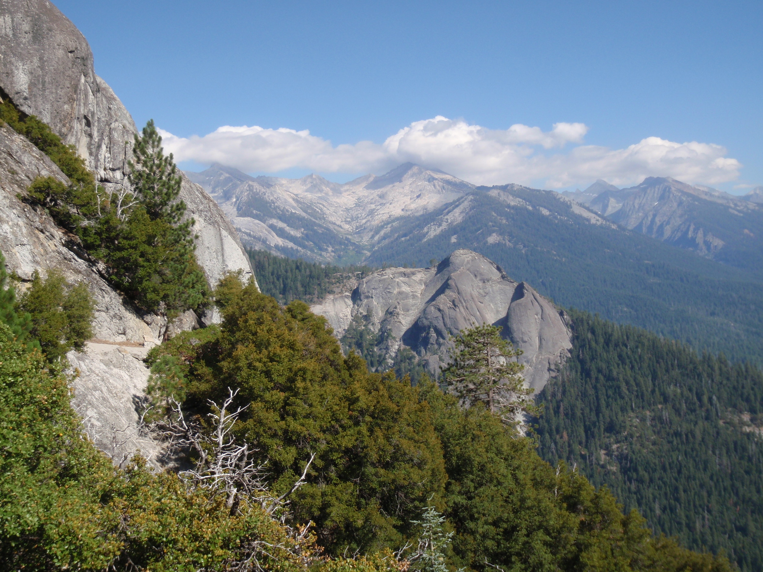
Day 1: Crescent Meadows to Buck Creek
Rocky slope and long view across the Middle Fork Kaweah River from the early miles of the High Sierra Trail
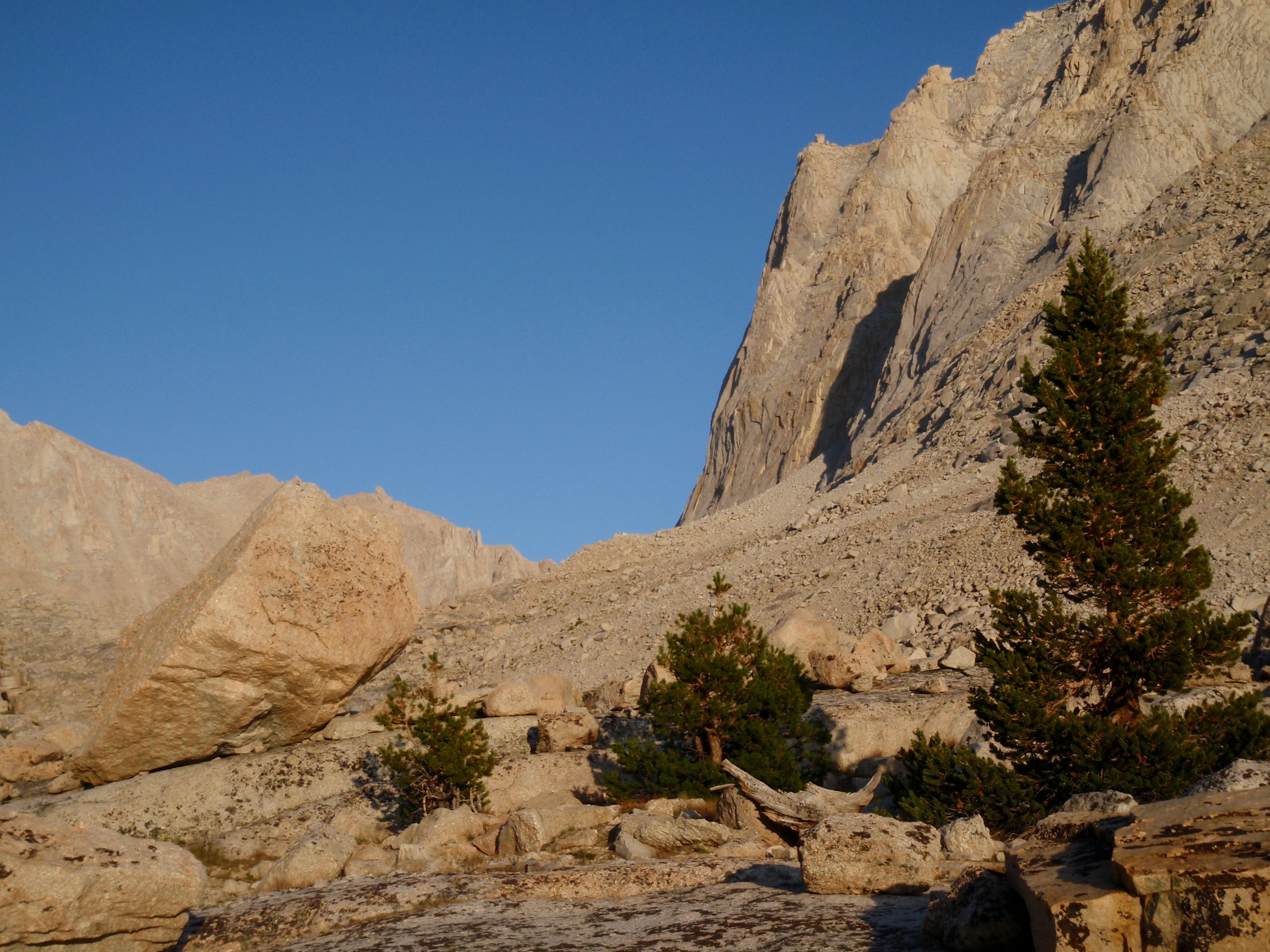
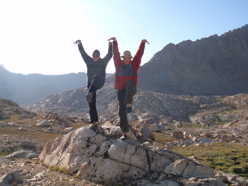
We hit the trail with a mission, hoping to get some serious mileage in before camping for the night. The mid-August heat combined with the exposed trail and relatively low elevation meant we quickly broke a sweat. At least the summer days were long and we made a tentative goal of Bearpaw Meadow (10.5 miles in) for the night. The views of Moro Rock and Sugarbowl Dome dominate the early section of trail, and puffy clouds contributed to some photo-worthy vistas. We reached the Mehrten Creek crossing (5.5 miles) around 5pm, happy to enjoy its fresh cool water and shade. It seemed that we were the only ones there, so we sprawled out on the rocks to enjoy a very late 2nd lunch. Before hitting the trail we decided to check out the nearby campsite in case we needed a fallback option and were willing to backtrack for it (however unlikely). A narrow & steep use trail leads to a smattering of small but flat tent sites and a bear box, where we found three middle-aged guys hanging around. At first they were quite defensive of the area, letting us know that there would not be any room for overnighting. Once we assured them that we were only making a late lunch stop and would continue up the trail they relaxed and became quite chatty, eager for some adult interaction. It turns out that they were on the final night of a 7-day trip with a large group of 10-12 year old boy scouts. They had done a loop over Elizabeth Pass, for a total distance of ~35 miles - "pretty respectable, I'd say" - according to the guy who seemed to be in charge. We all agreed that it was respectable, wished them a good final night in the wilderness, and headed back to our packs. As we headed up the trail, we chuckled about this definition of respectable. And so was born our catchphrase for this entire trip and many others since... we can always cheer ourselves up by assuring each other that by the NEW definition of respectable, we're doing just fine.

Andrew works on dinner at our basic but very serviceable first night's campsite, Buck Creek
We continued into Buck Canyon and made the first crossing of the creek, and decided that we'd rather not camp right across from the "glamping" cabins at Bearpaw Meadow. Besides, 8+ miles starting at 3pm suddenly seemed rather respectable. It wasn't yet 7pm but the small campsite between these first twin tributaries of Buck Creek was deserted, and it was too tempting to pass up in the waning daylight. We set up camp and made a quick dinner before grabbing some sleep in preparation for a full day's hike tomorrow.
Distance: ~8.25 miles | Starting Elevation: 6680' | Ending Elevation: ~7600'
Day 2: Buck Creek to Precipice Lake
We continued to drop down to the bridge over the main channel of Buck Creek, then climbed the steep switchbacks up the far side of Buck Canyon. The deep shade and cool morning air were in sweet contrast to yesterday's heat, especially as our packs were still heavy with 12 days of food/fuel and our breath was still short on our first full day at altitude. We reached Bearpaw Meadow as sunlight hit the trail, and paused to check out the facilities. The main building of the High Sierra Camp is a rustic wooden cabin that juts out over the Middle Fork Canyon with a small wraparound deck and canvas awning. We joked that we could be chilling there with our feet up, waiting for someone to bring us coffee... by the new definition of respectable. Of course, it was far too early for glampers to be awake, so the place looked deserted (despite being fully booked for the entire season, as always). In all seriousness, one of these years this type of outing will probably appeal to us and provide a much-appreciated means to keep enjoying the backcountry with less effort. But on that particular trip we had a different mission, and it involved carrying packs heavy with our own supplies and spending each night wherever the mood struck.

There's still a bit of shade between Lone Pine Creek and Hamilton Creek
Beyond Bearpaw Meadow we followed a gently descending traverse to the bridge over Lone Pine Creek. Twisted iron wreckage of an old bridge lays across the huge rocks below, a reminder of nature's great power. The new bridge is solid, and we soon passed the junction with the Elizabeth Pass trail. We continued our climb and came out on the exposed wall of the Hamilton Creek canyon. The granite scenery is stunning, but the trail got hot quickly in the heat of an August day. We had a fine long break at the ford of the creek and enjoyed the opportunity to soak feet.

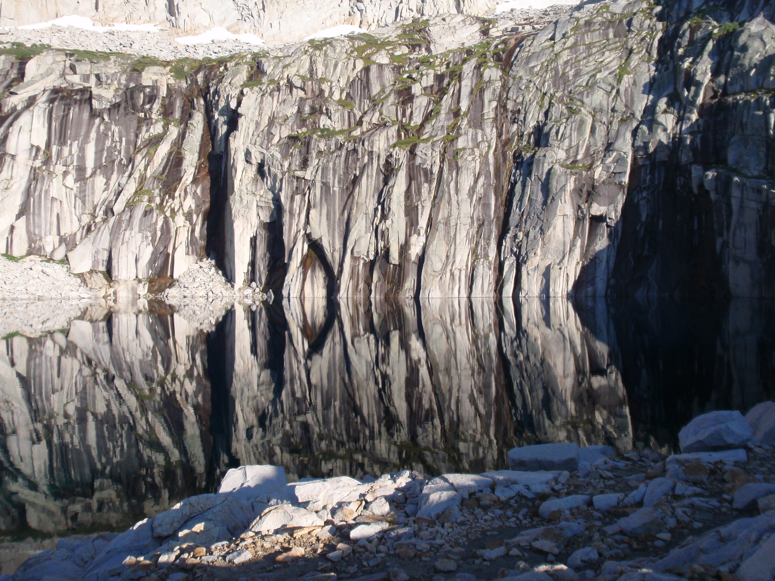
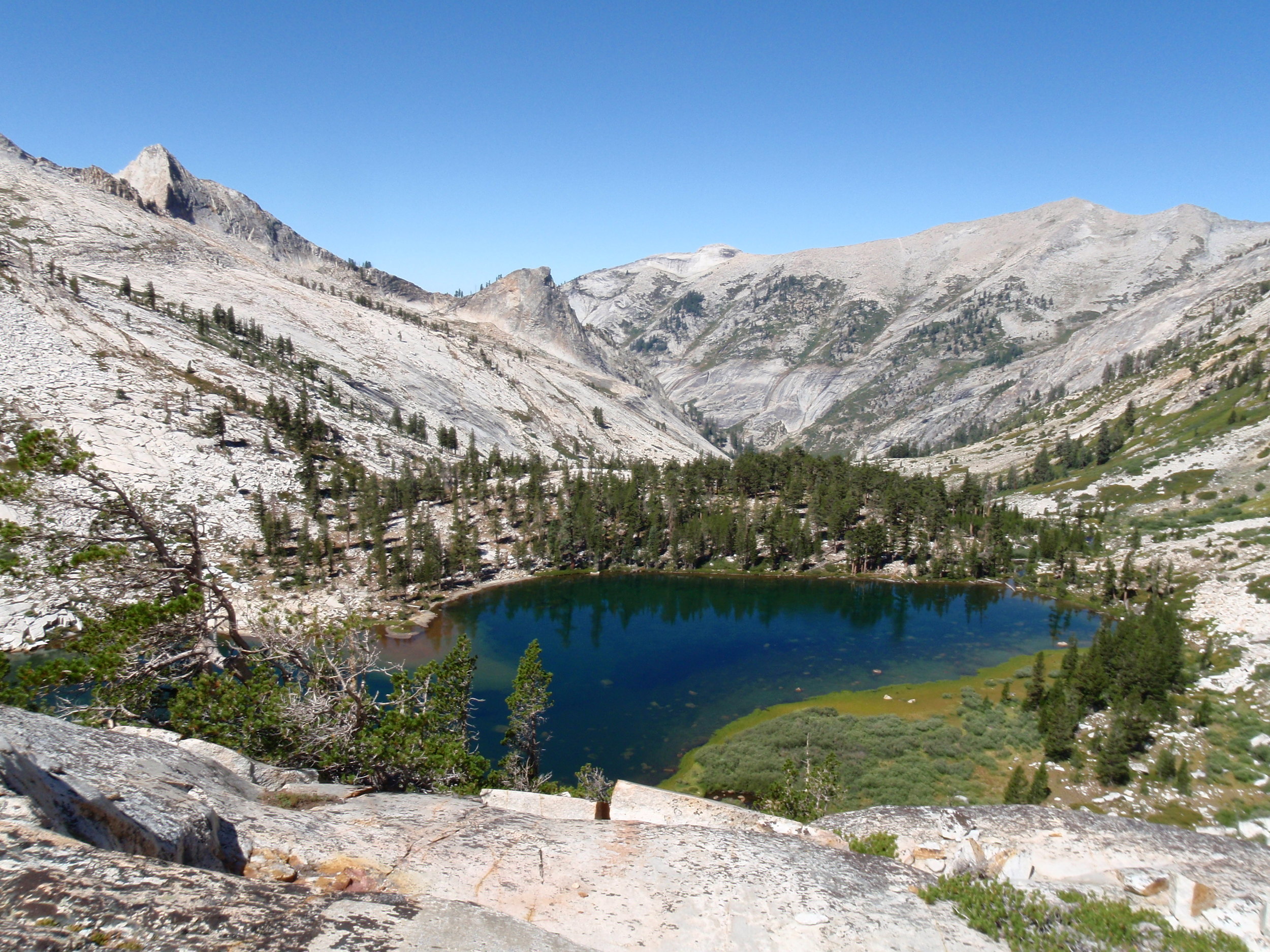
Surveying Precipice Lake and Eagle Scout Peak from our 2nd night's campsite
Views and heat both continued as we made the steady climb past lower and upper Hamilton Lakes. There were several areas that looked to be fine campsites near the upper lake, but we intended to get in most of the climb to Kaweah Gap before stopping for the night. The afternoon got hotter and we took every short break in the shade of a large boulder as there were no trees anywhere near the trail. We did have great views of Valhalla, and Hamilton Lakes themselves are stunning from both directions.
We reached Precipice Lake around 6pm and couldn't resist spending the night at such a scenic spot. Its far wall is steep granite with dramatic vertical striping which makes for perfect reflections, its water is a deep emerald green not commonly seen in the Sierras, and it sits in a small basin below the snow-covered shoulder of Eagle Scout Peak. We had a leisurely meal then spent a fine evening meandering around the little cirque, which we had all to ourselves.
distance: ~8.25 Miles | Starting Elevation: ~7600' | Ending Elevation: ~10,310'
Day 3: Precipice Lake to Moraine Lake

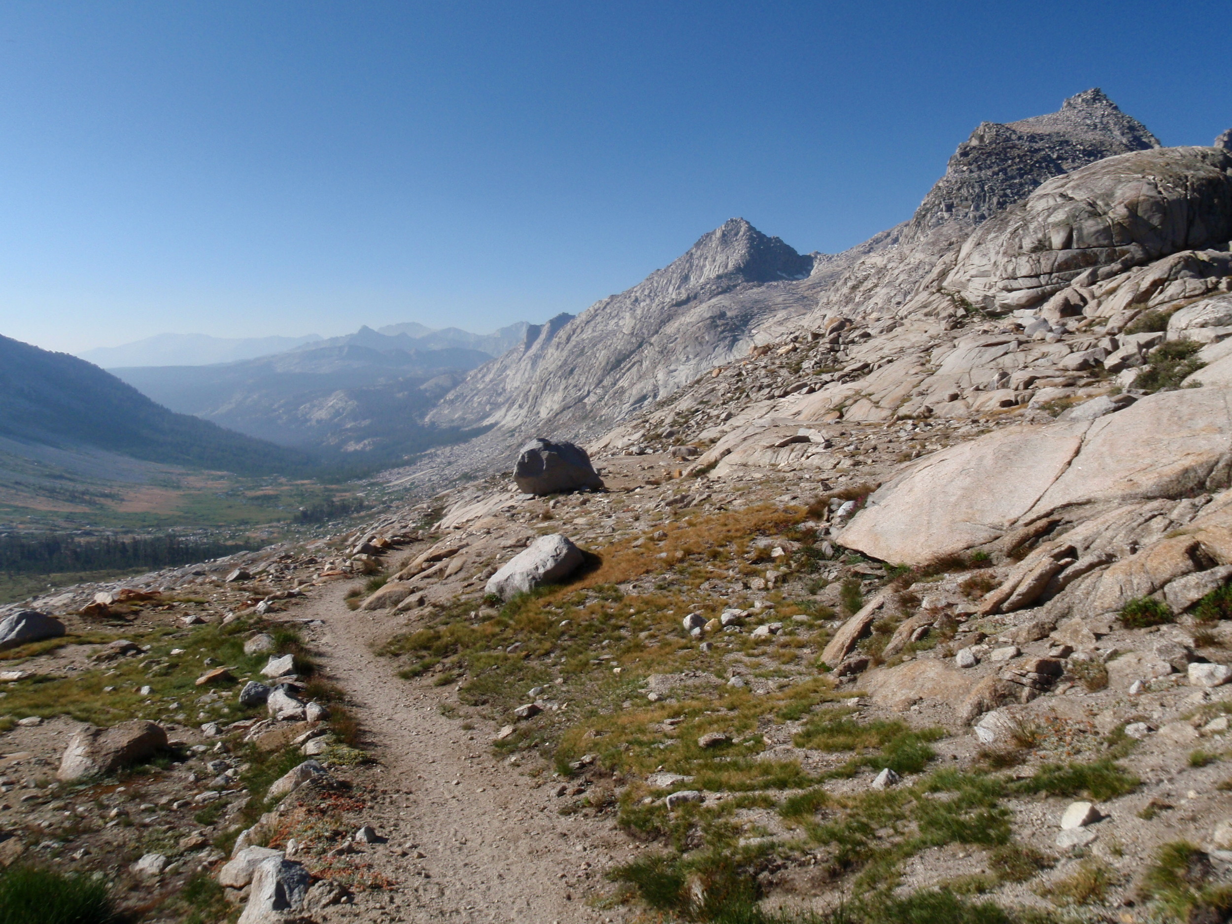
Nine Lakes Basin from Kaweah Gap along the High Sierra Trail
We woke to another clear day, and hit the trail by 8am to make the final ~400' climb to Kaweah Gap for awesome views back towards Eagle Scout Peak and down into Nine Lake Basin. We didn't have time to dawdle, but made a mental note that a return trip to the area would include exploration of this sweet rocky basin. Kaweah Gap is where the High Sierra Trail crosses the Great Western Divide, and from there we had an expansive vista down Big Arroyo Canyon as it dropped away towards the great Kern Canyon.

Climbing out of Big Arroyo Canyon with a view of the Great Western Divide
The trail descends quickly at first, and reaches the junction with the Little Five Lakes trail within a few miles. The canyon is wide and open, providing great views of the Kaweahs and plentiful water from several little streams. After that junction the trail starts a long and steady climb up the north wall of the canyon through a forest of lodgepole and foxtail pines, before finally reaching a large meadow at ~10,225'. The actual HST takes a more northerly route across the Chagoopa Plateau, but we had our eye on Moraine Lake as a campsite for the night so we took the southern fork. The two routes would rejoin within a few miles, and many consider both to be part of the High Sierra Trail. We skirted the plateau then started our steady descent along the rim of Big Arroyo Canyon, with more great views of the Great Western Divide. We re-entered the forest and soon reached wooded Moraine Lake. Once again, we found ourselves alone and located a sweet campsite on the south shore of the lake with excellent views of the Kaweahs in the last light of day.
Distance: ~10.75 Miles | Starting Elevation: ~10,310' | Ending Elevation: ~9,302'
Day 4: Moraine Lake to Junction Meadow

Cheri & Andrew on the edge of Sky Parlor Meadow
We awoke at dawn and got up in time to enjoy the pink-hued peaks perfectly reflected in the still surface of Moraine Lake. Distracted by the light show, we weren't terribly efficient about breakfast, but still managed to pack up and start hiking before 8am. The trail makes a short descent to the edge of Sky Parlor Meadow then skirts this broad expanse before rejoining the main HST. By mid-August there were no wildflowers in bloom, the grass had browned, and many trees were showing signs of stress, but the morning air was still fresh and clear and we stopped to marvel at the aptly named clearing surrounded by the Kaweahs and the Great Western Divide.

Andrew & Cheri about to descend into the depths of Kern Canyon
At far end of the meadow we forded Funston Creek, a smallish trickle, and soon rejoined the main route of the High Sierra Trail. We started our descent towards Kern Canyon, initially with a moderate slope then quickly getting steeper. As we dropped elevation the day started to heat up and we realized the bottom of the canyon would probably be like an oven. There were some great views down-canyon in between forested sections, and we ultimately reached a long series of rocky switchbacks that crossed Funston Creek several times before delivering us to the canyon floor near the Kern Canyon Trail junction.

Mike & Cheri along the Kern River in Kern Canyon
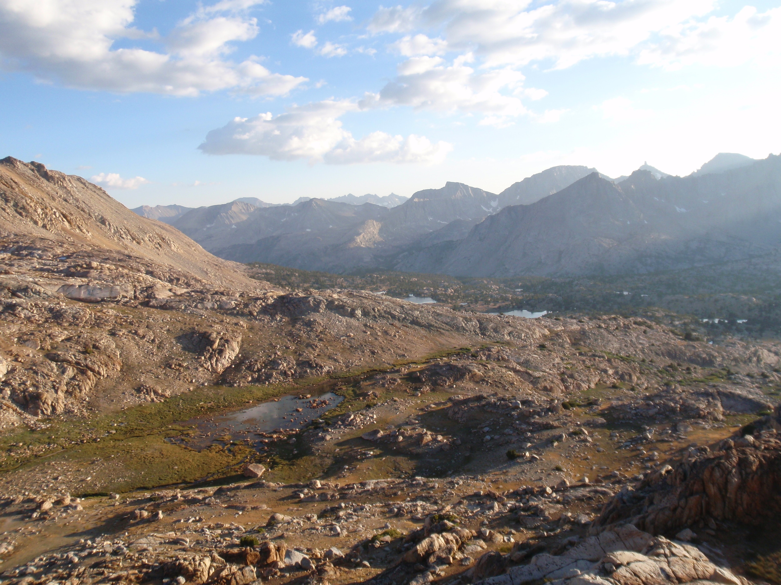
Our fears were unfounded as the canyon was decently temperate, due in part to the rushing green waters of the Kern River and in part to the shade from a good number of trees. We were happy to find a solid footbridge over the main channel of the Kern River and pointed out some huge boulders that had probably been moved by the powerful water during runoff season. Despite the water and shade, the day was quite hot and by noon when we reached Kern Hot Spring, none of us were in any mood for a hot bath (though we had the place to ourselves). We pressed on up the canyon. The walk towards Junction Meadow was less monotonous than expected, with numerous rivulets to rock-hop or ford, many hanging valleys high up on the walls of the canyon, and plenty of long vistas. The trail was varied, never far from the river, and always pleasant. We were surprised not to come across many people, as we'd heard that this area sees a lot of use. It was challenging to gauge our progress on the map as we quickly lost track of named creeks/drainages, and the canyon seems to stretch on forever. We passed several good camp-able spots but set a goal of reaching Junction Meadow to spend the night, since there would be a trail marker and we could be sure of our location. Junction Meadow is nothing to write home about but offers numerous decent campsites of various sizes with a modicum of privacy due to plenty of trees, boasts multiple bear boxes, and was a convenient spot to plan our approach for Mt Whitney.
Distance: 14 miles | Starting Elevation: ~9,302' | Ending Elevation: 8,080'
Day 5: Junction Meadow to Mt. Whitney Approach

Mike taking advantage of Wright Creek's cool waters
Early morning sunlight can't reach into the trees of Junction Meadow, a good enough excuse for our late start. We managed to get going by 8:30am, passing the Colby Pass lateral that we planned to take on our return trip. From there the trail makes a gradual but steady climb for about a mile as the tree-cover gives way to swaths of manzanita and other low shrubs. This makes for great views down Kern Canyon and out Kern-Kaweah Canyon towards Colby Pass but also meant we were exposed to the day's heat right away. The High Sierra Trail leaves the Kern River about a mile from Junction Meadow, and continues climbing towards Wallace Creek on an ascending traverse across an exposed, south-facing, rocky slope. We pulled out our long sleeves and wide-brimmed hats as some protection from the relentless Sierra sun, and were relieved to reach the burbling cascade of Wright Creek spilling across the trail. We stopped for a quick splash and tucked into the shade of some boulders for a snack, then rock-hopped across to continue onward and upward.

Cheri tries not to melt in the day's heat on the JMT above Wallace Creek surrounded by foxtail pine
Down below us, Wallace Creek splashes through its canyon over rocks and through patches of brush punctuated by an occasional majestic western juniper and small stands of Jeffrey and lodgepole pines. On the trail as the ground went from rocky to sandy with limited shade, the day's heat was relentless. At the John Muir Trail intersection (10,405'), it hardly seemed possible that we had walked only 4.3 miles from Junction Meadow. On the other hand, we were now in territory we recognized, as all three of us had previously thru-hiked the JMT. We crossed Wallace Creek and a few of its tributaries and our pace picked up as we were eager to catch a first glimpse of Whitney. The familiar trail evoked JMT memories, the mixture of excitement and remorse that so often accompany the final days of a long backpacking trip. The topo map shows this section as forested and there are tall trees but the ground is dry, sandy, and devoid of any undergrowth. As we continued our climb, the air temperature followed suit.

Cheri heads down the JMT towards Crabtree through a stand of lodgepole pine
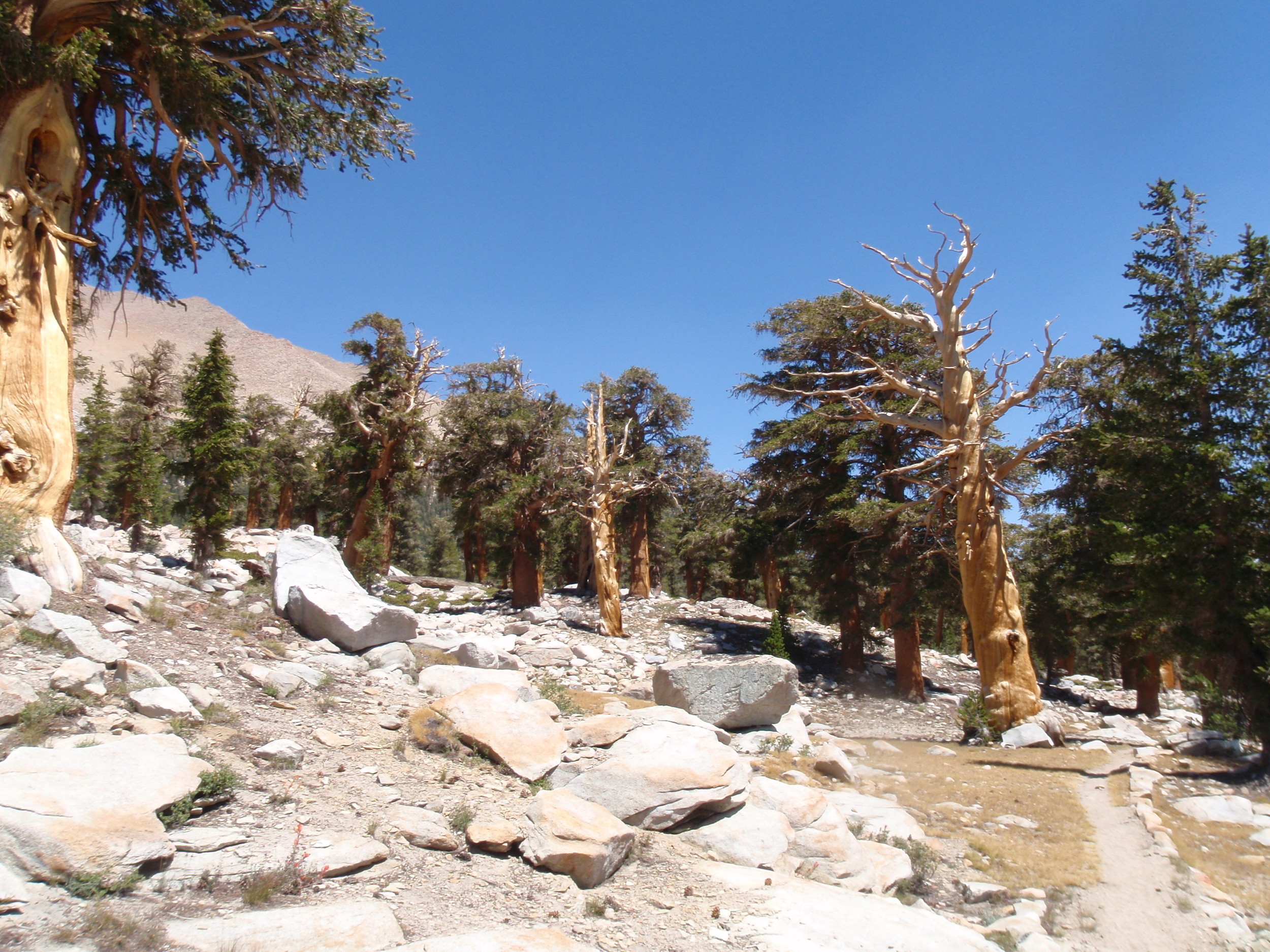
The 5-needled foxtail pine has a fairly limited range and is one of our favorite trees in the Sierra Nevada. Walking through ancient foxtails always puts a spring in our step, and we needed an early afternoon boost to power through the heat. We were on Day 5, but still carrying more than a week's worth of food in our packs, and we took frequent breaks crouched in the small patches of shade provided by the high mid-day sun. We were pleased to crest a small saddle and drop down towards Sandy Meadow, a broad field of green(ish) grass ringed by fairly thick forest. This renewed our energy for the climb that waited on the far side of the meadow, to the intersection where the PCT heads south and the JMT turns east towards Mt. Whitney. The terrain below Crabtree ranger station is similar to that above Wallace Creek, with large trees spread far apart in rocky/sandy terrain. By mid-afternoon we were all exhausted by the heat but it took us by surprise when Andrew stood up too quickly from his crouch and blacked out entirely. He came to right away but it was still a scary little moment.
Yep, that's Mt. Whitney beyond the trees. We're sleeping tentless tonight for the best stargazing.
Crabtree ranger station was unoccupied as we passed, but we each picked up the WAG BAG that is required for human waste disposal within the Whitney Zone and made note of camping restrictions. We had initially thought of making Guitar Lake our base for summiting Mt. Whitney, but we knew how crowded it can get with late summer JMT hikers and we were all hot and tired. We decided to camp away from the trail, below the timber line but far from the shores of the fragile lakes in this heavily used area of wilderness. We continued another mile or so up the trail then scouted out a flat area on durable surface large enough for our 3 sleeping bags. Our little campsite boasted fantastic views of Mt. Whitney (and the Kaweah ridgeline silhouetted by sunset), great evening golden hour light, and solitude. We were still easy walking distance to Whitney Creek and Timberline Lake to obtain water, and this was a small price to pay for sleeping in such a sweet spot.
Distance: ~10 Miles | Starting Elevation: 8,080' | Ending Elevation: ~11,100'
Day 6: Up Mt. Whitney Summit & back to Sandy Meadow

Hitchcock Lakes below Mt. Hitchcock, southwest of Mt. Whitney
Today we woke before sunrise, on a mission to summit Whitney. We packed up camp, stashed our backpacks, and headed out with just the essentials. It was another clear day and without the weight of our full packs we made good time. We were alone on the trail until we reached Guitar Lake (named for its shape) around 8am. There were still plenty of thru-hikers along its shore breaking camp on their way out to Whitney Portal via the summit. Mt. Whitney serves as the terminus of both the north-to-south John Muir Trail, and of the west-to-east High Sierra Trail. Every night during peak backpacking season Guitar Lake is surrounded by tents of hikers spending their last night on one of these two iconic trails. On our JMT thru-hike in 2007, we did the very same thing and found it to be a perfect choice. Today, dayhiking to the summit before heading back towards the west, it felt luxurious to leave our packs at an even lower elevation and hard to beat having a private campsite.

Andrew & Cheri on the final approach to Mt. Whitney Summit
Sky Pilot (Polemonium eximium) growing at around 13,500'
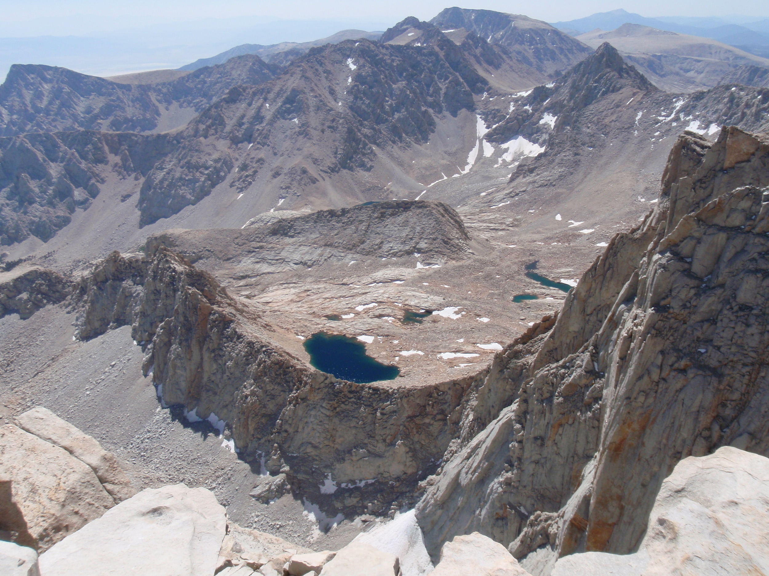
On this clear day we had perfect view in every direction and stopped several times to take pictures. The Hitchcock Lakes were particularly scenic under the prominent ridge of Mt. Hitchcock, above Guitar Lake. Other than our gawking, we made steady progress and started up the relentless switchbacks that lead to Trail Crest (13,484'). Although most west-side Mt. Whitney hikers are well acclimatized to the elevation and in great shape from several days on-trail, they all still carried full backpacks and we passed scores of them as we continued our climb. At Trail Crest we saw a row of backpacks, left by the hikers that were at the summit but would pick them up on their way back down towards Whitney Portal. We had nothing to leave so continued along the final 1.9 miles to the summit. In this section we found a few lingering snowdrifts across the trail, and also saw several beautiful specimens of Sky Pilot (Polemonium eximium), a central Sierra wildflower that blooms in July & August, grows only at the highest elevations (above 10,000'), and is adapted to rocky crags with only a tiny amount of organic soil and the harshest conditions that this range has to offer. We considered a quick Class IV scramble up Mt. Muir (14,015') but decided against it as we wanted to enjoy some time at the top of Whitney and still had a long day of hiking ahead of us.
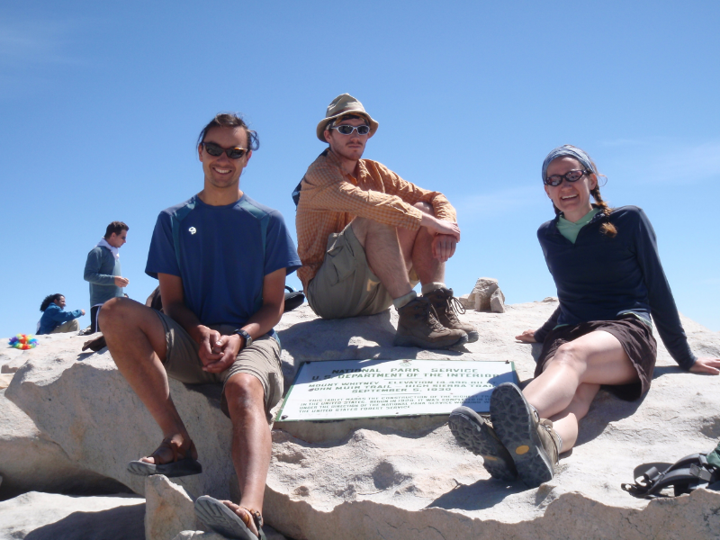
Andrew, Mike, & Cheri on Mt. Whitney's summit at the plaque marking the terminus of both the High Sierra Trail and the John Muir Trail
We passed the iconic jagged edge and reached the summit hut around 11am. There were a handful of people at the summit, primarily those who had started from Guitar Lake at (or before) sunrise. It was too early in the day to have many hikers from the east side approach, and we had passed many of the thru-hikers on or before the switchbacks. We enjoyed a leisurely lunch, chatted with some hikers, took plenty of pictures, and shooed away a few cheeky marmots. Despite the clear sky and intense sun, it never gets too hot at this high elevation. Andrew even lizarded on a warm, flat rock for a while. But eventually it was time to descend, since we wanted to make at least a little progress northward before camping tonight. We passed tons of hikers between the summit and Trail Crest, most coming from Whitney Portal (or Trail Camp) on the east side. We easily spotted the rare west-side thru-hiker stragglers (dirty, lean, and accustomed to the altitude) among the many east-side day & weekend hikers who were clean, well-dressed, and took frequent stops to catch their breath.

Wildflowers above Guitar Lake, with distant view of the Kaweahs
We practically skipped down the trail, reaching Guitar Lake by 2:30pm and picking up our backpacks not far below that. We continued down Whitney Creek Canyon to Crabtree Meadow, then headed north on the JMT/PCT. It was nearly 5pm by the time we reached Sandy Meadow. As this was the last decent spot to camp before Wallace Creek, we decided to call it a night.
Distance: ~16.2 miles | Starting Elevation: ~11'100' | Peak Elevation: 14,500' | Ending Elevation: ~10,650'
Day 7 : Sandy Meadow to Lake South America

Meadow below Bighorn Plateau along the JMT/PCT
We took a leisurely morning after yesterday's long walk and steep climb, and left Sandy Meadow around 8:30am. The first few miles of trail were familiar from Day 5, and we made good time through this exposed section without midday heat to contend with. At first it was a shock to carry our full packs, but we quickly fell back into our rhythm and soon enough reached Wallace Creek and the junction between the HST and the JMT/PCT. We continued north this time, following the JMT/PCT across Wright Creek and towards Bighorn Plateau. There were several green grassy patches in this stretch, a contrast to the yellow & parched conditions we found on our JMT thru-hike in 2007 (though it had been a month later, and a dry year at that). The clear blue sierra sky made a great contrast, and provided the perfect backdrop to distant peaks and prominent, tan-colored Tawny Point.
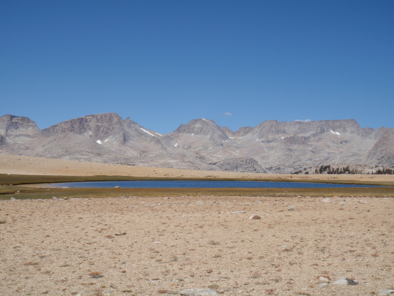
Unnamed lake (tarn) along the JMT/PCT on Bighorn Plateau
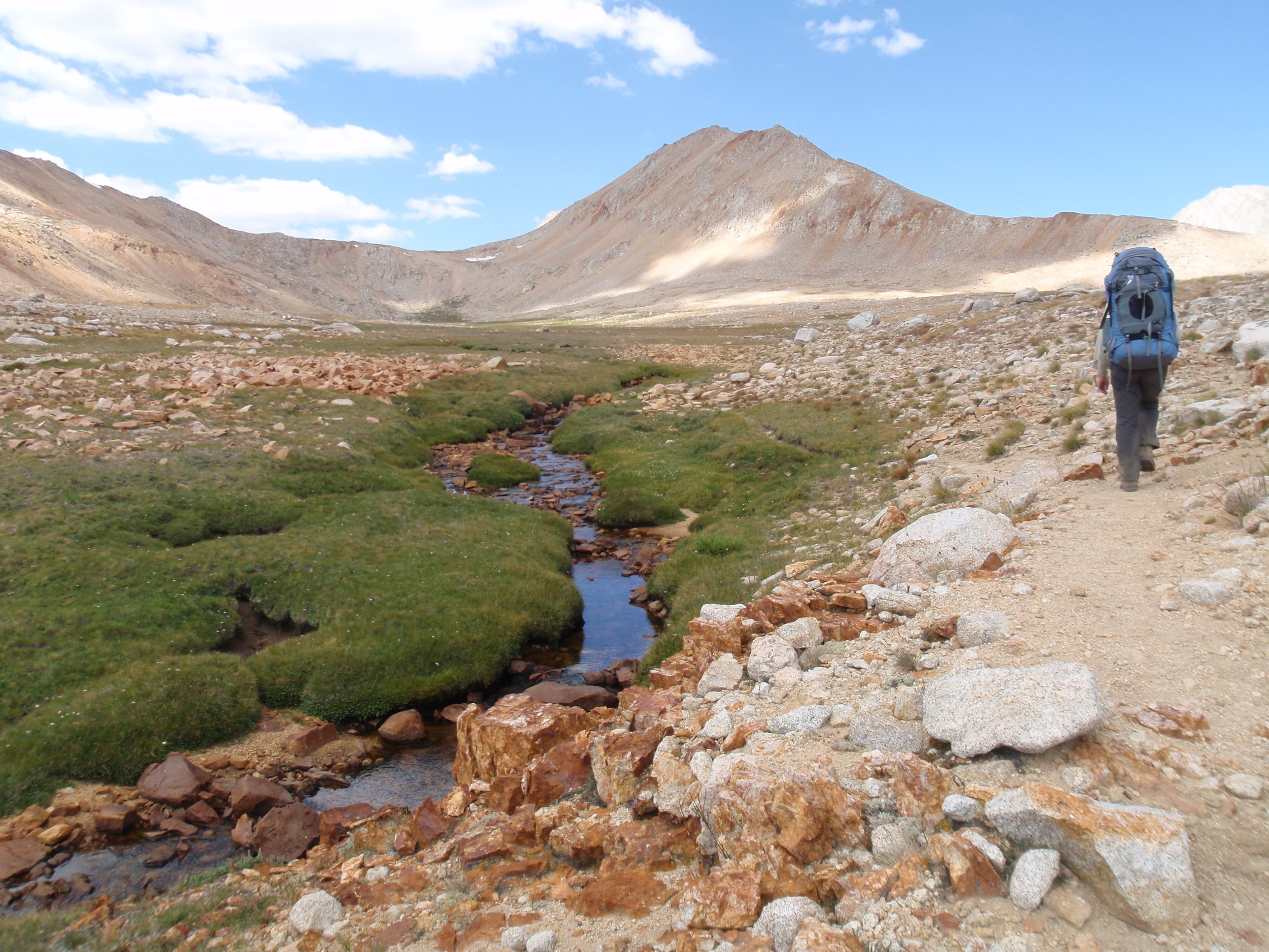
The idyllic meadows didn't last long. We reached the edge of Bighorn Plateau in the heat of the day and headed across this dry, open stretch of land named for the Sierra bighorn sheep that used to roam this area but that are now a federally endangered species restricted to a much smaller range. The plateau offers a dramatic, flat landscape with only a few gnarled foxtail pines and a single unnamed lake (a tarn, really) along the trail. That lake was completely dry on our 2007 JMT hike, but today is filled with water and surrounded by a rim of green grass. It would be a decent if exposed campsite but our goal was Lake South America. We took a few rest breaks in the shade of a rare tree, oohing & aahing at the surrounding peaks, but otherwise continued straight across the plateau to Tyndall Lakes for a late lunch.

View south from final climb into Upper Kern Basin, with "infinity tarn" visible in the distance

Lake South America with Mt. Stanford, Gregorys Monument, and Caltech Peak on the edge of the Upper Kern Basin
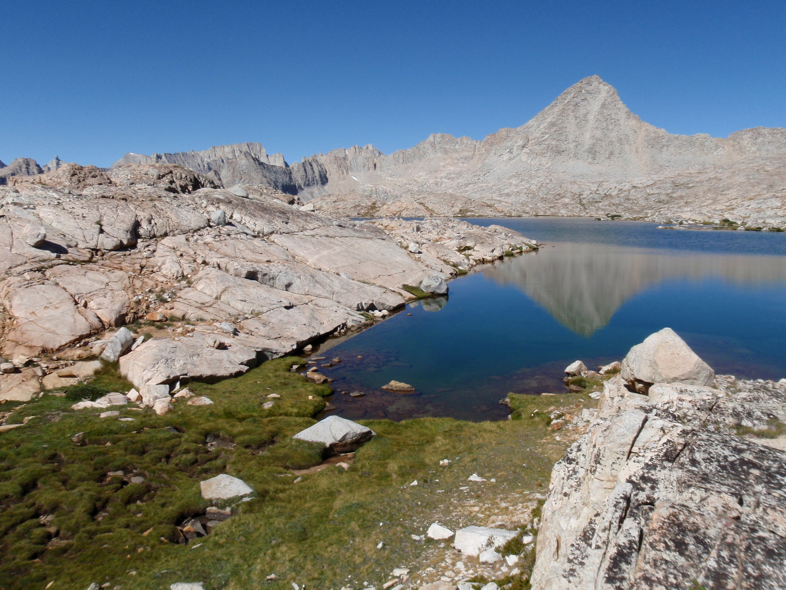
Mature lodgepole pines surround the shores of the lower Tyndall Lakes, and we took advantage of their shade. There were also several nice campsites along the shore, none currently in use. In fact, we hadn't seen another soul all day (strangely, since the JMT sees heavy use during August). We would leave the JMT soon and head west into Upper Kern Basin, where we were much less likely to run into other backpackers. After a long lunch we continued the long rising traverse past the little-used trail to Shepherd Pass, and a bit further to the junction with the Upper Kern Loop Trail. At this point we were all heading into territory we had not previously visited, and we marveled at the pale red-orange color of Caltech Peak rising above us to the north. The terrain was stark, with no trees to be found once we passed the Kern Cut-Off Trail at 11,440' and continued our gradual climb. We walked along a creek for a bit and that was lined by a corridor of green grass. The rest of the ground was a combination of rock, decomposed granite, and low subalpine wildflowers. Clouds were starting to build in the sky, for the first time since Day 1 near Crescent Meadow. They didn't appear to have anything in mind, so we enjoyed the show. We had a late afternoon snack by a little tarn just before making the final push to the saddle above Lake South America, and named this spot "infinity tarn" for its location near the lip of a small shelf.
Andrew & Mike surveying the scene in Upper Kern Basin below Mt. Ericsson
On cresting the saddle at ~12,200' we looked down on a small lake, pretty enough but not terribly dramatic. We were happy to consult the map and realize it was just a tarn. Lake South America would come into view around the next corner and it was a stunner in this sparse landscape. It is large, deep green-blue in color, and nestled up against the base of Caltech Peak with ridgelines of Mt Ericsson and Gregorys Monument rising to the north. We located a prime sandy campsite and set up our tent, then spent the next hour or two exploring the nearby basin. We came across a pair of backpackers that had just come over unmarked Harrison Pass and were headed south, the first people we'd seen all day. Other than that we seemed to have the Upper Kern Basin to ourselves. And what a sweet spot to land for the night. There are no trees to be found, but the combination of mounding rock, low grasses, wildflowers, jewel-like lakes, and craggy peaks makes a perfect canvas for classic Sierra golden hour light. We couldn't get enough of the evening, and continued basking in the views until well after dusk.
Distance: ~11.2 miles | Starting elevation: ~10,650' | Ending elevation: 11,941'
Day 8: Lake South America to Junction Meadow

Mt. Genevra reflected in an unnamed lake, Upper Kern Basin

Table Mountain and the Great Western Divide from Upper Kern Loop Trail
We packed up camp and took our packs but instead of returning to the trail we spent a few hours meandering through Upper Kern Basin, exploring little lakes and basking in views of the Great Western Divide along with the craggy peaks of the Kings Kern Divide. The sky was brilliantly clear, though the day was much cooler than we'd had so far, and we took full advantage of the perfect weather to lollygag around this amazing place. We were especially drawn to pointy Mt. Genevra and made our way over to the handful of small lakes near its base. In this western portion of the basin we found burbling streams, little meadows, and started to see trees once more. We had a nice and long late morning break and would have liked to spend an entire day in Upper Kern Basin but ultimately decided that we needed to get a little mileage in for the day. We picked our way across the basin in the general direction of the trail, and re-joined the Upper Kern Loop Trail near a collection of lakes at ~11,400' around noon. The sky was starting to fill with clouds, and while we appreciated the cool temps we wondered if we would finally be getting a Sierra afternoon thunderstorm. The trail dropped into a more heavily forested area and we continued down into the upper reaches of Kern Canyon. We alternately crossed big exposed slabs of granite with views towards the Great Western Divide and followed forested switchbacks along the headwaters of the Kern River.

Cheri, Andrew, & the stormclouds in Upper Kern Canyon
The weather had definitely shifted, and we were glad to have had such a picturesque morning to explore the Upper Kern Basin. Now our focus changed. We added a warm layer each and got down to hiking, in hopes of reaching a decent campsite before getting rained or hailed on. The walk along the upper stretches of the Kern River is pretty, but we didn't stop much. We made it all the way to Junction Meadow and while it wasn't perfect it was familiar, and good enough to spend another night. The trail climbs steadily out of Junction Meadow towards Colby Pass and we were afraid there wouldn't be anything better for several miles if we continued. So it was decided, we'd camp.
Distance: 9.4 miles + a bit of meandering | Starting elevation: 11,941' | Ending elevation: 8,080'
Day 9: Junction Meadow to Colby Lake

View towards Colby Pass from Gallats "Lake" along the Kern-Kaweah River as storm clouds build

Mike & Andrew take a late lunch on a shelf below Colby Pass with a backdrop of the Kaweahs and stormy sky
We didn't get any precipitation overnight but woke to a cool, overcast day. Junction Meadow makes a decent campsite but isn't otherwise appealing, so we made quick work of packing up and headed up the Colby Pass trail. We crossed the Kern River at the edge of Junction Meadow and immediately started to climb. There were plenty of granite steps to navigate on the initial climb out of Kern Canyon and into the side canyon carved by the Kern-Kaweah River. The dilapidated path appeared less frequently travelled than most of the trails we had used so far this trip, but it was not difficult to follow over the rocky terrain. The broad granite slabs, cascading water, and patchy trees made for classic Sierra hiking and we appreciated a cool day after baking in the August heat for the past week. Above Rockslide Lake, the trail stays fairly close to the clear green waters of the Kern-Kaweah until Gallats "Lake" (10,000'). The river widens in this big, flat meadow and a flat mound of rocks made it a great spot for elevenses, though there was no appreciable body of water that might be considered even a small lake. The flat grey sky of the morning had transitioned into one filled with darker storm clouds, so we didn't stay long. We still had another 2,000' to climb to the pass, and it looked like we would definitely be getting wet today. Another mile beyond Gallats the trees thin out and the trail passes a series of dry, subalpine meadow-lets with great views of the Kaweahs and along the Great Western Divide as it continues to climb. We tucked into one of these for a late lunch, and put on raingear before hitting the trail.

Mike on the south side of Colby Pass, view of small tarn below Milestone Bowl to the left

Mike and Cheri on the north side of Colby Pass, with Colby Lake far below

Colby Lake in early evening with clouds obscuring the pass
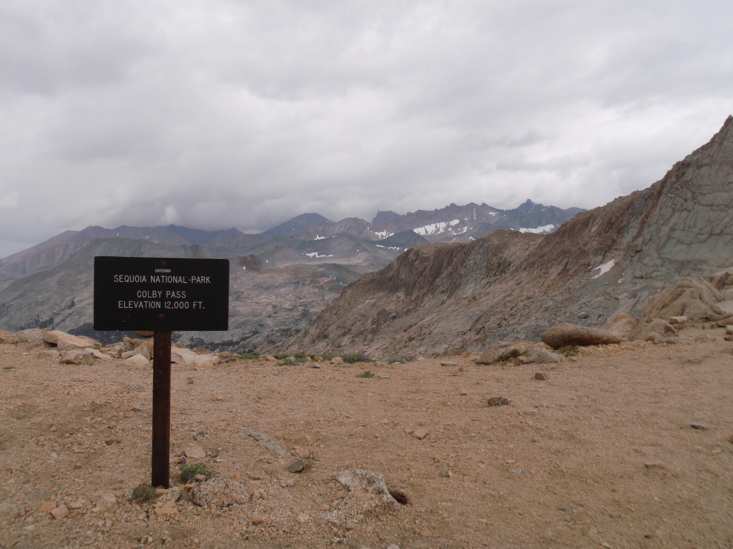
The wind picked up as we became progressively more exposed on the final rocky approach to Colby Pass. We started feeling raindrops, and the temperature continued to dip. We climbed past the final tarn, a deep green pool surrounded on all sides by granite, and made the final push for the pass. It was gusty, chilly, and damp, and the sky threatened much worse. We didn't stop long but couldn't help taking a quick snack break to take in the amazing views of dramatic ridgelines in every direction. Colby Pass crosses the Great Western Divide at 11,970', over 1000' higher than Kaweah Gap, and the terrain couldn't be more different. We love the stark highcountry landscape above treeline and would have enjoyed spending more time here if the weather had been different. Today, it made more sense to continue over the pass and head down towards Colby Lake, a drop of ~1500' from the pass. It looked to be the perfect place to spend the night, and we hoped to reach it before the skies really opened up. The occasional sprinkles turned into a steady light rain, though the wind let up as we started to get some protection by dropping into the cirque that holds Colby Lake. The trail descends steeply at first and we were careful not to slip on the wet granite. We started to hear thunder and see distant lightning, but nothing too close. We settled into a rhythm of walking in the rain, glad that we were over the pass and close to our day's goal. Based on the topo map we guessed that any camp-able spots would be on the north end of the lake and followed the trail along its east shore to a lovely forested and relatively flat area near the outlet. The rain conveniently let up long enough for us to set up a tent, change clothes, and make dinner. As we sat on the rocky shore enjoying the evening we watched low clouds obscure the pass then settle into a thick mist across the lake. Not long after we retired for the night, the thunder and lightning started afresh and rain pounded on our tent most of the night.
Distance: ~10 miles | Starting elevation: 8,080' | Ending elevation: 10,584'
Day 10: Colby Lake to Ranger Meadow
Mist rising in front of the Whaleback below Colby Lake

View south up Cloud Canyon with Whaleback to the left, Glacier Ridge to the right
We were up before the sun after yesterday's storm and early night. The sky had cleared so we had great morning light with perfect reflections across the lake's outlet as the mist dissipated. We hit the trail after breakfast and continued our descent into aptly named Cloud Canyon as we enjoyed a constantly changing sky. A massive finger of granite named Whaleback forms the east wall of the upper canyon and made a good point of reference as we walked. Our tentative plan had been to head cross-country up Cloud Canyon over unmarked Lion Pass, and we would leave the trail just beyond the Whaleback's nose. The day was pleasant and we made good time on the well-maintained trail through a series of switchbacks down to the creek. It was an easy ford and it was before 9am when we reached the point where we would set out off-trail. The route seemed straightforward enough, but the lower section of canyon was choked with brush and after a short discussion we decided that none of us felt like a prolonged bushwhack. We'd leave this off-trail route for another trip, and continue on-trail to Roaring River, then head up Deadman Canyon to cross the King-Kaweah Divide at Elizabeth Pass just to the west of Lion Pass. While this option would add 15-18 miles to the trip, trail miles are much easier than route-finding and we wanted an easy day after yesterday's storm. We stopped for a few pictures then continued down-trail. The day remained pleasant, though clouds were building in the upper part of the canyon.
Whaleback and the view south up Cloud Canyon from Big Wet Meadow

Peaks above upper Deadman Canyon with late afternoon stormclouds building
Big Wet Meadow lived up to its name, though the grasses were yellowing as expected for late summer. The creek slows and widens as it meanders through this picturesque spot, and we stopped for a late morning snack. From there, the trail enters the trees and there aren't many more expansive views. We followed the stream through the lower reaches of the canyon under an increasingly grey sky. By the time we reached the trail junction it was positively stormy, and it seemed that we'd probably have another evening of rain. Lower Deadman Canyon has the decaying structure and homestead plot of a sheep-herder who lived and died here, and we wandered around and read the plaque. We hadn't seen any other people since Upper Kern Basin and although there were a few established campsites in the area it didn't seem that any of them were recently used. It was early in the afternoon and we hoped to make it much closer to Elizabeth Pass for the day. We headed south up Deadman Canyon on a very gradual ascent that again stayed close to a creek for the most part. The trail crosses a few times but the water was low and each time it was a rock hop rather than a ford. The sky remained grey and the air became cooler through the afternoon. We reached Ranger Meadow around 4pm and decided to make camp for the night before the rain started. From our little spot we had great views of the peaks in upper Deadman Canyon, and a good vantage point for watching deer and birds visit the stream.
Distance: ~16 miles | Starting Elevation: 10,584' | Ending Elevation: ~8,800'
Day 11: Ranger Meadow to Tamarack Lake

Deadman Canyon trail below Big Bird Lake, looking south toward Elizabeth Pass

Mike (shade) and Cheri (sun) lounging on boulders at Elizabeth Pass after lunch
We had light rain on & off overnight but again woke to clear skies. Sunlight hit the mist rising up from the wet grasses and made a picturesque backdrop for breakfast and coffee. Above Ranger Meadow trees become sparse, providing a long view south towards Elizabeth Pass and a high country feel with rocky walls rising up on either side of the broad U-shaped canyon. The trail climbs gradually at first, passing the drainage from Big Bird Lake then continuing along the main creek to reach the head of the canyon around 10,000'. There are no trees beyond this point, but patches of low brush and plenty of wildflowers remain along the path of the drainage. We turned southwest with the trail and started the final climb towards Elizabeth Pass (11,370'). It was nearly noon when we reached the pass, and plenty hot on the trail with constant sun and no shade. We commented on how different weather conditions can be through the course of a single day in the high Sierra, let alone over a full week or (in our case) a 13-day trip. The pass itself was a Sierra classic with plenty of granite, deep blue sky, and dramatic clouds. We stopped for lunch and a quick nap on the rocks. Although today's hike hadn't presented much challenge, we were all starting to feel the effects of several long days of hiking at elevation with heavy packs and limited calories. It felt good to lounge in the afternoon sun (or shade).

South side of Elizabeth Pass
We realized that we had more time and food remaining than mileage left between here and the car, and decided to spend the extra day in the high country rather than return to the trailhead a day early or try to add another loop at lower elevations. We eyed Tamarack Lake on the map and made a tentative plan to set up camp there for the night. We thought we might revisit Lion Pass from the south side as a day hike, or possibly check out crossing into Nine Lake Basin over the shoulder of Mt. Stewart. In any case, we suddenly had less than 5 relatively easy trail miles ahead of us for the day, so we luxuriated on the rocks a bit longer. The clouds continued to build as we hung around at Elizabeth Pass. We had great views of the Tableland and Moose Lake directly to the west, and a sweet vista down Glacier Ridge to the north. The pass itself is the low point in a ridge of blocky granite intermixed with rusty colored rock and sand, and made for a stark contrast against the blue sky.
View across Lone Pine Canyon towards Eagle Scout Peak from the trail over Elizabeth Pass

View from base of Lone Pine Canyon - Tableland to the left & shelf holding Tamarack Lake to the right
The south side of Elizabeth Pass was much more lush and we made our way down through a series of grassy ramps and over wide granite slabs with early views of the Great Western Divide then a spectacular vista across Lone Pine Canyon towards Valhalla and Eagle Scout Peak. We left the clouds behind us on the north side of the pass and enjoyed an idyllic afternoon traipsing through late summer wildflowers on our descent. The trail itself was indistinct, but the route was well-marked by huge rock cairns that we took turns spotting across the hillside. Despite all of this lollygagging, we reached the junction with the Tamarack Lake spur by mid-afternoon. From there we turned east and made our way up Lone Pine Canyon following the drainage of Tamarack Lake.

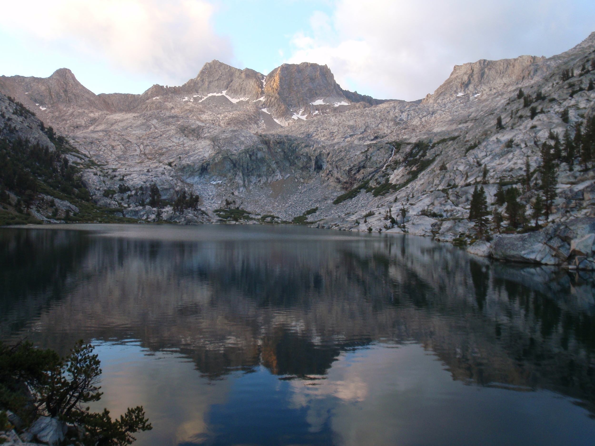
Lion Rock reflected in Tamarack Lake, evening golden hour
By now the clouds were spilling over the ridge from the north and a cool breeze accompanied our final climb. We reached Tamarack Lake by late afternoon in time to enjoy perfect reflections of Mt. Stewart and Lilliput Glacier in the calm surface of its teal waters. The lake is surrounded by flat slabs, perfect for camping, and we had the basin entirely to ourselves. We sat around after dinner and watched the alpenglow wash over the peaks. The clouds dissipated completely by dusk, and it was a perfect night for stargazing. We didn't even set up a tent.
Distance: ~9 miles | Starting elevation: ~8,800' | Ending elevation: ~9,450'
Day 12: Tamarack Lake Leisure Day
We had a leisurely layover day at Tamarack Lake since we still had food and time, and the weather was perfect. Our initial plan had been to scout Lion Pass, but after making the ~700' climb to the first ledge above Tamarack Lake we decided that a day of swimming, lizarding, and playing cards sounded more fun. We meandered around up there for the great views, then headed back down to the flat sandy beach and lakeside slabs near our campsite to while away the afternoon.


Distance: Meandered around the lake & up a ways, that's all
Day 13: Tamarack Lake to Crescent Meadow
It was a long-ish but relatively easy hike, backtracking along the High Sierra Trail all the way to our car. Plenty of downhill, and empty packs sped our progress.