Hwy 178 / Walker Pass to Hwy 58 / Tehachapi Pass (85.5 PCT miles)

It's dry in the desert
After just two on-trail water sources between KMS and Hwy 178, we were hoping to find our next water at Walker Pass. There is a BLM campground near the PCT highway crossing, but it doesn't have power or running water. During NOBO season, this is apparently a popular place for big spreads of trail magic, and trail angels frequently stock gallons of water either at the campground or the highway crossing. We've been told not to expect either of these in SOBO season. Our guidebook pages and the crowd-sourced/volunteer-updated water report both list a series of concrete cisterns supplied by a piped spring located a few hundred yards up the highway from the campground, but differ on whether it is likely to have water. The guidebook says it "always" has water, but the book is geared towards NOBOs and many sources that are wet in June are dry now. The printed copies of the water report that we borrowed from Eastwood at KMS say that on 7/2 the water in the pipe was down to a trickle at ~3 min per L though the trough was still full. No updates since then. That was a full 3 months ago, and we figure there are even odds that the source may now be dry. Our printed maps have an alert for "potential 43.7 mile dry stretch" from Joshua Tree Spring (north of Hwy 178) to Willow Spring (south of us), noting that the water near Walker Pass Campground is not reliable. It is not lost on us that both of these springs are currently bone dry, and have been since May and August, respectively. Some hikers (including Eastwood & Wrong Turn) plan to hitch into Lake Isabella from the crossing for a town day, eliminating the need to fill up on water at/near the highway crossing, but we don't have need for a resupply. A family ~2 miles up the highway will host hikers in their bunkhouse for a small donation, and though we don't want to go off-trail we decide that finding our way there (hitching or walking) to fill up on water makes for a good backup plan. A few miles north of Walker Pass, we found good cell service from the ridge and downloaded the updated water report. We were elated to discover that Pit Bull had sent in a report from just a few days ago that the water at the cisterns was flowing strong and clear! We arrived at the Walker Pass Campground just as the sun set, happy not to have to go on a major water hunt. As a special bonus, we found a single gallon of fresh water left over on a picnic table and I used that to start dinner as Macro went in search of the cisterns. This involved walking out the campground road to the highway, heading past the elevation sign to the 30mph sign, then following a faint use trail away from the shoulder out towards where a large patch of cat tails was conspicuously growing in the middle of sagebrush. He found clear, cold water gushing from a pipe at 10L/min and quickly forgot the hassle of the scavenger-hunt like approach as this was the best "on-trail" source we have seen in days that isn't a hose spigot attached to a building.

Uranium-laden water, when there IS any water
The stretch of trail from Walker Pass to Tehachapi Pass is the driest of the entire PCT, with very few natural water sources. The water report lists 12 natural sources in this 85-mile section, though only 5 of them are actually on-trail. The others are off-trail, most within a mile but one a full 1.8 miles away. Additionally, it lists where a water cache has traditionally been located but not stocked this season, and another cache that has been maintained this year. Finally, it lists other potential sources including cow ponds and house addresses where the owners permit hiker access, though these are 2-4 miles off-trail. The water report reads something like a cross between an incident report and a comedy sketch, with descriptions like "water under the manhole cover next to the highest tree stinks and there are dead mice floating in it", "no flow but pools with algae and debris", "would need a bucket and a string to collect", "usable murky pool, water tastes like wood", and "climb through fence, go down 25', look for shovel on left to dig hole to water". To reach Willow Spring (1.8 miles off-trail) hikers should "depart trail at mile 620 via unsigned gully, generally easy walking with only a few boulder scrambles" though "skilled cross-country navigators can cut 0.4 miles off the return trip by exiting the gully at the appropriate location". The Joshua Tree Spring north of Hwy 178 was posted WATER UNSAFE TO DRINK - URANIUM, but there is a helpful note in the water report that someone had spoken to to a Mr. Larson in the Bakersfield BLM office who confirmed that water from that spring had indeed been tested and found to contain uranium at higher levels than allowed in household drinking water but most backcountry sources are not tested at all and this uranium concentration would not stop him from consuming the water himself. There is even a notation about one of the far off-trail cow ponds about implicit consent for hikers to use the water based on a lack of No Trespassing signs. For better or worse, all but 2 of the natural sources located less than 2 milees from the trail in this section are currently dry. The only near-trail water for us would be a cache at Bird Spring Pass ~20 miles from Walker Pass, reported to be "large" in late September, "50+ gallons" 2 weeks ago, "150 gallons" a few days later, and "large" just 3 days back. A single hiker may use 1-2 gallons from a cache (possibly more if they camp nearby), but there are not many hikers on-trail this time of year so it seems that we can probably depend on water at this location. As a back-up plan, one of those aforementioned cow ponds is about 4 miles off-trail on that road. The next source beyond the cache (or pond) is a piped spring at Landers Meadow camp ~0.3 miles off-trail about 20 miles later with water reported to be flowing well in the past week. The third, Robin Bird Spring, is just 7 miles past Landers and is also flowing but with dirty water reported. That is the last source before Hwy 58, ~35 miles distant. Welcome to the new reality.

Bird Spring Pass cache, an amazing sight after 19 dry miles

Helpful diagram on how to find cow ponds in case cache is dry
We decided to cover this section in three days to optimize use of our available water sources. We left Walker Pass Campground pre-dawn on Day 100, with a plan to stop for dinner at the Bird Spring Pass cache and fill up before hiking another 7-10 miles. If the cache was empty, we would hike to the cow pond & back instead. The second day we would stop at Landers Meadow for "dinner" (really a hot lunch) and fill to capacity, then stop in at Robin Bird Spring just to top off since that water seemed to be of low quality. We would camp ~26 miles from Hwy 58 allowing us to arrive at the road in the early evening and head into town to get water and have dinner. Water caches are controversial for various reasons and we weren't sure how we felt about them prior to arriving in this section. I can tell you now that after hiking those 19 miles to Bird Spring Pass, seeing a huge collection of full 5-gallon jugs sitting under the shade of a Joshua Tree felt like winning the lottery. Whoever stocks this cache (thank you!!) also left a laminated map indicating directions to various cow ponds in the "vicinity" but were we ever glad that instead of hunting out ponds miles away on dirt roads, we could just sit in the late afternoon desert wind and cook dinner then fill our containers with already-potable water. Just as we were finishing up and preparing to hike off into the evening, Stitch and Packrat hiked in. We had met them in passing a few hours back, but had learned only that they skipped a large section and started at Walker Pass the evening before us. We chatted a bit befor leaving the cache and discovered that the couple is from Germany and are SOBO thru-hiker aspirants turned LASHers (Long A** Section Hiker). When circumstances prevented them from starting befor early August they realized that they probably couldn't complete the entire trail but decided to head directly south from Harts Pass and see how far they would get. They expected to work up to 30-mile days but found they never liked to go more than 20, so they were still in OR when the snow started to fall. They rented a car in Ashland and took a week-long road trip hitting highlights of the trail they would miss including Mt. Lassen, Lake Tahoe, Yosemite, and Devil's Postpile, before ending in Bakersfield to start hiking the SoCal section at Hwy 178. Their goal is to reach the border before their return flights to Germany leave San Diego in late November. We asked how they would manage these long waterless stretches, wondering whether they would occasionally hike longer days. Their solution is to stick with their mileage but just carry more water, sometimes enough for a full 2 days at a time! We wished them well, but realize we probably won't see them again with this difference in desert hiking style. Their story does highlight the very narrow window of time available to complete a SOBO thru-hike of the PCT based on typical weather conditions. While NOBOs might easily take up to 6 months by starting early, SOBOs really have only a 4-4.5 month stretch available for hiking. This difference is the reason so many SOBOs choose to skip and/or flip-flop to maximize the amount of trail that they see if their start date and/or hiking speed do not allow for a continuous thru-hike.
Fun Fact: In the Sierra Nevada, we kept our water first in our backpacks at night and eventually in our tent, to prevent it from freezing in the tubing or even the larger reservoirs. In the desert, we still keep our water in the tent with us at night. This is no longer due to the temperature but because it is such a precious commodity and we won't risk the potential that some creature may get into our packs and cause leakage/loss.
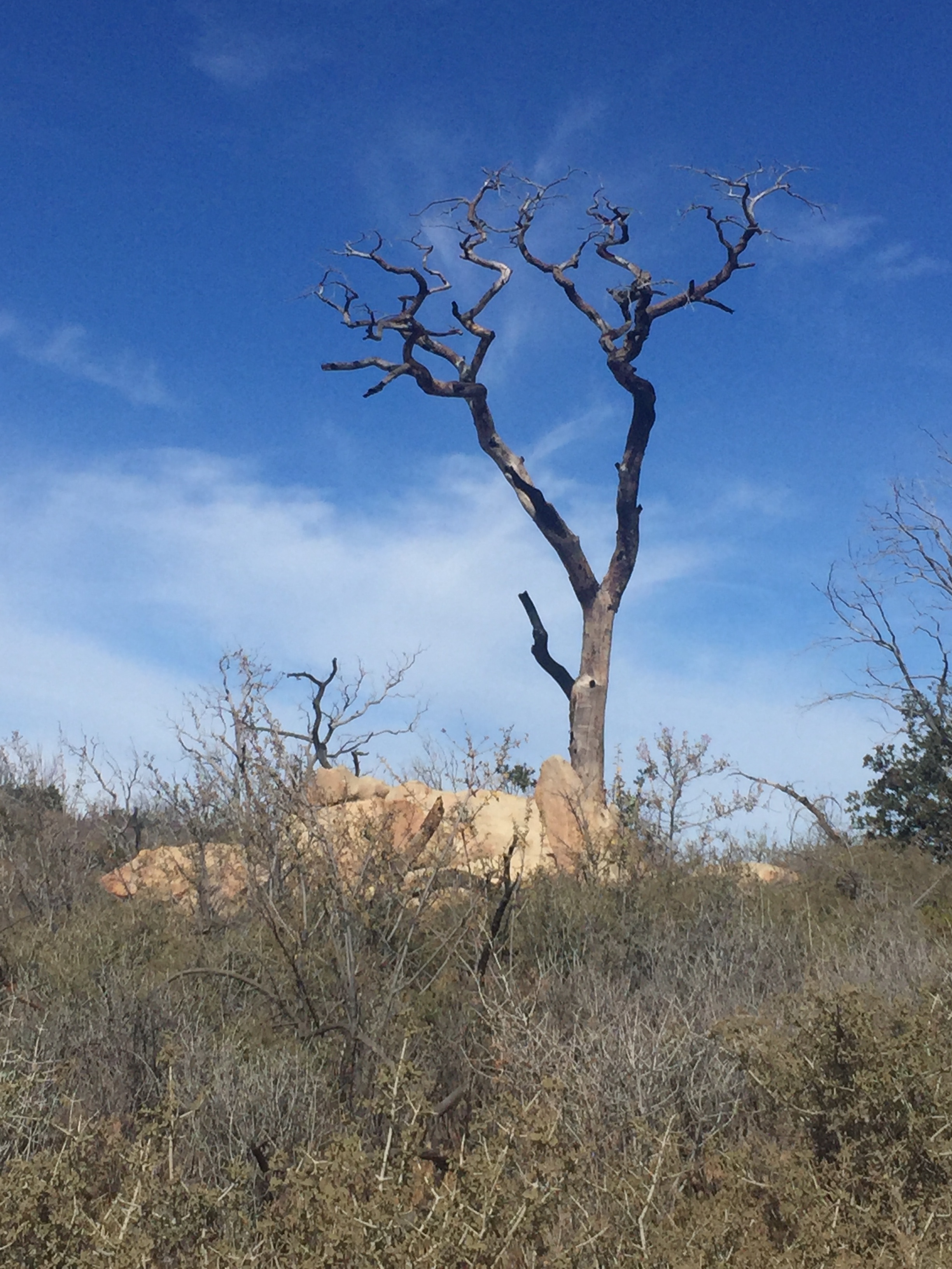
Burn zone on a high plateau in the Kiavah Wilderness

Yucca and Joshua trees and that big desert sky
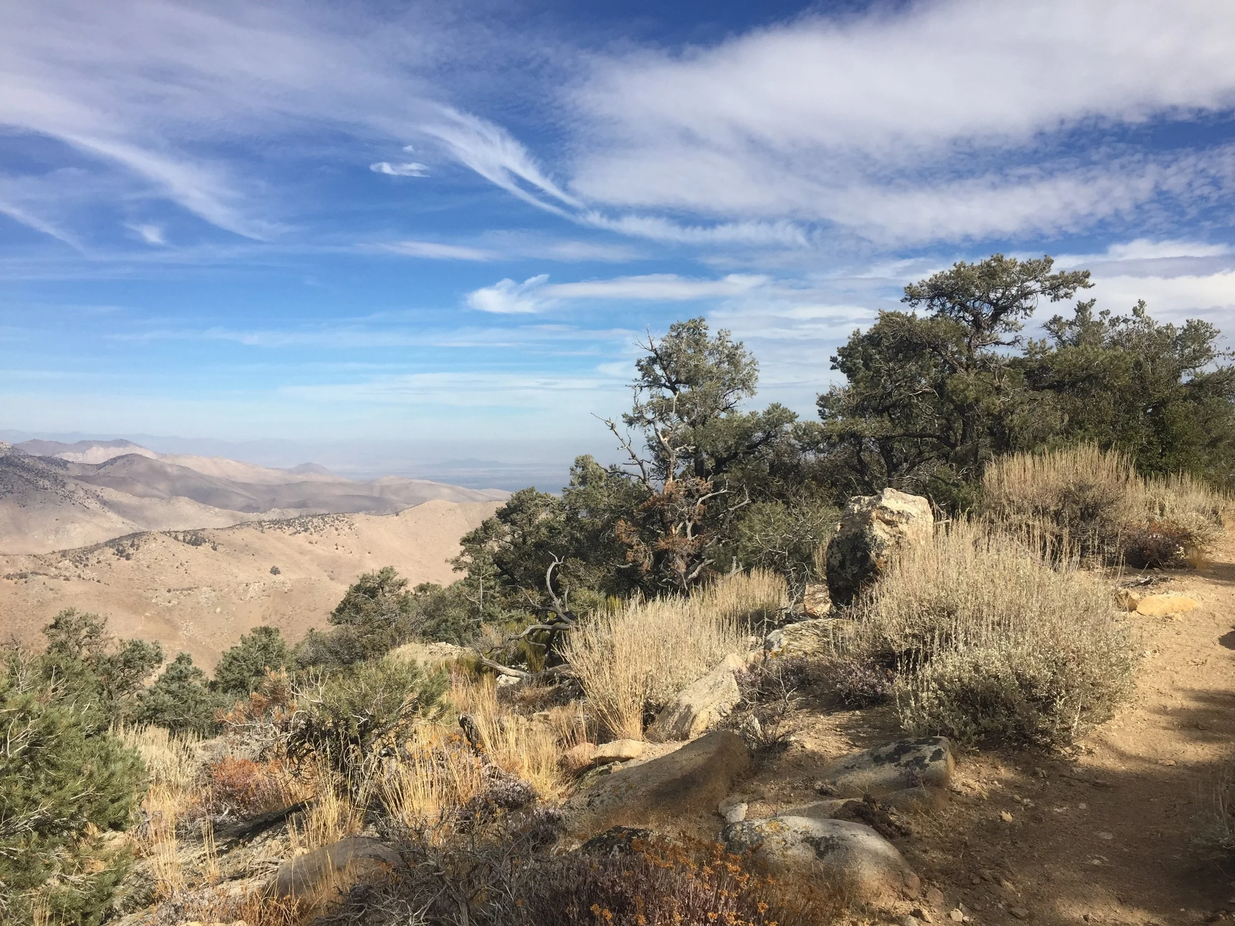
Pinyon pines and broad canyon views
The high desert continues to amaze us with its broad diversity. We left Walker Pass and headed into the Kiavah Wilderness of the Scodie Mountains as the sun came up. We climbed through sage-covered slopes then entered forests of Pinyon pine with occasional stands of Gray pine mixed in. There were wildflowers galore, though this late in the year most are yellowed with seedpods instead of blooms. We passed through a long high plateau of deciduous trees that had been burned by a previous fire, but each had a shrub regrowing around its bare trunk either from roots or seeds. There were handfuls of low cacti and plenty of grasses. The landscape was stark for certain, but never barren. We had incredible views on the climb up towards Skinner Peak, and again on the descent to Bird Spring Pass around Wyley's Knob. The entire expanse of Bird Spring Canyon stretched out to the east and in the golden-hour light of the late afternoon it looked more like a painting than real life. We picked up Joshua Trees on this descent along with yucca and a greater variety of low cacti, and broader expanses of white sand that picked up the light perfectly.

Desert evening light south of Bird Spring Canyon
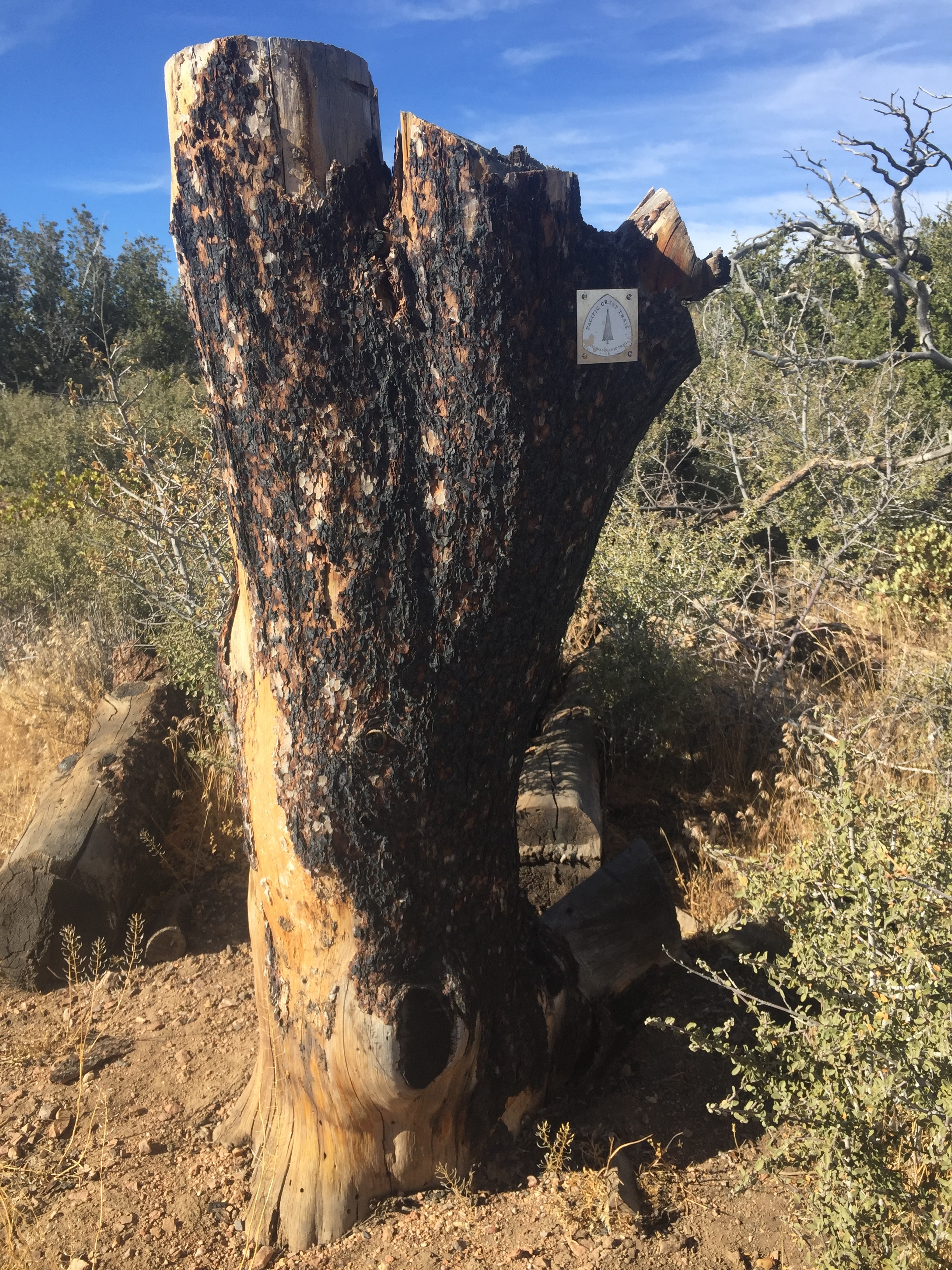
In the burn zone south of Willow Spring Road, this seems like a good enough spot for a PCT marker
Hiking 86 miles in 3 days over this hilly terrain necessitates walking by headlamp this time of year. In other stretches of trail we have been reluctant to hike after it gets dark, not wanting to miss anything. In these high desert mountains, we quickly learned to love the hours before full sunlight and after night falls. The pale colors reflect the light of the moon, stars, and our headlamps and we still have a very good sense of the surrounding terrain. Although the days are not blazing hot they are warm (sometimes uncomfortably so), and the coolness of the early morning and early evening are perfect for walking in just an extra light layer or windbreaker. It has been windy, especially on the ridges and more so after sunset, but the wind doesn't have the chill that it did in the Sierra and I don't mind it other than the dust it sometimes blows around. Being on-trail during the spectacular desert sunrises and sunsets allows us to appreciate these prolonged light shows more completely than we would if we were sitting in our tent peering out, or hanging around eating a meal in camp. We've decided that even if our itinerary didn't necessitate these higher-mileage days, we prefer to rise early in the desert and be on-trail before the sun rises.
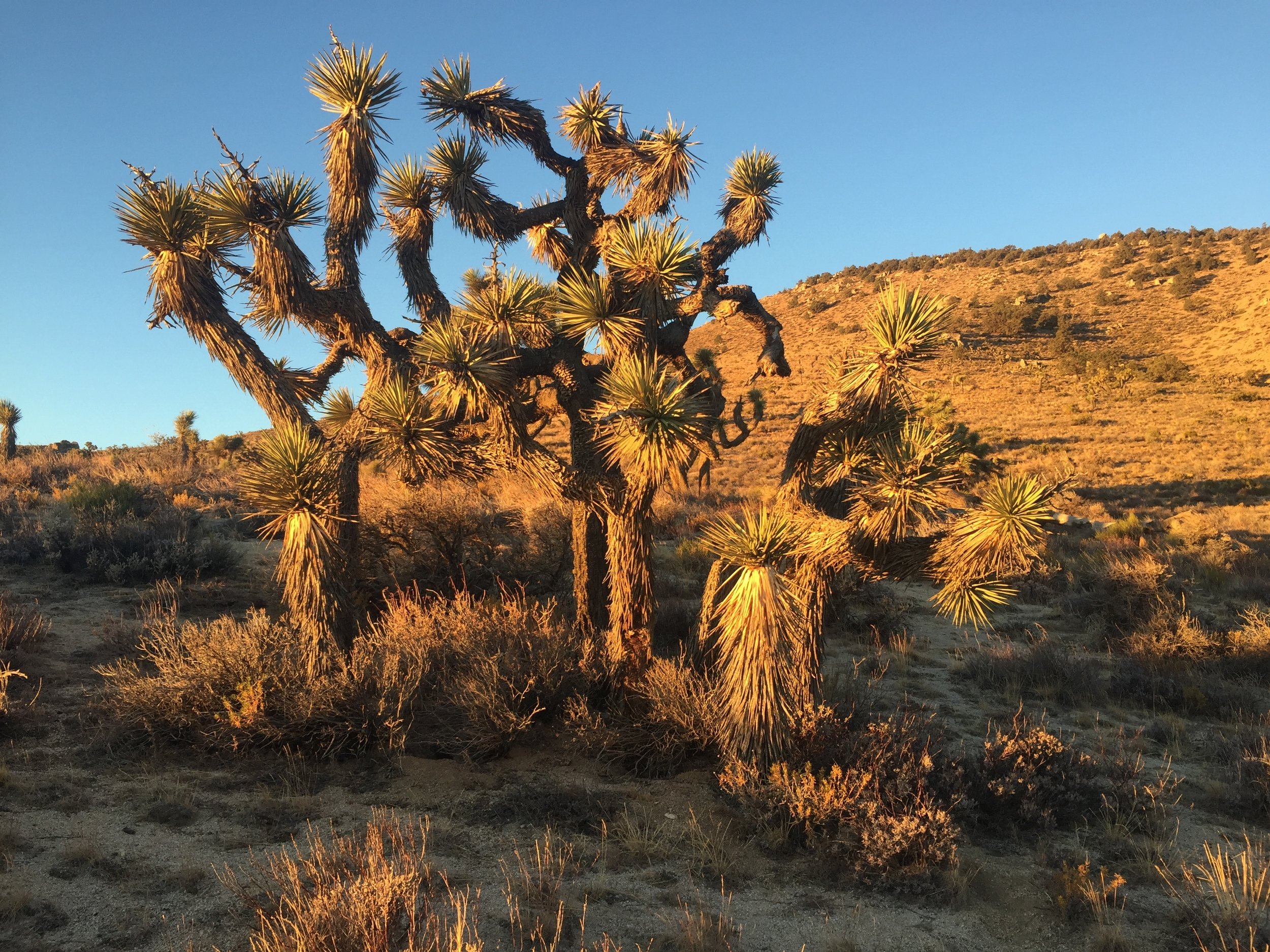
Evening golden hour on Joshua trees is pretty magical
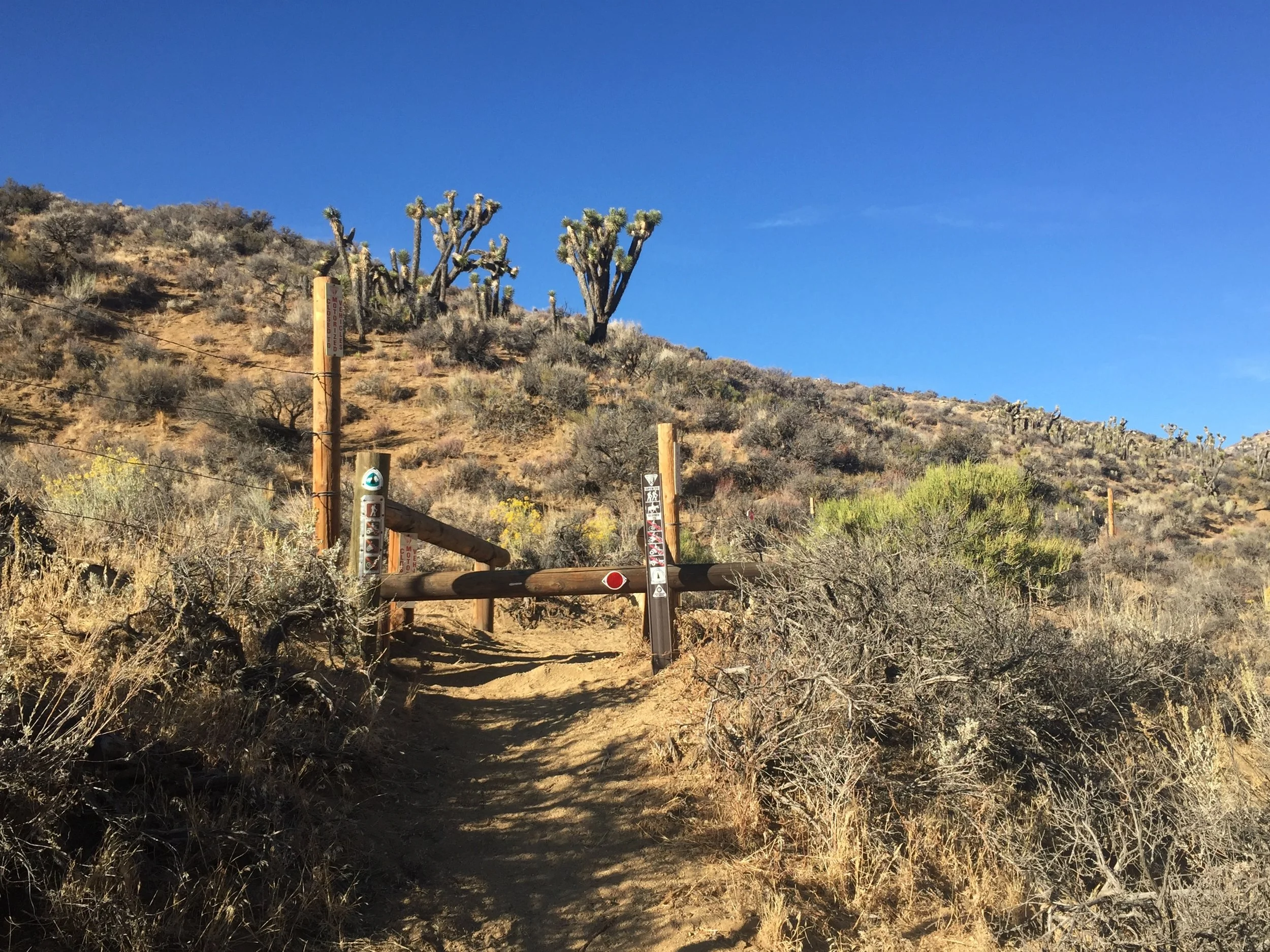
So many OHV roads here that the trail is "protected" with metal stiles we have to step over at every junction

Mixed forest makes for fall colors along Cottonwood Creek (dry) south of Landers Meadow
Leaving Bird Spring Canyon, we also left behind the only wilderness area of this stretch. The remainder of the area is criss-crossed by numerous OHV roads, dirt roads, and even an occasional deserted paved road, and there are even people who live out in these canyons as evidenced by fence lines and buildings visible in the distance. Despite this, we came across only a handful of people in these 2.5 days, and none hiking the trail (all were in vehicles seen at a distance). We walked through classic desert terrain of Joshua Trees, sage, rabbitbrush, etc for 15 miles after Bird Spring Canyon and became accustomed to this muted yet intense palette against a wide and deep blue sky. Crossing Butterbredt Road (dirt), we started a 7-8 mile climb that took us across Kelso Valley Road (paved) then up a long slope covered in Pinyon and Gray pines with tons of granite outcroppings. Here we passed the infamous "unsigned gully" to Willow Spring and were glad we had no reason to descend it, though it looked pretty enough. We continued to meander over and around knobs of similar terrain and assumed these would be our surroundings until Tehachapi. Topping out our climb we came to another zone of burned deciduous trees with shrubby regrowth around the ghost-like wood reaching into the deep blue sky above. Over that hill we suddenly found ourselves in a conifer forest of Jeffrey Pine, and this continued all the way to Landers Meadow Camp. After our "hot lunch" there we walked another 15 miles, first through mixed forest of pines, oaks, cottonwoods, and willows and then transitioning into dry slopes of oaks and grasses alone. We never would have expected that we would go from Joshua Tree deserts to hilly terrain much like we have in the greater San Francisco area in less than a day, in the southern CA desert no less. It struck us that not in a million years would we have thought to come backpacking in this region before deciding to hike the PCT. If someone had suggested a trip to the dry mountains between Bakersfield and Tehachapi, we would have called them crazy. Too dry, too far to drive, nothing to see. Having hiked in these mountains we now realize that they hold incredible beauty, but we still would not choose to backpack here - the scarcity of water sources makes it too difficult. We might make a picnic here, or a nice easy dayhike with water and a car waiting at a trailhead, but not a multi-day trip. This fact makes us appreciate even more the opportunity to walk through the entire range, seeing every inch of this diversity, as we thru-hike the Pacific Crest Trail.

Broad canyons are perfect for raptors
The wildlife in the desert is far different from what we encountered on previous stretches of trail. There are raptors too numerous to count, soaring on thermal currents both below us in broad canyons and above us on ridgelines. We've seen a surprising number of quail, all in the forested higher elevations. Jack rabbits scurry between sagebrush, and lizards dashing across the trail all day long have replaced the squirrels of previous sections. We've seen a handful of snakes (no rattlers yet, though we passed a sign warning of them), one scorpion, and two hairy tarantulas. We came across signs educating us about the desert tortoise (apparently CA's state reptile), though it seems doubtful we will be lucky enough to see one in the wild. We hear coyotes and frequently see their tracks & scat, so we know that they are around. Fellow SOBO Neemor woke one morning to find a fresh rabbit leg left outside his tent, presumably by one of these characters, so perhaps we are lucky not to have any too close. It is hunting season and we have seen a handful of hunters and plenty of deer tracks, but no actual deer. As Macro mentioned, we feel like strangers in this strange land and it is fun to see what each day brings, both in terms of flora and fauna.

Macro on a foggy morning north of Tehachapi

Golden hour is even better with clearing fog

Coming into our first wind farms above Tehachapi

We are enchanted by the turbines
On Day 102 we awoke at our campsite under a huge mother oak in Back Canyon to a chilly, damp wind. This struck us both as strange since despite a huge range of temperatures since leaving the Sierra, the air has been notably absent of any moisture. We started hiking with our usual light layers and as the sun came up we realized that we were on the edge of a fog bank rushing through the canyon. It was a magical surprise to have the damp cool wind of the fog accompany us through miles of high traversing through oaks and dry grasses. We approached the wind farms around Sweet Ridge and for miles the sound of whirring turbines was our soundtrack. We left the oaks behind and returned to a more classic desert landscape with yucca, buckwheat, and Pinyon pines. The wind continued to pick up strength and clouds built up in the distance, and we wondered if there may actually be some rain in the desert from the storm that is supposedly hitting the Sierra Nevada and Northern CA today. We made good time in these cool temperatures, and realized that it was a treat we may not have too often in the desert, so when the wet wind sometimes bordered on cold we tried to appreciate rather than complain. We passed Golden Oaks Spring, the final "water source" of this stretch. It had been reported to be dry for several weeks so we were surprised to see clear water coming from the pipe - a trickle to be sure, and the few inches of water in the trough still looked brown and stagnant, but still better than many other sources and different from our most recent info. Macro opened the logbook near the trough and read the note dated 2 days ago: "dead snake removed from filter to improve flow, now able to obtain good water". You can't make this stuff up. We had decent cell signal so I duly sent off an update to the water report so other hikers might make use of this source if desired. We had sufficient water and even ended up dumping the dirty water from Robin Bird Spring, and passed this one by.

You wouldn't believe how strong the wind is here

Tehachapi loves its trains
The final 6 miles to Hwy 58 / Tehachapi Pass were made up of an exposed series of traverses and switchbacks down a steep hillside across from a huge wind farm whose turbines were spinning wildly. Each time we crossed an open saddle the wind was so strong we had to brace ourselves with every means available, and on many occasions I was nearly blown over in the gusts. It is by far the strongest wind I have ever walked in, and we were both glad that these were not the narrow rocky trails of Sierra Nevada passes. Even so, it took longer than we expected and was more harrowing than you might imagine. We were relieved to drop down in elevation beyond the tops of the hills where we had only the usual strong wind to deal with, and then made good time among the Joshua Trees down to the highway. The final mile was a recently graded dirt berm just along Hwy 58, next to the traffic whizzing by on this busy divided road. It was 5:30 pm on a Saturday, we didn't have access to contact info for the many trail angels that apparently live in Tehachapi, and the last bus had already passed. Fortunately we were able to find a taxi service that would take us into town and after fighting the wind for the past few hours we didn't even mind the $30 price tag. We were both ready for a shower, laundry, and a night indoors even if it came in a cheap motel with trains running by hourly through the night. Tomorrow we'll hang out and catch up for half of a day before hitting the trail again, but we're looking forward to what surprises the desert may have for us as we continue south. We're starting to feel like pros at this water thing, already love walking in pre-dawn and after dark, can't wait for more desert light, and hope to see more interesting wildlife.
- Huckleberry