
“Some walkers have complained to me that the South Coast is not easy - I agree but for the region it is the ‘easiest’ walk - all the other walks in the park except the southern half of South West Cape are considerably harder. If I graded the South Coast Track as say Medium-Hard then how would other routes in the south-west be rated, say Hard or even Extremely Hard would not describe how much more difficult some routes are, perhaps Desperate would be correct for the inexperienced but that would be a ridiculous grade for experienced walkers who can handle the difficulties. ”
Location
Southwest National Park, Tasmania, Australia
Mileage: ~85 kilometers on-trail
Total Climb & Descent: 2735 M (~8970')
Days: 5 Season: early March
Year: 2019
Starting & ending trailheads
Melaleuca / Cockle Creek
Basecamp Town: Hobart, Tasmania

Map: South Coast Walk Map & Notes, TASMAP

Guide Book: South Coast Track 2nd ed. (2017), John & Monica Chapman

Charter Flights: Par Avion
Our Fave Online Trip Report: www.bikehikesafari.com/hiking-the-south-coast-track/
Pre-Trip:
Although it’s halfway around the world, we love Tasmania. Even without our family and personal connections to the area we’d be drawn to this beautiful place. Much of Australia’s smallest state has been preserved as open space and/or wilderness area and this little island boasts 20 national parks! Of course we’ve backpacked the Overland Track, easily the most popular and best-known of Tasmania’s Great Walks and often considered its crown jewel. We’ve also completed several of the 60 “Great Short Walks” (there’s an app for that).
Once we decided on an Australia trip for this year, we needed to pick a multi-day bushwalking (Australian for hiking or backpacking) adventure. We initially considered the Three Capes Track, a 48km trail in Tasman NP that meanders sheer cliff edges along the dramatic southeast capes at the southeast tip of the Tasman Peninsula. It’s a brand-new trail that just opened in late 2015 and has already garnered rave reviews with its artist-designed “story seats” along the track and architectural, environmentally sensitive cabins for sleeping. The walk starts with a 1-hour marine eco-cruise from Port Arthur to the start of the track, and a ranger stationed at each cabin provides information on the next day’s walk. The cabins have running water, gas cooktops, mattresses, solar lighting, and even USB charging stations! While this level of amenity broadens the appeal and accessibility of the trail, for us it starts to seem less like a backpacking trip and more like a hotel-venture with a little walking thrown in. The final deciding factor was learning that as with many hut-to-hut Great Walks in New Zealand, the walk can only be hiked in full as intended; ie as a 4-day walk with a nightly stop at EACH hut (4km, 11km, 19km, 14km hiking days on well-developed trail). There is no option to skip huts or otherwise walk further each day than designed, and no real option for side trips given the geography of these narrow capes. While we’ve heard great things from friends & family who have done the walk, we decided to save it until we’re a bit older and less able to get into the wilderness on our own.
With Three Capes out of the running, our thoughts naturally drifted to the southwest. A vast stretch of the bottom corner of Tasmania is set aside as the Southwest Wilderness, part of a World Heritage Area with few access points and fewer developed trails (AKA tracks). The land is mountainous and rugged, and not easy to see on a casual visit. Our only previous exposure to this region was at the Tahune Airwalk, an elevated walkway cantilevered 30-50m above the forest and Huon River on the eastern edge of the Southwest National Park, where we could peer into the distant wilderness. Turns out that there are several bushwalking options within the park. We briefly considered the Arthur Traverse, Southwest Cape, and Port Davey walks (some have tracks, others are mere routes). For our first real visit to this vast wilderness we decided on the South Coast Track, as it would be considerably more accessible and predictable than most other options.
While it is a developed trail and “Great Walk”, we quickly learned that the South Coast Track could provide just the wilderness experience we were craving. It is accessible only by airplane or boat on the west end, and via a lonely gravel road on the east. There are no huts along the trail, though several designated campsites do have composting toilets to minimize impact. No other trails intersect the main route and there is no way to shorten the distance. Despite being only ~85 km in length, it is widely recommended to allow 6-9 days for completion due to difficult terrain, variable water levels with changing tides, and likelihood of inclement weather. The entire Southwest Wilderness is famous for its mud, with stretches of calf, thigh, or even waist-deep muck often described in trip reports from the South Coast Track.
Not many maps cover the region, so we were happy to find the standard issue South Coast Walks map from TASMAP almost perfect (NB: not waterproof!). We ordered online to have in advance, but found it widely available from outfitters and parks in Tasmania. We purchased the 2nd ed. South Coast Track book online directly from the author John Chapman and found this definitive trail guide indispensable in planning and useful along the track. We pored over many trip reports and tried to gauge how long the walk might take us, what gear we should bring, and what food plans to make. We toyed with the idea of adding the Port Davey Track (partial or complete) to our adventure but in the end stuck with the basic South Coast Track for our first foray into Tasmania’s southwest.
It was difficult for us to decide how many days to allot for our hike. We have never been to this part of Tassie, and the southern Tasmanian coastal weather is famously fickle. Although February and March generally have the best hiking conditions, rain is common in every month and hail, sleet, or even snow can fall at the higher elevations on any day of the year. We ultimately decided to carry food for 7 days but plan for a 6-day walk. We would hike west to east (the more common direction), and booked a charter flight to Melaleuca for the morning of our 1st day. We also pre-arranged van transport from the eastern terminus at Cockle Creek back to the Hobart region (a 2-3hr ride) for 4pm on our 6th day. Some hikers choose to work out transportation upon completion of their hike and this is appealing from the perspective of flexibility. However, there is only a basic campground (no town) at Cockle Creek, and no regular transportation services. There are taxis in the nearest town of Dover (45 km), which also has infrequent bus service to Hobart (2 hrs duration, 1-2x daily). Geeveston (65 km) offers more regular bus services to Hobart (1.5 hrs duration, 4-6x daily). There is apparently a pay phone at Cockle Creek, unclear if there would be cell service. We didn’t know how busy the campground would be or the likelihood of finding someone there who might give us a ride to Dover or Geeveston, let alone all the way to Hobart.
A few more things:
Flights - Par Avion offers charter flights to the Melaleuca airstrip from the Cambridge Aerodrome outside of Hobart, near (but not at) the main airport. Advance reservation required. Minimum of 2 passengers needed to secure a trip. Flights available every day, timing dependent on demand. Maximum 20kg of luggage per person (charge per kg beyond that).
Ground Transportation - Several operators in the region offer backpacker transport between Cockle Creek campground and Hobart (or other regional destinations). Most require a minimum of 2 passengers, and the per-person price drops with additional people. Advanced reservation & payment is needed to guarantee a trip, though most will take additional passengers on demand at Cockle Creek (space permitting). There’s a list of current operators and phone numbers posted at Melaleuca and also at Cockle Creek.
Fuel - Not allowed to transport by air. Par Avion sells both canister fuel and liquid fuel to backpackers. You pay at the time of check-in and obtain from the pilot upon arrival. You CAN carry matches and lighters on Par Avion flights, though not in checked luggage and must declare.
Permits - There are currently no hiker quotas on the South Coast Track, or any specific permit required for the hike. All walkers must possess a valid entry permit for Tasmanian National Parks. The 2-month backpacker pass is $30 AUD and valid for 2 months. It can be obtained online, at any Tasmanian NP, or from most outfitters in Tasmania (we purchased ours from Par Avion when we checked in for our flight).
Campfires - Not permitted anywhere along the South Coast Track. The area is fuel-stove only.
Day 1 : Melaleuca airstrip to Buoy Creek on Cox Bight

Federation Peak on a day hazy from smoldering bushfires

Bathurst Harbor from our descent into Melaleuca
We arrived at the airfield a little later than hoped and were rushed onto a scale along with our bags. Turns out there is a 20-kg bag limit but we both made it under (Cheri at 17kg, Andrew at 19kg). We purchased park passes and fuel… and suddenly realized that we had no way of lighting our stove! We’d been careful to empty our backpacks of lighters and matches in advance of our commercial flights, and neglected to obtain replacements in town. Oops. Par Avion had neither, but did have piezoelectric igniters for sale. Unfortunately they cost $18 AUD - ouch! There were 6 other passengers to Melaleuca that morning, divided between 2 planes. We hung around the small waiting room another 20 minutes waiting while the pilots distributed passengers (& our backpacks) by weight and readied the planes. Chatting up the others we discovered that everybody else was headed for a boat tour on Bathurst Harbor and we were the only hikers (“bushwalkers”) in the bunch. Our flight path took us directly over Mt. Wellington then into the wilderness. We were shocked at the number of fresh burn scars and fires still smoldering below us, even though we knew that Tasmania was still reeling from the worst bushfires in recent history, most of which affected the southwest. Tasmania was also wrapping up its hottest summer on record. Our pilot commented that the temp was still 10 C (~50 F) at cruising altitude, as warm and still as he’d ever seen it. This allowed for a flight path right along the Arthur Range, and directly over Federation Peak - a stunner! We had a few bumps but nothing major and ~45 minutes after leaving Hobart we were landing on the bright white gravel airstrip at Melaleuca on a hazy but balmy and cloudless day.
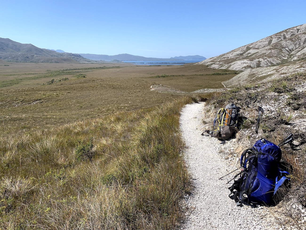
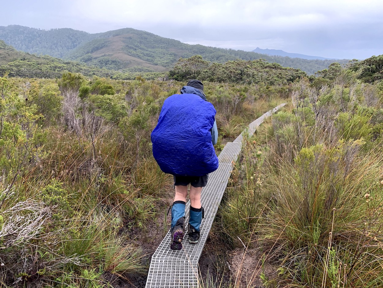
Typical boardwalk through low scrub of the button-grass plains
Park service volunteers wrapping up a month-long stint greeted our plane, pointed out the walker’s logbook, and reviewed a few standard wilderness policies. And they had spare matches! With all day to walk a fairly short distance we were in no hurry. We dropped our packs and wandered over to check out the historic hiker’s hut, the Needwonnee interpretive walk, and Deny King museum before setting out. Scanning the logbook we found that 2 hikers had just completed the track westbound (and flown out on our plane), with no other westbounders listed for days. A group of 6 from Melbourne left Melaleuca eastbound yesterday and another 4 started the day before; all wrote the same expected finish date as ours. There were only a scattering of South Coast Track hikers listed on the preceding days. We were happily surprised to discover how lightly-used this “popular” trail seemed to be, even at the height of peak hiking season.
Cheri approaching the base of the New Harbor Range as Freney Lagoon comes into distant view

Freney Lagoon and Cox Bight beyond with the Ironbound Range rising in the distance
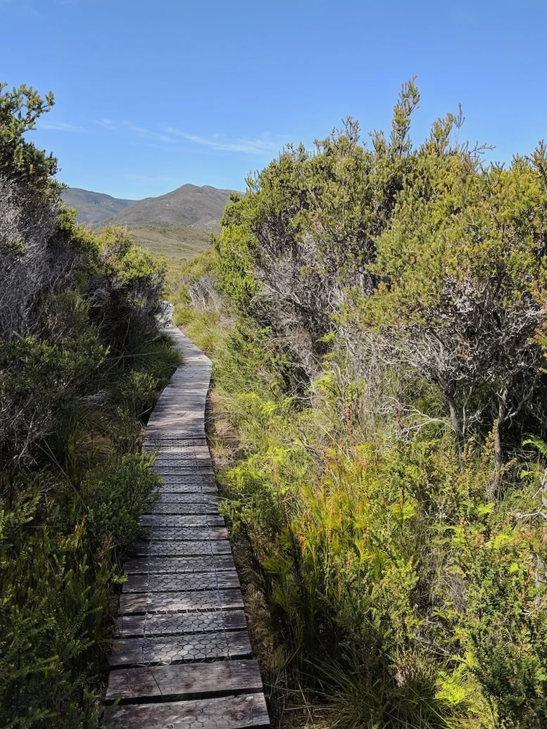
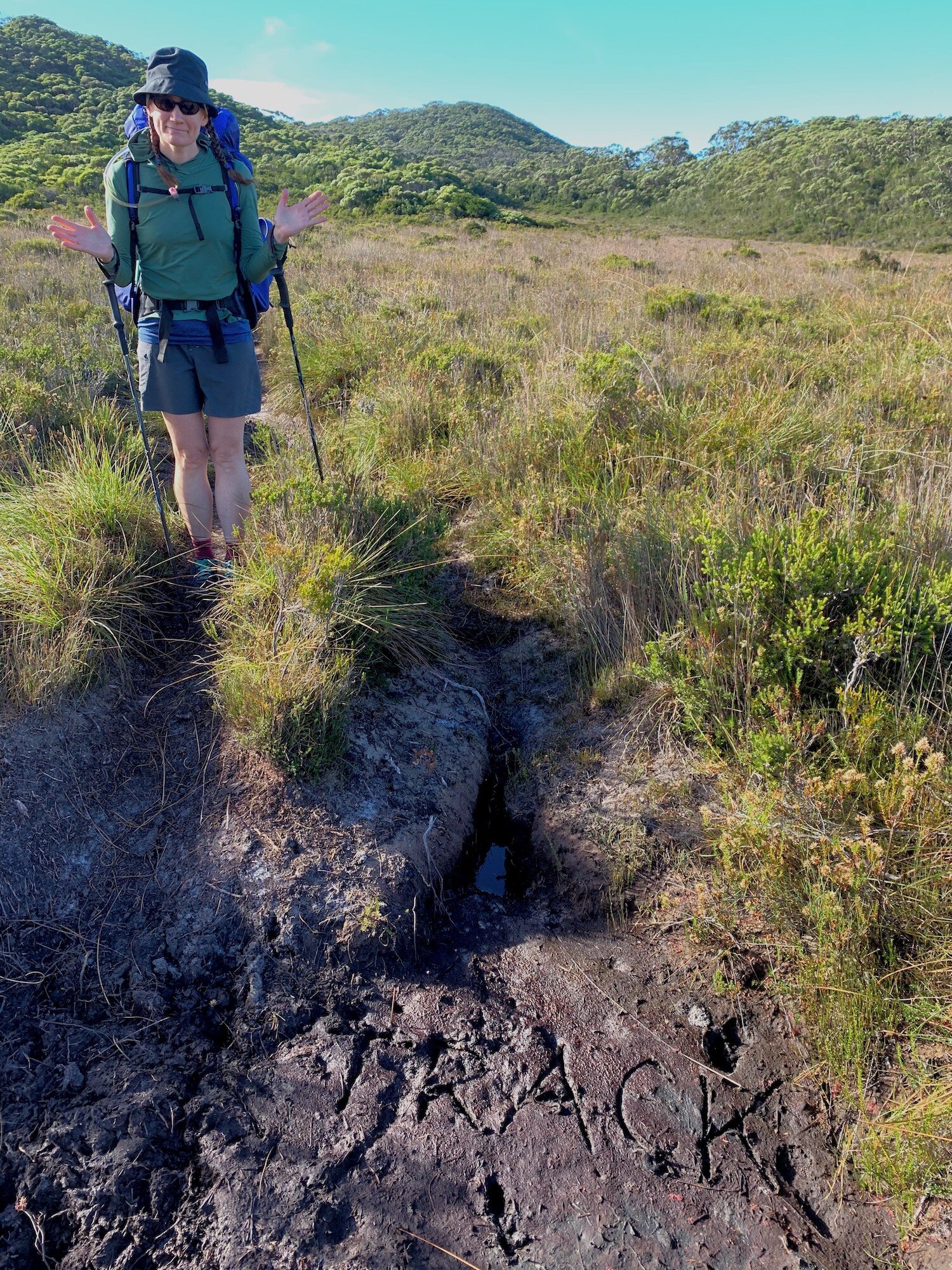
We remarked at the different types/generations of boardwalk in just the first few miles and ogled the stark white pre-Cambrian quartzite that makes up any exposed rock (or crushed gravel) along the trail. We wished for shade, but had to make do with a slight breeze coming off the Southern Ocean. The track traverses the lower eastern slope of the New Harbor Range and we were happy for the drier ground with peekaboo views of Freney Lagoon and the ocean beyond as we worked our way towards the coast. The track-builders don’t seem to believe in switchbacks and instead relied on wide swooping curves to negotiate the elevation change along the base of the hills. Where there wasn’t mud, boardwalk, or gravel, the ground is strangely springy from the high peat content. Erosion is clearly a huge problem here and in some stretches we walked on brand-new boardwalk alongside a parallel but degraded boardwalk, not far from another deep muddy rut that appeared to have been the 1st-generation trail.

Moth Creek’s tannin-stained waters with New Harbor Range rising up in the distance

Older, dilapidated boardwalk nearing New Harbor Range
Still marveling over the fact that we had the trail entirely to ourselves, we hoisted our packs and headed south towards the coast. It was warm and getting warmer as we followed boardwalks across a broad expanse of low scrub known as button-grass plains. This treeless terrain stretching towards the New Harbor Range is deceiving. While visually low and even, the grasses and shrubs often reach waist or even shoulder height. Their dense growth combined with poorly draining peatland soil make for some serious mud wherever there is not boardwalk. Although the wide views and gentle topography would make off-trail navigation a cinch, actual cross-country travel would be slow going. Seems as though the wombats agreed with us; we didn’t see any of these nocturnal creatures but learned early in Day 1 that they prefer to leave their oddly square scat right on the boardwalk planks of the South Coast Track so we’d see evidence of their existence for the entire trip.

Flotsam, driftwood, shells, and bones mark where the trail meets the beach at the western end of Cox Bight

The base of the Black Cliff Hills reaches into the Southern Ocean but beach passage poses no challenge on a brilliant afternoon with the tide out
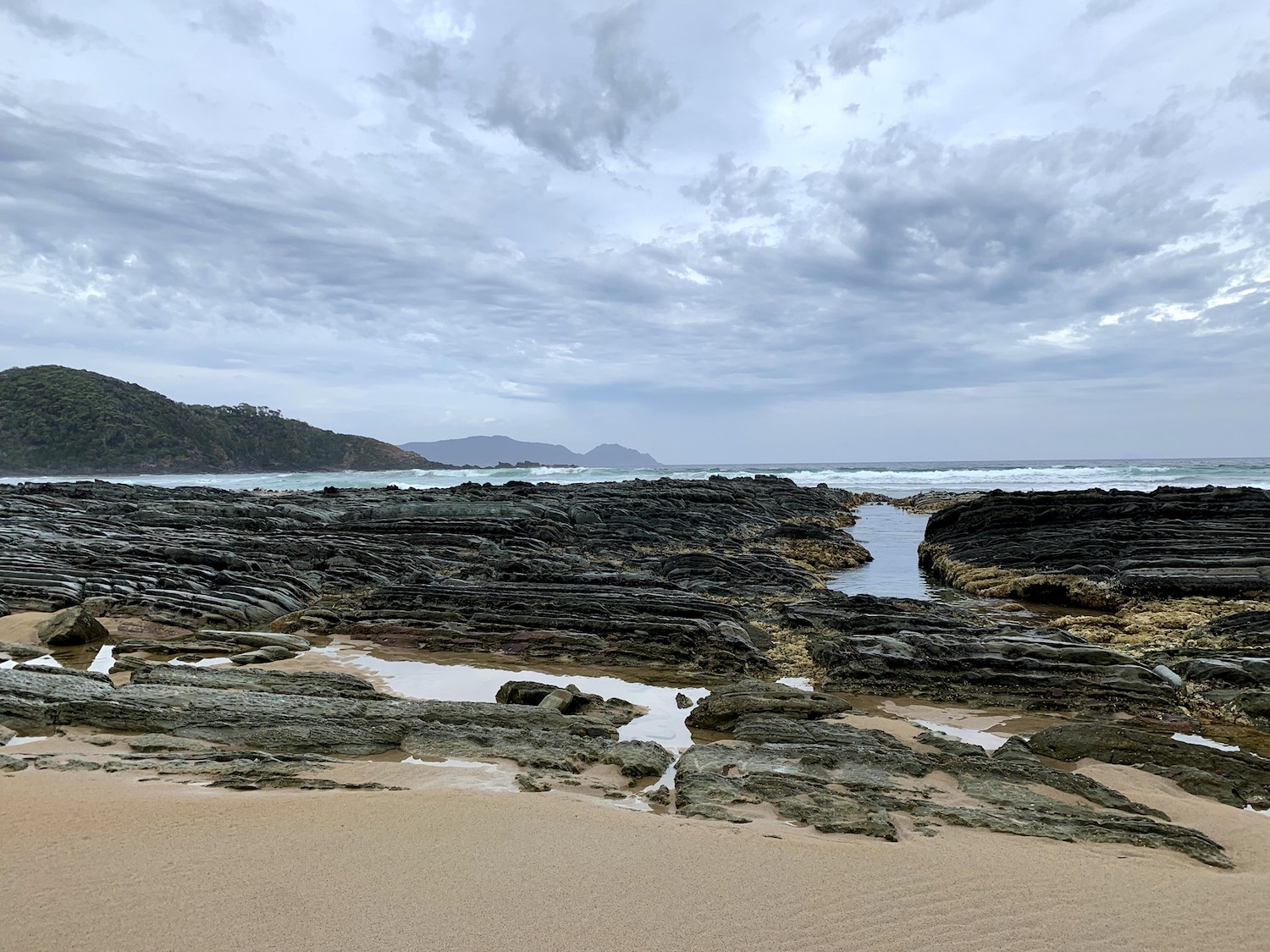
Just beyond Freney Lagoon we reached the firm white sand of Cox Bight. The Southern Ocean stretched out before us in all its clear blue-green glory and for the umpteempth time in just Day 1 we couldn’t believe we had the entire place to ourselves. Cox Bight is a deep U-shaped bay making the lush green outcropping of Point Eric look surprisingly distant though it’s only ~2km down the beach. Beyond that the Red Point Hills form the eastern arm of the bay. We meandered a bit along the water’s edge before continuing along the beach to Pt. Eric. Most people camp on the east side of this small peninsula for their first night, and the designated campsite was a lovely protected area with open views and good access to the sea. Still, we couldn’t bring ourselves to stop hiking just after lunchtime. Besides, the tide was out and as we weren’t carrying tide tables it seemed best to take advantage of this opportunity to get around the base of the Black Cliff Hills (impassable at some high tides).

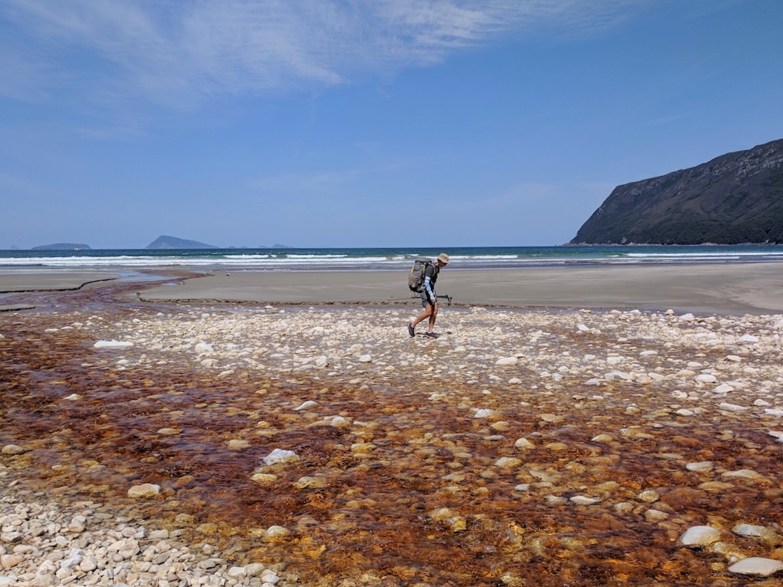
Buoy Creek cutting across the beach to reach Cox Bight

Clear aquamarine waters of Cox Bight on a warm afternoon
We reached tannin-stained Buoy Creek early in the afternoon. It would have been an easy wade, less than ankle deep, but we had time so we found a spot we could rock-hop without removing shoes or getting wet. We saw 6 sets of footprints headed south along the beach although the trail and designated camp area climbed the bluff near the creek’s outlet. We investigated our options and found the campsite deserted. It would have been fine in a storm but on this fine sunny day we weren’t inclined to pitch a tent in the dark shade of high shrubs with no ocean view. We came back down to the beach and found a perfect spot on the sand up against the dunes, at a reasonable distance from the creek and above the high-tide line. It was still only mid-afternoon so we had plenty of time to explore.

Bones and buoys show where the trail leaves the beach near Buoy Creek

We spent the rest of the day wading in the clear, warm waters of Cox Bight. We wandered as far as the end of the beach at Landing Point and poked around the tidepools there. Schools of shimmery fish swam around our ankles, and there were plenty of little crabs and sea stars to hold our attention. We ran up & down sand dunes, all the while watched by a handful of Black Currawongs. We discovered that the 6 sets of footprints walked nearly all the way down the beach before turning back and heading to the trail; we suspected it was the group who started the day before us and wondered if they missed the marker where the trail leaves the beach and heads into the hills. In any case, nobody else ever showed up.
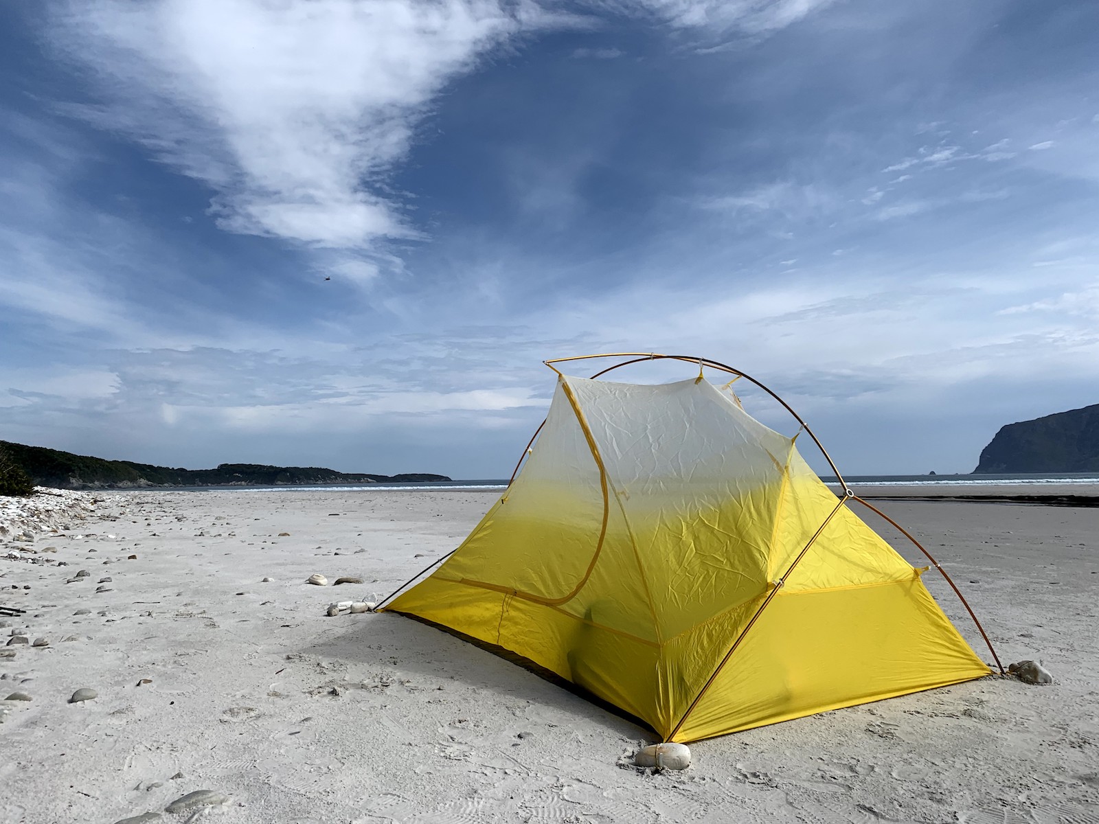
We found a set of wallaby tracks just behind our tent and napped in the sun, lulled by the sound of the waves. On waking we found the sky had clouded over. It remained warm and we enjoyed a leisurely dinner of Tom Yum soup and Chana Masala on a perfect balmy evening from our private Southern Ocean beach. No tent fly tonight!
Stats: 16.5 KM | 3 hours | 0 m Net Elevation gain | 80 m (262’) climb | 80 m (262’) descent

Day 2: Buoy Creek to Ironbound High Camp

The sun is barely up and it is going to be a scorcher.

Andrew tackling the stairs of Red Point Hill.
From our sandy campsite we had stellar views out into the blue mass of the Southern Ocean. The balmy temperatures lasted into the night and under a clear sky we had unobstructed views of the constellations and the Milky Way. Beyond the headlands of the Red Point Hills, we could make out the glow of the navigation light on Maatsuyker Island about 20km to the south. While admiring the stars, we noticed that the breeze was picking up and air was actually getting warmer in the darkness. We drifted off to sleep but awoke again around 4AM to find it noticeably warmer with a stronger, steady breeze. Andrew’s watch told us that the temperature had increased from 15C to 21C since midnight. We had expected today to be the warmest day of our adventure, but well before sunrise, it was already shaping up to be a scorcher.
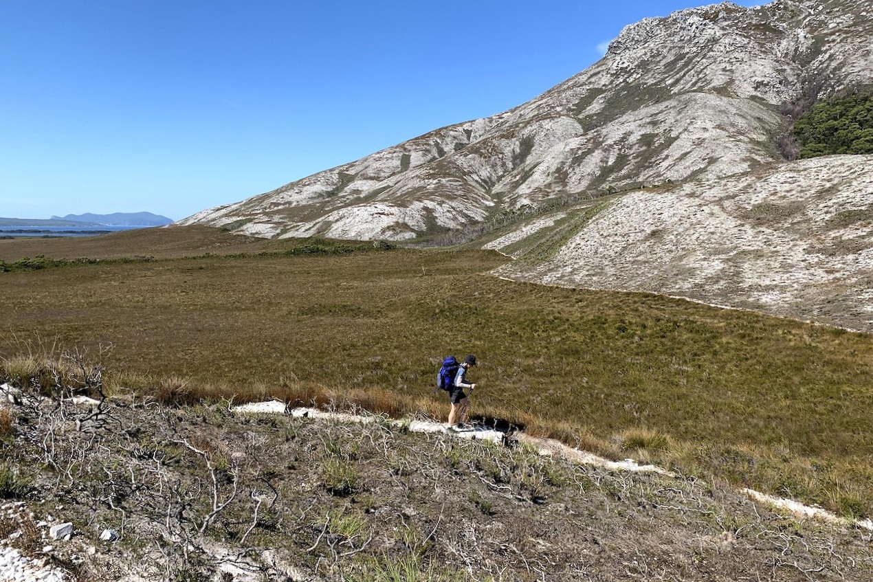
We said our goodbyes to the beach at Cox Bight and the cool iced tea-colored waters of Buoy Creek and started our climb inland across a marshy plane of button grasses and heaths. Thankfully there were long stretches of boardwalk to keep up out of the mud. It was a gentle meander over the plain as we crossed a couple tributaries of Bouy Creek, we were quite thankful for the boardwalk. Although it was a dry time of year, it was quite evident that even here the mud could be serious issue. We crossed and generally followed the drainage of Billarchi Creek to the 234m saddle of the Red Point Hills. At this saddle, we had spectacular views of the New Harbor Range behind us to the west and the massif of the Ironbound Range to the east. There was very little shade and although it was mid morning, it was getting quite warm. The white crushed stone trail twisted and turned out in front of us down the eastern slope of the Hills and we could see it snaking around the Spica Hills. There were high clouds that teased of shade that never materialized and it was getting a little hazy but not enough to cool things down. We would later learn that the haze was not a marine layer promising cooler air but rather smoke from the nearby bushfires being fanned by strong winds.

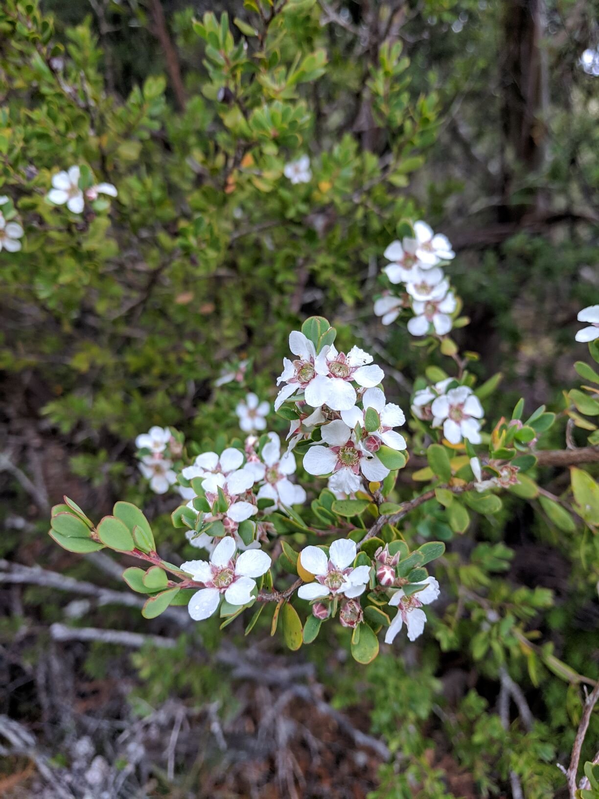
Flowering melaleuca on the ascent of the Red Point Hills.

Look mum, no hands! Happy to cool off and thankful that the safety rope is not needed.
We were now heading to some of the fabled (dare I say infamous) creek crossings of the South Coast Track. All that we had heard and read told of knee- to thigh-deep (or deeper!) crossings of treacherous tannin-filled waters. This year however, the drought had tamed the creeks and they were quite shallow. While the waters were a gorgeous tannin brown, we could easily see the bottom and they were simple affairs to cross. They also provided a very welcome respite, cool and shady, from the unforgiving sun. Faraway Creek would be our first major creek crossing. Normally it is slow moving but deep. We found it barely shin deep. After the exposed eastern slope of the Red Point Hills it was fabulous to cool off in the creek. After a short wander through the under story of trees, Louisa Creek was another easy crossing. Both of these were so shallow that the provided safety crossing ropes looked almost ridiculous, well above our shoulders or even our heads.

Cheri enjoying a much needed cool off during our elevensies at Louisa River.
From Louisa Creek, we left behind our lovely shade and followed the track as it snaked around the nose of the Spica Hills. From there on out we would be at the mercy of the hot sun overhead. Along the base of Mount Louisa, the buttongrass and heath spread out across the shadeless Louisa Plains. The notorious mud that we did encounter was dry and cracked, and aside from the heat it was easy walking. For this entire stretch we were on boardwalks that were high and dry vs underwater as they were oft described. The plain was divided by a large swath of trees that grew along the banks of the river. As we were heading towards this oasis of shade, the track would tease us as it looked like we were about to drop down only to skirt the edge of the forest. Relentlessly, we continued with our metronomic steps echoing on the boardwalk across the plain under the blazing sun, the looming Ironbound Range our constant companion. We eventually came to another embankment with its promise of shade and the crossing of Louisa River. We reveled in the cool shade and colder river, once again a tame and shallow affair. Several large boulders at the river edge made a perfect spot for lunch break, although in different conditions I could see that they would make for a hazardous crossing especially if the bottom couldn’t be seen through dark waters.

Cheri following the quartzite path on the Ironbound.
We left the dappled shade of our river gully with the sad realization that there would be no more shade until we made camp. As we had crossed the plain we could see the quartzite trail as a bright white line that appeared ahead of us. The trail shot up the slope and then traversed across the top, following the ridgeline. Let’s just say that this section of the South Coast Track is woefully lacking in switchbacks. Throughout this steep and steady climb, both of us we were very grateful for our trekking poles. As we stopped for short breaks to catch our breath, we enjoyed stellar views back over our shoulders to the west. Far below was a tapestry of hills and ranges leading back towards our start at the Melaleuca airstrip. About 2/3 of the way to the crest, we contoured around the nose of a small cliff wall and were able to tuck into to this little pocket of shade behind a outcropping of granite. It felt like heaven.

US celebrating 15 years.

Sunset at Ironbound High Camp. Have you seen the Lorax?
From there, we pushed up and followed the ridge towards the high saddle. Despite the elevation of 900m (2700’) it was nearly 40C (104F). On top of the heat and winds, looking north towards the Western Arthur Range and Federation Peak, we could see smoke from bushfires billowing just over the far slopes. It was pretty intense and we half expected to see flames roiling over the peaks. Above treeline on these exposed slopes the boardwalk track kept passing through button grasses and heaths and I was staring to wonder if we would reach the fabled Ironbound High Camp. I recalled that the high camp was small and marginal yet it was near a creek and surrounded by forest. Finally the trail entered a forested mountain gully and trail came down to this sturdy wooden bridge over a small clear water creek. Up to the left was. use trail that disappeared into the under the canopy. Cheri followed it up and soon called out that she had found a campsite. As promised, space for just big enough for two people who like one another in a wee tent.
We made camp, gathered water for dinner, brekkie, and the next day. Our camp chores complete and bellies full of dinner we hiked out to the windswept plateau just past our Dr. Seussian forested gully. By this time, the bushfire smell permeated everywhere and the haze was just starting to obscure the view. We could still see the largest of the island, Ile du Golfe, set out in the Southern Ocean. All in all, it was a spectacular day for us to celebrate our 15th wedding anniversary.
STATS: 20 KM | 8.5 HOURS | 825 m (~2705)' NET ELEVATION GAIN | 1160 m (~3805') CLIMB | 335 m (~1100') DESCENT
Day 3 : Ironbound High Camp to Osmiridium Beach via New River Lagoon boat crossing

Smoky air atop the Ironbound Range before we drop into the rainforest
After drifting off to sleep breathing smoky air, it was a relief to hear rain falling on the tent overnight. It never got heavy but did continue until morning, and definitely helped ease our concerns about the nearby bushfire(s). That morning the smell of smoke still hung in the air and the tent fly was barely even wet. It was the start of another warm day, but with a temperature significantly lower than yesterday’s and without any wind. We packed up and left our protected little campsite by 8:15am. Reaching the short section of boardwalk just below high camp, we found that thick smoky sky in every direction now obscured not just the distant peaks but also the rest of the Ironbound and even the coastline just below. The nearby offshore islands seemed to float in the dense hazy sky like dark ghosts, and we couldn’t tell where the sea ended and the sky began.

Andrew negotiating roots…

…and mud

Cheri headed down a steep, narrow, wet path

In some places a fallen log becomes the trail. Cheri demonstrates.
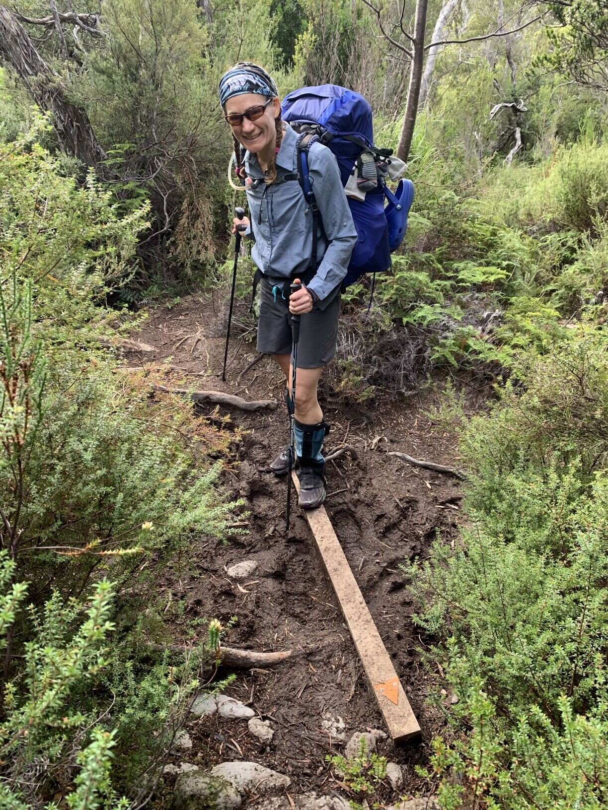
Knowing that the east side descent of the Ironbound Range was notoriously narrow, steep, muddy, and root-y we both started in tall gaiters for today’s hike. It felt a little silly to wear them with shorts but the day was shaping up to be warm and, “when in Tasmania….” It wasn’t long before we left boardwalk behind as the “trail” plunged steeply into dense rainforest. As promised, it had huge steps between footholds, wet vegetation of every kind, slippery rocks and roots, and plenty of mud. In many places the trail was more of a suggestion than anything, but with the surrounding forest so thick it was impossible to stray much.

The going was slow and plenty wet, with many sections of trail under running water. We were glad for our tall gaiters at first, though they sure look goofy with shorts. Andrew tired of sweaty calves and took his off by mid-morning, while Cheri kept hers on for the protection against mud and scrapes. We made a game of using poles, hands, and carefully chosen foot placement to find the “best” (driest) route down while minimizing slips, falls, scrapes, and sinking into the deepest of the mud. It was definitely a test of balance, strength, and flexibility but also a fun mental challenge to think several steps ahead and make constant minor adjustments. Although the surroundings couldn’t be more different, the physical and mental skills were reminiscent of those used when crossing steep talus fields in our home range the Sierra Nevada, and we were happy to have that experience to draw on.
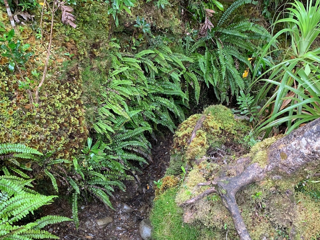
Despite the challenging conditions we appreciated the long rainforest descent for its sustained shade and lush greenery, particularly as the temperature started to climb as we dropped in elevation and the day wore on. We never stopped along this stretch as there was no dry place to sit or even lean, but we pointed out each new plant and flower species in the lush environment, most of which were new to us. And there was plenty of fungus, the first we’d seen so far on our South Coast hike.

A rainforest fungus we affectionately named “orange cauliflower”
It was mid-morning by the time we reached the dry and sheltered clearing in a wide saddle known as “Ironbound Low Camp" (~390m). Several downed trees made perfect benches and there was definitely space for a few small tents, but with no view nor nearby reliable fresh water source we wouldn’t consider it a great campsite. Nevertheless, it made a perfect snack spot.

Finally back to some ocean views. But it’s stormy out there.
After Low Camp the descent was much less steep and the trail corridor less treacherous. There were even some stretches of dry forest. And a deep shady ravine with wide rocky slabs and a rushing creek that would have made a great lunch spot if it weren’t so early in the day; instead we rock-hopped across and continued on. We expected that once out of the Ironbound Range the trail would flatten out and we’d have some easy coastal walking. We couldn’t have been more wrong. The trail was somewhat more defined but remained narrow, quite muddy, frequently overgrown by tall grasses, and had plenty of small but awkward ups and downs. In some sections it traversed steep (& muddy) slopes, limiting foot placement options. While definitely “easier” walking than the descent from the upper reaches of the Ironbound, it shouldn’t be confused with actual easy walking. We hadn’t seen much of the sky today and were a little surprised to feel droplets of rain as we pushed our way through dense understory ferns. A few minutes later it was raining in earnest, enough to justify pack covers.

Turua Beach with its ridged rock formations would make a great lunch spot on a sunnier day.
The trail did continue to even out through stretches of sparse and dry forest and we enjoyed peekaboo views of an overcast coast in a light but steady rain. The smell of smoke had dissipated and the morning’s hazy air had transformed into stormy skies. After a few very hot days the cooler temperatures were much appreciated. Despite the easier walking, the section between Ironbound Low Camp and the campsite at Little Deadman’s Beach seemed to go on forever. We’d initially planned for a beach lunch but with the continued rain and endless trail, when we passed an accessible coastal inlet with some tree cover we scrambled down to the water and called it a perfect spot for packets of tuna and more tortillas. Sadly, the mosquitos also liked the protection from wind and rain so we didn’t stick around long… and soon found that we had stopped just 10 minutes short of Little Deadman’s Bay. The campsite there was a sprawling affair with lots of benches and other “improvements” made from boardwalk remnants and ocean debris, deep in the shade but with easy access to a little rocky beach. It looked well used in general but was completely deserted on this grey day. We pressed on.
Typical marker to indicate where trail leaves beach
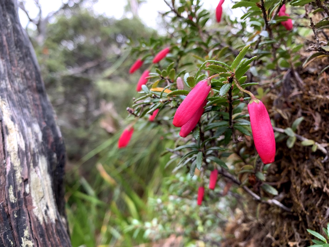
We found the Southern Ocean here a completely different beast from the last time we saw it (was that just yesterday??). Dark waves crashed and the steady rain became a downpour as we crossed the exposed stretch of rocky shore, so we stopped to put on raincoats. As luck would have it the rain stopped not long after we had climbed back into the forested headlands at the east end of the tiny beach. It stayed damp and grey for the next few km, but even with several creeklets to cross this stretch was the easiest walking we’d seen all day and we made good time to the much larger Turua Beach. This wide sandy stretch would have made a sweet spot to while away a sunny afternoon, but with the ocean churning and the sky dark we wanted to make it to the boat crossing sooner than later and still had 11km to go. Back up onto a bluff and into the forest we went. The section over Menzie’s Bluff was really quite civilized, with various generations of rotting boardwalk but no serious mud and only reasonable terrain changes. We started to see shrubs with brilliant purple and pink berries that really popped against the dense forest and dark sky. The 3km went by fast and soon we were making the typical steep sandy decent to yet another beach. This time it would be Prion Beach, a long open stretch of sand backed by low dunes that allegedly boasts great views of the surrounding mountains. On this stormy afternoon, we only had teasing glimpses of Precipitous Bluff and La Perouse through rapidly shifting clouds.

Andrew stops to look back halfway along 4km Prion Beach

Boats tied up at the New River Lagoon. Heavier than they look!
We crossed dark brown Grotto Creek and settled into a rhythm for the 4km beach walk to the end of the dunes. The sky remained dark and moody with scattered light squalls but no serious rain, and we hoped that the storm would hold back until we after we had made the boat crossing. Aside from the gulls and currawongs that accompanied us, it seemed as though we were the first souls to ever come across this deserted stretch of sand. It’s incredible how a Southern Ocean storm can transform a “popular” walking track into a remote and somewhat dangerous-feeling stretch of coastline. Even though we knew at least 6 others had walked this stretch just the day before (or possibly even earlier today), there was no evidence of their passage.

Rerouted trail stays inland of the New River Lagoon, through dense growth
We turned inland towards the base of the dunes just after 3pm. Once we left the wet sand there were plenty of footprints to follow, and we soon spotted a piece of driftwood draped with flotsam marking the route. Turning along the shore of New River Lagoon we found one boat tied up on our side, and another two across the channel. The boats were big flat-bottomed aluminum rowboats, much more substantial than what we’d seen in earlier pictures. We soon discovered that they were also quite heavy, and it took both of us to drag the boat over the sand to the water. Under an ominous sky with persistent moderate wind we loaded our gear into the boat and started paddling across the dark but relatively calm water. The long PVC oars were a bit unwieldy, and we zig-zagged across the ~200m channel. We were glad that the crossing was a decent ways inland from the lagoon’s opening, since there would be nothing between the coastline and Antarctica if we somehow drifted out. Fortunately for us, the current was not particularly strong and despite our poorly coordinated strokes we had no real difficulty getting to the far shore. We unloaded gear, dragged a 2nd boat what seemed like half a mile (though probably only 30-40m) across the wet sand, and split up for the second crossing. By now it had started to rain, but we were also more confident in our progress so we hardly noticed. We left one boat tied up and made our final crossing together, past a large group of black swans who must have been laughing at us by now. We cursed the weight of the boat as we dragged it across the wet sand, but made sure to leave it secured for the next group. All in, it took us just under an hour to make the triple boat crossing. There was no fresh water at Lagoon this year (apparently in some years there is a creek a short walk away) so we had no intention to stay. We took shelter from the rain in the deserted campsite to enjoy some late afternoon dried mango.

Wallaby in the dense forest before Milford Creek

Gotta love a big new bridge over the wide deep & dark waters of Milford Creek. Andrew is pretty happy to see it.
The boat dragging and rowing took more out of us than we expected, and an already-long day of difficult walking in stormy weather didn’t help. We had a ways to go if we were to camp at Osmiridium Beach as planned, so we didn’t hang around long. The trail has been re-routed from the description in the guide; apparently it used to follow the beach on the far side of New River Lagoon until near the outlet before climbing up onto the bluff. The lagoon has changed course so there is no longer any beach on the far side; the water laps along the edge of the steep bluff. A new trail has been constructed that climbs directly onto the bluff not far from the campsite, but it is already severely overgrown and has a ton of small ups and downs so we found it very slow going. We did have several spectacular views out across the coast, New River Lagoon, and Prion Beach under dramatic and photogenic skies, which made up in part for the slog. Another bonus was a wallaby sighting in the dense forest. The best treat of the day was finding a huge, well-constructed bridge over the dark brown waters of Milford Creek. This river had very still waters but seemed deep and full of downed trees and apparently used to be one of the more hazardous crossings on the track. We grabbed an extra liter of water at the bank then continued on. There was a small spot marginally suitable for a tent in dense dry forest not far beyond the bridge and we briefly thought about staying there, but the pull of a beach camp was strong. It seemed like we’d been walking forever by the time we reached the buoy that marked where the old “trail” (from the mouth of the lagoon) rejoined the new “trail” (along the top of the bluff) so we were elated to find that the trail got significantly easier at that point.

Evening golden hour across the plain as we hike towards Tyler Creek
We again settled into a walking rhythm, this time in densely shaded forest but without any significant mud, overgrown greenery, or major terrain changes. The rain had passed and it would have been downright pleasant if we weren’t both tired and hungry. It was nearly 6pm when we broke out of the forest onto a rolling buttongrass plain with distant hills in one direction and coastal inlets in the other. The golden hour light was magical and buoyed our spirits a bit. We didn’t know how well-marked the side track to Osmiridium Beach might be, so we spent far more time than necessary investigating every wide spot between muddy clumps of grass after we’d walked long enough that we thought it could be coming up. There was plenty of water at our feet in the form of muddy seeps, and stretches of boardwalk kept us from sinking in. We had read that there is not always reliable fresh water at Osmiridium, so we assumed that Tyler Creek (the landmark for the side track) might be quite small and easily missed. We went on like this for much longer than we might like to admit, when Andrew pointed out a man-made structure on the next rise that was the composting toilet for the Osmiridium campsite. Apparently it is a fairly well-established stop! Not long after that, we came to a well-trodden side track and a sign pointing us to Osmiridium Beach. So much for all of our navigational efforts…

Osmiridium Beach early evening light

Best campsite at Osmiridium Beach. Privacy, crashing waves, and stargazing.
We made our way through a confusing maze of mud, footprints, and buttongrass towards the general direction of Tyler Creek and the composting toilet. As we neared the campsite we heard several voices. We crossed Tyler Creek (actually quite large) on a large stack of downed logs (and some flotsam), and discovered that 8 tents were already set up among the trees of the official campsite. Wet clothes & gear were draped across criss-crossing lines, and a handful of people were smoking. Most were wrapping up their dinners and settling in for the evening. We learned that 6 were the group from Melbourne that started a day ahead of us as we said a few quick hellos, dropped our packs, and set out to orient ourselves. We could have squeezed another tent in between the others (and they did offer), but it would have been close quarters. The beach was a short walk away, past the mouth of Tyler Creek, and we ultimately decided on that option. We set up our camp at the base of the bluff on the wide sandy inlet along the creek, sheltered just a bit from the wind. We had no difficulty getting water from Tyler Creek and made dinner at dusk with the crashing waves of Osmiridium Beach as our soundtrack. Several of the campers wandered back and forth to the beach and waved, but it was getting dark so we didn’t really socialize. The sky cleared enough so that we left the tent fly half-off and we fell asleep watching shooting stars.
STATS: 20.5 KM | 9 HOURS | 835 M (~2780') NET ELEVATION Loss | 200 m (~655') CLIMB | 1035 m (~3395') DESCENT
Day 4 : Osmiridium Beach to Granite Beach

The southern cross and our own galaxy

Venus, a crescent moon in the dawn sky above Osmiridium Beach.
During the night, the skies did clear and the stars were brilliant. I had been happily sleeping, and awoke to hear the 6 Melburnians returning from a stroll on the beach. We later found out that there had been quiet the spectacular bioluminescence show. Instead, I marveled at the Southern Cross and the myriad of stars in the Milky Way and marveled, not for the first time, at the immensity of the universe. Drifting back to sleep, I enjoyed our beach site and wasn’t awake again until first light started to light up the clouds.
Morning brought some beautiful cloud formations and skies that were filled with pink. The Southern Ocean was a churning mess of waves from the storms and it was powerful and beguiling. We had our brekkie, a cuppa on the beach, and packed up camp. Before heading out, we took one last stroll on this lovely beach. We made our way through the forest back to the main campground and back to the trail. The Melburian 6 were getting their brekkie together and we met the 2 other hikers, a couple of Italians, who were taking a break from working on farms. We navigated the maze of mud and buttongrass tussocks and eventually, I’m quite certain that we took a different route back than the one we took to the campsite, found our way back to the South Coast Track.

Osmiridium Beach blushing at dawn
In case you were wondering where the tracks is, Cheri found it.
After the stormy dark grey day before, we welcomed the brilliant blue skies and high cirrus clouds. We followed the track as it traveled up away from the beach. We started the climbing traverse across the Rocky Plains. There was plenty of grassy plains all around us, however the rocky part, no so much. Soon we were up a hill and had transitioned from the plains into a very forested section with dappled shade that was most pleasant. Tree ferns surrounded us, some were just knee high and others were towering overhead. Because it was the South Coast Track, there was still plenty of muddy rooted sections to keep us on our toes and we were again grateful for our trekking poles to help navigate with a minimum of inadvertent mud baths. Once we had avoided that particular obstacle, we followed the ridge of Prettys Point and were surrounded by these massive beech and eucalyptus trees that towered over us. This small ridge then dropped down very rapidly to bring us to one of my favorite beaches of the whole trip along Surprise Bay.
We emerged from from the forest to a brilliant golden sand beach, crystal blue waves, jagged dark rocks jutting out of the sands and lush green forest all around. It was a truly beautiful surprise. We walked along the beach enjoying the tranquility with seagulls and oystercatchers as our only companions. At the eastern end of the beach we nestled in to some of rock formations/sand dunes for a our lunch and savored the sun, breeze, and happily reflected how beautiful and desolate it was down here. We would have loved to camp here, however, the day was young, and we had a few more km to go. We crossed the cool tea colored Surprise Rivulet, a refreshingly brisk wade, and started the steep clip up over Shoemaker Point. I looked back to take in the view of the beach one last time, and could see the bulk of the Ironbound Range over the saddle of Prettys Point.

On the trail with the Ironbound Range and Precipitous Bluff.
The climb up from the beach was steep and the ropes and wooden steps that were provided made it a less difficult ascent, although it was still tricky. Once we had made the top of the headland, the walking was much easier and it was simple up and down over Shoemaker Point. As we descended we caught glimpses of the massive face of the Fluted Cliffs across Shoemaker Bay. The Fluted Cliffs, along with Percipitous Bluff and Pindars Peak are all dolerite sills formed 165 million years ago. The beach started out sandy like every other beach we had crossed on the track thus far, but after the first little creek crossing, the smooth large boulder started appearing. These granite boulder made up the entire beach as it narrowed towards the eastern edge. Around the western edge of the gulch where Sandstone Creek reaches the beach. We followed the use path up the western bluff to check out a small exposed campsite. It was not all that appealing to us, and we headed back down to the beach. As we headed back down to the beach to cross the creek, we came across a jet black Tiger Snake who had been happily sunning itself until we disturbed him/her (We didn’t stick around to ask what gender it was).

Yes, we are still in the land of mud.

Cheri navigating the talus field of Granite Beach while gazing at the Fluted Cliffs.
On the far side of the creek was a shower of waterfall coming down from an unnamed creek. We took the stairs up the cliff and crossed the top of the waterfall before climbing up further to a large campsite spread out through the trees. We met 3 other hikers (a Canandian and 2 Aussies from Adelaide) who had were spending a rest day here. We said brief hellos as we set up our campsite and then Cheri and I took the opportunity that a sunny afternoon provided to relax and headed down to the beach again. The waterfall at beach was a brisk and very refreshing rinse off shower. Of the two of us, Cheri is much more tolerant/braver about cold water. Needless to say she took to the waterfall shower first. Given a choice, I’ll be happily lizarding extracting as much warmth from the surrounding rocks as a I can. Fortunately there was enough sun and strong breeze to help us dry off and warm up. The rest of the afternoon was spent enjoying the raw churning storm waves coming in and the strong wind at the beach. Eventually, the breeze got the better of us and we headed back up the bluff. It was pretty amazing that no more than 50m inland and under the cover of some trees, and the was no breeze. Later that afternoon the 2 Italians and the Melburian 6 tramped in to camp. We had not spent much time with the previous night at Osmiridium, so we all enjoyed sitting around and eating in a little cluster of folks and got to know some of their backstories. The Italians were doing casual farm work and had been bouncing between jobs. They had actually hiked in from Cockle Creek at the eastern terminus and headed out past Melaluca and on to Bathurst Harbor before returning. The 6 mates have all known one another since middle school. They have kept in touch every since. For the past several years, they will meet up 1-2x per year and do a week or so of backpacking together. It was really a blast seeing their camaraderie.
STATS: 8 kM | 3 HOURS | 0 M NET ELEVATION GAIN | 380 M (~1245') CLIMB | 380 M (~1245') DESCENT
Day 5 / Granite Beach over the South Cape Range to Cockle Creek

Granite Beach Sunrise
Cheri crossing the endless small talus of Mt. Fitzgerald's shoulder as the high clouds coalesce above
After a long and leisurely afternoon yesterday, we awoke fairly early today. Even so, we found that the Canadians/Adelaideans had already left and the group of Aussies from Melbourne had dined and packed up with remarkable efficiency and were nearly ready to head out by the crack of dawn. The Italians were up but still enjoying breakfast. We felt no urgency ourselves, as our ride from Cockle Creek wasn’t scheduled until 4pm tomorrow, but we also had no reason to dawdle in camp so we ate breakfast and hit the trail by 8:15am. The trail made an immediate steep climb through dry forest with no stairs or switchbacks to ease the ascent. While not easy, we appreciated the relatively cool temperature and steady shade and found this climb much preferable to that of the sweltering and ultimately smoky Ironbound Range just a few days ago. The trail occasionally had some deep muddy ruts and we got a leech or two on an arm as we brushed past tall grasses. These little black guys hang out on wet grasses and leaves in the dense forest then drop onto hikers as they walk by. (Yeah, terrestrial leeches that fall from the “sky” - maybe one reason there aren’t many hikers on this trail?!) Despite this, we quickly settled into a rhythm and it wasn’t long before we caught up to the slowest of the Aussies. There were a few stretches requiring a rocky scramble but otherwise the only difficulty came in the form of a relentless ascent. We kept a steady pace and passed three more Aussies on the climb. While we are in decent shape, the Italians have been on-trail for over a week and are nearly forest sprites. They passed us at a rapid clip.

Last views back towards Granite Beach Bay and beyond, before our last climb up to Flat Rock Plain
The trail broke out of the forest for our first coastal views of the morning and near the top of a rutted slope we found the last 2 Aussies leaning back against their packs enjoying the scene as they waited for their mates. We decided it was a fine place for a break and joined them on the side of the trail. We joked about the near uselessness of their walkie-talkies, since so much of the terrain looked similar and there were no distance markers or other signage to speak of. They agreed that most days the exchanges consisted of “I’m in the trees, going up a hill”, “Me too. How far back do you think you are?”, “Not sure, I’ll let you know when I can see you”, etc. We all had a chuckle and agreed that it helped pass the time and keep them connected as they inevitably spread out on trail through the course of each day. The others finally appeared and we took that as a cue to get back on-trail for the last bit of climb to the large grassy knoll of Flat Rock Plain. At ~400m of elevation this isn’t the high point of the South Cape Range, but it is the highest spot with a view on the trail, so we spent a few minutes taking it all in.

A deep and narrow section of trail en route to Track Cutter’s Camp. It’s a good thing we are skinny trail runners!

Loving us some fresh boardwalk across the wet plains!
From there we headed back into deep forest into the muddiest stretch of track so far. The track was braided with several options around each muddy pit (none of them dry), and more track markers in a short stretch than we’d seen in the previous 4 days. We were happy for our poles, which helped us probe the depth of mud and select the best spots to step. We were able to move relatively quickly and soon left the banter of the lead Aussies behind us. After crossing a tiny trickle of a creek we climbed a bit more to a clearing known as “Track Cutters Camp” in dry, open forest. We took advantage of the large downed logs to use as benches and enjoyed tortillas with the last of our Tasty cheese. Cheri felt something crawling around on her calf and thought maybe an ant had worked its way up from her shoe. She opened up her gaiter and was shocked to see a LEECH inching along her skin! How it got inside a snug gaiter is anybody’s guess but fortunately it hadn’t yet latched on so it was easy enough to fling back into the forest. It was pretty clear that we wouldn’t need all day and most of tomorrow to get to Cockle Creek, but we had checked for cell service at each clearing on the way up into the South Cape Range with no luck so it seemed unlikely we’d be able to contact our transport for an earlier ride. There was no rush, and it seemed as though we’d have plenty of spare hours to spend somewhere so we spent time wandering and admiring the big trees in this stretch of forest before continuing on.
We had already passed the high point of the range (not obvious) and the trail now went down much more than up. There was still plenty of mud, rocks, and roots but nothing too challenging. Near Blackhole Creek the trail pops out into a large open plain with great views of the sky, hills to the left, and peekaboo glimpses of the Southern Ocean to the right. The boardwalk was brand-spanking-new in this section so we picked up the pace and Cheri almost stepped on a fat black Tiger snake taking advantage of the teeniest bit of sun coming through the clouds. She stopped just in time and it slithered off into the grasses next to the trail.

Back to the coast! More stormy seas/skies.
It was another light rain kind of day and we put raingear on and off a few times through the early afternoon. We followed the trail up and over a few forested knolls but otherwise it generally followed a downward course out of the range. It was 1pm when we crossed the last tiny rise and we checked for cell service one last time from the deeply forested spot we’d chosen for a snack. To our surprise, we actually had decent coverage! We called Kevin from the transport company to inquire whether he might change our pickup time from tomorrow evening to tomorrow morning. He was extremely accommodating and said he’d come whenever we wanted - he suggested that we might even want a pickup tonight. This hadn’t been on our radar, but after a quick discussion and consultation with the map we told him we were game. It was a rainy afternoon and we had 4-5hrs hiking left to the end of the trail. If he didn’t mind a short notice pickup, we were happy to enjoy a warm shower tonight instead of a night at a drive-in campground with no amenities. Arrangements confirmed, we now had a goal and set off in earnest.

Trees provided a little windbreak, but tall grasses soaked our legs whenever we weren’t on the beach.
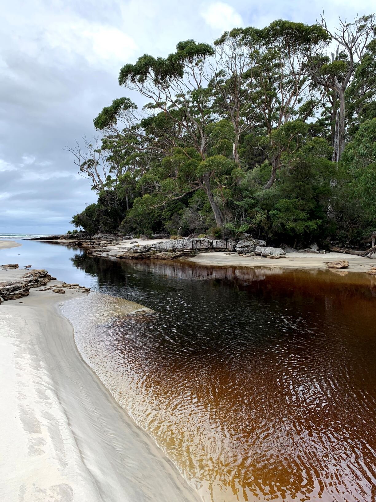
There was a bit more forest walking, over many downed branches and small trees, then a relatively sudden arrival to South Cape Rivulet (5.5 hrs of walking including 3 breaks). This is another of the water crossings listed as potentially dangerous in high water or storm conditions. At knee to thigh-deep, it was the deepest crossing of our trip but the current was slow and there was a wide range of options for crossing location. Despite the stormy day and brown tannin-stained water it didn’t pose a challenge. We ran into Amir & Fabio, who had set up camp across the river for the night, and chatted for a bit as we lounged on a wide flat piece of driftwood for a final snack break of the hike. As luck would have it, it started to rain just as soon as we started eating so they retreated to their campsite and we wrapped it up and headed eastward. There was a smaller point and 2nd campsite partway along the beach but it wasn’t spectacular. We climbed onto Coals' Bluff as the sky opened up and we were once again happy for the tree cover. The track passed through long stretches of overgrown grasses so our feet were soaked from the vegetation although the forest protected us from falling rain. We dropped down to our final Southern Ocean beach at Lion Rock.

Stairs up to the final bluffs of the South Coast Track
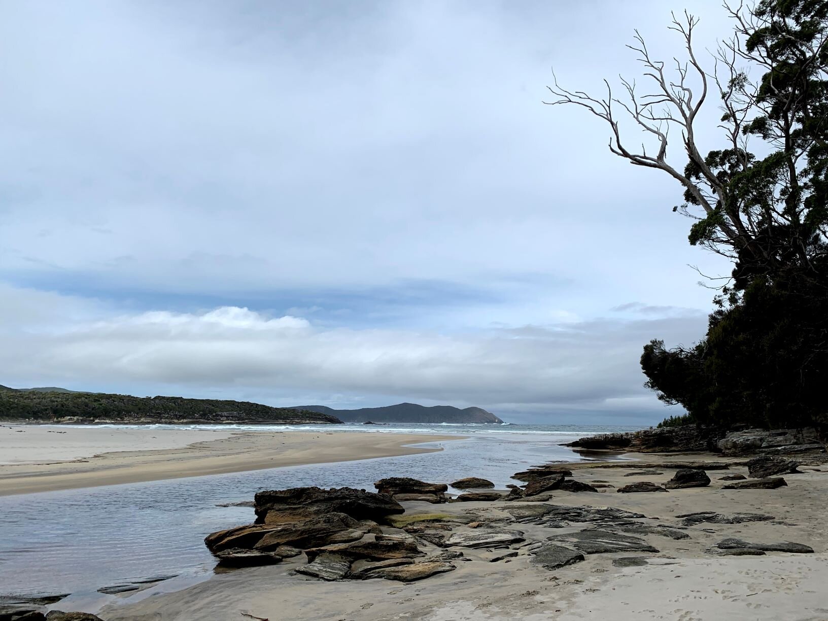
Even on a stormy day, this was a spectacular stretch of coastline and would have made a great place to stop for the night if we weren’t headed all the way to Cockle Creek. A wooden ladder led up the sandy dunes to the designated campsite (appealing but we didn’t check it out). The small bay boasted picturesque dune grasses, a tannin-stained creek, dark grey rocks tumbled smooth by the ocean, and the dramatic bulk of Lion Rock just offshore. All that along with crashing waves, dramatic skies, and a wide sandy beach. And of course, there wasn’t a soul to be seen unless you count the seabirds. At the opposite end of the beach there was a dramatic cliff and we kept our eyes peeled for a trail marker up onto the bluff as we crossed the sand.

“Track” across the cliffs of the South Cape Bay, faintly marked by hiker’s footsteps and the occasional orange triangle.
Nearing the cliff, we realized that there were stone steps carved & built right into the rock. These ascended straight from the beach and continued to a set of wooden stairs visible near the top of the cliff. We always appreciate some good trail work so we spent some time admiring the workmanship then said goodbye to our final beach and headed up the steps. We were in for a real treat at the top - we found that rather than building a trail in the forested bluff skirting the cliffs, the track builders had routed the trail directly along the edge of the sandstone! Trail markers and cairns marked the way, and a faint footpath was worn by hikers who came before us. On this blustery day we had a spectacular vantage point to enjoy 180-degree views of a very stormy Southern Ocean and back towards the South Cape Range we had just crossed. Despite the wind and rain we spent far too long going back and forth for the very best view and being mesmerized by the constant motion of the water below.

Walking along the edge of the South Cape Bay cliffs
Finally we had to pull ourselves away from the cliffs and head back into the forest for our final push to the trailhead at Cockle Creek. A sign listed the destination as 2 hours away, though we doubted it would take that long. We made very good time on the wide, smooth trail with bridges over every seep, constructed edging, regular steps, and even handrails (!). We joked that this “starter trail” was for day hikers coming out of Cockle Creek, and that they’d have a serious shock if they went further than Lion’s Rock and had an expectation that the South Coast Track looks like this all the way to the western terminus at Melaleuca.
We passed a few day hikers in ponchos, and put on raingear again ourselves as the light rain became steady. We enjoyed blooming melaleuca shrubs and tried unsuccessfully to keep our feet dry as we pushed through wet grasses draping over long stretches of low boardwalk. With the amount of time we spent at South Cape Rivulet and on the cliffs above Lion’s Rock Beach, we were suddenly on a bit of a schedule so we made a steady push to reach Cockle Creek just before 6pm. As a final South Coast Track bonus, we ran into one more wallaby in the dense forest just before we came up to the boot cleaning station and walkers’ log book that marked the end of our Tasmanian Great Walk.
A friendly volunteer offered us an apple as we sat at a picnic table changing out of our wet shoes. We learned that another foursome had come from Granite Beach today as well; looking across the dirt lot we recognized the Canadians/Adelaideans and gave a wave. Kevin was already there and pulled his van around to load our gear. Five amazing days after setting out from Melaleuca airstrip, our South Coast Track journey was complete.
STATS: 18 kM | 8.5 HOURS | 0 NET ELEVATION change | 915 m (~3000') CLIMB | 915 M (~3000') DESCENT