
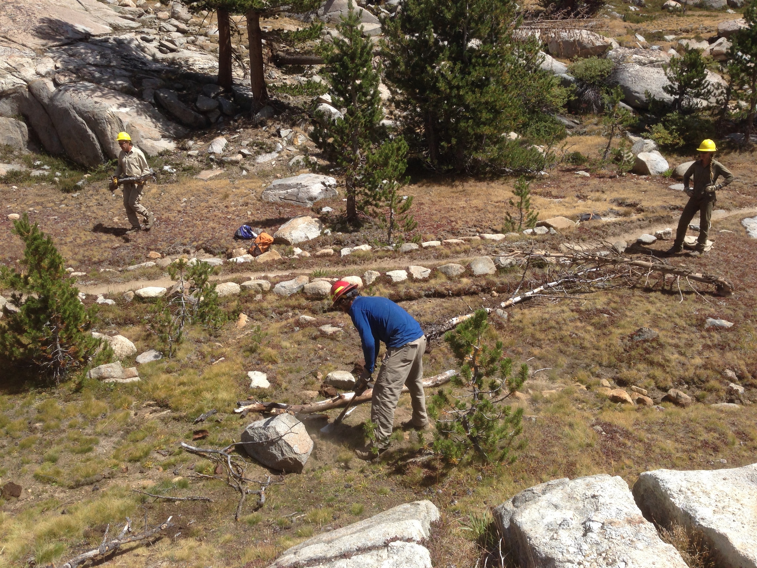
“The dude swinging the hammer was kind of a quiet badass”
LOCATION
John Muir Wilderness, Sierra NF, CA, USA
Non-workday MILEAGE
~24 miles on-trail, ~13 miles off-trail
Hiking Days: 3 Work Days: 4
Pre-Trip Dayhike: Mt Givens SUmmit
SEASON: Late August Year: 2014
STARTING & ENDING TRAILHEADS
Lost Valley (Florence Lake) / Jackass Meadow

Basecamp: Bolsillo Campground, Kaiser Pass Road
Map: Tom Harrison Mono Divide Trail Map

GuideBooks: The High Sierra: Peaks, Passes, Trails by RJ Secor

Our Inspiration: The PCT Association
Outback Oven pizza, Old Rasputin imperial stout, and the NYT crossword puzzle - car camping at its finest!
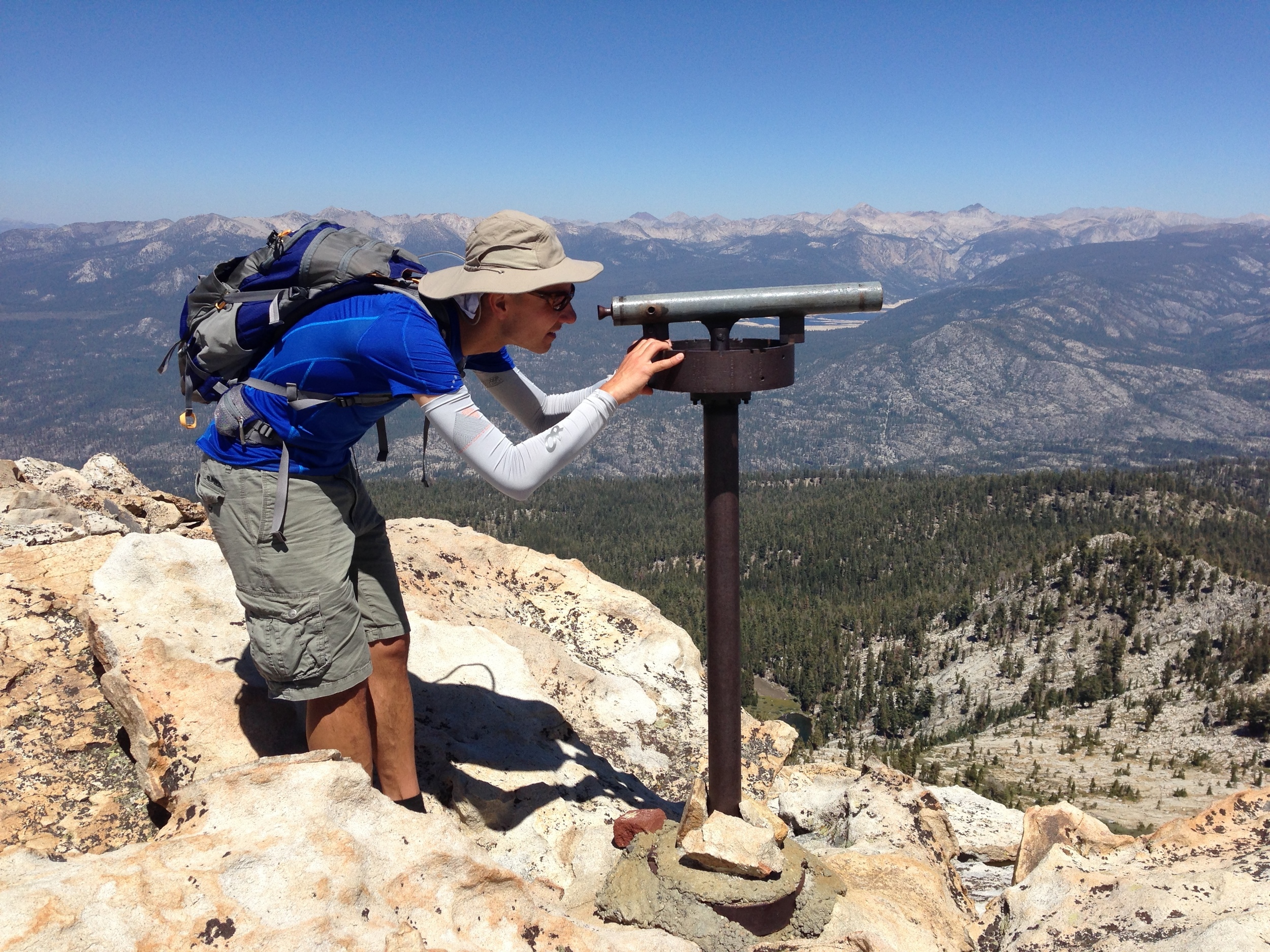
Pre-trip: Mt. Givens Summit from Bosillo Campground | 8.1 miles round-trip | Elevation gain (& loss) 3,490'
We arrived a day early and were thinking of heading up into the high country, but were unable to ascertain if it was acceptable to meet the crew at the worksite on the following evening (or find anyone who could pass a message along to the group). Instead, we car-camped at Bolsillo campground and took the opportunity to day-hike up nearby Mt. Givens for spectacular views of the surrounding ridges and peaks. We returned to camp around dusk and discovered that the site across from us had been filled by a fellow volunteer. We shared a beer and stayed up well past dark sharing stories of the trails. We would meet the rest of the team the next morning at the High Sierra Visitor Information Station just up the road.

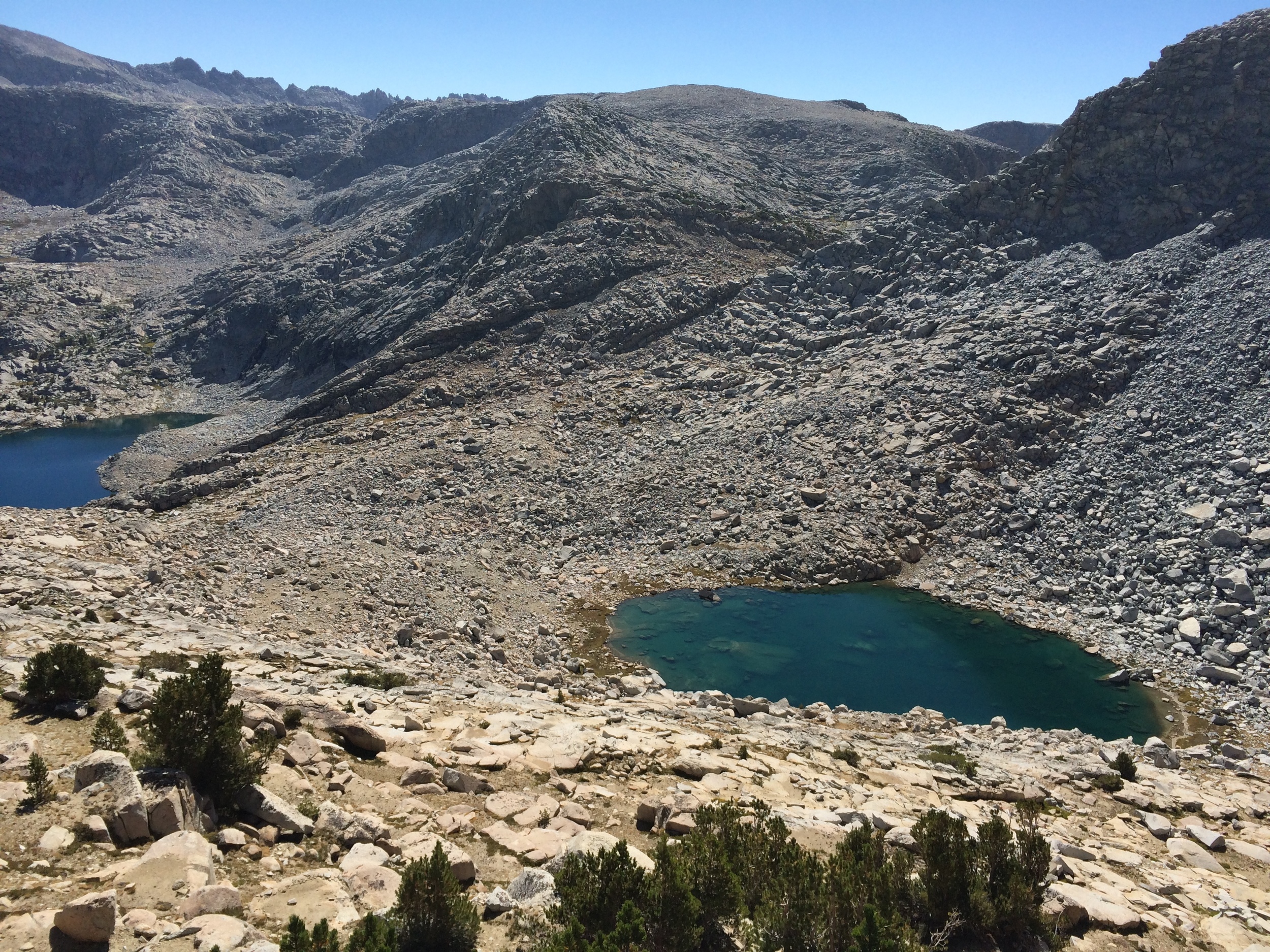
Looking down on Givens Lake en route to Mt. Givens summit

Andrew on the blocks near Mt. Givens’ summit
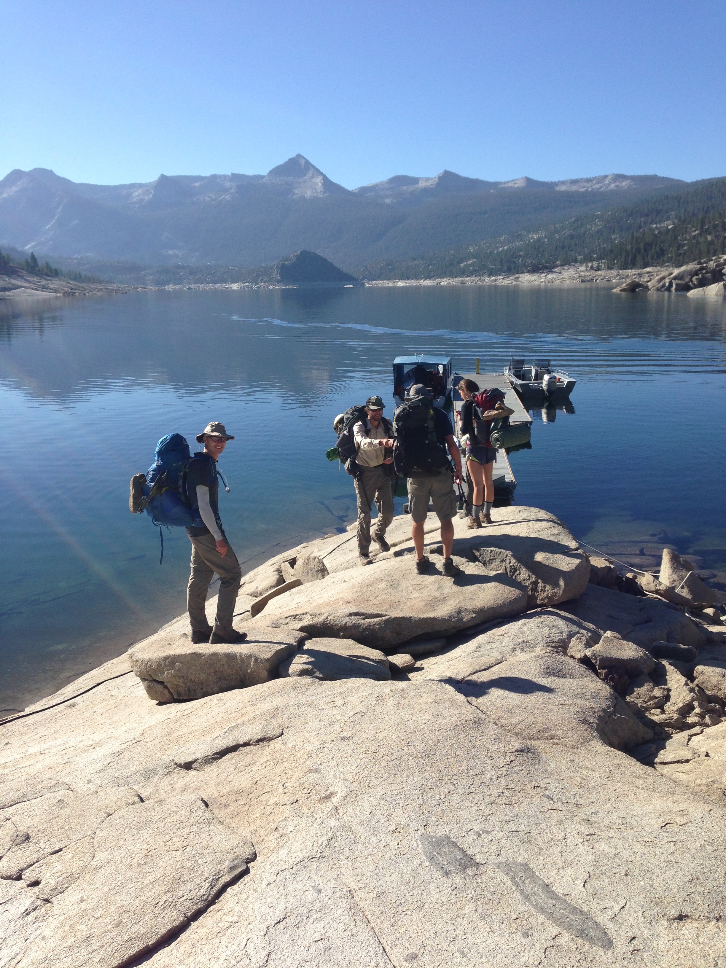
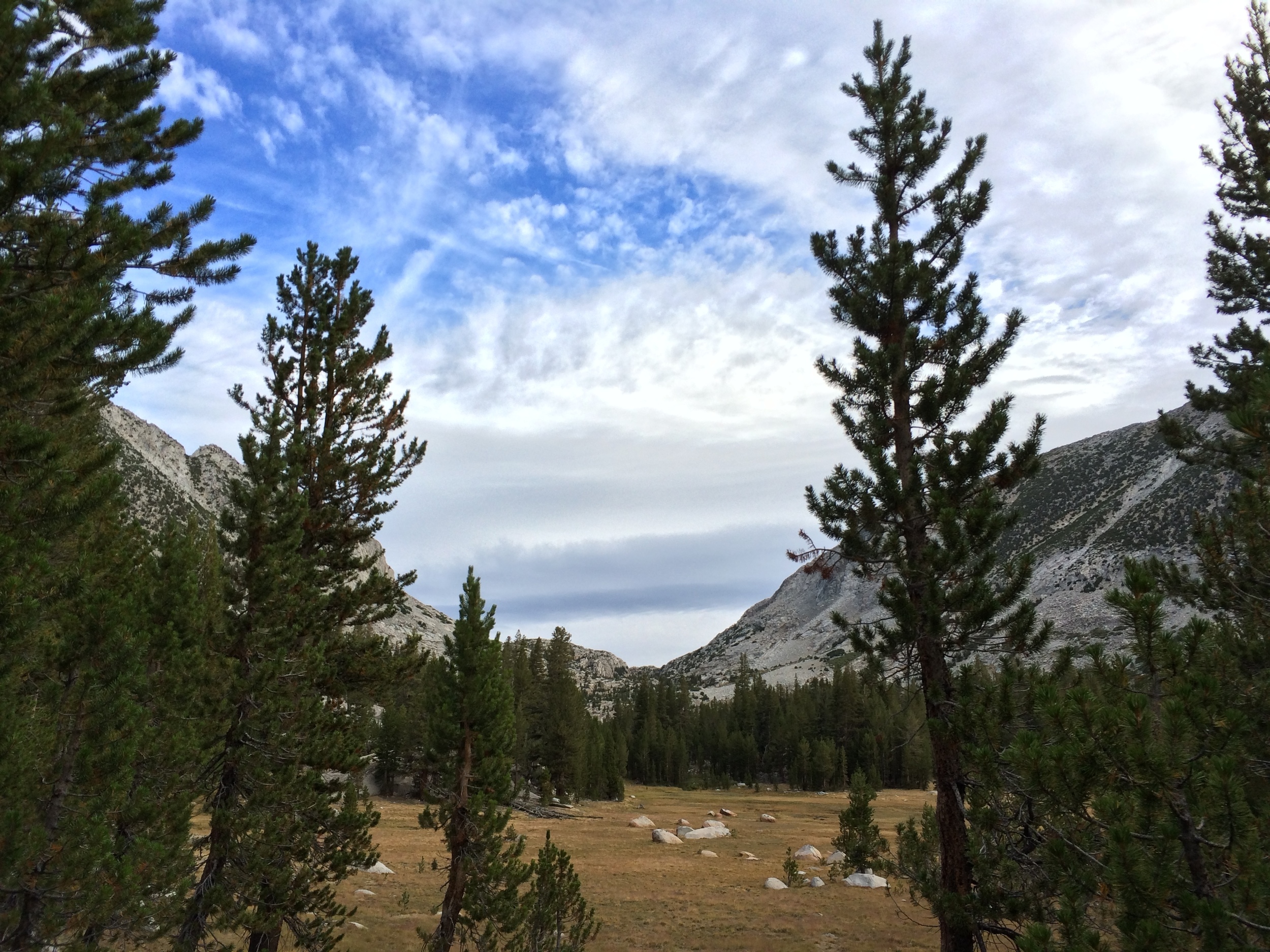
Day 1 Florence Lake east dock to Sallie Keyes Lakes | 10.5 miles trail | 3,896' total Climb | 1,106' total Descent
Despite the extremely low lake level, the water taxi was running and the PCTA generously provided tickets for the entire crew, so we all started our hike from the dock at the east end of the lake. If you look closely, you'll see that the waypoint for the dock on our trip is well below the average water level/shore line. We had the requisite safety briefing sitting on granite slabs near the lake before heading up the trail as a group towards our work-week basecamp at lower Sallie Keyes Lake.
The team

Fellow volunteer Pops C and his trusty Trail Bug, outfitted with only a single seat so he could throw out a sleeping bag inside
Our team consisted of two wilderness rangers, the Sierra NF trail crew of 4 + a crew chief with a wealth of experience working for multiple agencies (check out his Instagram feed for some awesome trail work pics: @refusnik), and 6 PCTA volunteers including the two of us. We were supported by a trail chef who stayed all week to cook one delicious meal after another, and a team of packers who dropped off our group camp and work equipment then returned at the end of the week to pick it up. The volunteers were evenly split between men & women. 3 of us had full-time jobs, 2 were retired, and 1 was in between college & grad school. 3 of us live in the SF bay area, 1 was from Sonoma County just to the north, and the remaining two came from non-PCT western states (ID & AZ). Two had served long public-lands careers (smokejumper, USFS admin), one was currently employed in private-sector land conservation, and two had done seasonal public-lands stints in the past. One had thru-hiked the PCT the previous season and was looking to give back, two of us had plans for a thru-hike within the next few years, and two were daydreaming about the remote possibility. One had never even been on the Pacific Crest Trail but had met some friendly PCTA staff at a regional trails conference. He's an avid trail maintenance volunteer in his home state of Arizona and decided to make a long road trip in his vintage VW Beetle "trail bug" to check out the PCT and lend a hand while he was at it! We all, of course, shared a strong affinity for the mountains and trails in general, and a desire to spend a little of our free time contributing to a trail work project with significant impact.
The work
This trip was classified as "strenuous" and noted to consist of "rock work" on the PCTA website volunteer page. We are both pretty fit and reasonably young, and we were motivated to use our week of vacation to take advantage of our strengths in service of the trail. There are trail work volunteer opportunities that range widely in duration, difficulty, and type of work, but we knew we didn't want a car-camping trip where we spent half-days raking pine needles... there will be plenty of time for that type of volunteer work later in life.

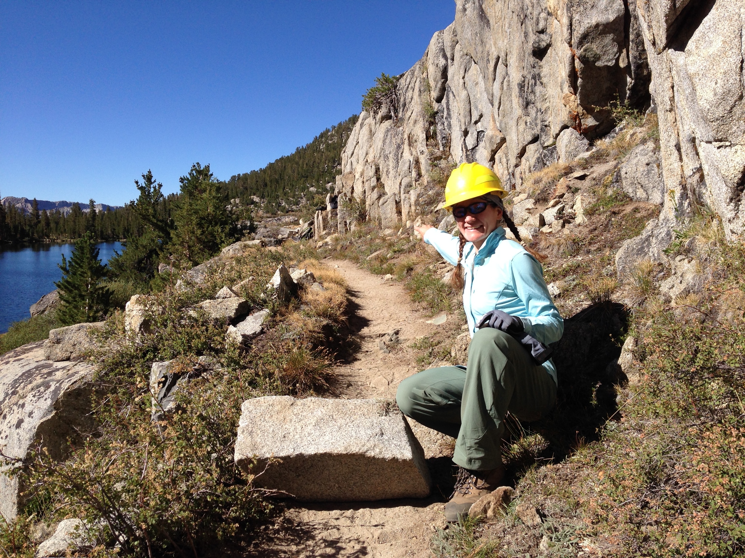
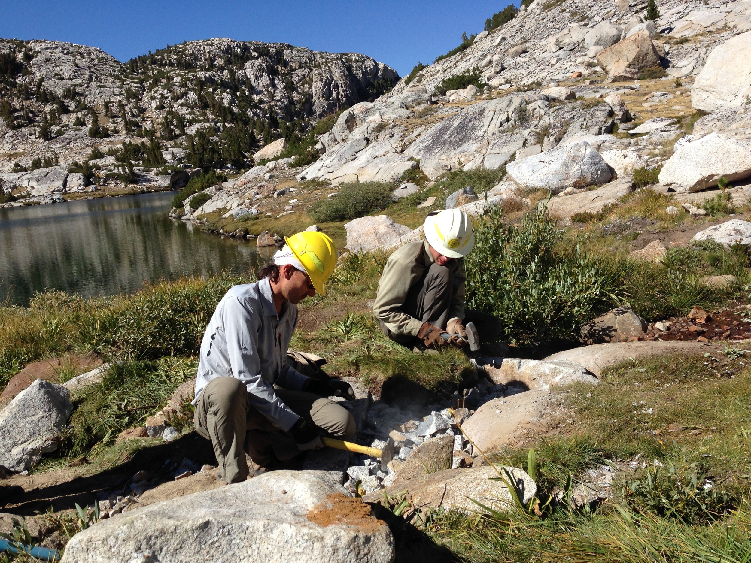
Crush! The entire retaining wall is backfilled by this granite gravel that we painstakingly made by hand each day
We found the hike in to Sallie Keyes fairly straightforward, especially since our packs had only personal gear and little in the way of food. From there, the work was exactly as predicted. No power equipment is used in the USFS wilderness areas, so all of the work was done by hand. We selected large rocks from nearby hillsides (being careful not to leave any trace of having taken them) and rolled, slid, or dragged them to the trail by hand or with rock-bars. We cut straight lines in these huge rocks with wedges and sledges, and buried them on end several feet in the ground to create check steps that would hold up to stock use and remain intact for another 100 years. We built a large retaining wall to repair a section of trail that had completely washed out, and in doing so we learned that the way to make medium sized rocks, small rocks, and "crush" is by repeatedly hitting larger pieces of granite with hammers of various sizes. We used similar techniques to build a durable raised section of trail through a boggy area near a lake. Finally, we collectively dug out over 100 filled-in waterbars to restore drainage and prevent further trail erosion, eliminated social trails through sensitive meadows, and erased evidence of campsites that didn't meet standard leave-no-trace backcountry guidelines.

Dirt is taken from far off-trail and carried in canvas bags. Check steps are buried super deep in the ground for stability. Everything is backfilled with crush. Andrew surveys his work.
We worked standard government 8-hour days, with a mid-day break for lunch. The tools were stashed near the worksites and we hiked there each day with hard hats, work gloves, and a daypack with our personal items. We generally split up into two crews with volunteers and paid staff on each, and sometimes switched between crews at mid-day based on interest and need in various tasks. By the late afternoon our workday was done and we usually had time for a quick swim in the lake before dinner was ready. After dinner we sat around for a bit and chatted with the rest of the team but we were generally exhausted and went to bed early every night. Rock work is hard work!
P.S. Although we are fairly fit, our home life does NOT consist of swinging heavy hammers, rolling enormous rocks, and carrying canvas bags full of dirt 8 hours a day, 4 days a week. We were definitely schooled by the full-time trail crew and wilderness rangers!
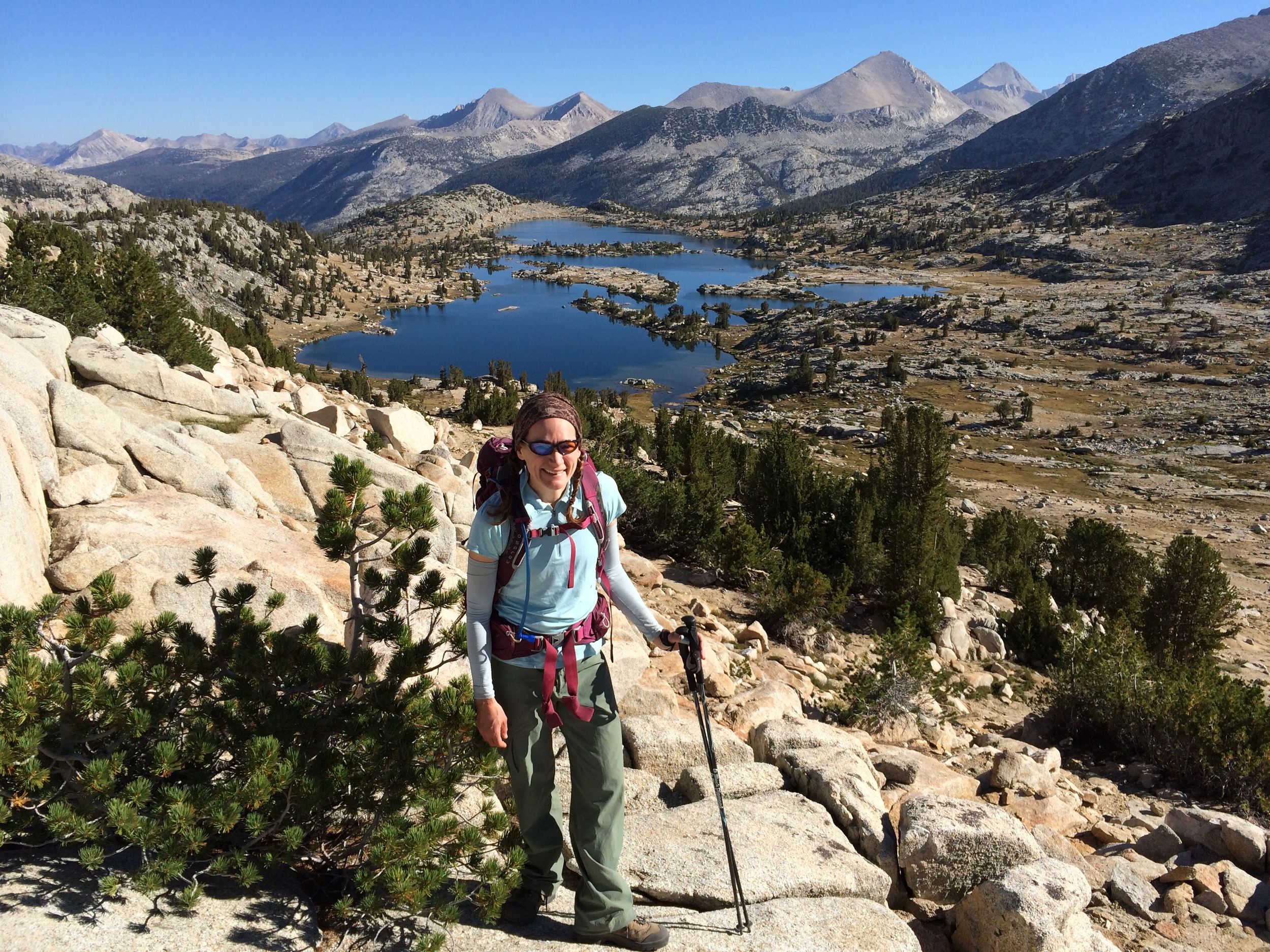
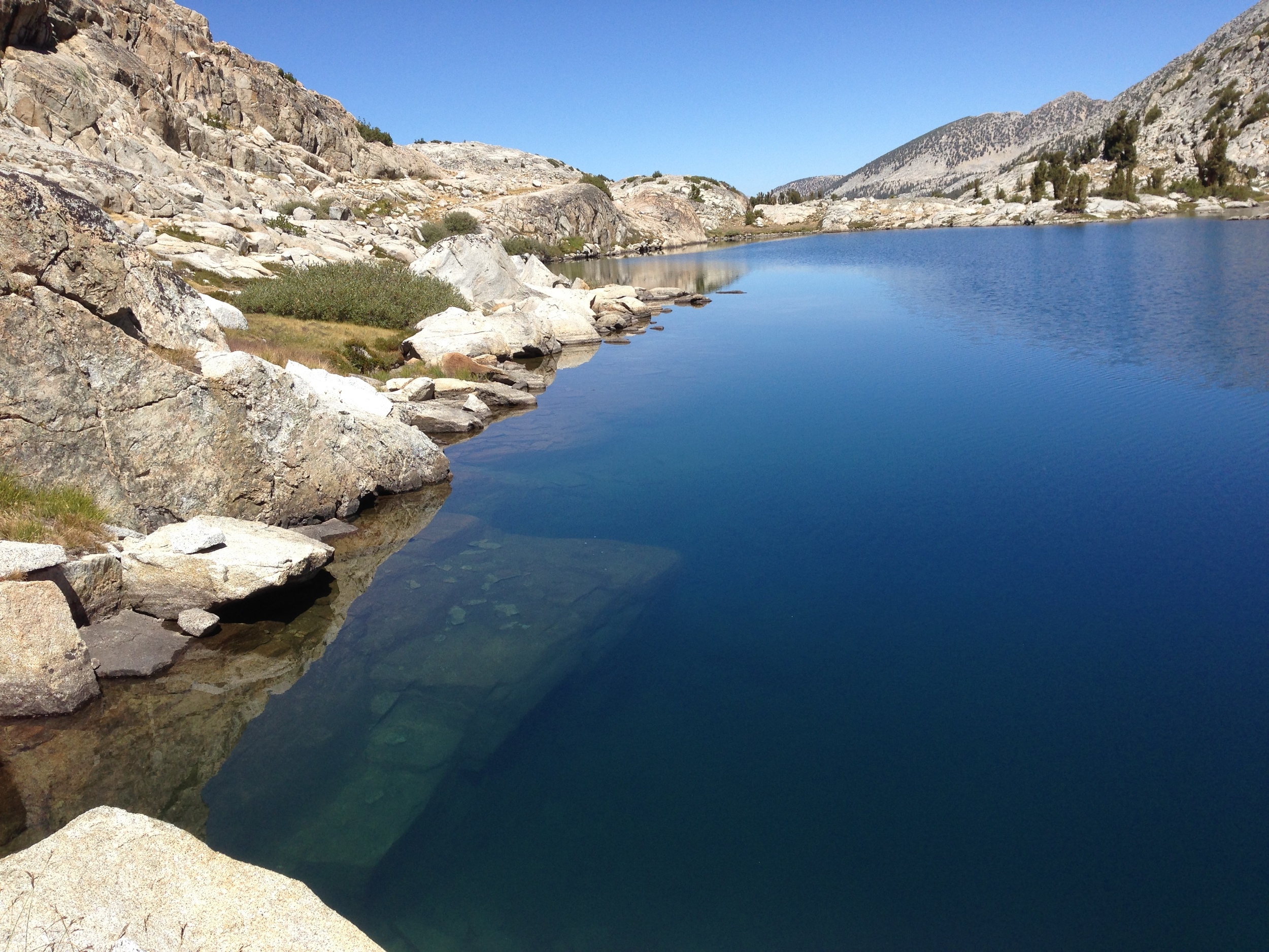
Selden Pass to Sharp Note Pass & lakes loop (rest day) | 5 miles trail + 5.2 miles off-trail | Elevation gain (& loss) 3,270'
The volunteers had a "rest day" mid-week (the paid trail crew continued on our projects -- we felt a little bad leaving them, but it was our vacation after all). The two of us took advantage of another clear day to explore unmarked Sharp Note Pass and the musical basin beyond that contains Sharp Note, Flat Note, and Medley Lakes along with the much larger Island Lake. A few fellow volunteers who had never hiked off-trail tagged along, and a good time was had by all. We enjoyed spectacular views and reflections of Gemini and Seven Gables, and a sweet vista of the Silver Divide. Our return route took us above Sandpiper Lake and around the north end of lovely Marie Lake, then back over Selden Pass and to our base camp at Sallie Keyes just in time for dinner.
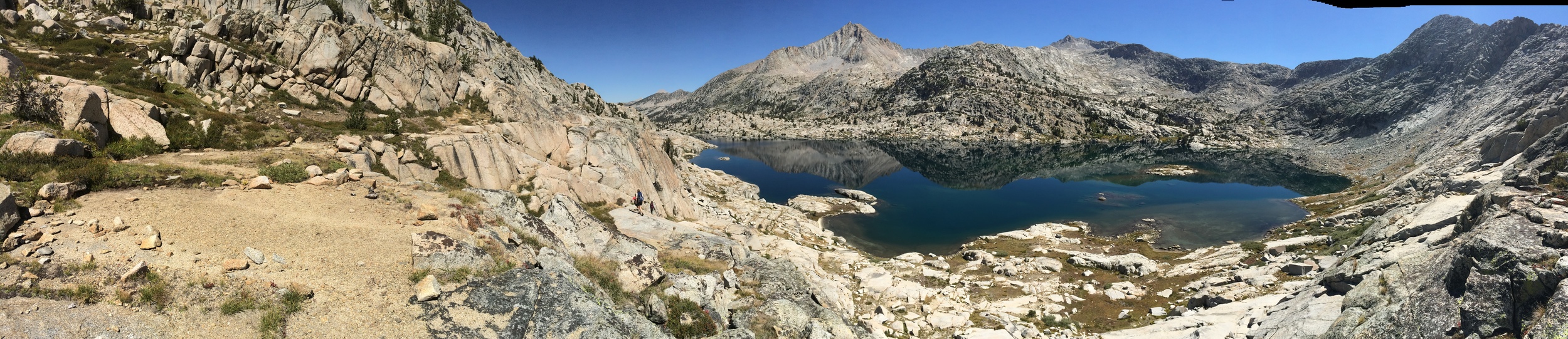
Island Lake as seen from below Sharp Note Lake
Day 7 Sallie Keyes Lakes to west end Florence Lake via Tombstone Pass | 0.2 miles trail + 7.7 miles off-trail | 997' total climb | 3,805' total descent
We volunteers were released on the final day of the trip with a water taxi ticket and free reign to hike at our own respective paces back to the trailhead and waiting cars. We weren't in a hurry, and that section of trail isn't terribly scenic, so we explored a cross-country route over Tombstone Pass that dropped us down just behind the expansive Jackass Meadows campground. We dodged the crowds of RV-ers then road-walked back to our cars around the dammed west end of Florence Lake. The upper part of the route offered plenty of sky, rock, trees, and views though as we started to lose elevation the undergrowth quickly grew thicker and required some serious bushwhacking in the final mile or so. Given the dense growth and steep terrain in that section, we probably wouldn't choose to take this route in the opposite direction. Despite the roadwalk and bushwhack it was a nice little alternative to backtracking on a heavily-used and fairly plain section of dusty trail and we might do it again if we found ourselves in a similar situation.

View south from the high traverse along the Tombstone Pass route
THE VERDICT
This was an A+ volunteer experience. We were a little perplexed at the start, when nobody at the High Sierra Station knew anything about the trip just 1 day before we were supposed to meet. But at the appointed time the supervisors and volunteers all came together as scheduled and the week ran like a Swiss train from there. Our skills were utilized, we felt appreciated for our efforts, we were well-supported, and to top it off we had a ton of fun. We would join another PCTA work trip in an minute if the opportunity fit with our busy calendar.