
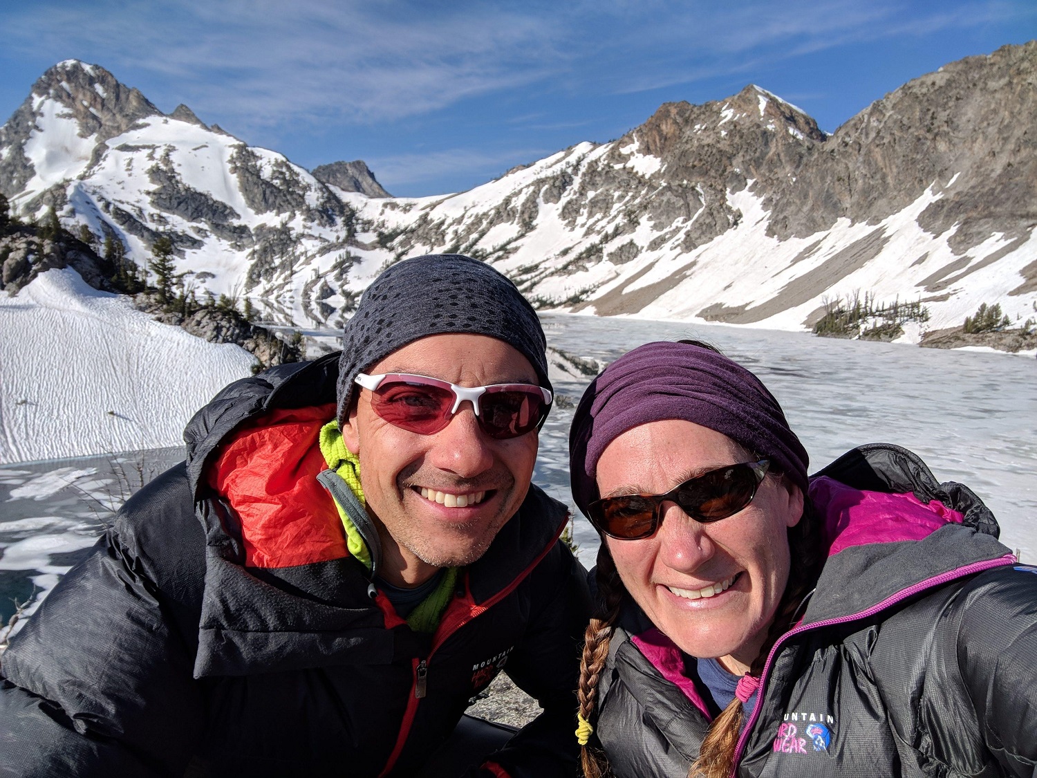
“Idaho is terrible, don’t go there”
LOCATION
Sawtooth Wilderness and Sawtooth National Recreation Area, ID, USA
MILEAGE
36.4 miles more or less "on-trail", with several over snow (+ 25-mile car ride mid-trip between Hell Roaring & Iron Creek trailheads)
TOTAL CLIMB: 8482' TOTAL DESCENT: 8711'
DAYS: 4 SEASON: Late-June
Year: 2018
STARTING & ENDING TRAILHEADs
Tin Cup (Pettit Lake) / Hell Roaring / Iron Creek
Basecamp Town: Stanley, ID

Maps: Adventure Maps Inc. Sawtooth & White Cloud Mountains Trail Map (2015)

GuideBook: Wilderness Press Backpacking Idaho, 2nd ed.

Permits / Info: USFS Stanley Ranger Station, Sawtooth Mountain Guides
Pre-Trip
Our good friends Hillair and Michael have spent many years visiting the mountain town of Ketchum, Idaho. They are kindred mountain spirits and were enthusiastic supporters of our PCT thru-hike, meeting us at Tuolumne Meadow and again at Red's Meadow for resupply. When we heard they were going to spend the entire month of June in Ketchum and were open to visitors, we immediately started looking at a way to combine a visit to their new place with some time in a new (to us) mountain range. There are many wild areas in central ID, but the Sawtooth Mountains have been on our radar for some time now. In truth, we knew very little about these mountains but had heard many positive murmurs. In any case, through all of our travels we have yet to meet a mountain range that we couldn't love.
Cheri gazing at Liberty Pass across a rather icy Lamoille Lake
We made a fun little road trip of our journey out to Ketchum. Cheri found us a sweet Airbnb spot not far from the Ruby Mountains and just south of Elko, NV. We left the SF Bay Area behind, crossed the Central Valley of CA, crossed the Sierra Nevadas, and continued across the Great Basin until we reached the snow-capped Rubies just in time for a late afternoon trail run to stretch our legs. Driving up into Lamoille Canyon to reach the trailhead we were reminded of our Ruby Crest adventure just a few years ago. There was no snow at the trailhead and we headed up the trail, with an initial goal of Liberty Pass for the views. It wasn't long before we started hitting patches of snow, and there were plenty of downed trees to navigate too. Our run turned out to be a combination run/hike/slushfest due to the early season conditions and by the time we reached Lamoille Lake (9747') it was a bit later than planned and our feet were thoroughly soaked. The lake was still more or less covered in ice, and the route to Liberty Pass was ~100% under snow from there. We decided Lamoille would be our destination for the day, and we ran back down and headed to our Airbnb for showers and dinner. It was a quick little visit to the Rubies but great to spend time in this lovely little range and well worth the stop.

Andrew flying through the arrowleaf balsamroot so ubiquitous to the mountain trails around Ketchum ID
Saturday morning we left Elko and turned northward. As the miles went by we transitioned from bluebird skies to increasingly ominous clouds. Just as we arrived in town, the dark grey sky opened up and a solid but brief rain shower welcomed us to Ketchum. We spent the next few days catching up with Hillair and Michael and exploring town and the nearby trails. The weather remained unsettled, with dramatic fast-moving and sometimes ominous clouds, and at least a little precipitation every day. The peak "summer" season doesn't really start until the 4th of July, so it was pleasant to see the quieter site of Ketchum during this shoulder season. Ketchum is a great home base for trail running, and we got in a handful of solid runs in the many trails not too far from town. On the flip side, we found it very challenging to obtain conditions reports for heading deeper into the mountains.

Our first view of the Sawtooth Mountains, from a lookout just north of Galena Summit
There are several outfitters in Ketchum and they were happy to share their favorite mid- to late-summer routes, but nobody had really been out yet this year so they didn't have any current intel on stream crossings or snow levels. We stopped in at the Sawtooth National Recreation Area Visitor Center just north of town; they were super friendly but the best recommendation of the volunteer there (who had just arrived in his RV from San Diego) when we told him we were looking for a multi-day backpacking trip in the Sawtooths was to hike into the forest along a 3.5mi jeep road behind the center, pitch a tent there, and camp for a few days. He also told us that the entire wilderness area is closed until the snow melts, to minimize SAR efforts!! That didn't sound right at all, but it also didn't seem worth arguing over so we smiled, thanked him for his time, and left. Finally we decided to take a drive over scenic Galena Summit to Stanley, where we hoped that somebody would have a little more useful (and accurate) information. We stopped in first at the USFS ranger station, where we learned that (as we expected) the Sawtooth Wilderness is NOT closed. The ranger emphasized the risk of snowmelt/high water crossings, and encouraged us to stay within our experience level, but urged us to get out and enjoy our time in the mountains. Unfortunately, he too had not yet been into the high country this season and didn't have any info on current conditions. He did make the very good suggestion to consider stringing together a series of 1-2 night trips out of different trailheads instead of pursuing an ambitious multi-day trip deep into snowy/wet given the early season and that this would be our first visit to the Sawtooths. Ultimately, we got in touch with Rachael at Sawtooth Mountain Guides - a huge shout out to her for sharing the experience of their guides, who had already been out training. From her we learned that the bridge over Redfish Creek is out, resulting in what can be a very challenging crossing that varies day to day right now. She also shared that the creek along the Pettit-Alice stretch can be deep & fast, but that there are many more options to find better spots to cross, and possibly some downed logs to use. With her input plus our background research, and armed with a few new maps (thanks to the guys at Elephant's Perch),we were able to put together the framework for our trip.
Day 1: Pettit Lake to Toxaway Lake

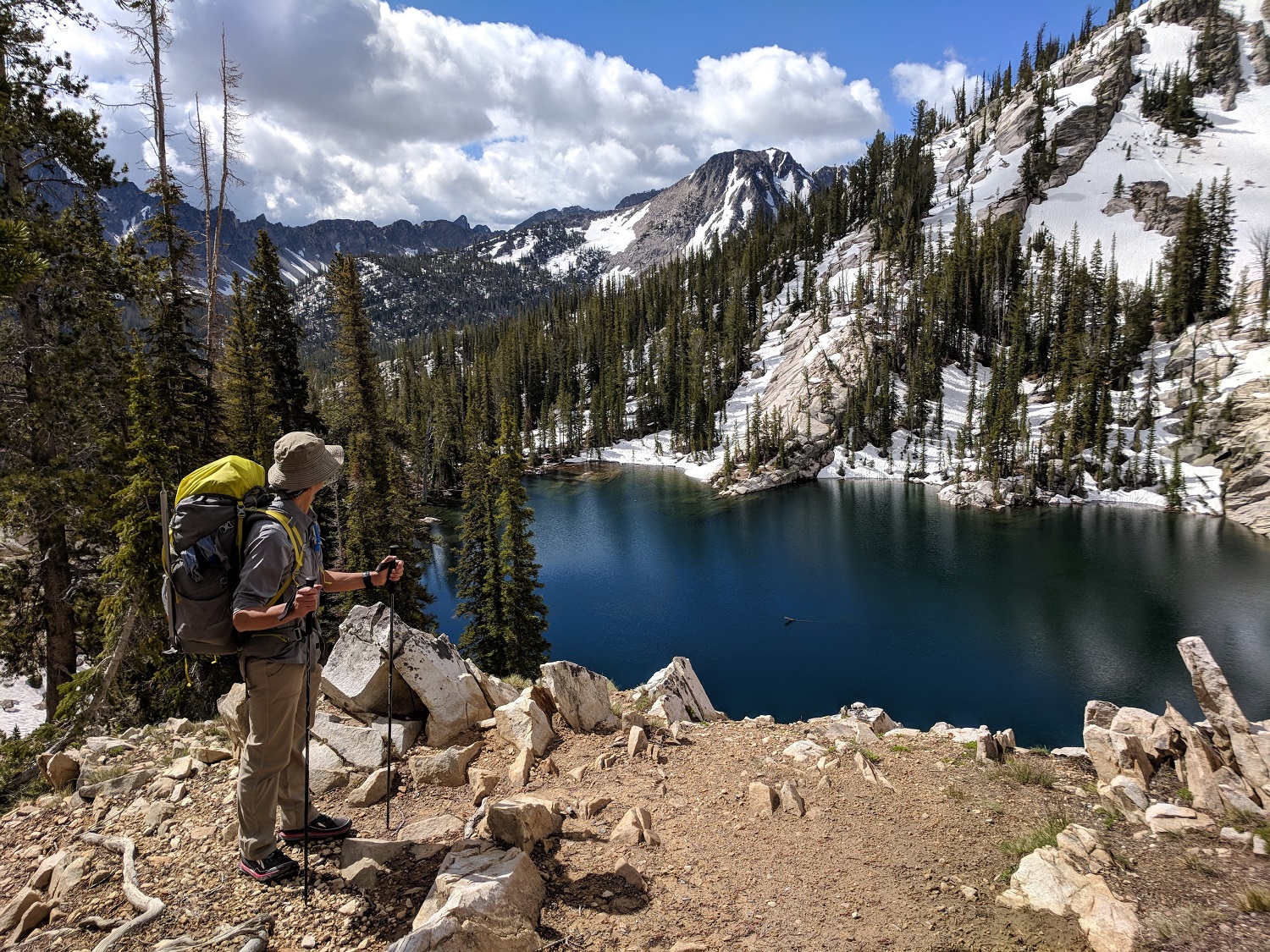
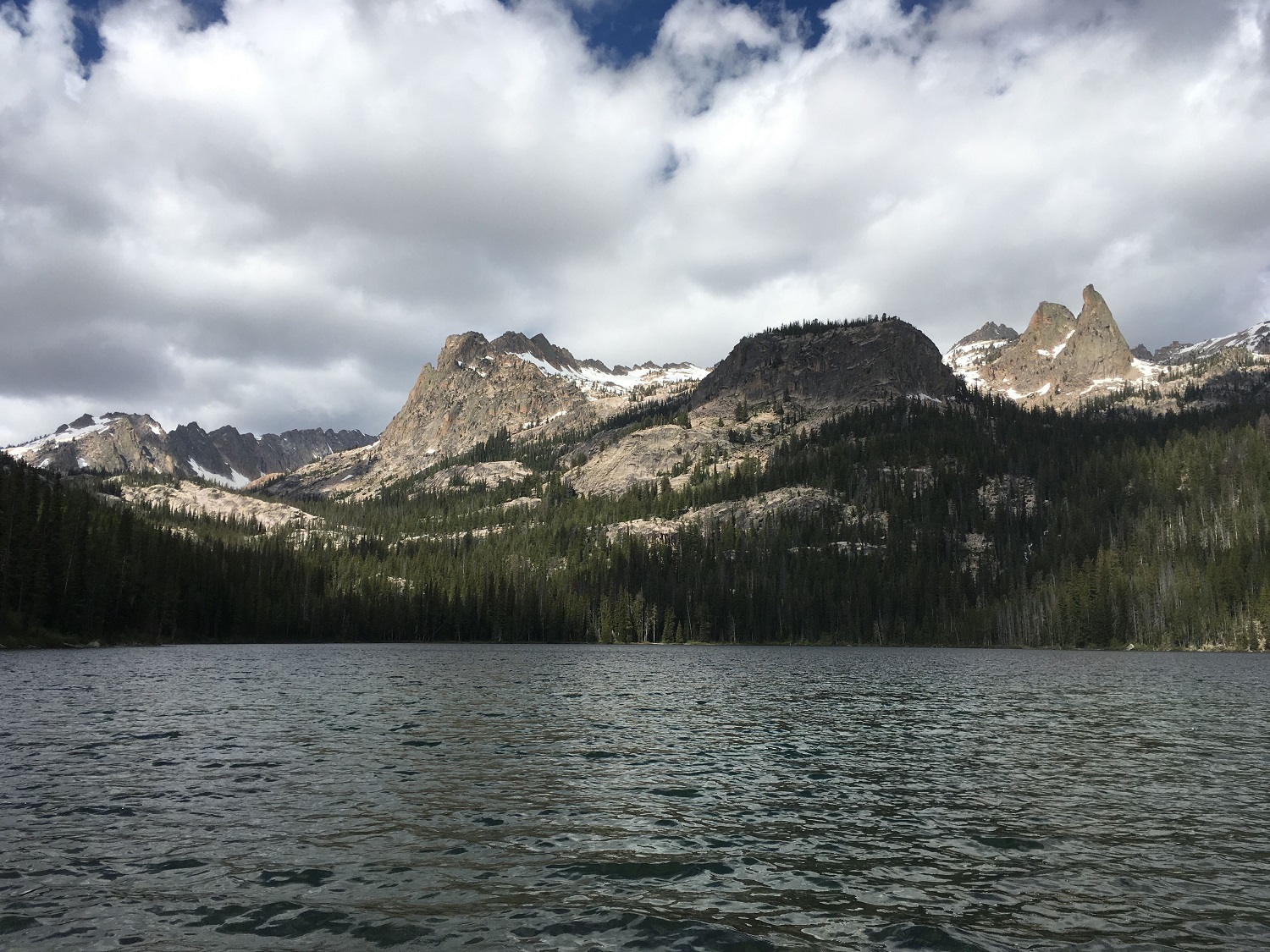
Pettit Lake reflections as we approach the wilderness boundary
Michael and Lola (their Portugese Water Dog) were kind enough to drive all the way to the Hell Roaring TH so we could stash our car there, then they took us back down to the Tin Cup TH. With Lola in the lead checking all of the smells, Cheri, Michael and I chatted as we started out along the shore of scenic Pettit Lake. The water was mirror smooth, perfect for reflecting the peaks dressed with white snow caps and surrounded by grey skies. It was a pleasant walk through many wildflowers, and we hardly noticed the hum of heavy equipment from the private land on the opposite shore. At the far end of the lake we reached the wilderness boundary (NOT closed), where we parted ways. Lola initially thought she might join us, but once she realized we weren't carrying a treat bag she decided to head back with Michael for some bird watching and we headed on up the canyon.

Andrew climbing up out of the green valley
The trail was pretty soppy at first with early season mud, but as we got further from the lake there was more rock and organic material and the footing improved. Under a mixed conifer forest of Douglas firs and lodgepole pines we slowly climbed up the trail. With each step the chorus of bird song increased and it soon drowned out our quiet footfalls. The understory plants were a mix of rhododendron in bloom, Oregon grape, huckleberry (sadly not even flowering, let along bearing fruit) and other shrubs. It wasn't long before we could hear the rushing water of Pettit Creek and then the trail approached its banks. As we approached our first crossing point we could see that it was flowing both fast and high. We were happy to find a solid log across the creek not too far upstream, though it was fairly high above the water and with the recent rains it was quite slippery. There was a much smaller log just at the water level, but it looked less stable and more prone to getting feet wet. Cheri decided to straddle and "scooch" across the upper log, keeping her feet up out of the water as she went. Andrew elected to balance on the lower log, using the larger one as a handrail and safety net. Either way, we both got across without difficulty. After that the canyon opened up some more and we got our first views of the peaks deeper into the range. Soon we reached our second creek crossing and this had a solid log conveniently across the water right at the trail, so we walked right across. From there the trail climbed onto a slope of talus, aspens, and wildflowers via a series of short switchbacks with great views both ahead to McDonald Peak and El Capitan, and back towards the valley from whence we came.

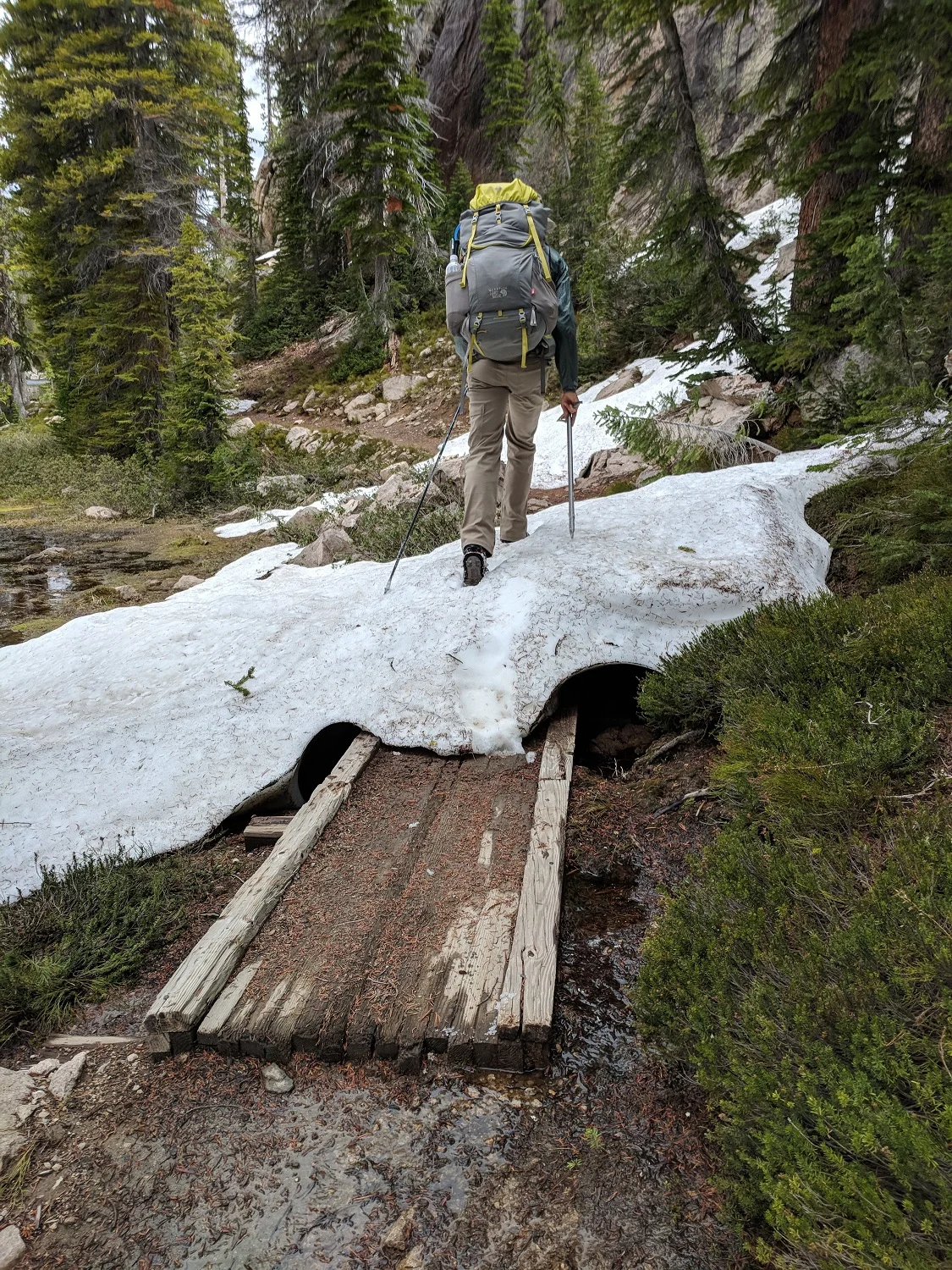
A leaning bridge is better than no bridge! And this one was surprisingly stable.
Soon we came across the rushing cascade escaping the hanging valley that holds Alice Lake. The actual trail crosses the river just above these falls, in a stand of willows... but the water was fast, cold, and deep. It looked to be a safe ford, but not pleasant on a stormy day. Looking at the map we discovered that there was another ford further upstream, and looking at the terrain we realized we could skip both by finding our way across the talus on the near shore. We chose this option, and were rewarded by a series of cairns that let us know we weren't the first to have this bright idea. A bit higher up, we truly did have to cross the outlet and were relieved to find a bridge over the raging snowmelt that dropped through a narrow cut in the rock. It was a bit dilapidated and the water was touching the underside, but it was stable and that was enough for us. The trail here provided some great views back towards the east, before heading back into the forest where we started to find our first large snowdrifts across the trail. The final crossing was just below Alice Lake, where we took off our shoes for a shin-deep ford of some very cold water at a wide spot in the creek. There was a small logjam further down, but it was wet and looked unstable so with loaded packs we gave it a pass. Around the corner we found Alice Lake and a gaggle of fathers and sons up for the day from Pettit, fishing and skipping stones. The two activities seem mutually exclusive, and we didn't see many fish, but they all seemed to be having fun.

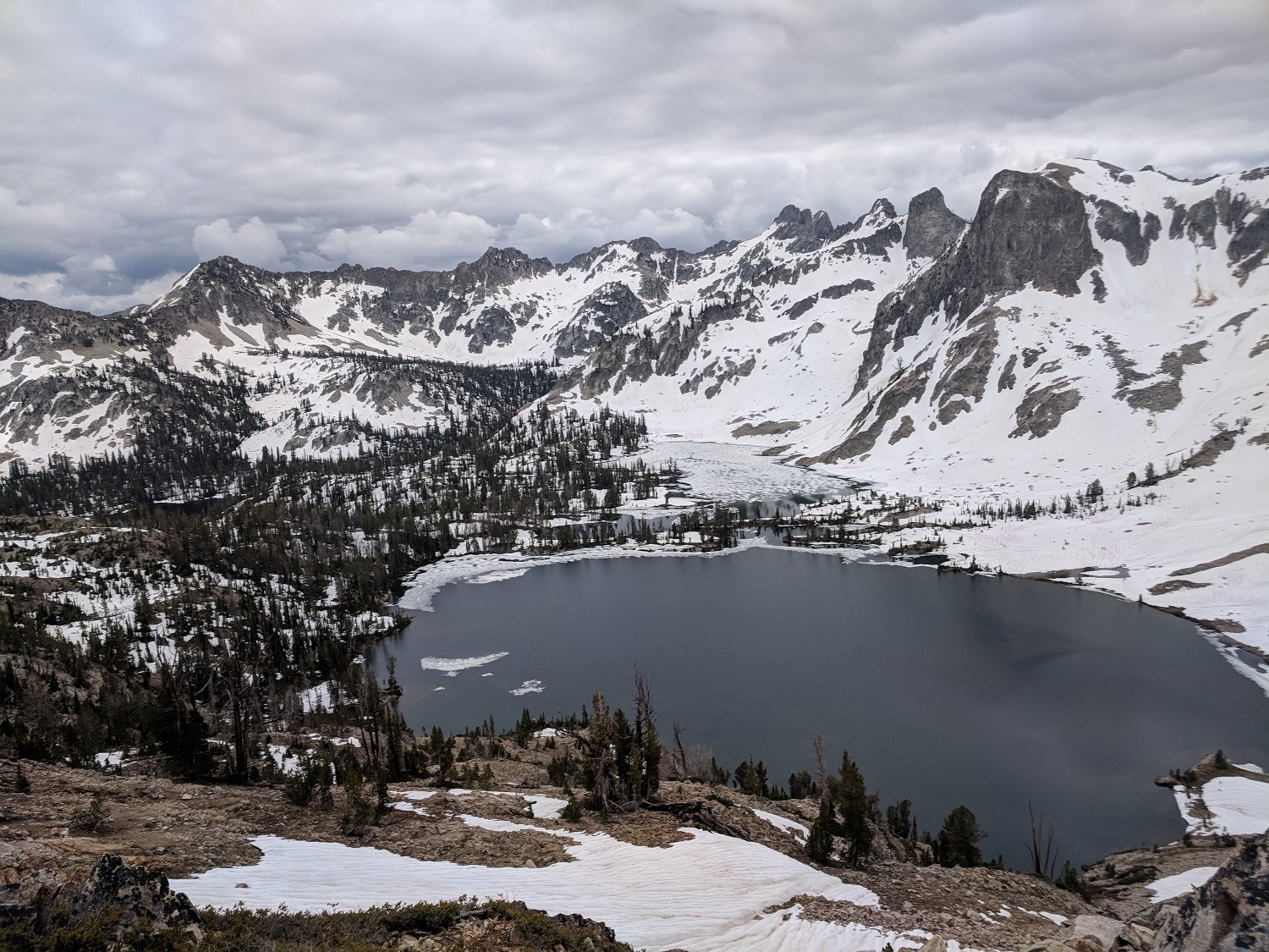
Alice Lake. Enough said.
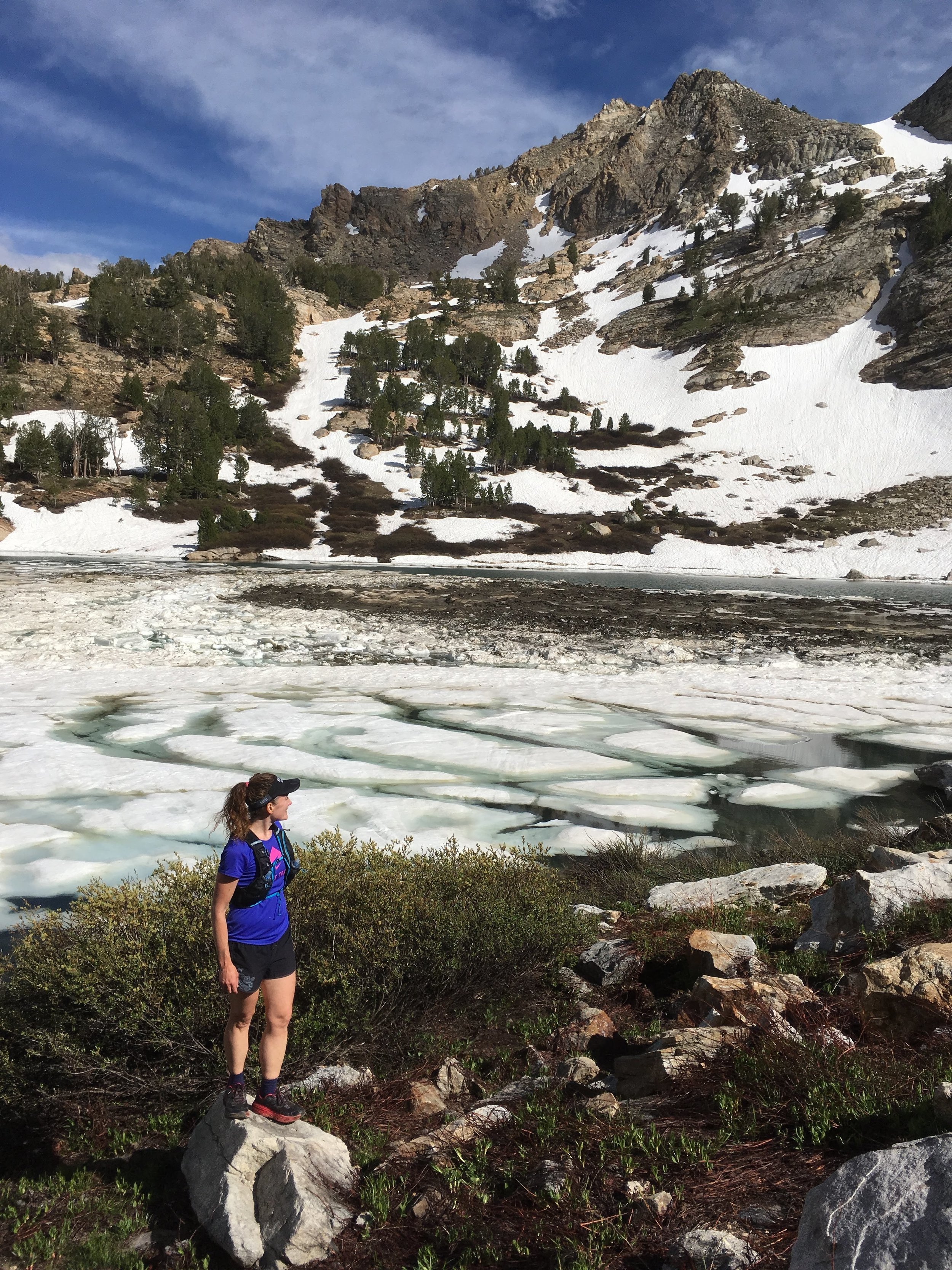
Alice Lake is quite a looker, surrounded by craggy peaks. Nobody was camped there though it was easy to see how it could be quite popular on a summer weekend. Although we walked through ~50% snow cover on the trail near its shores, the lake itself was ice free. We could have easily found a dry-ish patch to camp either near the outlet or at the far end of the lake, but it was early in the day and despite the ominous sky we wanted to get a bit deeper into the wilderness. We lost the trail in the snow above Alice Lake and knew from our guidebook that the trail had been recently re-routed so it was unclear if our 3-yr old map would correctly show the trail (NB it does not), but with a little trial and error we climbed a forested slope and re-joined the actual trail across some snowy talus. The guidebook describes Twin Lakes as a quieter alternative to often-crowded Alice Lake and notes that excellent campsites are on the narrow isthmus between the two lakes. Twin Lakes were a knockout in the scenery department, but offered nothing in the way of campsites for us given that the lower lake was solid ice and the upper was surrounded by suncupped snow, slush, and mud.

Occasional hints that there is a trail nearby

Twin Lakes - upper with a few icebergs, & lower nearly covered in ice. No campsites in sight.
We had followed some fresh bootprints on & off since reaching snow, and just as we were deciding that we would cross the pass to camp somewhere on the other side, we ran into our first backpackers of the day. They were wandering in the forest above the lakes and asked which way we had come from. They seemed dejected to hear we were on the same route and let us know that they had lost the trail when it disappeared in the snow going the wrong way. They had been going back and forth repeatedly, looking for a way to connect to a highly visible stretch of trail cutting across the rock on the far side of the upper lake. We shared our info about the mismatch between printed map and actual trail, and told them this was our first time here. We suggested that sometimes just a different set of eyes is all that is needed to sort out a navigation problem, and followed their tracks across snowdrifts to the last snippet of exposed trail. Sure enough, the trail seemed to disappear heading to the right, but the pass was definitely to the left. The long stretch of visible trail pointed out by our compadres seemed far too low on the slope above the upper lake to connect to our current route, but it did match what was on our map (NB the current trail no longer uses that stretch). We ignored the printed map and scanned our surroundings for clues. Looking at the slope across a small drainage from our position, we could see a faint line in the snow and a bit of what looked to be some human-made rock work. Telltale signs of a possible trail - maybe switchbacks heading up the talus? We headed directly there and it wasn't long before we located the (re-routed) trail. From that point to the pass it was not challenging to find the trail, though the snowfields became progressively larger and steeper as we climbed and as the exposure increased for each crossing we were very glad to have our ice axes. At one point we looked back to see the other pair standing on a snowy rise by the lake's shore. They pointed at us, so they must have realized that we had located the route, but as we got to talking we realized that they weren't carrying either ice axes or poles, and probably were not comfortable going any further in the current conditions. We didn't see them again, and assume they must have gone back to Alice Lake for the night.

Cornice! The first thing standing between us and Toxaway Lake

Cheri picks her way down the snowy slopes of Snowyside Peak
Andrew looking for a place to cross the outlet of "Snowyside Lakes" - the weather made a 180 in the past half-hour.
After one last high-angle snow traverse we crossed a flattish section then came around the final corner to see the pass just ahead of us. It would have been smooth sailing except for the 6-7' high cornice that filled the entire notch of the pass and stretched from the trail all the way up the slopes of aptly named Snowyside Peak. Fortunately for us, there was a mound of granite just to the right of the pass that was snow free and we scrambled up to get a better view. We were able to downclimb the opposite side without difficulty and accessed a short stretch of open trail before reaching the huge snowfield that blanketed the entire cirque on the north side of the pass, obscuring all of the ground between us and a couple of unnamed lakes surrounded in trees down below. The snow was soft and it was easy to pick a line down towards the first lake, hoping that we might find patches of dry trail along the eastern shore. We were glad to be over the pass before it rained, since we assumed that it probably would. But as we progressed, the dark and moody grey skies lightened up and before long there were big blue holes letting bright sunlight through. By the time we reached the first trees, there was no more than a scattering of innocent-looking white clouds and we both took off a layer for the first time all day. Our feet were soaked from the snow but in the afternoon sun we didn't mind. Just above the lakeshore, we "reconnected" with the trail, if standing in a snowfield right over where the map indicates trail counts for anything. We thought to look for a place to spend the night along these unnamed lakes as we worried that Toxaway might be crowded, but the combination of slope, downed trees, snow, and mud did not lend to excellent campsites. We continuing our descent along the chain of lakes, rewarded with patches of open trail here and there to confirm we were on the right track. We lost the path where our map suggested that the trail crossed the lakes outlet and decided to descend the last bit of slope without crossing. We made our way between big patches of snow across wide granite aprons, stepping between many rivulets as tons of water cascaded down towards Toxaway Lake. Just as we started to wonder if we might have to tromp through the marshy swamp down at the edge of the lake we found a decent place to cross the main inlet with just a wide rock-hop and some willow-whacking.

Our campsite at Toxaway Lake
Distance 9.1 miles | Total Climb 3140' | Total Descent 1798'

Mexican Quinoa Bowl tacos. With avocado!
We were back into dense forest with deep snowdrifts, and in the shade of the late afternoon we started to realize that sopping wet feet are kind of cold. When the trail broke out of the trees onto a dry rocky knoll a ways above the western shore of enormous Toxaway Lake, we sat for a snack and to take off our shoes and socks. Sitting there we looked around and realized that there must be some decently camp-able ground between the trail and the lake, and took a little scouting mission to check it out. Fate works in strange ways and there are times when once we decide to camp it takes forever to find a spot. Other times we stumble upon our site within a minute or two of deciding that we had hiked a respectable distance for the day. This was one of the latter kind of times, because we immediately found our spot - not visible from the trail but flat, dry, and nestled on a shelf well above the lake. We had water access, privacy, and good views up to Snowyside Peak behind us and golden-brown Sand Mountain across the lake. We pitched our tent, took off our wet shoes a second time in 15 minutes, and set about our camp chores. For dinner we had Good To-Go's Mexican Quinoa Bowl made into tacos, with a fresh avocado courtesy of Hillair. By camp standards, 5 stars for sure.
Day 2: Toxaway Lake to Imogene Lake via Edith Lake

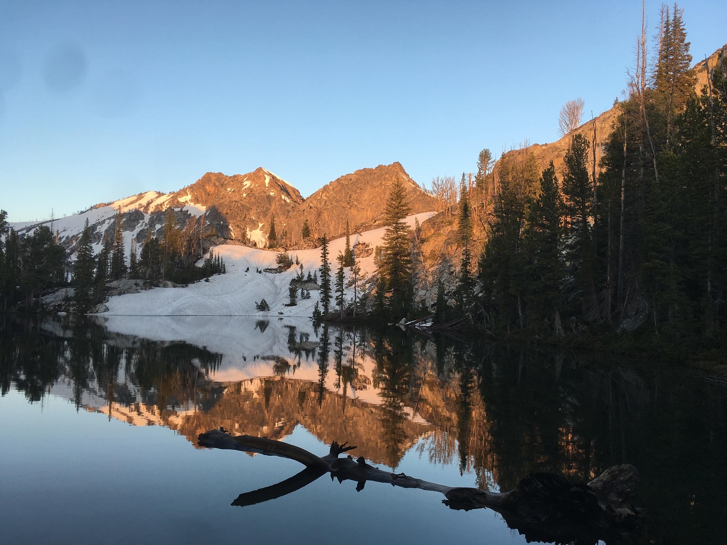
Toxaway Lake sunrise from our campsite

The opposite end of Toxaway Lake makes a great mirror
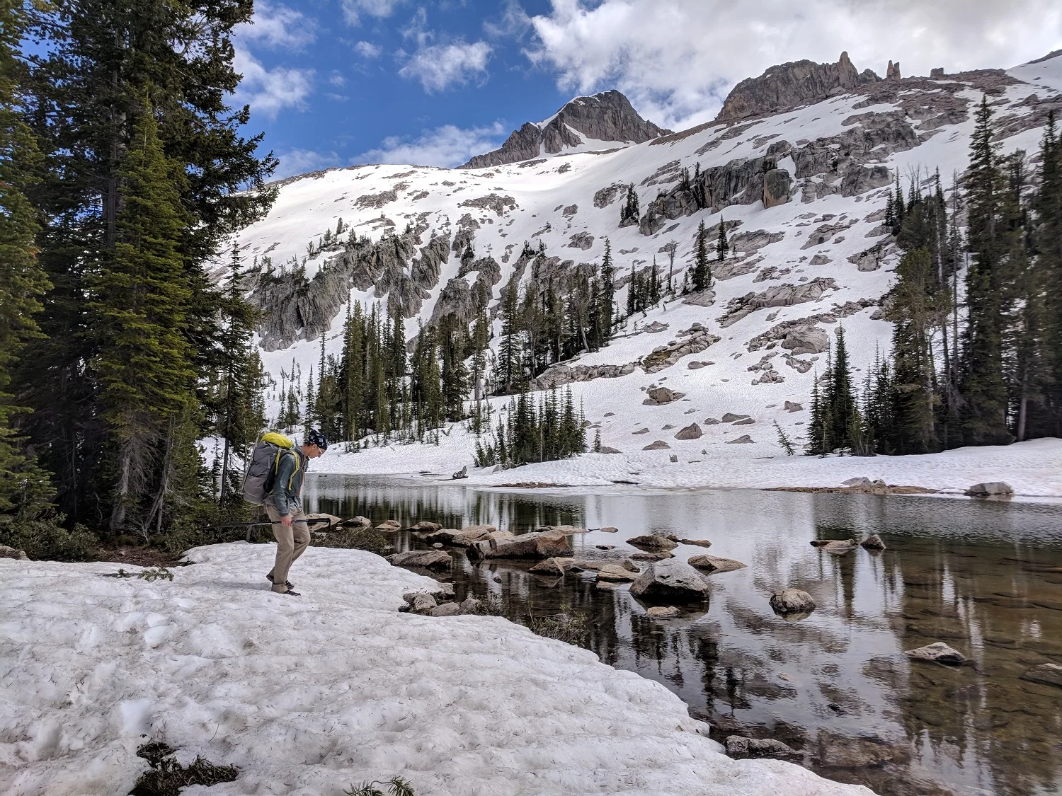
The next morning broke with blue bird skies and barely a hint of wind in the air. After a leisurely brekkie, we broke camp and headed out on the trail above Toxaway Lake. We met a group of 4 backpackers just as we started on the trail - they had come in from the opposite direction on the classic Pettit-Alice-Toxaway loop and camped not far beyond us near the shore of Toxaway. They'd be both the first and last people we saw all day. We were back in the snow before long, and occasionally followed their footprints. We had fleeting but stellar views of the surrounding Sawtooths reflected in the giant mirror of mile-long Toxaway Lake through breaks in the forest. By about midway along the lake, the snow petered out and we were back on mostly-dry ground. At the far end of the lake, the trail crossed the outlet creek on a much-appreciated bridge then roughly followed its course as it crashed down rocky rapids, flowed in wide sheets across granite aprons, and lazily flowed through grassy meadows making its way down the valley. We passed the junction for Edna Lake and Sand Mountain Pass, and briefly discussed whether we might take this route. Although it looked straightforward and snow-free from this side, we knew from guidebooks that this pass holds snow later than most in the area, and is considered a bit tricky even well into July most years. We ultimately decided to stick with our original plan and continued on to the Edith Lake junction. It was a warm day and as we started to climb switchbacks through completely dry forest it was hard to believe that just an hour back we had been hiking entirely over snow.

Our first view of Edith Lake

Snowmelt pool above Edith Lake, near junction to Sand Mountain Pass
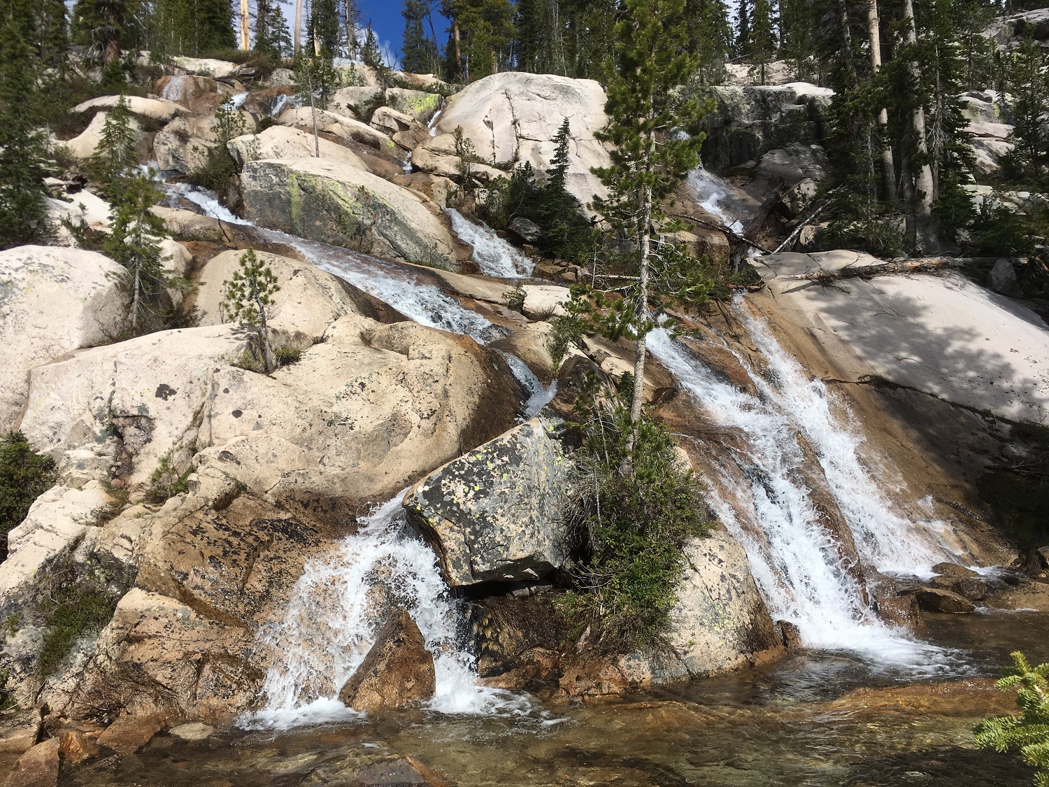
Behind us we had a broad vista stretching down to Farley and Yellow Belly Lakes then across the wide green valley beyond and over to the distant White Cloud Mountains. We made quick time on dry trail, and the switchbacks ate the canyon wall climb right up. We crossed the outlet creek of Edith Lake a few times (often not quite at the trail, though it was always easy to find a decent spot) before coming to a wide braided cascade spilling down a quintessential apron of pink Sawtooth granite and obscuring the trail before crashing over a ledge into a full-fledged waterfall. Fortunately, there were enough dry boulders to allow an easy & safe rock-hop rather than a ford of the pool at the base of the cascade. Not long after that, we were back above snowline and made our final approach to Edith Lake. We knew we must be close when the terrain leveled out and we started passing brown carsonite "No Camping" flexiposts placed by the USFS, sticking out of the snow in every clearing that was even remotely flat. Lucky for us, we didn't plan to stay long. We gained our first views of Edith, a sleeper hit. At first glance it looks like many a small oval high-country lake. But this one is surrounded by steep pink granite aprons, suncupped snowdrifts extending into the water, and wide blocky talus with a dramatic orange-tan peak presiding high above. From near the edge of the lake a lone common merganser let us know quite loudly that we were disturbing her domain in the wilderness and should move along. We used a down log in a snow-free patch by the shore for a snack break, but assured her we didn't plan to swim. Nevertheless she took wing and flew to the far end of the lake. Returning to the trail, we found that it climbed around much of the lake providing panoramic views from many different angles and as we wound upwards the water color changed from deep green to various shades of blue and finally settled on an inky blue-black hue. We stopped for one last look and saw our friend the affronted merganser, who had quietly swum back to the "near" end of the lake to resume her bird-y business.

Andrew on the final switchbacks to the pass between Edith & Imogene Lakes

Whitebark pines
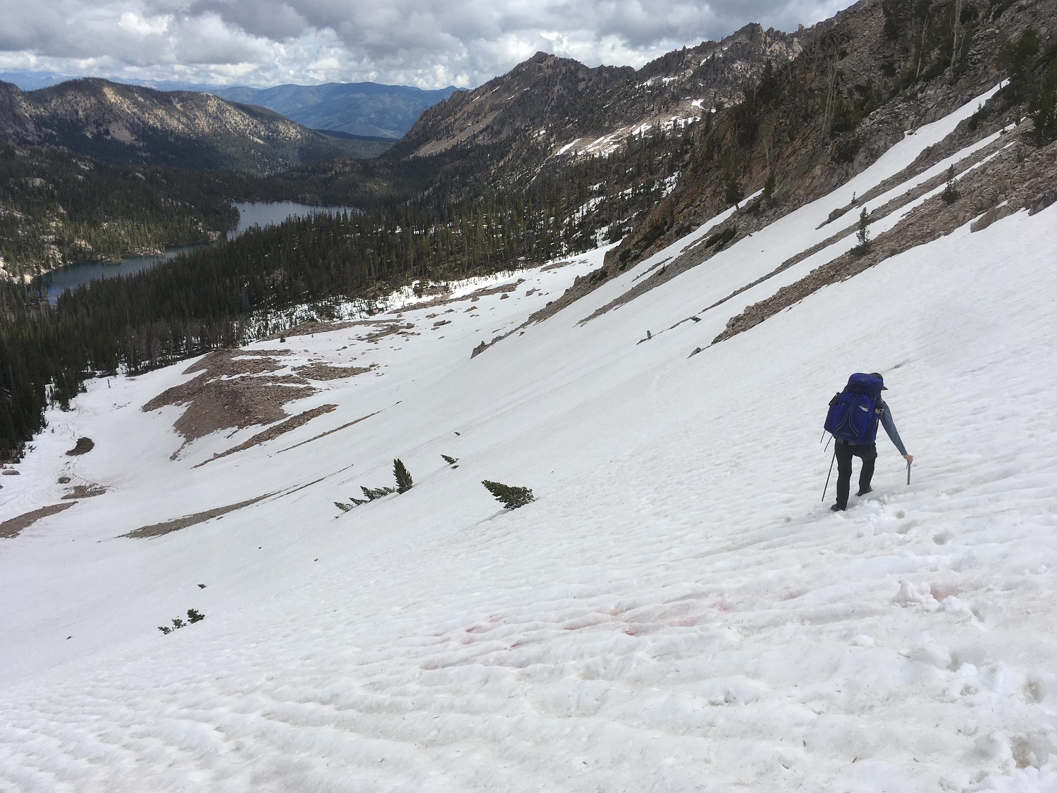
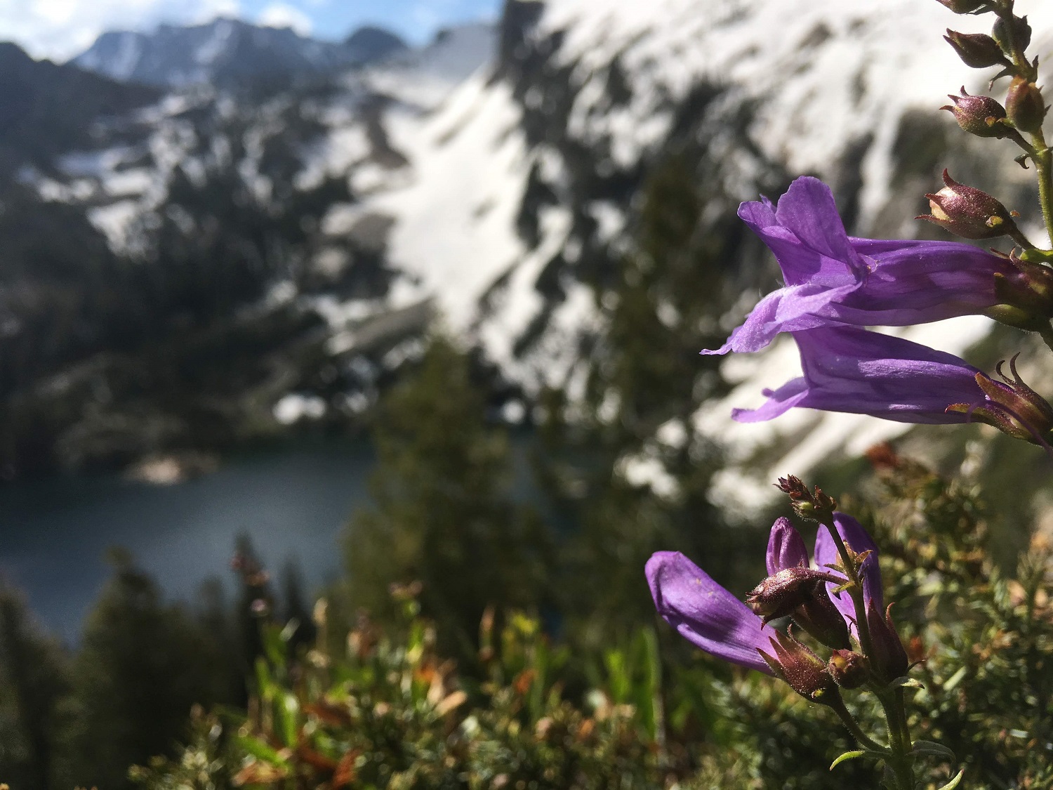
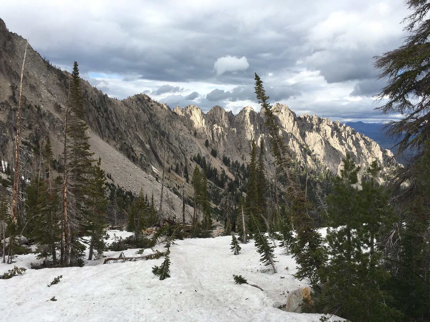
Above Edith Lake we were back into snow and more or less followed a wide creek of snowmelt across a talus field to a higher basin where the trail towards Sand Mountain Pass (presumably) headed up a steep and snowy headwall towards a long corniced ridge. We didn't see any evidence that anyone had taken that route recently, and were glad that our route headed off to the right. "Our" slope had large patches of snow, but we could easily see the rocky trail as it made tight switchbacks up the slope between windswept whitebark pines towards the pass. On initial glance it looked fairly stark but on closer inspection the landscape here was a riot of colors. The granite was a combination of pink, green and khaki tan, interspersed with bright snow. The whitebarks added a mix of browns and deep green along with the grey-brown to golden highlights of the snags, and the deep blue sky was spotted with both grey and white clouds. The ridge to our left was a deep red-orange, and on top of this diverse palette there were blooming wildflowers sprinkled along the way. Despite the strong wind and steep slopes, the walking was relatively easy (comparatively), and we made good time to the pass.

Andrew making his way down a steeper, longer snowfield
Andrew crossing a snow bridge over a wooden bridge over the soppy ground at the edges of Imogene Lake's marshy inlet
When we found the notch free of snow it felt luxurious to simply walk across, though we found the far (north-ish) side to be another huge snowfield. This time it was a bit steeper, and there were several islands of talus along the way. There were a few old/weathered tracks in the snow, so we knew we weren't the first on this route. We pulled out our ice aces and picked a wide and sweeping descending traverse, making our way from one island of land to another. Imogene Lake seemed impossibly far below, but step by step we made progress. The snow was soft and wet and with the brisk wind it got chilly fast. About 2/3 of the way down to the lake we stopped to regroup and have a snack at a short section of exposed trail on a talus island. We could hear the lake's inlet rushing beneath the snow, and according to our map the trail crossed this inlet several times as it descended. Cautious of falling through a snow bridge, we decided to make our own way to the lake to minimize crossings. The footprints from above swung much wider so the only tracks we had to follow were from an elk or a deer. Eventually we settled on the right-hand side of the drainage, and even found the actual trail as it made its final switchbacks down to the shoreline. We were elated not to have to cross the inlet, which at this point was a swampy marsh at least 40' across. The "new" trail around Imogene Lake follows the eastern shore, and was 70-80% covered in deep snow. It was easy to find the trail, and there were fairly recent boot tracks along the entire lake, but the snow was soft enough that it was sloppy, wet, and somewhat slow going.

Imogene Lake, ever changing Idaho sky
We left the wind behind once we dropped to the level of the lake, but unfortunately we also came into prime conditions for mosquitos, and met huge swarms of these pests as we made our way towards the opposite shore. Imogene Lake is picture perfect with several rocky islands and surrounded by scenic peaks, so it is a shame we had to keep moving or be eaten alive. About halfway around the lake Cheri gave in and pulled out her headnet for the final stretch. At the northern end of the lake, we left the main "new" trail and followed the "old" trail around a rocky knoll, where we found several nice and snow-free campsites. We opted for one fairly high above the lake with good views of the surrounding peaks, and pitched the tent right away to have a mosquito-free zone. It had been a short hike from Toxaway Lake, so after setting up camp we headed out to explore our new neighborhood for the rest of the afternoon. We followed the old trail all the way along the western shore of Imogene and found it to be completely snow-free! There were plenty of downed trees, and other evidence that it was not an official maintained trail, but it was much easier walking than the east side had been and afforded us some different views across the lake. At one point we looked up to the snowy headwall of the valley and with the light just right could see our tracks across the snow from the morning's descent. From this vantage point it looked fairly impressive!

Just an icy unnamed lake near 8700' in the Sawtooth Wilderness. NBD.
Near the main inlet stream, we came across a sweet green cascade that was the outlet from a chain of unnamed lakes. We scrambled up the slope following the course of the water, picking our way up a series of small shelves to see each of 3 sweet little lakes nestled against the sheer granite walls and steep talus slopes of the ridge connecting to Payette Peak. Each was just a bit prettier than the last, but any one of them would have made a pleasant spot to while away an afternoon in the mountains. The largest lake, and the last we visited, was still covered with a sheen of ice and we sat on a sunny boulder along the lakeshore to soak it all in before heading back the way we came. A huge logjam at the outlet of Imogene Lake made for an easy crossing of the snowmelt-swollen river, and we arrived at our campsite with ample time to start dinner. Tonight was "homemade": broccoli & sundried tomato pasta with ground TVP and plenty of Asiago Cheese. The mosquitos came out in force as we ate, and we retired to the tent even before it got dark. The sky was clear, and we left the fly rolled up so we could stargaze through the mesh as we drifted off to sleep.

After-dinner vibes at Imogene Lake
Distance 9.2 miles | Total Climb 2376' | Total Descent 2289'
Day 3: Hell Roaring Drainage, and Sawtooth Lake

Our campsite at Imogene Lake, under the stars and moon.
Andrew got up well after dark to take some moonlit photos and saw a brief but bright flash of light as he got out of the tent. Not long after, another one seemed to come from behind the ridge to our east. He couldn't figure out the source, since the moon was still visible and there were only a handful of thin high clouds in the sky. A nearby airport? A night hiker practicing flash photography? By then, Cheri had gotten up too and saw the next one. They were fleeting and just infrequent enough that it was hard to place the source. She suggested UFO, government conspiracy.... more outlandish ideas. As if to mock us, there was another flash as we climbed back in the tent. Then, after what seemed like ages, we heard a low rumble. Eureka! Before drifting off to sleep we counted 75 seconds between the next flash _of lightening_ and the distant thunder. The storm was at least 15 miles away, so we were fine. Half awake some time later, Andrew noticed that the moon was missing, and so were the stars, and right about then there was a much louder thunderclap. He hopped out of the tent, secured our rainfly, and made it back into his sleeping bag just in time for the deluge to begin. Right about then, Cheri woke up and groggily asked if we should put on the fly. Um, yes... but it's already done. Back to sleep to the sound of rain battering the tent. A few hours later, Andrew awoke again to find the stars back out and the moon truly set. He snapped a few "night" photos only to realize it was already getting a bit lighter and some birds were already singing at 4AM. Oh, summer!

Morning golden hour, crisp and clear, at Imogene Lake.

Early season high water coming out of Imogene Lake
Although the morning started out once again with bluebird skies, clouds started to appear while we enjoyed a peaceful brekkie overlooking the lake. With our slacker schedule we had nowhere to be, and we took the opportunity to watch the clouds build over our morning cuppa (coffee for Cheri and tea for Andrew). Alas, we couldn't stay forever, and we did want to explore some other parts of the Sawtooths. We broke camp and headed down the trail. For the second time on this trip, we were especially thankful for a bridge over a creek. Imogene Lake's swollen outflow raged down a rocky hill, nearly running over the low footbridge that we might not have even noticed in late August. The clouds continued to build and soon our warm summery sunlight was a thing of the past. It wasn't long before cooler air and a few scattered rain drops let us know that the weather was once again changing. We didn't get much rain but the sky turned positively dark and then the thunder started in earnest. Expecting another downpour, we talked about stopping to put on rainjackets but before we made a decision the clouds let loose and we were instead treated to a hailstorm, with garbanzo-bean sized balls of ice pelting us and bouncing off the trail. We were thankful for some tree cover, though is was far preferable to pouring rain and it stopped soon enough. In true Idaho style, within another 15 minutes the clouds were clearing and the sun once again presided over the sky.

Hail flocked fir tree
On the final switchbacks down to Hell Roaring Lake, we started to see the first of many (by ID standards) hikers and backpackers. First there was a pair of young guys heading out for a fastpack to Tin Cup TH (carrying almost nothing, they were gonna get wet!), then a family with three 6-10yr old boys and an infant (!), heading up to Imogene for the night. Mom had an 80L pack stuffed to the gills and looked prepared for anything. Finally there was an older guy and what looked to be his dad, camped at Hell Roaring but headed to Imogene to fish. Maybe that was only 10 people, but to us it seemed like a crowd. Nevertheless, we had a long snack break on the shore of Hell Roaring Lake and not a soul passed. We watched the changing light play across the peaks on the far shore, including a prominent granite spire jutting up towards the sky. We consulted our map and learned its ominous name, The Finger of Fate. Well, regardless of any input that it might have on our fates, it was pretty darn cool looking. We crossed many inlets and seeps along the lakeshore, perfect for wildflower spotting. The main outlet had a log "bridge" and that was our last glimpse of lakes and peaks for this stretch of the trip.

Thin, dry forest in Hell Roaring drainage
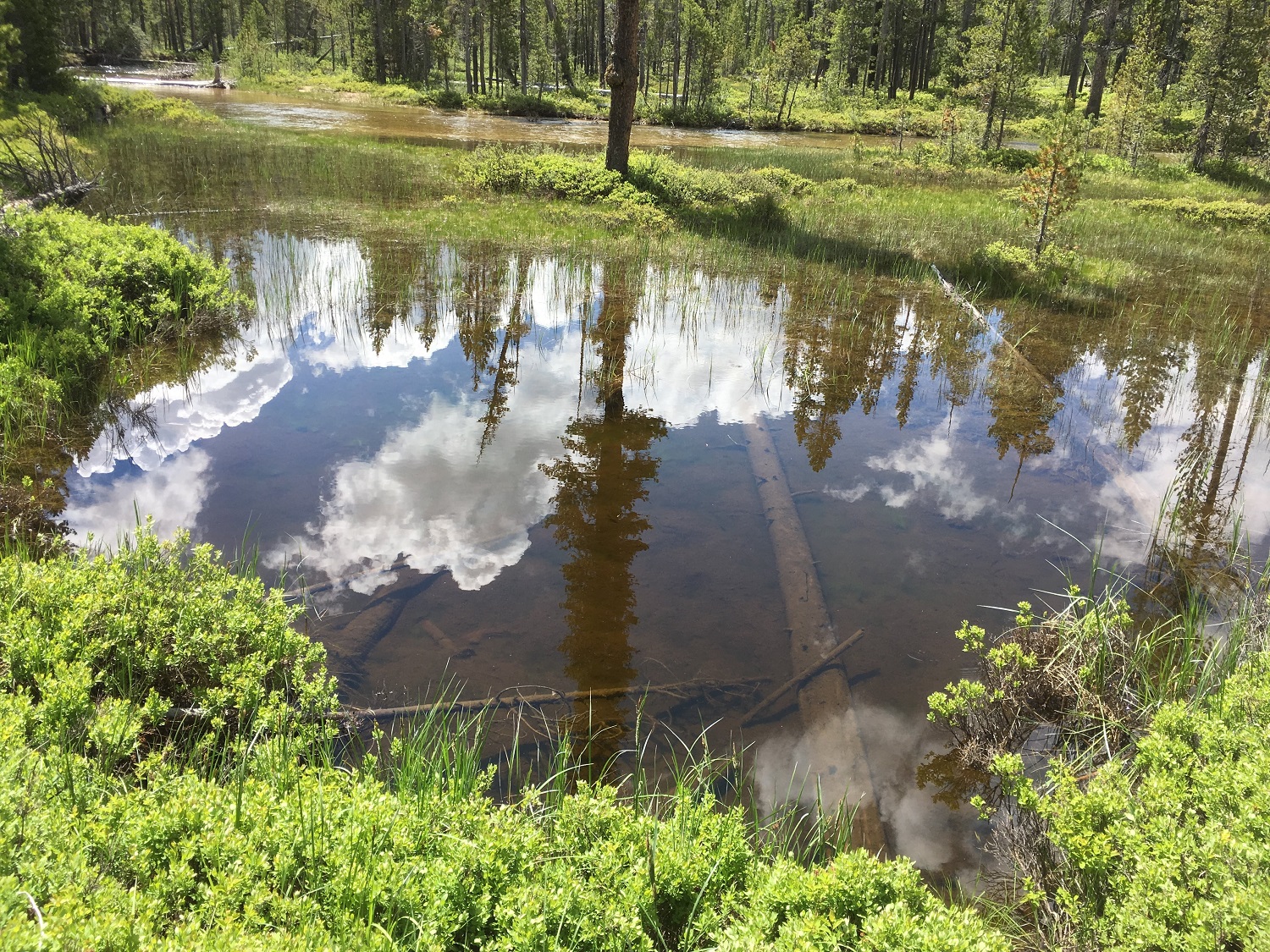
We found ourselves headed down a broad canyon of thin, dry new growth forest and for the first time in three days could not hear the sound of rushing water. We commented on the apparent misnomer of Hell Roaring, since the lake had been rather idyllic and now the water was nowhere to be seen. The question went unanswered. Rachael from Sawtooth Mountain Guides had warned us that the last 4 miles of this route would consist of "boring forest walking" since our passenger car wouldn't likely make it to the "upper" trailhead on a rough 4WD road and allow us a quicker exit. While it wasn't the high county, it was still pretty. The forest didn't provide that much shade so there were plenty of wildflowers to keep our attention, mostly of the yellow variety. We finally caught a glimpse of the creek again and found it had turned into a broad, lazy river snaking back and forth across a grassy meadow. No Hell Roaring here. The trail again diverged from the creek and we moved into more mature forest. For the 3rd time in just as many days, our map diverged from the actual situation as we came right back to the banks of the creek, which had suddenly started to live up to its name. For the last 1-1.5 miles to the trailhead, we more or less paralleled this crashing, churning, roiling body of water as Hell Roaring Creek cut steeply down the hillside over rocks and downed trees, creating tons of small islands and side pools as it tried to find a way to get all of the snowmelt down to the valley below. Nature is powerful.

Hell Roaring Creek, finally starting to roar
Upon reaching the trailhead, we discovered that our lonely Prius had been joined by a half-dozen cars since we left it there two days back. We loaded up our packs and headed north towards our next trailhead. Since we still another day of food and time, we intended to check out another corner of the Sawtooths. We passed through Stanley and were surprised to find that in just a few days it had transformed from a sleepy crossroads to a busy recreation hub with trucks and SUVs parked everywhere, and people swarming the sides of the road. Sunny weather? Thursday vs Monday? Or just that much closer to the opening of the "summer" season? In any case, we passed right through and continued on towards our next destination, Iron Creek TH.

Forested slopes above Iron Creek blanketed with the ubiquitous arrowleaf balsamroot

Cheri has a quick nap near the Alpine Lake trail

Trail above Alpine Lake as the sky became more ominous and it started to rain
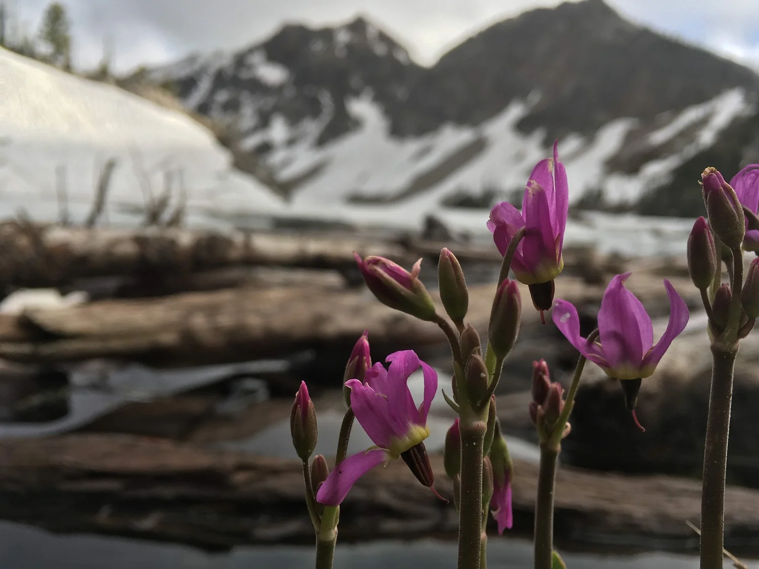
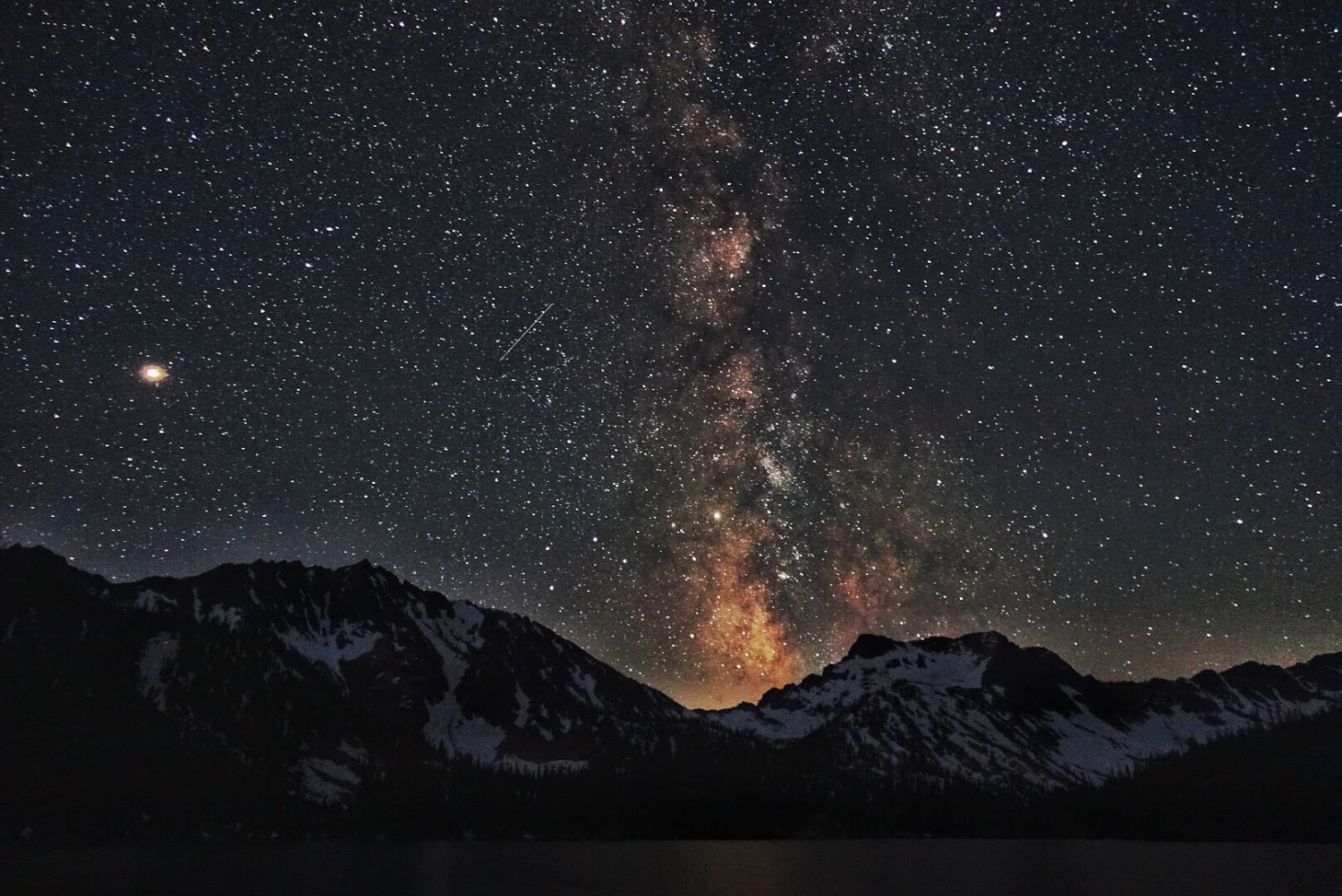
Shooting stars along the shore of Sawtooth Lake
While we drove the short distance to Iron Creek, we discussed our options. There are three main front-country lakes accessible from this trailhead. Sawtooth Lake is by far the largest and seems to be the "main attraction," and from Instagram posts we knew that it was at least accessible this early. Alpine Lake is slightly off-trail just before Sawtooth, and much smaller. Goat Lake is in the opposite direction, accessible by an "off trail" route described as "challenging" by the pamphlets distributed at the Chamber of Commerce in town. We weren't concerned about our ability to find/access Goat Lake, but had not heard or seen anything about conditions there in mid-June and based on its elevation and aspect, we guessed there was a good chance it might be pretty snowy. We were hoping for another night of solitude or nearly so, and were a little hesitant to head straight to the wilderness's eponymous lake with this in mind. But it was already mid-afternoon and the sky was looking a bit more stormy. We didn't want to find ourselves backtracking down a snowy gully in the rain to find a place to camp so we decided to head towards Sawtooth/Alpine and see how the day shook out. We reached the Iron Creek TH at the end of a long dirt road and were taken aback to see 20-30 cars parked there. Yikes! Apparently we had stumbled on the Yosemite Valley of the Sawtooths. It was too late to change course, so we threw on our packs and started up the trail, hoping that at least some of the cars were from day hikers who would be heading out for the night.
We passed a few hikers headed out then came across two large groups of trail crew volunteers from the Sawtooth Society orienting for a weekend trip. The crew leader let us know they were camping lower down than the lakes, and had a total of 24 volunteers! We were impressed with the size of the effort, and figured they must account for the few white vans at the trailhead along with at least some of the cars. By the time we passed them, the sun was gone and there was a volley of big wet raindrops that lasted just long enough to convince us to stop and put on rain jackets. As luck would have it, within a few minutes the rain had stopped and in less than half a mile we had to stop and change again, as the sun was back out and we were too hot. Even before we reached the last trail junction towards Alpine and Sawtooth Lakes, it became quite clear that the vast majority of cars we had seen parked were from day hikers as we passed a flood of people in groups of 2 and 3, trying to beat the storm out of the mountains.
Optimistic that we may have another night by ourselves (or nearly so) at a lake in the Sawtooths, we continued to climb and enjoyed the increasingly open views. In the lower forested section of trail there were old-growth Douglas firs and the sloping ground was blanketed with yellow arrowleaf balsamroot. Ahead and above us were jagged snow-capped granite peaks like we had seen over the past few days, and up to our right were treeless and crumbly pale granite crags that sent rivers of pale decomposed granite "gravel" across the trail, reminiscent of the pale pumice flows we crossed near Oregon's Mt. Thielsen on the PCT, or the sandy red formations of the Mokulumne Wilderness in our home state of CA. We stopped for a final snack at the junction with the Alpine Lake trail, and were a little surprised to see that the lake was so close. By now the weather had changed to downright threatening and there was a cold, moist wind whenever we were not protected by trees. It was only another mile to Sawtooth Lake but it involved a few hundred feet of climbing into the next higher cirque, and we thought briefly about finding a spot at Alpine for the night. By this time we had passed so many hikers heading down we figured there couldn't possibly be anyone left to be camped up higher and decided to continue. It just seemed wrong to get this close and not see the wilderness area's namesake!
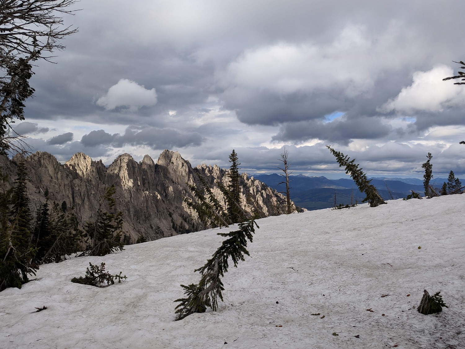
Those crags, though!
We did add an extra layer each and no sooner did we start hiking than it started up with a light but cold and steady rain. We figured we'd seen the last of the day hikers when two wet & bedraggled guys and their equally wet & bedraggled terrier came down the trail. We exchanged a brief hello for "the snow is perfect for hiking" as they passed. We turned to each other and said it looked like we'd be back in the snow after all. As they predicted, a few more switchbacks up and the trail dipped under several large snowfields. The snow was soft, there were plenty of footprints, and for the most part it was low-angle and low-exposure, so we stuck with our poles and left our ice axes stashed. Over a final rise and we came to a small unnamed lake Soon enough we were back in the snow and came to a small lake. We checked the map to confirm that it was not Sawtooth Lake, and commented on a clearing near the shore that was snow-free and looked to be a very inviting campsite surrounded by whitebark and lodgepole pines. By now the rain was steady but not hard, and there were footprints every which way in the snow. The wind was picking up and there was lots of water flowing along the edges of and under the snow between the lakes. We decided to scope out real Sawtooth Lake before making a camp decision, so we pushed on another few hundred feet to the bigger, more famous lake. We were rewarded by howling winds, huge wet snowdrifts, low clouds, and a lake filled with icebergs, so no swimming tonight. That settled it - we high-tailed it back across the snow down to our sweet little campsite at the smaller lake below.

Danger: Never cook dinner in your tent. Unless it's storming.
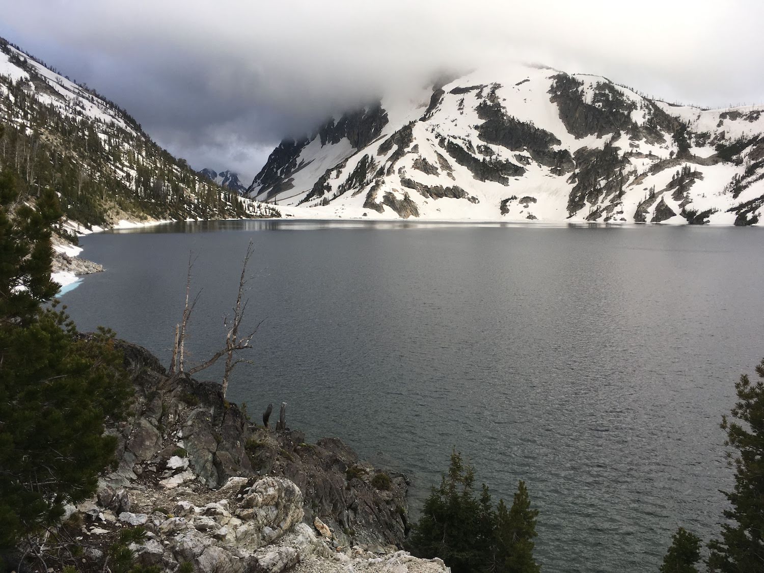
The far end of Sawtooth Lake, stormy but without icebergs

Cheri practices her penguin moves to stay warm in the cold evening wind
We made quick work of setting up camp in strong wind and steady rain, and cocooned ourselves in the relative oasis of our tent. We expected that the storm would blow over quickly based on our experience of the past few days, but we were chilled and damp and fired up the stove in a vestibule to make hot water for tea while we waited. We broke out the cards and dice for several rounds of cribbage and Yahtzee, accompanied by the sounds of a raging mountain storm. We were a little hesitant to get out of our tent, for fear that the wind would rip out the stakes and blow it away, so we just watched the rain pound on the fly and enjoyed our dry spot. We eventually cooked dinner in the vestibule, another Good-to-Go number (Bibimbap) augmented by peanuts and rice vermicelli with an extra packet of sriracha - another win. After was seemed like an eternity (but was only a few hours), the rain did let up and the wind died down to a cold, stiff breeze. An ultralight 2p tent doesn't have much room and we ventured out to stretch our legs. It stays light nearly forever this time of year this far north. We took advantage of the lingering daylight to make another trip up to Sawtooth Lake and explore a bit more. We were surprised to see another tent set up at the only bare patch of ground right at the lake's outlet, in what looked to be a marginal site at best. We couldn't talk over the noise of the creek and the wind, but waved hi to a soaked-looking guy eating a freeze-dried meal from a pouch while his equally-soaked German Shepherd looked on. We meandered around the near shore of the lake and had to admit that it was pretty spectacular even with the surrounding peaks hidden in cloud. Half of the lake was clear, and the other half was covered by floating ice. Beyond a large knoll we came across the only other campable spot, also wet and marginal but with pretty sweet views. There were 5-6 guys huddled under a tarp next to a clothesline of wet socks, drinking from a shared flask and trying to get a smoky wet fire going (NB: campfires are not actually allowed at Sawtooth, Alpine, or Goat Lakes). Suddenly our small but dry UL tent seemed like a castle. We enjoyed our late evening sightseeing but it was downright cold and before long we were snuggled up in our sleeping bags for the night.
Distance 13.7 miles (8.5 + 5.2) | Total Climb 2661' (491' + 2170') | Total Descent 2618' (2148' + 470')
Day 4: Down from Sawtooth Lake, via Alpine Lake
The next morning was calm and cold. We had an early brekkie and then Cheri suggested we go back up to Sawtooth to look around. I was reluctant at first, but after we got up there I was wondering why I doubted going up a second time. It was beautiful. Overnight many of ice chunks and frozen together and the rest of the lake was smooth as glass. The combination of the lake and environs was incredible and we could completely understand why it is such a popular lake. We climbed up on a small ridge above the lake and there was an abundance of wild flowers up there, many of which we had not seen at all on this trip. Alas we finally had to head back down and break camp.
Heading down trail we took a little detour down to Alpine Lake. It was splendid little stop for a snack and just enjoying a little more high mountain time before leaving the Sawtooths. Surrounded by the sound of the waterfalls across the lake and the birdsong above it was a very peaceful moment. We next headed down the way we had come the day before and enjoyed the rugged crags granite pillars above and the tide of pink decomposed granite that flowed at their base. We encountered more and more day hikers and the trail crew hard at work. They were a couple of teams one group was limbing and cutting the blow down we had scrambled over the day before and a second team was rebuilding water bars that had been flattened with trail use. Thanking them for their hard work we continued down and towards the wilderness boundary and the trail head.
Distance 4.4 miles | Total Climb 305' | Total Descent 2006'
Post-Trip
After the trail head, we headed back to Stanley and stopped in at the Stanley Baking Company for some elevenses. From there were stopped in at Redfish Lodge on a little nostalgia trip for friend and well we couldn't turn down soft serve ice cream once we were there. It was quite the culture clash from a just that morning just the two of us at an alpine lake and then immersed in a sea of humanity at the beach, on paddle boats, SUPs, and motorboats. It was all a little discombobulating after a few days of relative solitude. We realized which version of the mountains we prefer, although there was soft serve. And if you followed our PCT adventure, you know how much we love ice cream. Happily satiated on vittles from the backing company and our visit to Redfish Lodge, we were heading back over Galena Summit. We did make one last stop before Ketchum. There was a sign that read "Bill's Bridge Goat Watching Area." They had us at Goat Watching. We meandered down the road and found a platform with informational signs about mountain goats and a couple of spotting scopes. Alas, the goats were being sheepish and we didn't see any. Arriving in Ketchum, we spent our last afternoon in town with Hillair, Michael and Lola before the road trip home.
We drove home a slightly different way and crossed southwestern Idaho where we came across a swarm of Mormon crickets (Anabrus simplex) crossing the highway. It started with few and then the road surface was slick brown red with smeared insects with hundreds more moving across the road. Alas no pictures, or perhaps you are happy that there were none. As we crossed into Oregon the numbers dropped off and the rest of road trip was free of large insects. From Oregon we entered Nevada again north of Winnemucca finally catching up with I-80 again.
Fortunately our friends Rachel and Enrique were home in South Lake Tahoe so we skirted around from Reno to make it to South Lake Tahoe. One last beautiful mountain night as we shared dinner and a hike and a blissful night of sleep. The next morning, we headed back down towards home hoping to beat the traffic leaving Tahoe back to the Bay Area.